
Home Preamble Index Areas Dales Hills Lakes Places Reserves Rivers Structures Villages References Me
 Saunterings is a set of reflections based upon walks around the counties of
Cumbria, Lancashire and
North Yorkshire in North-West England (as defined in the
Preamble).
Apart from the Dales, Hills,
and so on listed at the webpages linked from the banner above
there are other
places, such as antiquities, geological features and good viewpoints,
that may be of interest to a walker (well, to me, anyway).
Below is a list of
some of them.
The right-hand column indicates a walk to or around the place,
the number being a link to a Sauntering visit and a + indicating a
pre-Sauntering visit.
Saunterings is a set of reflections based upon walks around the counties of
Cumbria, Lancashire and
North Yorkshire in North-West England (as defined in the
Preamble).
Apart from the Dales, Hills,
and so on listed at the webpages linked from the banner above
there are other
places, such as antiquities, geological features and good viewpoints,
that may be of interest to a walker (well, to me, anyway).
Below is a list of
some of them.
The right-hand column indicates a walk to or around the place,
the number being a link to a Sauntering visit and a + indicating a
pre-Sauntering visit.
Grid ref
75 +59 /200- Adam Sedgwick Trail SD6991 +
- Allonby Bay NY0642
- Alum Pot, Ribblesdale SD7775
- Ambleside Roman fort NY3703 +
- Angerholme Pots SD7798 51
- Apronfull of Stones SD7178 47
- Ash Gill Quarry SSSI SD2695 246
- Askam viewpoint SD2178
- Aspen Colliery coke ovens SD7328
- Bainbridge Roman fort SD9390
- Beggar's Stile SD7772 63
- Bleasdale Circle SD5746 +
- Birkrigg Common tumuli SD2874
- Birkwith Caves SSSI SD8076
- Bowder Stone, Borrowdale NY2516 +
- Bowness Knott viewpoint NY1115
- Braithwaite Wife Hole SD7476 173
- Brandelhow Park NY2520 155
- Brat's Moss cairns NY1702 228
- Brougham Roman fort NY5328 7
- Bull Pot of the Witches SD6681 +
- Burnmoor stone circles NY1702 228
- Burrow Walls Roman fort NY0030
- Butter Tubs, N of Hawes SD8796 +
- Calfclose Bay, Derwentwtr NY2621 18
- Cam High Road SD8987 14
- Carrock Fell fort NY3433 +
- Carrock tungsten mine NY3232 61
- Casterton stone circle SD6379 139
- Castle Dykes henge SD9887
- Castle Folds settlement NY6509 31
- Castle Hill, Leck SD6577 +
- Castle Howe, Tebay NY6105 +
- Castle Stede, Hornby SD5869 196
- Castlerigg stone circle NY2923 +
- Cathedral Cavern NY3102
- Cliff Force Cave SSSI SD8796
- Cock Wood Gorge SSSI SD7434
- Combe Scar SSSI, Dentdale SD6787 +
- Conistone Dib, Wharfedale SD9867 140
- Cracoe Reef Knolls SSSI SD9860
- Crowshaw House viewpoint SD6639
- Darwen Hill viewpoint SD6721
- Duddon Bridge iron works SD1988
- Dunmail Raise NY3211 65
- Ease Gill Kirk, Leck vly SD6680 +
- Eden Benchmarks NY7901
- Elva Plain stone sircle NY1731
- Ewe Close settlement NY6113 +
- Fairmile Roman road SD6298 68
- Fairy Holes, Whitewell SD6546
- Fleswick Bay, St Bees NX9413 +
- Flinter Gill, Dentdale SD7086 +
- Force Crag mine, Coledale NY1921 +
- Fox's Pulpit, Firbank Fell SD6293 +
- Friar's Crag, Keswick NY2622 18
- Gamelands st circle, Orton NY6408 31
- Gatekirk Cave SD7478 +
- Gaping Gill, Ingleborough SD7572 24
- Gatescarth Pass NY4709 +
- Giant's Grave, Millom SD1381
- Giggleswick Scar SD8766 148
- Glencoyne Bay, Ullswater NY3818 187
- Goldsworthy Sheepfolds SD7179 15
- Gordale Scar, Malham SD9164 +
- Gosforth Cross NY0703 141
- Great Douk Cave SD7477 +
- Great Stone of Fourstones SD6666 183
- Great Urswick chamber SD2674
- Greenside mine Glenridding NY3617 +
- Grizedale Sculpture Park SD3393 +
- Gunnerkeld stone circle NY5617
- Gunnerside Gill NY9301
- Half Moon Bay, Heysham SD4060 101
- Hanging Stones, Whitendale SD6456
- Hanging Walls of M Anthony NY6532 56
- Hardcastle Crags SD9730 +
- Hardknott Pass NY2201 +
- Hardknott Roman fort NY2101 +
- Heights Cave, Malham Moor SD9664
- High Cup Nick NY7426 +
- Hodge Close quarry NY3101 +
- Honister Crag SSSI NY2114 +
- Honister Pass NY2213 +
- Hull Pot and Hunt Pot SD8274 189
- Ingleborough Cave SD7571 24
- Ireby Fell Cavern SD6777 22
- Irwell Sculpture Trail SD8723
- Jeffrey Hill viewpoint SD6440 +
- Jenny Brown's Point SD4673 134
- Jubilee Cave, nr Settle SD8365 133
- Jumbles quarry, Slaidburn SD6959
- Kendal Roman fort SD5190 251
- Kilnsey Crag, Wharfedale SD9768 140
- King Arthur's Round Table NY5328 7
- Kinniside stone circle NY0614 141
- Kinsey Cave, nr Settle SD8065
- Kirkby Thore Roman fort NY6325
- Knott Head viewpoint NY2224 +
- Lacra Bank, Kirksanton SD1581
- Lacy's Caves, Eden valley NY5638 42
- Lady Anne's Highway SD8094 +
- Lane Ends viewpoint SD4149 112
- Latterbarrow, nr Hawkshead SD3699 220
- Lead Mines Clough SD6316 27
- Leck Beck Head SSSI SD6679 22
- Lily Tarn, nr Ambleside NY3604 146
- Long Meg and her Daughters NY5737 42
- Lord's Island, Derwent Wtr NY2621
- Lost John's Cave, Leck Fl SD6778 +
- Loup Scar, Burnsall SE0261
- Low Borrowbridge Roman ft NY6101 +
- Lowsy Point SD1874 57
- Lunds Tower viewpoint SD9943
- Maiden Castle, Swaledale SE0297 25
- Maiden Way Roman Road NY6537
- Malham Cove SD8964 +
- Malham Roman Camp SD9165 +
- Marble Steps Pot SD6877 +
- Maryport Roman fort NY0337 254
- Mastiles Lane SD9265 +
- Mayburgh Henge, Eamont Br NY5228 7
- Meal Bank Quarry SSSI SD6973
- Megger Stones, Dentdale SD7085 +
- Meregill Hole, Ingleboro SD7475 +
- Millerground viewpoint SD4099 +
- Monks Bridge, Calder Abbey NY0610
- Myrtle Bay, Derwent Water NY2510 155
- Napes Needle, Great Gable NY2009
- Nan Bield Pass NY4509 +
- Norber erratics, Austwick SD7669 148
- Occupation Road, Dentdale SD7085 +
- Oddendale stone circle NY5912 +
- Oughtershaw viewpoint SD8583 +
- Over Burrow Roman fort SD6175 +
- Papcastle Roman fort NY1031 253
- Peel Island, Coniston SD2991 +
- Peel Park, Accrington SD7729
- Piel Island, Barrow SD2363
- Pikedaw Calamine Caverns SD8764
- Pillar Rock, Ennerdale NY1712
- Plumpton Roman fort NY4938
- Priest's Hole, Dove Crag NY3711
- Ravenglass Roman fort SD0895 226
- Rayseat Long Cairn NY6807 +
- Ribchester Roman fort SD6435
- Rivington Country Park SD6313
- Rosthwaite Fell SSSI NY2512 +
- Roughton Gill mines NY3034
- Rowten Pot, Kingsdale SD7079 47
- Ruskin's View SD6179 139
- Rydal Cave, Loughrigg NY3505 +
- Sampson's Bratfull NY1008
- Sand Tarn, Wild Boar Fell SD7598 +
- Sandwick Bay, Ullswater NY4219 188
- Scarness Bay, Bassenthwte NY2130
- Scawgill & Blaze Beck SSSI NY1725
- Seathwaite graphite mine NY2312
- Shap Avenue NY5614 185
- Sharp Edge NY3228 +
- Silecroft beach SD1281 107
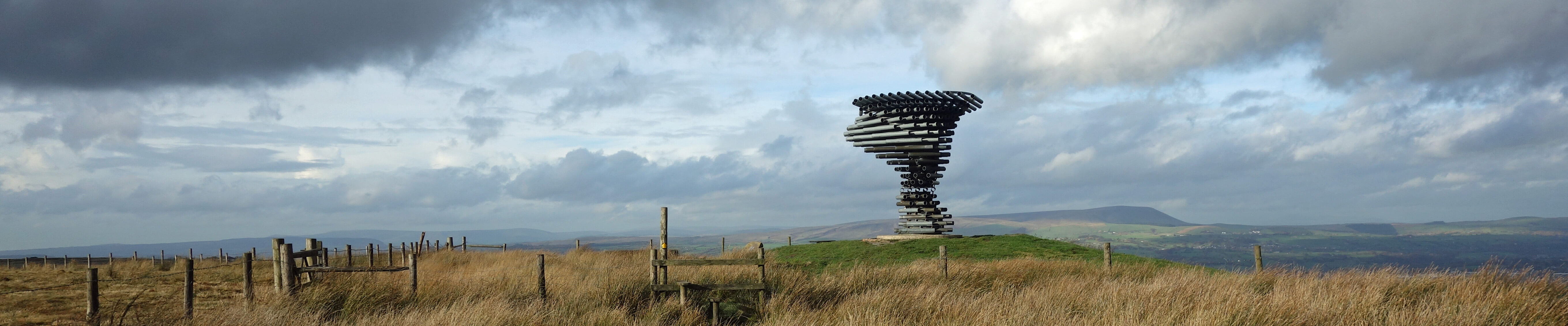
- Singing Ringing Tree SD8528 34
- Skelmore Heads barrow SD2775
- Sorrelsykes follies SE0288
- St Helen's Well, Gt Asby NY6813
- St Patrick's Chapel SD4061 101
- Sticks Pass NY3318 +
- Striding Edge NY3515 +
- Studrigg Scar, Crummack SD7870 63
- Stump Cross Caverns SE0863
- Subberthwaite settlement SD2587 205
- Surprise View, Borrowdale NY2618 18
- Swinside stone circle SD1788
- Tan Hill inn NY8906
- The Atom, Wycoller SD9339
- The Cockpit, nr Pooley Br. NY4822 +
- Three Men of Gragareth SD6778 22
- Threlkeld Quarry museum NY3224 143
- Tilberthwaite Gill NY3000 +
- Ting Mound, Fell Foot NY2903
- Tithe Barn Hill viewpoint SD4455 37
- Tom Croft Hill viewpoint SD6991 225
- Tor Dike, Kettlewell SD9875 +
- Trollers Gill SE0762
- Trough of Bowland SD6252 59
- Trow Gill, Clapham SD7571 24
- Victoria Cave, nr Settle SD8365 133
- Walla Crag, S of Keswick NY2721 18
- Wallowbarrow, Duddon Vly SD2296
- Walna Scar Road SD2896 246
- Wasdale Screes NY1504
- Wayside Arts Trail SD8530 34
- White Raise cairn NY4822
- White Scar Caves SD7174 161
- Witton Park, Blackburn SD6527 262
- Woodhouse beach, Crummock NY1617
- Wrengill quarry NY4708
- Wrynose Pass NY2702 +
- Yockenthwaite stone circle SD8979
- Yordas Cave, Kingsdale SD7079 47
Home Preamble Index Areas Dales Hills Lakes Places Reserves Rivers Structures Villages References Me
Š John Self, 2018-
Contact: johnselfdrakkar@gmail.com

Top photo: Rainbow over Kisdon in Swaledale; Bottom photo: Ullswater