
Home
Preamble
Index
Areas
Hills
Lakes
Dales
References
Me
Saunterings: Walking in North-West England
Saunterings is a set of reflections based upon walks around the counties of Cumbria, Lancashire and
North Yorkshire in North-West England
(as defined in the Preamble).
Here is a list of all Saunterings so far.
If you'd like to give a comment, correction or update (all are very welcome) or to
be notified by email when a new item is posted - please send an email to johnselfdrakkar@gmail.com.
205. Where is Subberthwaite Common?
When our hosts for a visit to the Lake District û our first visit to the National
Park since last October û suggested a walk on Subberthwaite Common I wondered if,
after my long absence, my memory of the Lake District had faded. It turns out
that Subberthwaite Common is indeed within the National Park although it is not
mentioned in the index of any of my Lake District books û from which one
might deduce that Subberthwaite Common is of little interest to visitors. Most
of them shoot straight past it, heading for more renowned regions, such as
Wasdale and the Duddon valley. However, locals (such as our hosts) appreciate
the quiet terrain and the views of distant hills.
Subberthwaite Common is just within the National Park, north of the A5092 border
near Ulverston. This gently undulating region of moorland with bracken, heather and grass lies
just west of the modest heights of Blawith Knott (248 metres) and Great Burney (298 metres).
To the north we had views of the Coniston Old Man group and of the Duddon fells around
Stickle Pike. If there werenÆt rain clouds around then weÆd probably have seen the
Scafell hills too. I understand that, on a clear day, there are views from
Blawith Knott and Great Burney east to the distant Pennine hills but our hosts were
kindly not leading us up there.
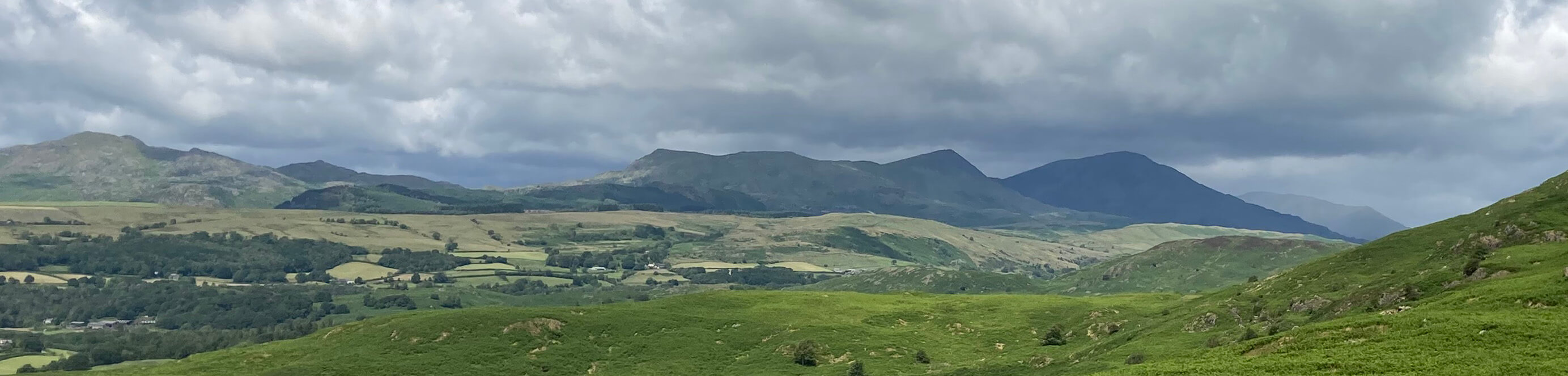
The view north
We set off west, with views of Black Combe and the Whitfell ridge ahead of us and, nearer,
the green fields around Broughton. Closer to hand (but donÆt handle it: it harbours ticks)
was rampant bracken. We have become so used to bracken smothering our hills that it doesnÆt
normally merit a mention. But here the green of fresh bracken (and no doubt in autumn the
rusty red of dying bracken) is such a dominant feature of the landscape that one canÆt
help wondering what it would be like without the bracken.
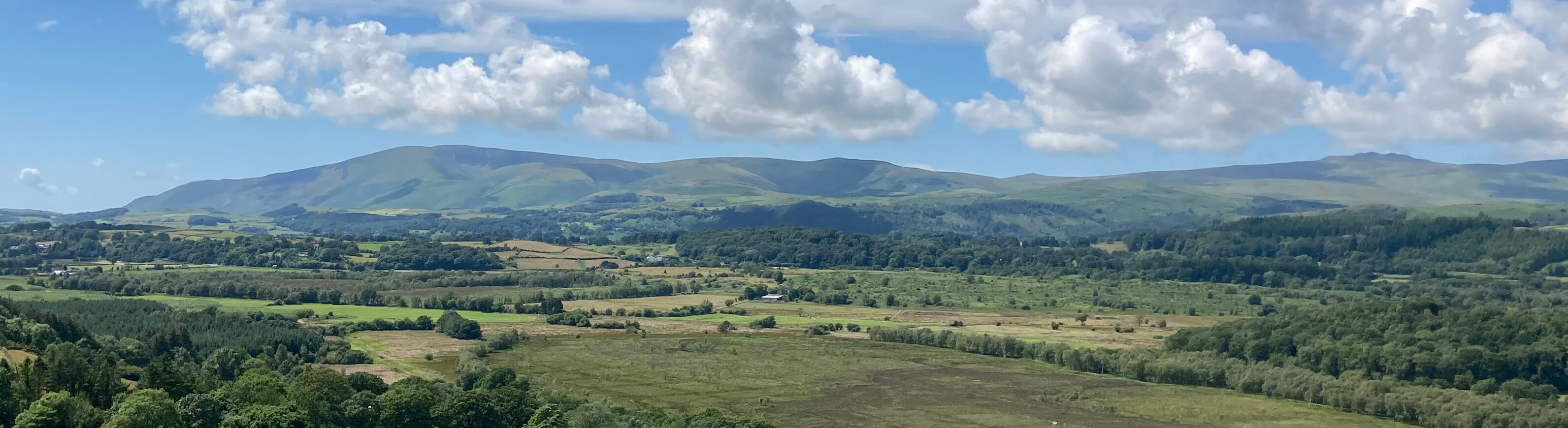
The view west
For, yes, although bracken does provide cover for small mammals and some nesting birds,
itÆs generally agreed that weÆd prefer to get rid of the dense monoculture of bracken, if
only we knew how to. In the past bracken was used for livestock bedding, as a compost
ingredient, as a mulch for winter soil protection and as a biofuel. It is possible that
in the future bracken will become a harvestable product again, to be used as a peat-free compost
perhaps.
Also in the past, bracken would have been naturally controlled to some extent. Subberthwaite
Common would have been wooded and bracken does not flourish under trees. There would have been
browsing animals to trample down its growth although I donÆt think any of them would actually
have eaten the bracken (bracken is carcinogenic). Today, there are horses ranging on the
moorland but probably not enough of them to make a difference.
There are, inevitably, calls
to use chemicals to kill the bracken û but given our usual competence in such matters weÆre
likely to do more harm than good.
According to the makers of Asulox, the market leading product for bracken control is
Asulox, for which the active ingredient is methyl (4-aminobenzene-1-sulfonyl) carbamate.
Asulox has been approved for use in England but not in Scotland or Wales û but it is currently
unavailable following a 2023 EU regulatory ruling. Thank you, EU.
Who knows what lies hidden by all this bracken on Subberthwaite Common? Historic
England has a good idea. This
website
refers to ôtwo prehistoric hut circle settlements,
an enclosure, individual hut circles, cairnfields, funerary cairns, a dispersed medieval settlement and its associated field system, and three kilnsö, all of which ôrepresents evidence of the Bronze Age and medieval exploitation of this landscapeö. We walked through what the website considers the core area of the ancient structures, past what appeared to be the remains of old stone walls and a number of roughly circular heaps of stones that are considered to have been the base for the buildings of a hut circle settlement. It seems that the residents of these huts preferred detached dwellings.
We walked on past the isolated farm of Birch Bank, with campsite, and
followed a track west below Blawith Knott, wondering whether all the bracken prevented
any way up other than the standard path from where we had parked. It appeared to be
still rainy to the north.
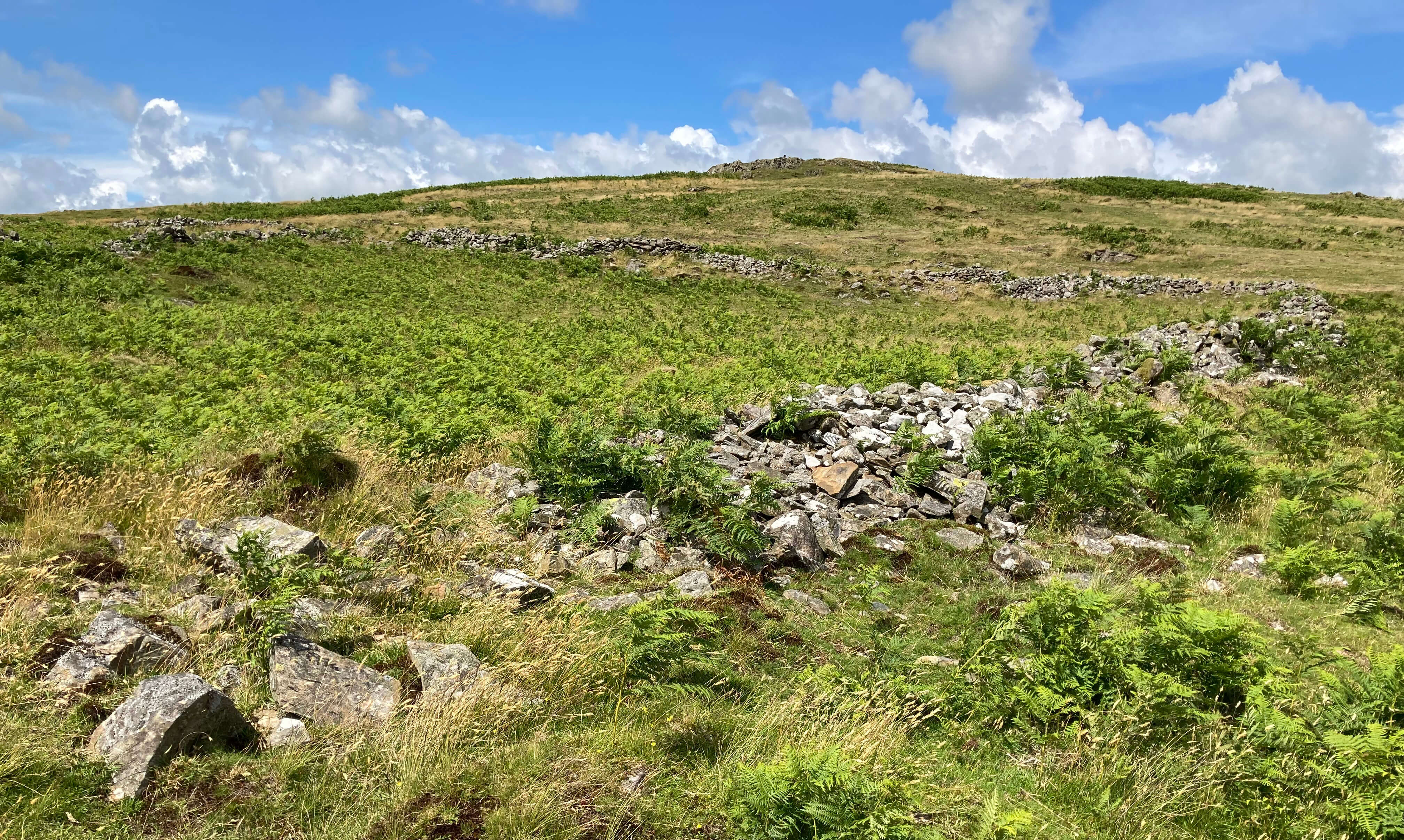
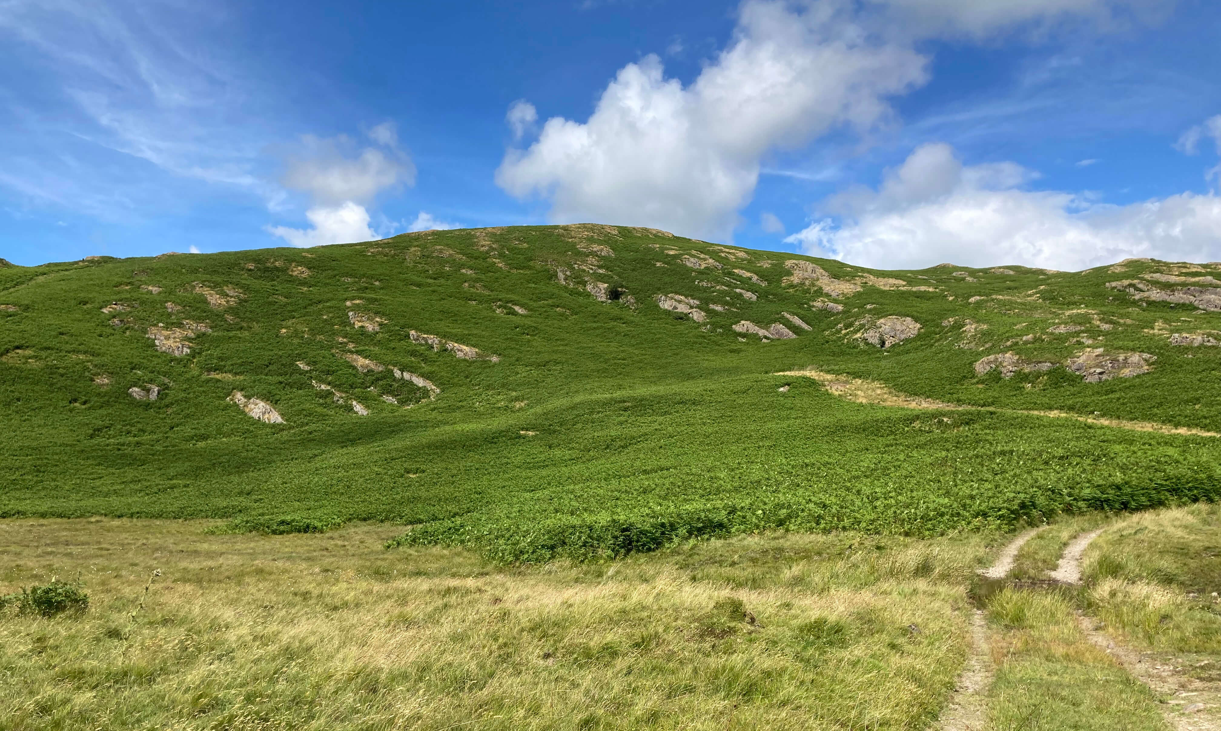
Left: Some old walls plus bracken; Right: Blawith Knott plus bracken.
Afterwards, on closer inspection, I did find one book on my shelf that referred to
Subberthwaite Common û The Lake District (Millward and Robinson, 1970).
It says that Subberthwaite Common is "covered with hundreds of tiny, roughly heaped stone cairns
which are now overgrown with heather and hard to recognize", these being prehistoric man's
solution to the problem of what to do with unwanted stones, and that "the most impressive site
[is where] the footings of stone huts and relics of an enclosing wall seem to indicate
a permanent settlement." Well, obviously not permanent û but long-lasting, at least.
Date: July 6th 2024
Start: SD266879, by the road, south-west of Blawith Knott (Map: OL6)
Route: SW on bridleway û road û SE, NE, E past settlement û road û
NE û Birch Bank û N, W on bridleway û road
Distance: 2.5 miles; Ascent: 30 metres
Home
Preamble
Index
Areas
Hills
Lakes
Dales
References
Me
® John Self, 2018-

Top photo: Rainbow over Kisdon in Swaledale;
Bottom photo: Ullswater