
Home
Preamble
Index
Areas
Dales
Hills
Lakes
Places
Reserves
Rivers
Structures
Villages
References
Me
Saunterings: Walking in North-West England
Saunterings is a set of reflections based upon walks around the counties of Cumbria, Lancashire and
North Yorkshire in North-West England
(as defined in the Preamble).
Here is a list of all Saunterings so far.
Guaranteed ad-free, AI-free and free!
251. From an Otter to Oxenholme
In the summer the 555 (Lancaster-Keswick) bus has a sibling. This second bus zips along
the M6 between Lancaster and Kendal (rather than stopping at Carnforth, Milnthorpe,
and so on), thereby saving 92 minutes (there and back). The bus is intended for
people, like me, keen to have as long as possible in the Lake District.
I had rather forgotten about this extra 555 service. I didn’t use it (or
any public transport) during the covid period and somehow, despite my increasing
reluctance to drive far for a walk, I hadn’t thought of using it since. It seemed
time to give it a try again.
I set off south from the Kendal bus station alongside the River Kent but
I hadn’t got far when I noticed that people were taking an unusual interest in the
river. There was an otter! It cavorted in the river and rummaged about on the
opposite bank. I didn’t get a clear view of it but it seemed small and was probably a
young otter. It was making its way downstream so I walked with it for a while until
I lost sight of it.

The River Kent at Kendal where the otter was seen
I was heading for the Roman fort marked on the map near Watercrook Farm
within a loop of the river. Very little seems to have been written about this
fort and I have not seen a photo of it. I deduced that there wasn’t much to
see, but I’d try. The remains of the fort are on private land and the nearest
footpath is actually on the opposite bank of the river.
The narrow path is squeezed below the sewage works, which has buildings
of some architectural magnificence (for a sewage works). Eventually there was a
gap in the trees from which I could survey the fields wherein the fort was. All
I could see was some unevenness in the land, plus some cows. As I expected. I
understand that the fort was abandoned in about 370, so it has had plenty of
time to fade away.

The field with the Watercrook Roman fort remains
I then had a pleasant walk for a mile or more south on the west bank of
the river. Again, I had no expectations of excitement, and so it proved. It was
quiet, apart from the sound of the river – and becoming a little too warm. I walked
as far as Hawes Bridge, which had been the northern limit of my walk from Levens
Hall in [160], and then turned east to walk up the gently rising lane to Natland.
I am trying to take more notice of the villages that I walk through, rather
than regard them as interruptions to the real walk. After all, villages
do have character, reflecting the quirks of humanity living therein, whereas some
might feel that one hill is much like another. Anyway, Natland seemed a neat place,
that took some pride in its neatness. There’s a neat village green, with the
village church adjacent. Natland’s Oxenholme Road had detached houses, all, it seemed, with a
name relating to nature, and with views from this elevated position over to Kendal.
This Oxenholme Road led me to the village of Oxenholme, naturally. First
impressions were that Oxenholme was a more workaday place, with a red-brick terrace
and a greater variety of houses, and more activity. Of course, I did not carry out a thorough
investigation of either village, so this characterisation may be unfair.


Left: The Natland green and church; Right:An Oxenholme terrace.
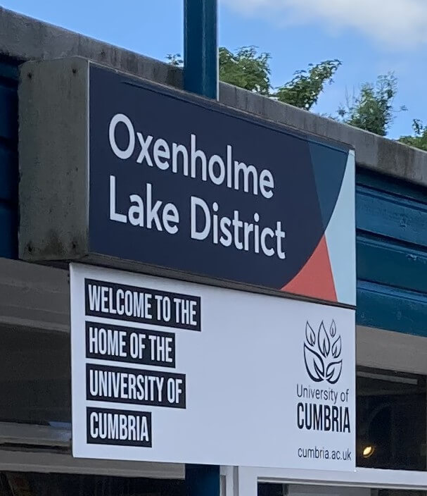 The main road through the linear village of Oxenholme, called Helmside
Road since it is below the hill called The Helm, brought me to the railway station,
for which Oxenholme is best known today. In 1988 the rail authorities renamed this
station to ‘Oxenholme Lake District’, in order to distinguish this Oxenholme Station
from all the other Oxenholme Stations, of which there are none.
I thought that train announcements always said "Oxenholme the Lake District" but
having listened carefully it is indeed "Oxenholme Lake District".
Either way, it is really "Oxenholme, for the Lake District" because Oxenholme is
not in the Lake District National Park.
The main road through the linear village of Oxenholme, called Helmside
Road since it is below the hill called The Helm, brought me to the railway station,
for which Oxenholme is best known today. In 1988 the rail authorities renamed this
station to ‘Oxenholme Lake District’, in order to distinguish this Oxenholme Station
from all the other Oxenholme Stations, of which there are none.
I thought that train announcements always said "Oxenholme the Lake District" but
having listened carefully it is indeed "Oxenholme Lake District".
Either way, it is really "Oxenholme, for the Lake District" because Oxenholme is
not in the Lake District National Park.
Which reminded me that this whole walk was not in the National Park and as
a ‘trial run’ for using the 555 bus to explore the Park was perhaps not a
fair test. One thing I had remembered about bus trips is that, in order to reduce
the stress of being on time for the return bus, it’s worth having some optional
extras at the end of the walk so that you can sample whatever is possible in the
time available.
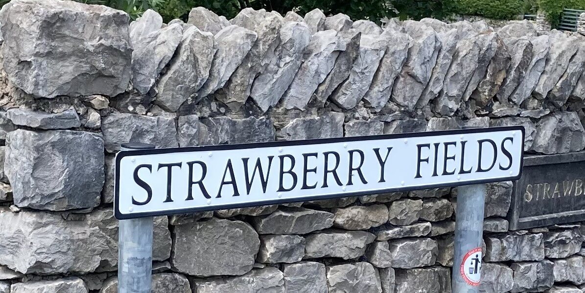 On this occasion I had in mind a possible visit to Kendal Castle. I walked
down (another) Oxenholme Road and passed Strawberry Fields, a road in a new estate
built on a region that was previously called Strawberry Fields
(it was probably Strawberry Fields forever).
I continued along the
line of the old canal (no sign of any restoration to an actual canal (yet?)) and
eventually found my way through a large cemetery to walk up to complete a tour
around the castle ditch and then wander around the ruins.
On this occasion I had in mind a possible visit to Kendal Castle. I walked
down (another) Oxenholme Road and passed Strawberry Fields, a road in a new estate
built on a region that was previously called Strawberry Fields
(it was probably Strawberry Fields forever).
I continued along the
line of the old canal (no sign of any restoration to an actual canal (yet?)) and
eventually found my way through a large cemetery to walk up to complete a tour
around the castle ditch and then wander around the ruins.
This
history of the castle
dates its building very precisely, to 1241, and says that it had become derelict by
1572. For most of its life the castle was the home of the Parr family,
which begat Catherine Parr (1512-1548), for whom Henry VIII was her fourth husband.
It is not known if she ever visited Kendal, so I don't know why those who
write about Kendal keep mentioning her.
According to the website just quoted, Kendal Castle has been "awarded a coveted Green Flag".
This sounds impressive - but I thought a green flag meant that a sea was safe for
swimming. Or that it provided a vehicle recovery service.
Here, however, the Green Flag
is the "international mark of quality" for parks and green spaces, although it seems that
the large majority of Green Flag holders (2,393 of them) are in the UK (perhaps
not surprisingly since the scheme is administered by Keep Britain Tidy).
And thence to an ice-cream to await the bus.

Part of the ruins of Kendal Castle

Looking from Kendal Castle over Kendal to the Lake District hills
Before this outing I had thought that in order to encourage my use of public
transport I would make a summer series of walks from the 555 bus to forge my way
through the Lake District, bus-stop by bus-stop, to Keswick. After now re-experiencing
the 555 bus I have gone off the idea, mainly because I prefer Saunterings to wander
about at whim and not follow an ordained route. I value the autonomy – the freedom
to go where I want, especially off the beaten track, and to change my mind as I
wish.
On this 555 Kendal trip I spent less than half of the total
hours actually walking (and that is likely to become more the case the further I travel on the bus).
The rest of
the time was spent on the bus or waiting for the bus – or buses, four of them in my
case, as I have to bus to and from Lancaster (and timetables do not always coincide).
The special 555 bus may zip up the M6 but it crawls through Kendal, Windermere, and
so on, even slower than ordinary traffic because of all the bus-stops.
In the imagination a bus trip is relaxing, as you are relieved of the stress
of driving. In reality, it is less so. At the risk of seeming ungrateful, I will say that a long
bus journey is not as comfortable as a drive in our car. The bus is relatively
rattly, bumpy and noisy. This is hardly to be complained about on a short journey
but after an hour or more one longs for smooth peace. Especially if you are accompanied
by garrulous co-passengers, who talk increasingly loudly to make themselves heard
above the rattles and the other passengers. On this occasion,
during my drowsy return, miscellaneous
phrases – Screaming Lord Sutch, Taipei, dish-washers, Jude Bellingham, Dunmail
Raise, … – kept interfering with my thoughts about the otter.
Date: June 21st 2026
Start: SD516928, Kendal bus station (Map: OL7)
Route: S by River Kent – opposite Watercrook Farm – around meander, S
– Hawes Bridge – E – Natland – NE, SW, NW through Oxenholme – Oxenholme station – NW –
line of old canal – N, E through cemetery, N – Kendal Castle – W, N – bus station
Distance: 8 miles; Ascent: 100 metres
933 +471 /2400
Home
Preamble
Index
Areas
Dales
Hills
Lakes
Places
Reserves
Rivers
Structures
Villages
References
Me
© John Self, 2018-
Contact: johnselfdrakkar@gmail.com

Top photo: Rainbow over Kisdon in Swaledale;
Bottom photo: Ullswater
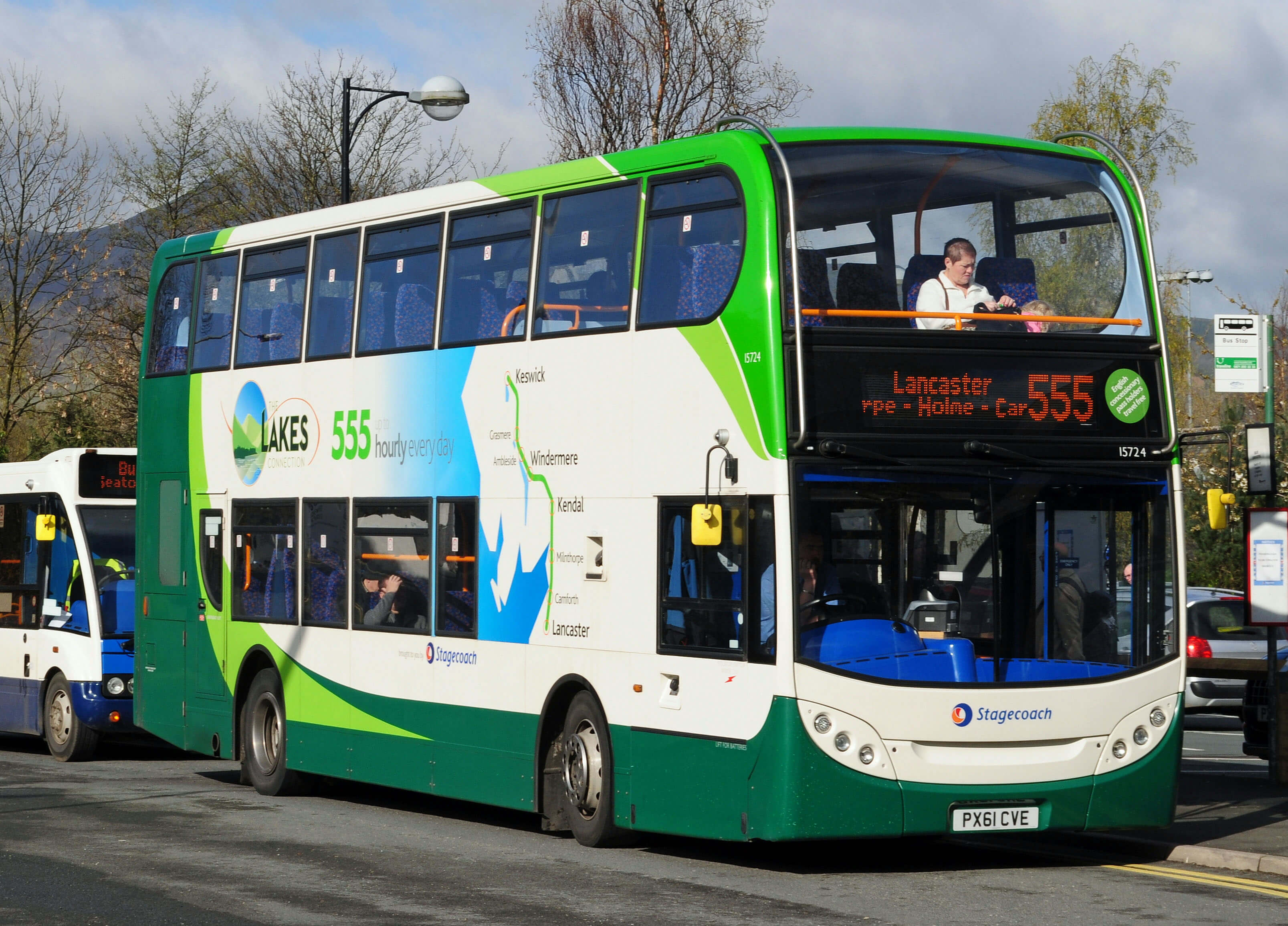 If and when I walk from a 555 bus-stop I'll add the walk to this List of 555 Walks
which I'll include here (with previous walks that were, or could have been, from the 555 bus):
If and when I walk from a 555 bus-stop I'll add the walk to this List of 555 Walks
which I'll include here (with previous walks that were, or could have been, from the 555 bus):