
Home
Preamble
Index
Areas
Dales
Hills
Lakes
Places
Reserves
Rivers
Structures
Villages
References
Me
Saunterings: Walking in North-West England
Saunterings is a set of reflections based upon walks around the counties of Cumbria, Lancashire and
North Yorkshire in North-West England
(as defined in the Preamble).
Here is a list of all Saunterings so far.
Guaranteed ad-free, AI-free and free!
If you'd like to give a comment, correction or update (all are very welcome) or to
be notified by email when a new item is posted - please send an email to johnselfdrakkar@gmail.com.
254. Maryport and a Mysterious Moor
On the next morning (after [253]), we drove to Workington. Nobody
has ever done this before, unless they had to. We had to. We had to
get the car charged after finding that we were unable to do so in
Cockermouth. Will market forces ever create some order
among the multiple plugs, sockets, apps, payment schemes, and so on?
Or are we waiting for Elon Musk to buy up all the charging stations and
make them all Tesla-only, as seems to have happened at the Rheged Centre near Penrith.
We were resigned to a challenging search around Workington for the trading estate
with charging points at Morrisons but eventually found it. To our surprise, there was a
great number and variety of charging points, one of which serviced us. Perhaps
trading estates will realise that there is more
future in electric charging, where people
may visit Morrisons, McDonalds, Halfords, as they wish, while their cars are charging,
than there is in petrol stations, where
users can just fill up and leave without trading at all.
We did not see anything of the seaside and port area of Workington and so our
impressions are limited to those of the rather drab back streets. We escaped with relative
ease from Workington and headed north to Maryport. The two names suggest different
ambiences. Maryport was originally called Ellenfoot, being at the foot (or mouth?)
of the River Ellen but was renamed in 1748 after Mary Senhouse, of the Senhouse family,
then the major local landowners. But the name Workington (first attested in 946) has
nothing to do with ‘working’: it is thought to mean 'the town of Wirc’s people', so it
too may be named after a person.
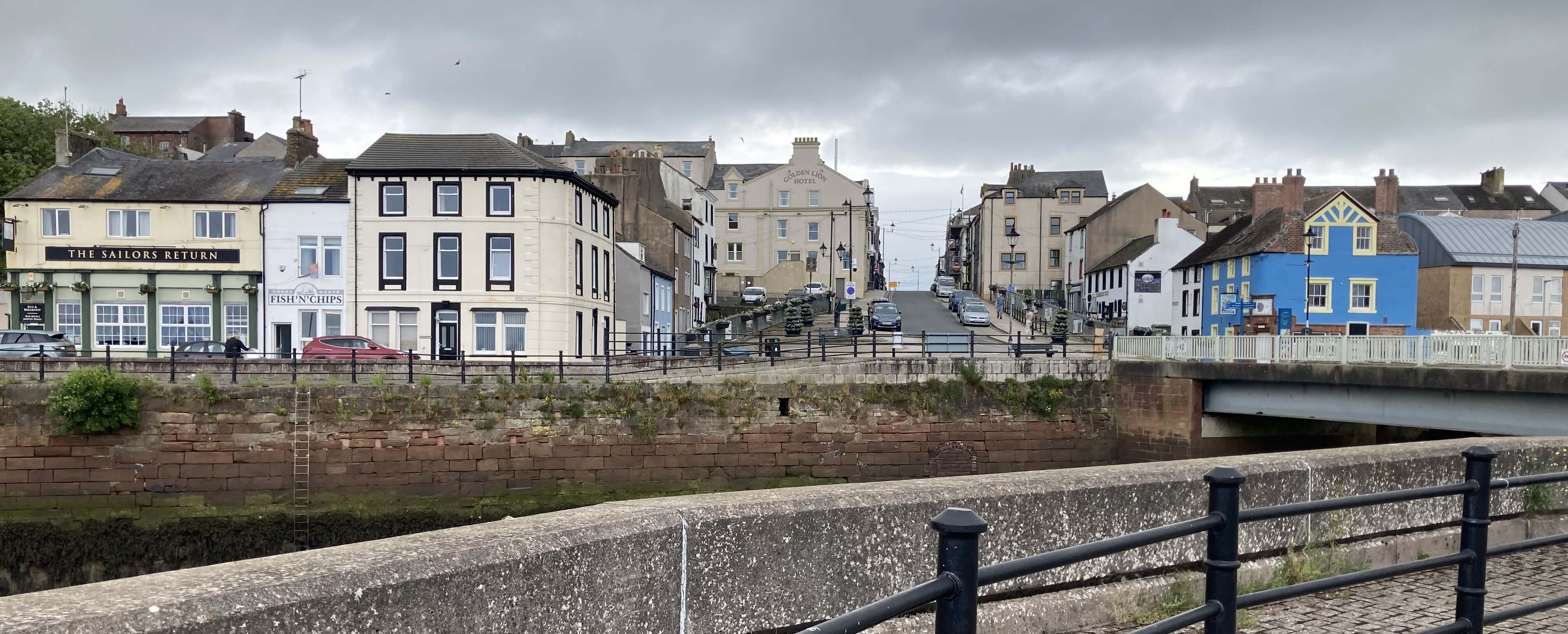
Maryport, with the tide out
Maryport seemed a pleasing place. The port area is quiet, indeed inactive while
we were there. The people were friendly. The new aquarium and yacht marina help
Maryport’s attempt to become more of a tourist attraction. There’s a dignity about
the place, with no attempt that I saw to add the tawdry seaside ‘attractions’ of some
resorts (unless a small crazy-golf course counts as such). There’s a lower and higher
promenade to the north, providing sweeping views over the Solway Firth to Dumfries
(largely hidden by cloud on this occasion). Along the higher walk there’s the
Senhouse Roman Museum, which provides a comprehensive (too comprehensive for me)
history of the Roman’s efforts to protect this coast all the way up to Hadrian’s Wall.
The site of the Roman fort is today just a raised platform in an adjacent field, any
artefacts found there having presumably been transferred to the museum.
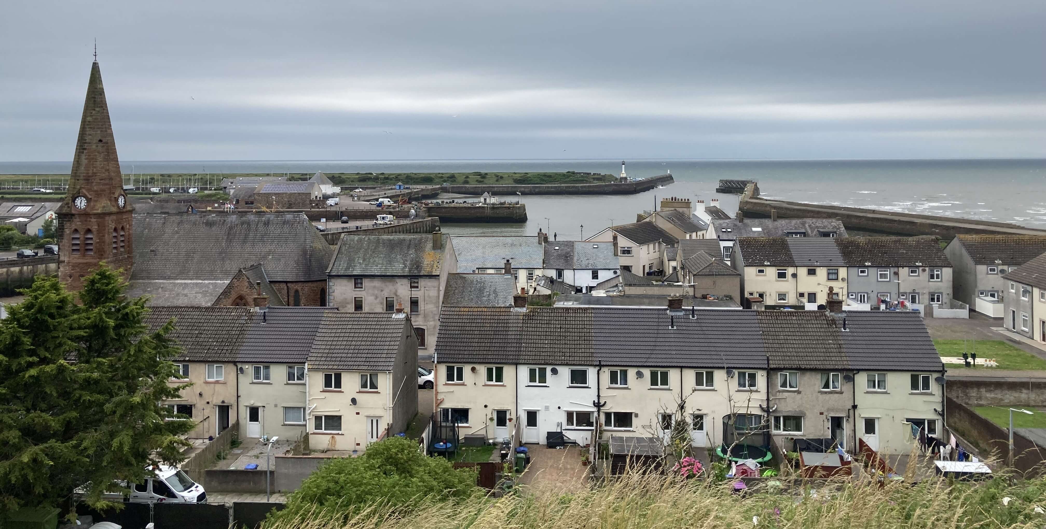
Maryport, from the higher promenade
And yet my main feeling walking around Maryport was one of sympathy. It’s like
watching Hull City versus Manchester City. One wishes the former well but knows
that the odds are unfairly stacked against them. Maryport developed as an
industrial centre in the 19th century, with an iron foundry and shipyards and then
primarily as an exporter of coal from the Cumberland collieries. In 1927 a new
deep-water dock at Workington took away much of Maryport’s trade and then
the nearby collieries closed, with the result that the majority of
Maryport’s workforce became unemployed. It has been a slow, difficult recovery
from then. If Maryport’s future lies in attracting visitors then it will be a
challenge to lure them here from the Lake District.
After a pleasant ice-cream by the dock, obtained after the aquarium delayed closing
just for us, we departed.

Maryport, with the tide now in
An echo of Maryport’s problems can perhaps be seen at a site which lies in the
triangle of land between Workington, Maryport
and Great Broughton. The OS map shows, just west of Great Broughton and south
of Broughton Moor, an area of about two square miles with no
access by road or foot.
The only words on the OS map are 'Peatmere Hill', 'Ribton Woods', 'Horsegrassing Plantation'
and 'South Terrace',
which sounds pleasant enough. There are also about a hundred - well, what do you
think they are? - marked.
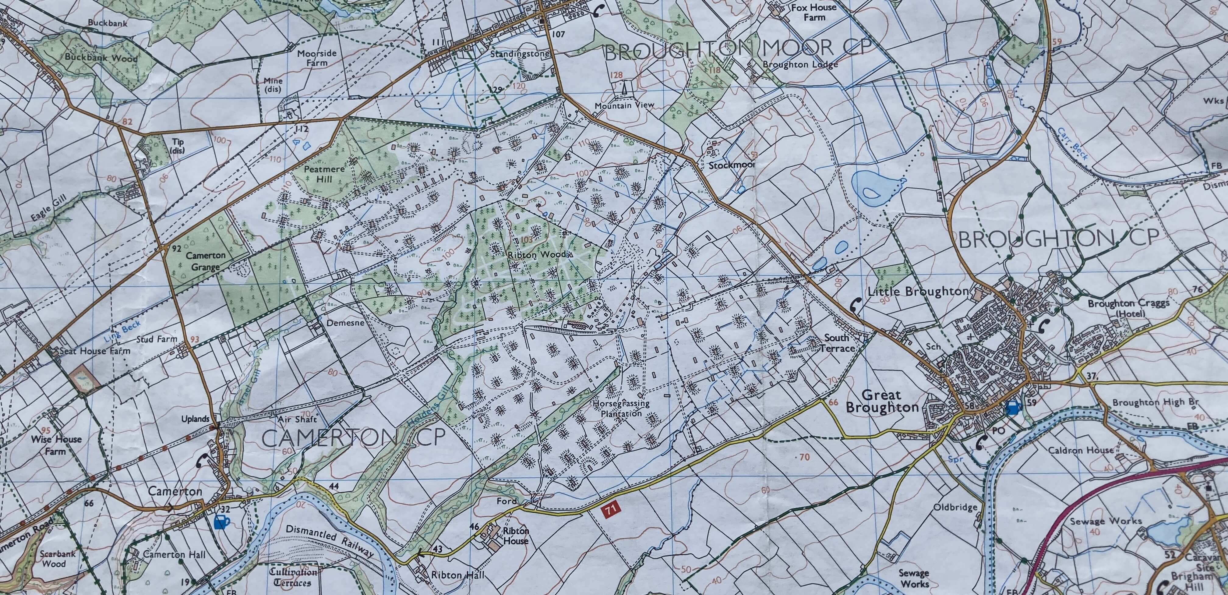
The OS map of the region
This land was requisitioned in 1939 for a Royal Naval Armaments Depot and was
later used by Germany, the United States and Nato. It was closed in 1992 (that is,
it was deserted as it was). The local Borough Council bought the site in 2008 for £1.
Who from? The government, I suppose. The sale confirmed that the site had been
rendered worthless and that the seller was keen to wash their hands of it.
The council attempted to rebrand the site as Derwent Forest but so
far has found nobody prepared to take on the redevelopment because of the huge cost
of dealing with the abandoned armaments, the hundreds of dangerous buildings, the
many hidden mineshaft entrances, and the serious asbestos contamination. A proposal
for redevelopment of what seems to be only a small part of the site was rejected
by the council in 2022 and then appealed (I don’t know what the present situation is).
So that’s 34 years and counting when two square miles of Cumbria has been abandoned
because it’s too dangerous. And it has been completely fenced off from the public
for 87 years so far. An unnerving and depressing
Youtube video
shows the extent and condition of the site.
Please have a look - would you have believed that this was in Cumbria?
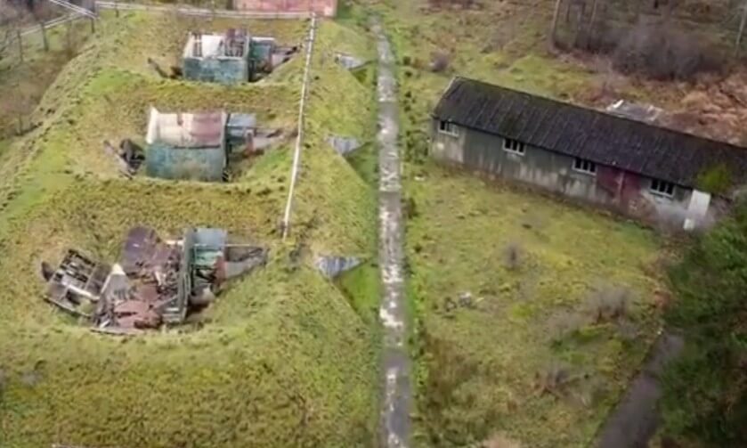
A still from the Youtube video of the Broughton Moor site
It’s not acceptable, is it? This is potentially valuable, useful land (which it
was before). The government should insist, by law (as perhaps is already the case?),
that any organisation that takes over land to (temporarily) pollute it should be
required to restore the land to a safe, healthy condition when they have finished
with it. Unfortunately, in this case the organisation responsible is the government
itself. It is a national shame that this site exists. Can you imagine that two
square miles of the Chilterns, say, would be commandeered and then left too dangerous
to do anything with? [1] But here, in faraway north-west Cumbria, the government takes
over land for armament storage, munitions factories, nuclear power plants, and so
on, and then forgets about it.
The question naturally arises: what could or should be done to redevelop
this region? Well, villages throughout the land are being pressed to find space for new
housing. Instead of hundreds of villages being forced to have new houses they don’t
really want, the new houses could be built here. Judging from the map, a whole new
town the size of Cockermouth (population 10,000) could be built here. That in itself
would not be enough. The residents of Maryport and Workington already
struggle to find employment. New, progressive industries would be needed to
revitalise the region, although nowadays more people are able to work from home
and would welcome living in such a location, close to the Lake District.
Or a nature reserve? Or a youth-oriented adventure park? Or a large
holiday complex? Or a prison? Some sort of
vision is surely better than just ignoring the problem or coming up with desperate
proposals to revive coal-mining here to provide employment. I don’t know
the answer but I would prefer the government to consider, not disown, the question.
But I suppose it is up to the local council now. After nearly twenty years, perhaps it has plans underway?
[1]. After making the comment about the Chilterns, I thought I should check that there
are indeed no abandoned Royal Naval Armaments Depots in the Chilterns.
I was surprised to find, from this website,
that there have been twenty RNADs in England. None were in the Chilterns, I think.
Only two RNADs, now called Defence Munitions centres, are still operational, at
Plymouth and Gosport.
Date: July 7th 2026
Start: NY033366, by the dock at Maryport (Map: OL4)
Route: around the lanes of Maryport, along the lower
promenade to Bank End and back along the higher promenade
Distance: 4 miles; Ascent: 60 metres
Home
Preamble
Index
Areas
Dales
Hills
Lakes
Places
Reserves
Rivers
Structures
Villages
References
Me
© John Self, 2018-

Top photo: Rainbow over Kisdon in Swaledale;
Bottom photo: Ullswater