kisdon rainbow

Home   Preamble   Index   Areas   Hills   Lakes   Dales   Places   References   Me

Saunterings:  Walking in North-West England

Saunterings is a set of reflections based upon walks around the counties of Cumbria, Lancashire and North Yorkshire in North-West England (as defined in the Preamble). Here is a list of all Saunterings so far.
If you'd like to give a comment, correction or update (all are very welcome) or to be notified by email when a new item is posted - please send an email to johnselfdrakkar@gmail.com.

225.  Garsdale

howgills

The Howgills from the Tom Croft Hill puddle park

Garsdale is the least walker-friendly dale in the Yorkshire Dales – but I went there, anyway. Garsdale is the valley of Clough River, which runs for about eight miles west towards Sedbergh, embraced by Aye Gill Pike to the south and Baugh Fell to the north. There is plenty of open access land on those two fells but there is no access to it by footpaths across the valley pastures. Anyone wanting to walk there has to tackle the fells from one or other end and then face a long, boggy tramp along the ridge.

There are some footpaths in the valley but they appear so under-used that a walker there feels like a trespasser about to be hollered at at any moment. In any case, the footpaths don’t fit together to make a sensible circuit of the valley. It is necessary occasionally to walk on the A684 (the Hawes-Sedbergh road), which is somewhat busy and doesn’t allow for walkers.

Nevertheless, I like Garsdale. It has an authentic, unpretentious, take-it-or-leave-it feel. Unlike most other dales, such as its neighbour on the other side of Aye Gill Pike, Dentdale, it doesn’t engage in the endless endeavour to entice evermore visitors. Apart from the A684, it is a quiet valley, with numerous pleasant homesteads spread out along the valley and a fair amount of farming activity, with many green buttercupped fields. There are no camp-sites or holiday parks in the valley. There are also no pubs or shops or anything else that sets out to cause a passing traveller to linger. That being so, nobody has bothered to write anything to advertise the attractions of Garsdale. There is no brochure of Garsdale.

Ignoring a ‘road closed’ sign, I set off east from the car park on Tom Croft Hill, with its fine view of the Howgills. Clough River was peaty brown, gushing under Danny Bridge. (By the way, why does Clough River follow the American custom of putting the ‘River’ after the name?)  The quiet lane passed a number of restored farm buildings and neat homesteads, although I’m not sure that I’d want to live in such an out-of-the-way place. It wasn't always out-of-the-way: this lane was on an ancient route between York and the Lake District. I passed a gate that informed me that I would be fined up to forty shillings if I left it open. It was already open, so I did. Beyond Hind Keld East I found out why there was a road closed sign. A ditch was being dug across the road, for reasons that escape me. With some encouragement from the workers, I scrambled across.
Lindsey Fold      Swarthgill House      Smorthwaite

Left: Lindsey Fold;  Middle: Swarthgill House;  Right: Smorthwaite.

baugh fell

Baugh Fell (the farm shown is called Blirtses)

After another couple of miles – using three footpaths across fields (over Bellow Hill, behind Swarthgill House and behind Blades Farm), with intervening stretches of the A684 – I reached what is, if anywhere is, the centre of Garsdale, with a fine bridge, a large Anglican church, several smart houses (one reached by a private bridge across the Clough) and a row of cottages along The Street. I was disappointed to see that the prominent building (once Garsdale Hall, a farmhouse with attached barn) on the road’s bend that I had photographed derelict in 2007 was even more derelict now, although perhaps less so than might be expected after eighteen years of neglect. In 2007 I thought that there was some hope that the building would be restored – but I doubt it now. Which is a shame.
garsdale hall 2007        garsdale hall

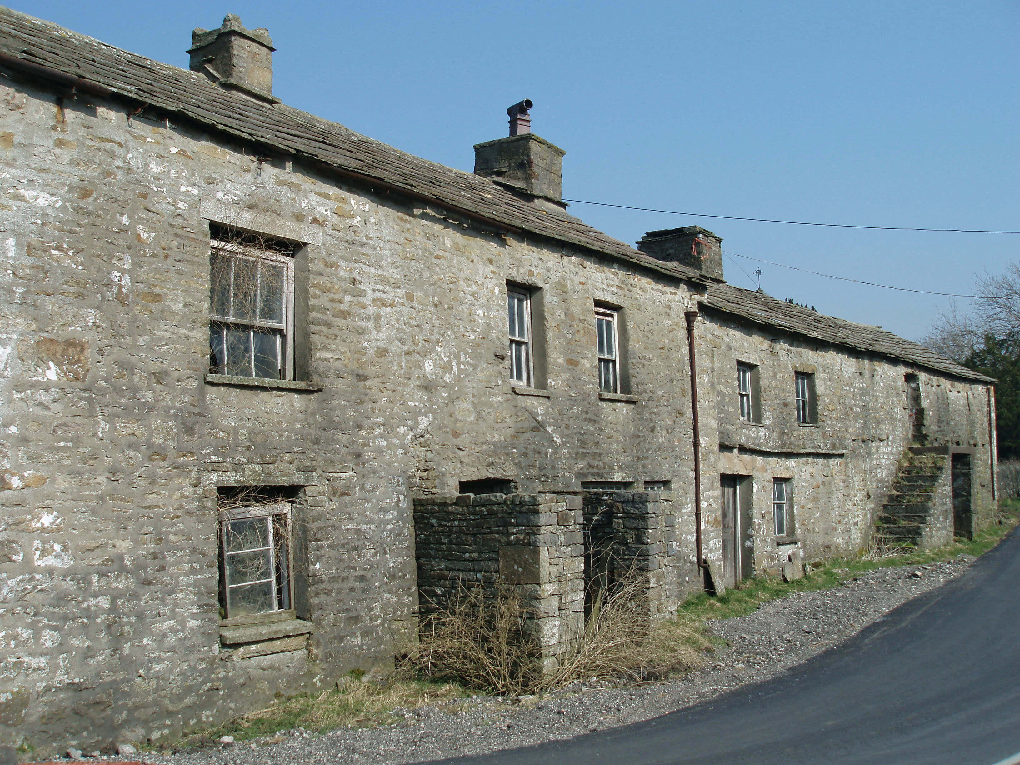
The derelict building in Garsdale (once Garsdale Hall) in 2007 (left) and now (right).

I walked on as far as Dandra Garth, which was the limit of my ambition. Dandra Garth is one of only three grade II* listed buildings in Garsdale (there are no grade I buildings). Many of the other buildings in the valley are just grade II. However, from memory, I thought that Dandra Garth was difficult to view and that did prove to be the case. So I couldn’t really see what features earned it its *. It is, I read, a three-storey stone farmhouse probably of the 17th century.
clough river        dandra garth

Left: Clough River and the row of cottages;  Right: Dandra Garth (or as much of it as I could sneak a view of, which just about included the gabled porch with pigeon holes).

I turned to walk back, taking a different combination of road and footpath (including a long, pleasant, if uneventful, section alongside Clough River) to get to the car-park. I paused first at the church to find somewhere to sit with my sandwiches. As is often the case, it seemed a large church for the small local populace, especially considering that there were a number of other religious buildings in the valley, including six Methodist chapels (I don’t know how many are still active: I passed one that definitely wasn’t). I wandered into the churchyard, where I was amused to see that the only bench outside was unusable, one of the four legs being broken off. That bench was the only thing I saw in Garsdale that might be considered to be provided for a visitor.
garsdale church

Garsdale church and bench

    Date: June 18th 2025
    Start: SD694913, Tom Croft Hill car park  (Maps: OL19, OL2)
    Route: E – Danny Bridge – E – Hind Keld East – SE on lane and footpath – Badger Dub – SE on A684 and footpath – Swarthgill House – SE on A684, E – Smorthwaite – S, NE – Dandra Garth – W on A684 – Aye Gill – NW by Conder River – New Bridge – W on A684 – car park
    Distance: 8 miles;   Ascent: 50 metres

The two preceding items:
     224.   Around Anglezarke Reservoir
     223.   A Grand Bowland Circuit, plus Easington Fell
Two nearby items:
     163.   Baugh Fell and Alpacas
       13.   The Cairns of Grisedale Pike
A list of all items so far:
               Saunterings

Home   Preamble   Index   Areas   Hills   Lakes   Dales   Places   References   Me

    © John Self, 2018-

ullswater

Top photo: Rainbow over Kisdon in Swaledale; Bottom photo: Ullswater