
Home
Preamble
Index
Areas
Dales
Hills
Lakes
Places
Reserves
Rivers
Structures
Villages
References
Me
Saunterings: Walking in North-West England
Saunterings is a set of reflections based upon walks around the counties of Cumbria, Lancashire and
North Yorkshire in North-West England
(as defined in the Preamble).
Here is a list of all Saunterings so far.
Guaranteed ad-free, AI-free and free!
If you'd like to give a comment, correction or update (all are very welcome) or to
be notified by email when a new item is posted - please send an email to johnselfdrakkar@gmail.com.
252. All Quiet on the Westmorland Dales Frontier
 I think it happened like this. In 2016 a group of vintage farmers gathered in the Three Greyhounds in Great Asby, as usual, for a chinwag:
Harry: Well, what do you think of being in the Yorkshire Dales?
Jim: Don’t be daft. We’re not in Yorkshire.
Alan: No, we’re in Cumbria. I heard it on the wireless.
Bill: Do you mean Cumberland? I’ve heard of that.
Joe: I thought we were in Westmorland. I learned it at school.
Jim: Ah, Westmorland. I remember it well. A fine name, lost forever.
Harry: Anyway, we are in the Yorkshire Dales. They shifted the boundary up past us.
Alan: Whatever for?
Bill: I don’t care what they say. I’m having nowt to do with Yorkshire.
Jim: We could just say we’re in the Dales, like they do, as if there are no other dales.
Alan: ‘The Dales’ is a bit vague. How about the ‘Cumbrian Dales’?
Harry: That’s no good. Everyone will think of Langdale or Patterdale.
Jim: ‘Westmorland Dales’ then? Nobody remembers what Westmorland was.
Harry: Great idea! And we could make Westmorland Dales mean whatever we want.
Jim: And the Yorkshire Dales lot will have to lump it.
Landlord of the Three Greyhounds: Evening lads. Just heard your Westmorland
Dales idea. That’ll get the punters flocking here searching for our dales. I’ll arrange a
few quiz nights to raise some money for it. Then we can stick up a few signs and Roberta’s your auntie.
Joe: Who’s Roberta?
And so the Westmorland Dales were born.
Recently, signs have appeared in the region north of Tebay to tell us that
we are in the Westmorland Dales. What exactly are these Westmorland Dales? I have
not seen the name on any OS map. I don’t think ‘Westmorland Dales’
is in the index of any book on my shelves. Do the Westmorland Dales exist as an official,
legal entity? Or were they dreamt up in a pub?
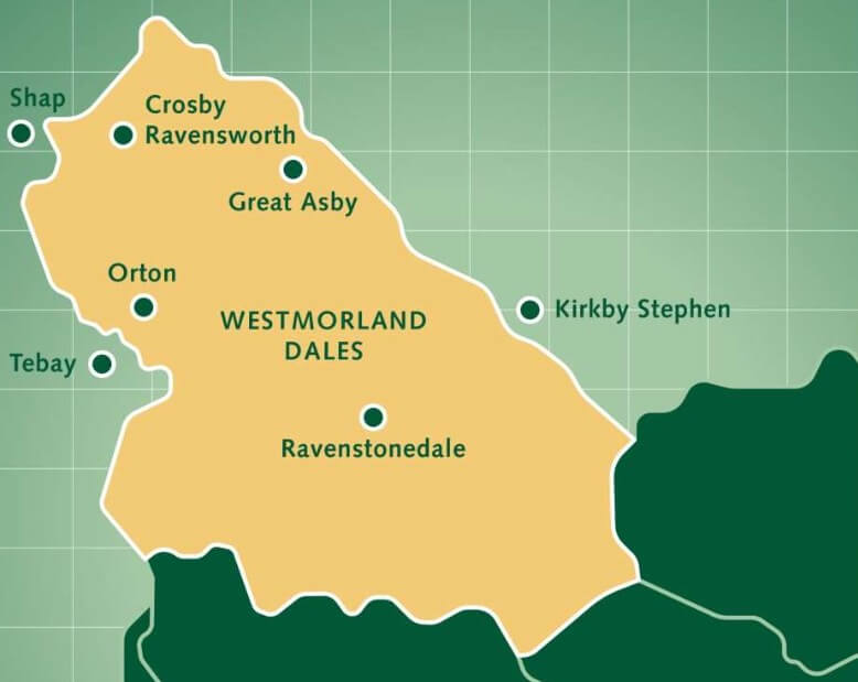
According to the
Yorkshire Dales
National Park website, the Westmorland Dales lie within the area shown on the map
above right. I set out from Great Asby to investigate the frontier of these Westmorland
Dales. The population of Great Asby is about 300 but I walked through the
village and saw only one person (in a car). There was no sound apart from the gentle
twittering of some swallows. The beck that presumably sometimes flows through the
village was dry.
Great Asby seemed a very tucked-away place. Nobody would pass
through it on their way somewhere else. I thought it a charming place – a range of
houses, from the grand to the less so, two churches (who apparently work together, as
more churches should), a pub (in a building dating from 1707), a primary school,
some open green spaces, and (on my return) some rural activity.

Great Asby
However, I saw nothing to indicate that I was in the Westmorland Dales or the
Yorkshire Dales. Great Asby lies a few miles north of the limestone hills that were
no doubt the main attraction for the Yorkshire Dales authorities. Some of the houses
are of limestone, as are the walls around fields, but the village is not in a dale and,
as far as I noticed, it doesn’t provide views typical of the Yorkshire Dales.
When the Yorkshire Dales National Park was established in 1954 it was all
within Yorkshire. The 1974 re-definition of the counties and their borders moved
three parishes (Dent, Garsdale and Sedbergh) of old Yorkshire into the new county
of Cumbria. No doubt the Yorkshire folk of those parishes resented losing their
Yorkshireness but were perhaps assuaged a little by remaining within the Yorkshire
Dales. In 2016 the borders of the National Park were extended to include parts of
Cumbria and Lancashire, so that the Park was now 28% in Cumbria and 1% in Lancashire.
No doubt the residents there resented being considered part of the Yorkshire Dales
when they had never been part of Yorkshire.
There was at the time some vague discussion about changing the name of the
National Park to ‘The Dales’. However, I am sure that the
(Yorkshire) majority on any decision-making committee would have resisted such a
change. After all, ‘Yorkshire Dales’ had become the established brand name for
this tourist destination. It seems to me that the residents of the self-proclaimed
Westmorland Dales have said ‘ok, if we must be within the Dales then they will be
Dales of our own naming’. And they chose the old county name of Westmorland in a
bold move to keep alive the historic name of Westmorland which many were sad to lose.
For example, Griffin (1974, in Griffin (2005)) considered that despite Westmorland
being “the loveliest and least spoiled county in England, a county of sturdy
independence and fine traditions … dear old Westmorland has now gone for ever”.
I headed north from Great Asby. Once off the road, it was a challenge to follow
the path, although it is designated the ‘Dales High Way’. I’ve already questioned
the ‘Dales’ and now I question the ‘High’ and the ‘Way’ too. Anyway, I found my way
to Rutter Force, which is given a star (indicating a tourist feature) on the OS map.
Any tourist making a special effort to see Rutter Force should ensure that they do so
after heavy rain, otherwise there may be only the dribble that I saw. It is described
as 9-metre high. The setting, with the nearby centuries-old Rutter Mill, plus
water-wheel, is attractive.

Rutter Force and Rutter Mill (to see the waterfall as it
should be seen click here)
The water flowing over Rutter Force is Hoff Beck. This beck is (or was) one of the
few remaining strongholds in England of the native white-clawed crayfish. The non-native
North American signal crayfish has pretty well wiped out our crayfish elsewhere. The
larger signal crayfish out-competes the native crayfish and, to make matters worse,
carries a fungal disease lethal to the native crayfish. (It’s a similar story to our
red squirrel, grey squirrel situation).
I am not up-to-date with reports on this beck’s crayfish but the white-clawed
crayfish is still mentioned as a feature of the region, so I hope that it still
survives. I didn’t notice any work having been done to help our crayfish. Increased
cattle, drainage and fertilisers had damaged the Hoff Beck banks and affected the water
quality. Crayfish need clean water and natural hiding places within the beck. I did
not, of course, search for the white-clawed crayfish as they are a protected species.
It would be illegal for an unlicensed person like me to handle them, as is necessary
to distinguish them from signal crayfish.
I walked on beside Hoff Beck, over quiet pastures in one of which the cows eyed
me all the way across their field, wondering what I was up to, as they had every right
to. After a kilometre or so I crossed the National Park boundary although there was
nothing to indicate why this side of the field was inside and that side outside.
However, I had noticed that the ground had changed to a sandstone colour, so perhaps
the northern boundary has been determined by a change of bedrock from limestone to
sandstone.
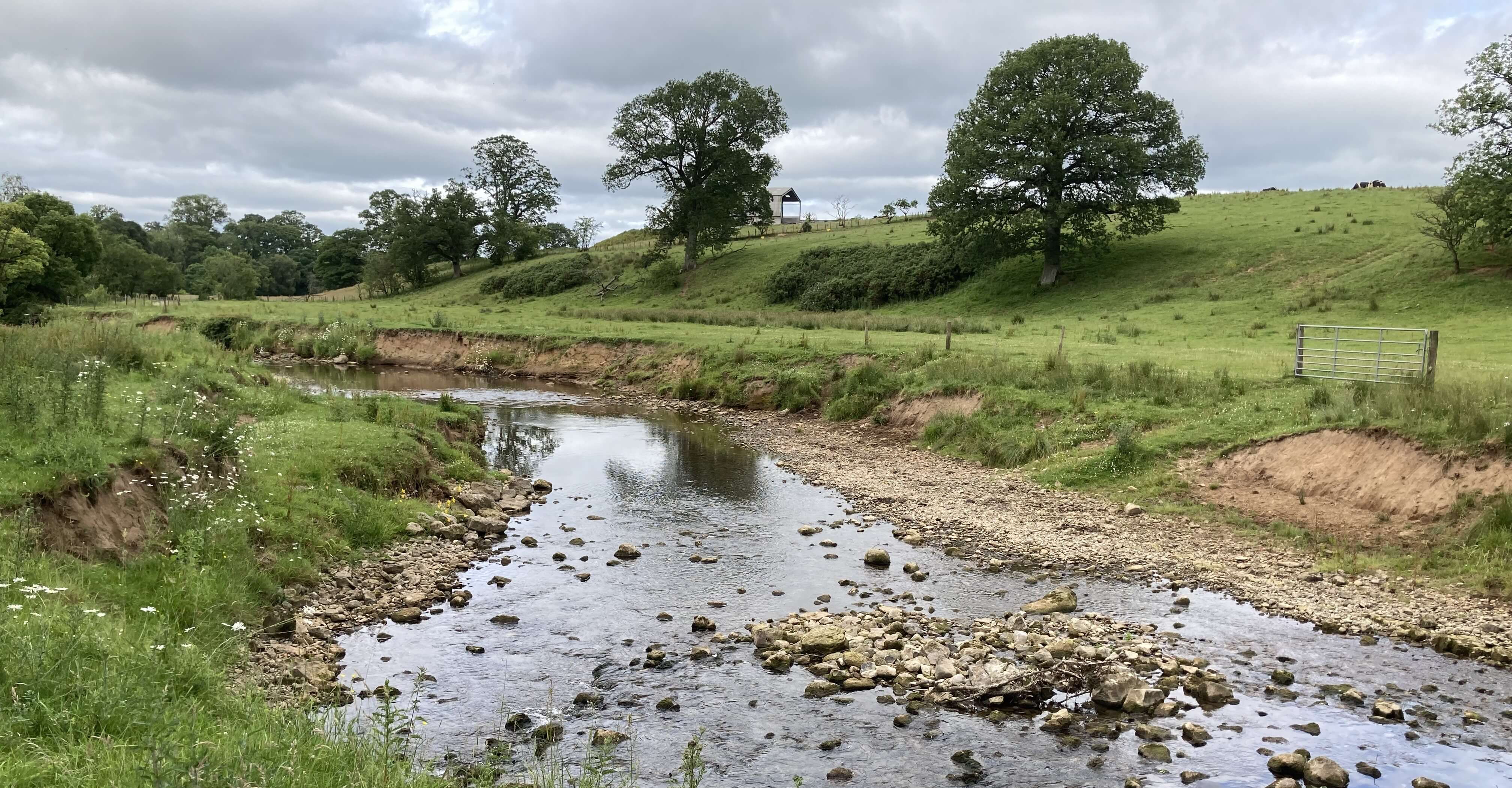
Hoff Beck
The hamlet of Hoff seemed to be no more than a pub (if it’s still alive), so I walked
on to Burrells, where the map indicates a Friendship Farm (which I didn’t notice)
and where two people paused to have a chat about my walking, so perhaps it is a
friendly place. From there, since the game of path-hunting, sometimes through
head-high vegetation, had palled, I just walked back on quiet roads, with views
to the Pennine hills, walking alongside and then over the National Park boundary,
with again no sign of it and no indication that I could see of why the new boundary
is where it is.
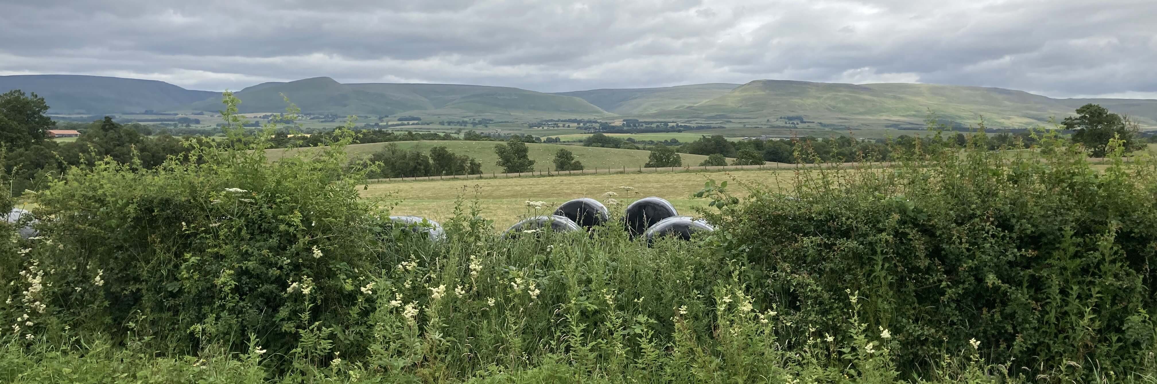
A view to the north Pennines
Overall, I am puzzled by these Westmorland Dales. Where I walked I saw no sign that
anyone cared whether they were inside or outside the Westmorland Dales or the Yorkshire
Dales. Does being inside or outside the Dales make any significant difference to
the locals? Perhaps it would help if there is no confusion as to what the
label ‘Westmorland Dales’ actually connotes. The
Yorkshire Dales National Park website says:
“In an area which lies to the north of the Howgill Fells in Cumbria, extending over 200 sq km
from Maulds Meaburn in the north to Tebay in the south-west and Ravenstonedale in the south-east,
the Westmorland Dales is an exposed, largely treeless, open landscape offering expansive
panoramas of surrounding upland areas.”
Other literature describes the Westmorland Dales similarly. So, it seems, the Westmorland
Dales lie to the north of the Howgills and the A685. There is only one dale (Smardale
[232]) in that region
marked on the map.
However, their own map (shown above) equates the Westmorland Dales
with the whole 2016 addition to the Yorkshire Dales, north and south of the A685, and
therefore includes the northern Howgills. The Howgills are of Ordovician and Silurian slates,
not limestone like the hills north of the A685, but this does not bar the northern Howgills
from the Dales because the southern Howgills have been in the Yorkshire Dales since 1954.
If the northern Howgills are
within the Westmorland Dales then the latter acquires several real dales (Bowderdale, Langdale,
Uldale, Weasdale). So, simple question: is Bowderdale within the Westmorland Dales?
Personally, if I were a Westmerian (that is, someone born in Westmorland) and had
the power to do so, I’d extend the Westmorland Dales as far as I could. The old county of
Westmorland was much larger and included many dales (such as Borrowdale and Bretherdale,
now within the Lake District National Park) much more impressive than any within the
north-of-A685 Westmorland Dales. If the Westmorland Dales is an invention with no
legal standing (as I suspect) then why cannot it be extended to include other dales
that were previously in Westmorland, which stretched as far west as Ullswater and
Windermere? So Bannerdale, Mardale, Longsleddale, Crookdale, Kentdale, and so on would all be
part of the Westmorland Dales. After all, if the Westmorland Dales is to be considered a
subset of the Yorkshire Dales National Park why cannot it also be a subset of the Lake
District National Park?
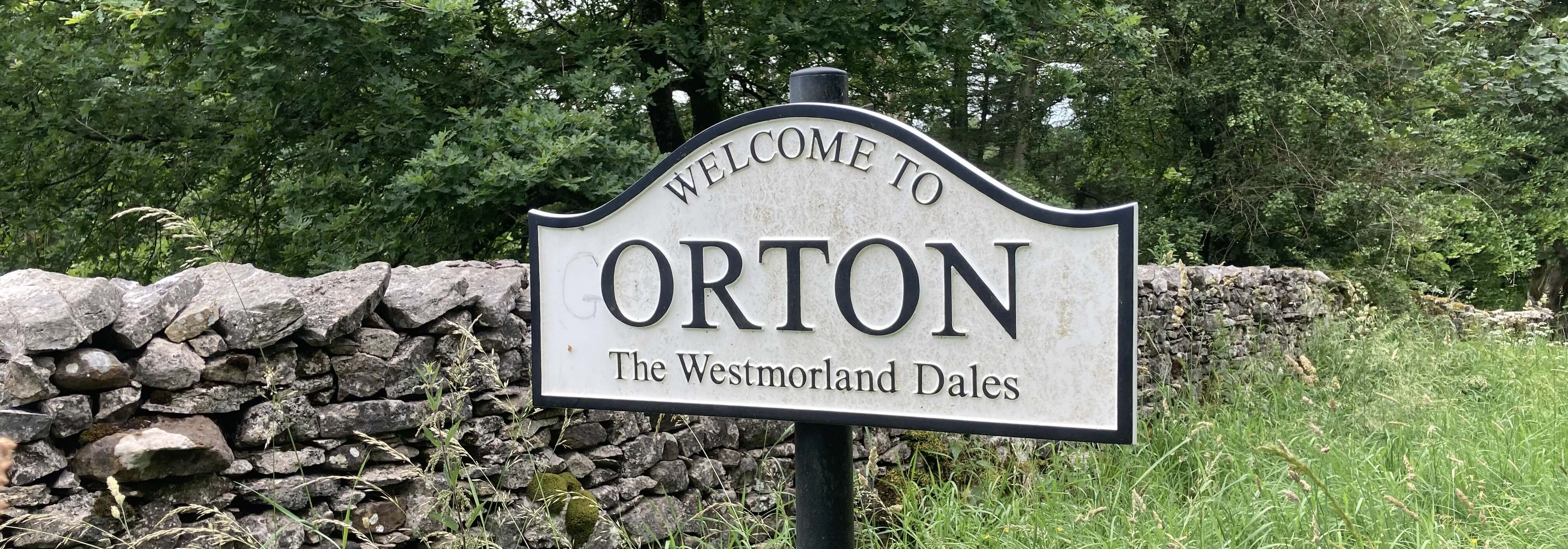
The only sign I saw of the Westmorland Dales
(Have they decided
to get rid of the Westmorland Dales road-side signs, as shown at the top - perhaps because they mention
the Yorkshire Dales National Park? I saw no sign of the Yorkshire Dales.)
P.S. After the farmers’ chat in the Three Greyhounds, the unitary authority (whatever
that is) of Westmorland and Furness Council was established in 2023. So the historic
name of Westmorland is not lost.
Date: June 29th 2026
Start: NY678129, Great Asby (Map: OL19)
Route: N on Dales High Way, past Rutter Force – Hoff – NE –
Burrells – S on road – Great Asby
Distance: 9 miles; Ascent: 50 metres
Home
Preamble
Index
Areas
Dales
Hills
Lakes
Places
Reserves
Rivers
Structures
Villages
References
Me
© John Self, 2018-

Top photo: Rainbow over Kisdon in Swaledale;
Bottom photo: Ullswater