Home
Preamble
Index
Areas
Map
References
Me
Drakkar
Saunterings: Walking in North-West England
Saunterings is a set of reflections based upon walks around the counties of Cumbria, Lancashire and
North Yorkshire in North-West England
(as defined in the Preamble).
Here is a list of all Saunterings so far.
If you'd like to give a comment, correction or update (all are very welcome) or to
be notified by email when a new item is posted - please send an email to johnselfdrakkar@gmail.com.
9. "The Prettiest Mere of All" Lakeland
We are fond of our superlatives, especially when it comes to the Lake District. If it is a matter of fact – the highest mountain (Scafell Pike) or the deepest lake (Wastwater) in England – then there is little scope for discussion. But when it is a matter of opinion we can have endless arguments.
What, for example, is the best mountain in the Lake District? For some
the highest is necessarily the best. Others would opt for another of the high mountains, such as Helvellyn or Great Gable. Wainwright, in the last of his seven volumes on the Lakeland Fells, felt compelled to list the “six best fells”: Blencathra, Bowfell, Crinkle Crags, Great Gable, Pillar and Scafell Pike. He added that “the grandest of the lot” is Scafell Pike. However, the fell that he liked best was Haystacks, which some don’t even count as a mountain, since it is less than 2,000 feet high. I don’t know if Harry Griffin, who wrote about the Lake District in The Guardian for over forty years, committed himself to a best fell but he did say that a friend considered Pen “his favourite Lakeland summit” and that “it is also, certainly, one of mine”. The fact that Pen is not one of Wainwright’s 214 may have been a factor. Griffin did, at least, express an opinion on the fell that afforded the best view: Bowfell.
 What about the lakes? Wordsworth said that Ullswater has “the happiest combination of beauty and grandeur which any
of the lakes affords”. Many would concur but some would suggest Derwent Water instead. The famous Baddeley guide (1880, 1922)
said that the “upper reach of Windermere is without doubt the most striking example of diversified beauty in the British Isles.”
Davies (2016) comments that Buttermere is “a perfect little lake”. Well, you can’t get better than perfect, although perhaps
the ‘little’ disqualifies Buttermere from being thought comparable to Ullswater or Windermere.
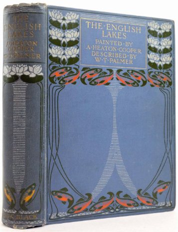
I have been provoked towards these thoughts by reading that William Palmer, in his classic book
The English Lakes (1905), written with the artist Alfred Heaton Cooper, referred to
the “prettiest mere of all”. To what do you think he was referring?
I felt duty-bound to see it. I began my search at Grasmere. Some will say that I need look no further. Davies indeed comments that Grasmere “does look very pretty”, as, of course, it does when viewed from Loughrigg Fell. No doubt the Wordsworths considered it so when they wandered up Loughrigg from Dove Cottage. But no, the prettiest mere is not Grasmere, according to Palmer, although it is within walking distance of it.
You will probably next think of Easedale Tarn. The walk to Easedale Tarn, past Sourmilk Gill, is one of
the standard Lake
District walks, popular since Victorian times – so popular that for many decades there was a refreshment hut by
the tarn. The tarn itself is in a fine setting, lying in a hollow between Blea Rigg and Tarn Crag, forming an
ideal spot for a summer picnic. I did indeed continue my search by walking up to Easedale Tarn. The path is
now reinforced almost all the way, trodden to submission by many boots. It was a relief to get off this path and to
wander on grass. I came upon a couple plodding gingerly along. The man said only one thing: “It’s a bit soggy in places, isn’t it?” I don’t know if he was unhappy or happy about that. It is often a lot soggy everywhere.

Easedale Tarn
But no, it was not Easedale Tarn that Palmer had in mind. I continued up the steep slope alongside which Belles Knott seemed surprisingly precipitous. I turned north, hardly able to contain my anticipation. When walking to a mountain top one is aware of the looming presence ahead. At the top, the view over the other side is always a pleasant reward but the top itself, so long the target, is not really a surprise. However, when walking up to a tarn, there is nothing of the tarn to see on the way. It is only at the moment one reaches the level of the tarn that it is suddenly revealed, all of it. It is as if a curtain in front of a masterpiece is whipped aside.
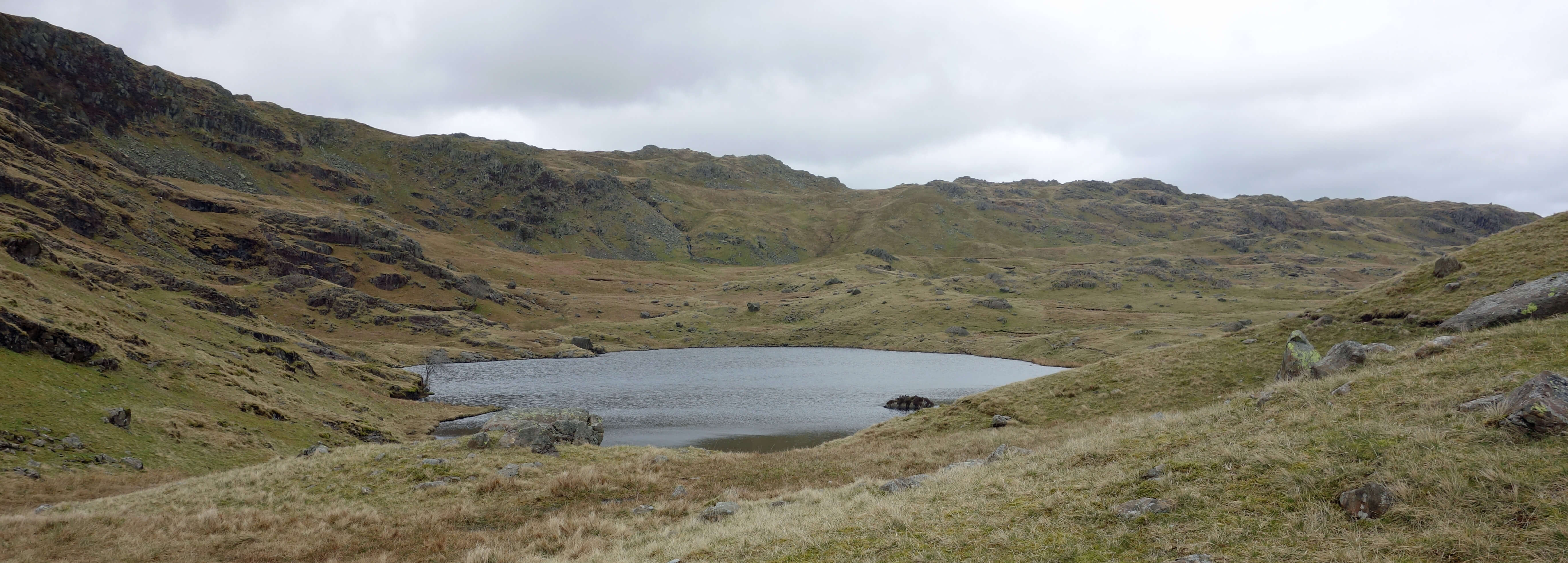
And there it was ...

The Prettiest Mere of All
... Codale Tarn. Palmer wrote in
Chapter 17
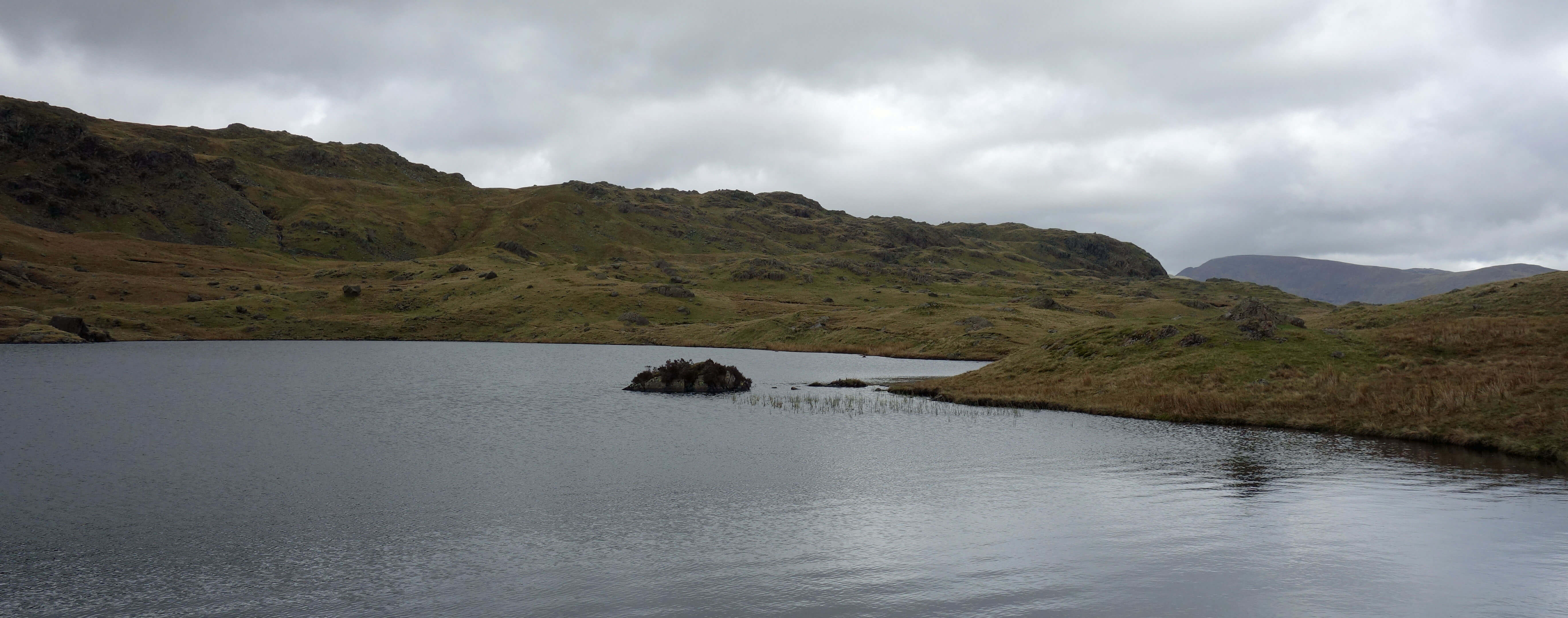
that "Codale Tarn, to my mind, is the prettiest mere of all: stand back from its
outlet and drink in the picture – the narrow dark band of water, the great pile of rock
dabbed with spits of grass, seamed with moss-laces and with parsley fern." Codale
Tarn had not figured in my consciousness before I read this comment. How could
I have overlooked such a gem?
I was not alone in not really being aware of Codale Tarn. Davies describes the best tarns, in addition to the sixteen lakes, and
includes Easedale Tarn but does not mention Codale Tarn. Baddeley said only that Codale Tarn is “an insignificant sheet of water …
swampy and stuffy”. Wainwright, being focussed upon the mountains, did not usually say much about the lakes and tarns. He did,
however, describe Easedale Tarn as “a romantic setting, inurned in bracken-clad moraines with a background of craggy fells”.
He then added that Easedale Tarn “is not the only jewel in Tarn Crag’s lap. A smaller sheet of water, Codale Tarn, occupies a
hollow on a higher shelf.” That’s it, but still it seems that he conceded that Codale Tarn is a ‘jewel’, although a lap
is a funny place for two jewels.
I was not disappointed by Codale Tarn. But then, despite Palmer’s words, my expectations were not that high. It was
obvious from the map that Codale Tarn does not have the rugged scenery of Helvellyn’s Red Tarn, the lofty eminence of Bowfell’s
Three Tarns, or the manicured beauty of Tarn Hows. Codale Tarn is an average-sized tarn, set within modest fells. Perhaps
‘pretty’ meant something different in 1905. Today, it smacks of faint praise. Something ‘pretty good’ is not that good.
It suggests perhaps a twee artificiality, but that certainly does not apply to Codale Tarn. The scene seems entirely natural,
apart from the fact that over the centuries we have removed trees in order to farm sheep. I could see no other sign of
humanity: no buildings, no walls, no paths, no cairns, no rubbish and, of course, no people.

Codale Tarn
I began to walk around the tarn in order to appreciate it from all angles. Then, suddenly, I saw two walkers, heavily backpacked, striding out purposefully. They marched to the main inlet of the tarn and began placing various instruments in the beck. I wandered around. They were researchers from Lancaster University, testing the nutrients entering the tarn. Being from Lancaster University myself (although over two decades ago) we began to mention names, hoping to find mutual acquaintances – and we did find two names that we all knew. They were amused to think that they’d come all the way to this remote tarn only to find a Lancaster University person there. They had several more tarns to test, so I left them to it, pleased to know that others also have an eye on Codale Tarn.
I must admit that I had grown rather fond of Codale Tarn by the time I left it. It has an unpretentious charm.
I cannot say that there is anything special about it at all. And yet through its very ordinariness, it becomes a
special place. It is a prototypical Lakeland tarn. If you wished to show someone a typical Lakeland tarn then you
could not do better than Codale Tarn. And you can’t say fairer than that.
Date: April 23rd 2018
Start: NY339073, Grasmere car park (Maps: OL7, OL6)
Route: NW, NW on Easedale Road – Easedale – W – Sourmilk Gill, Easedale Tarn, path
south of Belles Knott – N – around
Codale Tarn – SE – below Slapestone Edge – E – north side of Easedale Tarn, around Ecton Crag – SE – Grasmere
Distance: 7 miles; Ascent: 405 metres
Home
Preamble
Index
Areas
Map
References
Me
Drakkar
© John Self, Drakkar Press, 2018-

Top photo: The western Howgills from Dillicar;
Bottom photo: Blencathra from Great Mell Fell


 What about the lakes? Wordsworth said that Ullswater has “the happiest combination of beauty and grandeur which any
of the lakes affords”. Many would concur but some would suggest Derwent Water instead. The famous Baddeley guide (1880, 1922)
said that the “upper reach of Windermere is without doubt the most striking example of diversified beauty in the British Isles.”
Davies (2016) comments that Buttermere is “a perfect little lake”. Well, you can’t get better than perfect, although perhaps
the ‘little’ disqualifies Buttermere from being thought comparable to Ullswater or Windermere.


