
Home
Preamble
Index
Areas
Dales
Hills
Lakes
Places
Reserves
Rivers
Structures
Villages
References
Me
Saunterings: Walking in North-West England
Saunterings is a set of reflections based upon walks around the counties of Cumbria, Lancashire and
North Yorkshire in North-West England
(as defined in the Preamble).
Here is a list of all Saunterings so far.
Guaranteed ad-free, AI-free and free!
If you'd like to give a comment, correction or update (all are very welcome) or to
be notified by email when a new item is posted - please send an email to johnselfdrakkar@gmail.com.
236. The Not-the-Lune-Valley-Ramble Ramble
A low, grey cloud covered everywhere and it didn’t intend to budge all day. It was a day for
a brisk, purposeful walk, not one for lingering amongst the autumn colours (there hardly were
any). For an objective, I set out to see how many ways we have made use of the River Lune.
I tackled the not-the-Lune-Valley-Ramble Ramble. The
Lune Valley Ramble is a 17-mile
walk from Lancaster to Kirkby Lonsdale on the south bank of the Lune to the Crook o’Lune and
thereafter on the north bank. Obviously, there is an opposite bank that is not part of the Lune
Valley Ramble. This is where I set off to walk.
I don’t recommend this not-the-Lune-Valley-Ramble Ramble – it is not as straightforward and pleasant
as the Lune Valley Ramble (in fact, in parts it is no fun at all) – but I like to be contrary.
The Lune west of the Millennium Bridge was very low, exposing much mud, plus an old
bike and much else besides. (… for tipping rubbish into – 1) It was
hard to picture large ships berthed here at St George's quay
during Lancaster’s ‘golden age’ (the 18th century), unloading their goods
into the tall warehouses now converted into flats. In recent decades it had been usual to see
one or two smaller boats here but I haven’t even seen them for a while. (… for
trading at the quay – 2)
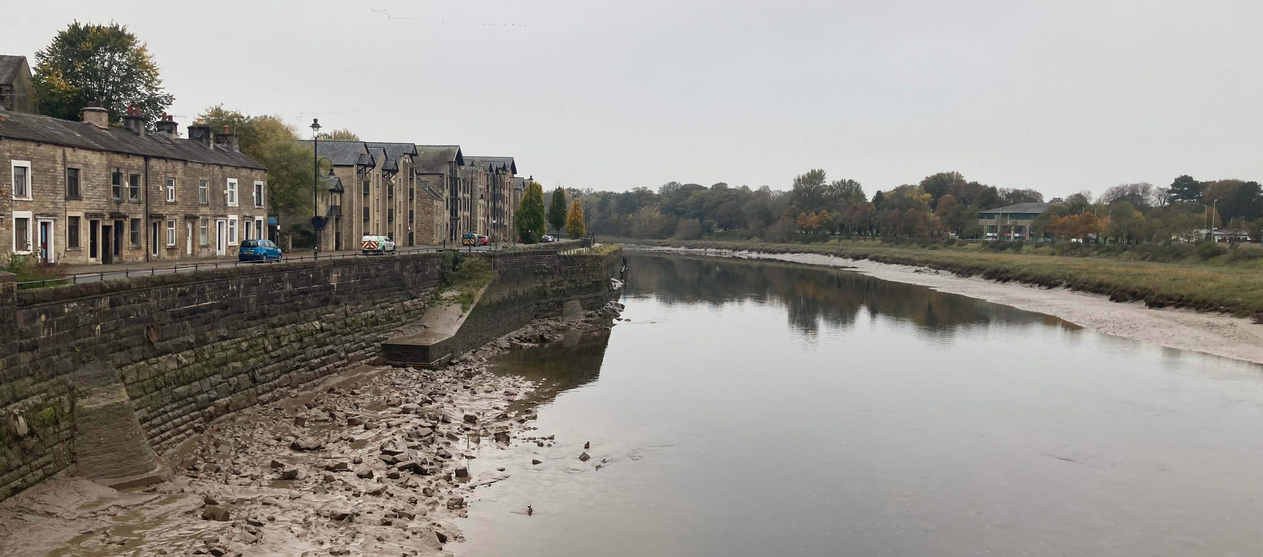
Left: From the Millennium Bridge, looking to the old quay; Right:
From the Millennium Bridge, looking up-river (Ashton Memorial on the horizon, just)
Looking in the other direction, visibility was so poor that the Ashton Memorial could
hardly be seen. During Lancaster’s golden age
the largest of several shipyards, Brockbanks, was based on the
bank in the foreground. It began in 1738 and closed in
1817 having built over a hundred ships. It doesn’t seem to have been best situated for a
shipyard, as some of the ships built were too big to pass under the then bridge and
so had to be floated down-river in parts and assembled there. (… for
shipbuilding – 3)
Beyond Skerton Bridge I walked across green fields on a path separated from
the river by a tangled mass of undergrowth and debris. The river itself, hardly
glimpsable, dribbled over exposed mud and rocks with barely enough water for the
gulls to paddle in. This all changed at Skerton Weir, the tidal limit of the Lune.
Above the weir the Lune rested, wide, deep and still – or nearly so, as the leaves
on its surface moved at about one inch per second.
At the weir a sign said ‘Rowing Club’ – but it didn’t say which one (as far as
I noticed). I think it’s the Lancaster John O’ Gaunt Rowing Club, founded in 1865
after a split from the Lancaster Rowing Club (founded 1842, closed 1932). The boathouse
by the weir seemed well shuttered up, whether permanently or not, I couldn’t tell.
Perhaps it had closed for the winter, as I had read that its boats were badly damaged
in Storm Desmond in 2015 and it had been decided to move them to safer ground over
winter.
Because of the weir, the Lune is, in normal conditions, docile for a couple
of miles upstream and it is therefore ideal for rowers. (Lancaster University
and the Grammar School have boathouses at the Halton end of this stretch.) The
Lancaster Regatta was (and perhaps is) held on these calm waters, mainly at Halton
Waters, I believe, the first one being held in 1842. The John O’ Gaunt Club last hosted
the event in 2007 but some kind of regatta has continued since, although without
much fanfare, it seems. I’ve never heard or seen sign of such an
event [1]. (… for rowing on, including in regattas – 4)
Apart from
these organised rowing events [2], this stretch also used to be the site for pleasure outings,
to be taken in your best Sunday clothes, it seems, from the photograph below. (… for pleasure
boating – 5) Also, because of the stillness, the river is quite liable to
freeze here and in the very cold winter of 1893 it was possible to skate from Halton
to Skerton Weir. (… for skating on – 6)

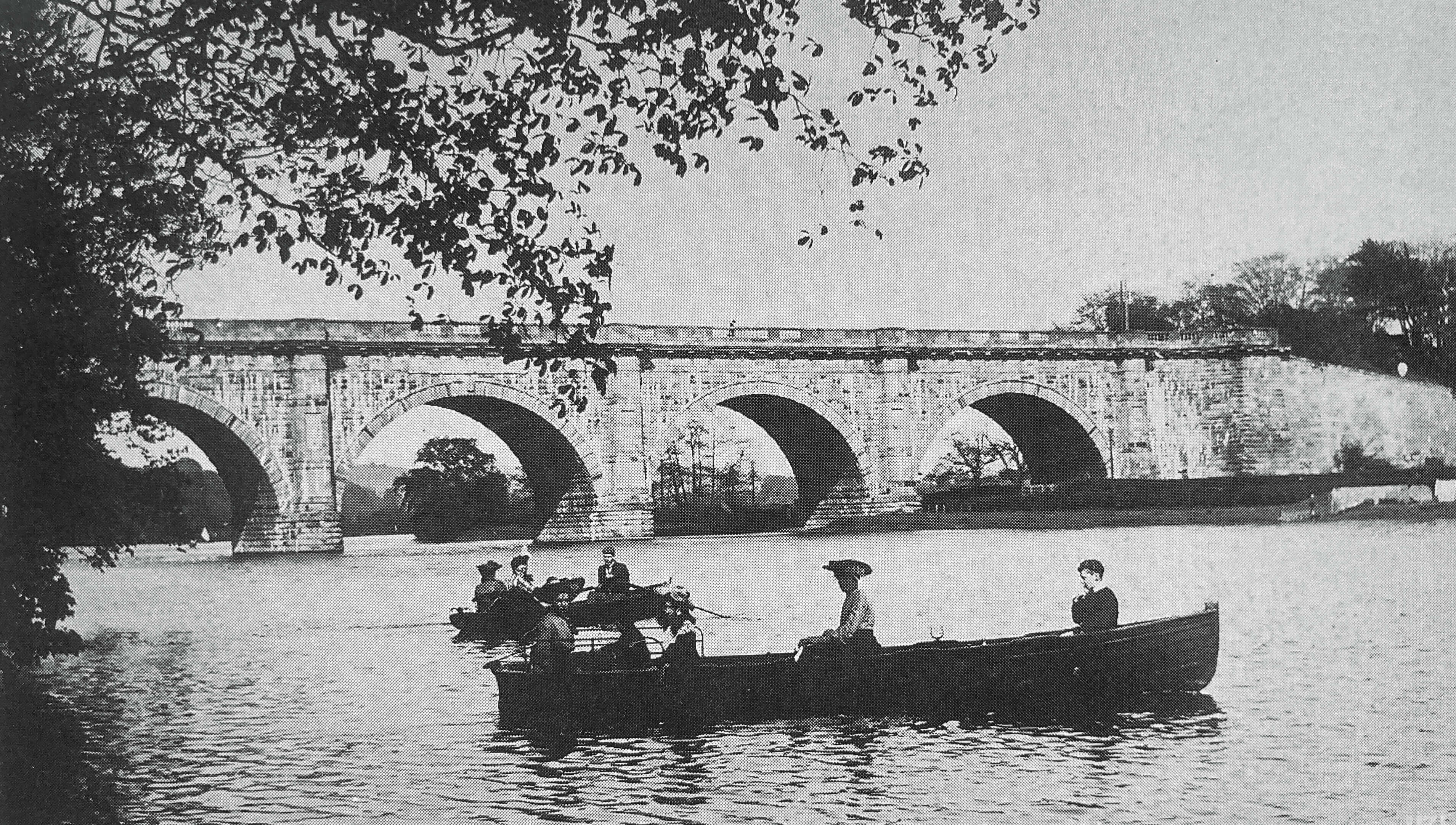
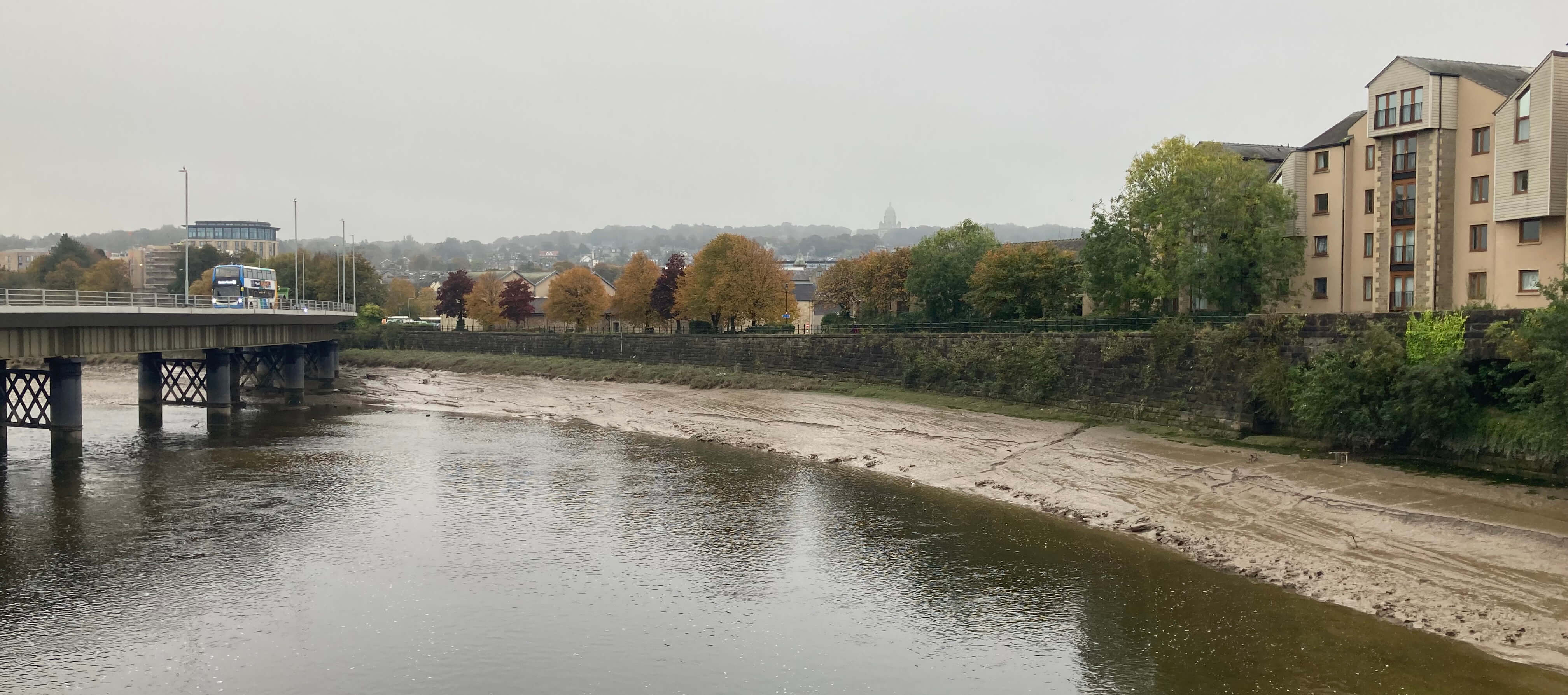
Left: Approaching the Lune Aqueduct, hardly visible in the murk, with
the Lune looking as still as a lake; Right: Boating
near the Lune Aqueduct (this old photo has nearly as much colour as mine).
The path continues right by the river’s edge just a few inches above river level, which,
because of the weir, is always the same, except in flood conditions. Then, behind a new
housing estate, the path rises and falls a few times before dropping down below the Lune Aqueduct
carrying the Lancaster Canal. High above on the aqueduct I could see two anglers dangling
their lines some 19 metres into the Lune below. I don’t think they were serious. If they
did catch anything it would be a challenge to reel a fish up 19 metres. They were probably
really there to fish in the aqueduct and just dropped their lines into the river for a
laugh. (… for recreational fishing – 7)
Recreational fishing in the Lune has, of course, a long tradition. The Lune was once
known as one of England’s best salmon rivers but the numbers of salmon have dropped to about
a quarter of what they were twenty years ago. The chairman of Lancaster and District Angling
Association commented in the
Lancaster
Guardian in 2024 that “there needs to be observable actions to stop the salmon from
falling off a cliff edge into extinction”. An interesting image.
I saw three more anglers later, by the riverside where they belong. I didn’t see
them catch anything. In fact, I have never seen a Lune angler catch anything. I suppose
there must be some appeal in staring forlornly at a river for hours. However, I did once
see an angler carrying a large salmon. I assume that he had just caught, not bought, it.
Nowadays, he would have to return it to the river.
Beyond the aqueduct the path continues, rather scruffily and in places very
muddily, below the fences of houses and then the Halton Training Camp. This land was
acquired in 1938 for the Royal Engineers Amphibious Bridging Camp although it is now more
general purpose. Its original name shows that its location by the river is not incidental.
There are several ramps down into the river and I have seen military personnel in their
equipment in the river, but not recently. (… for military training – 8)
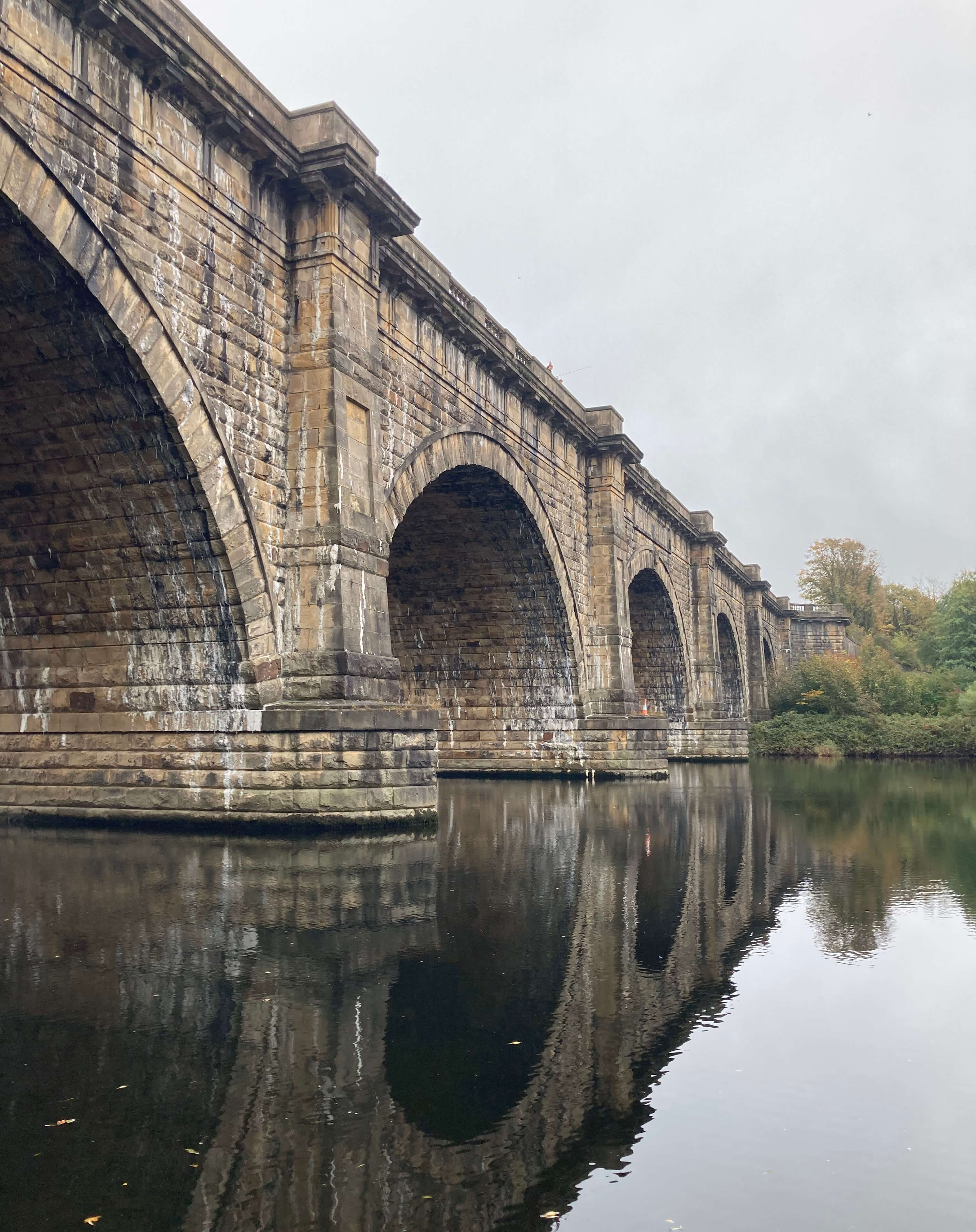
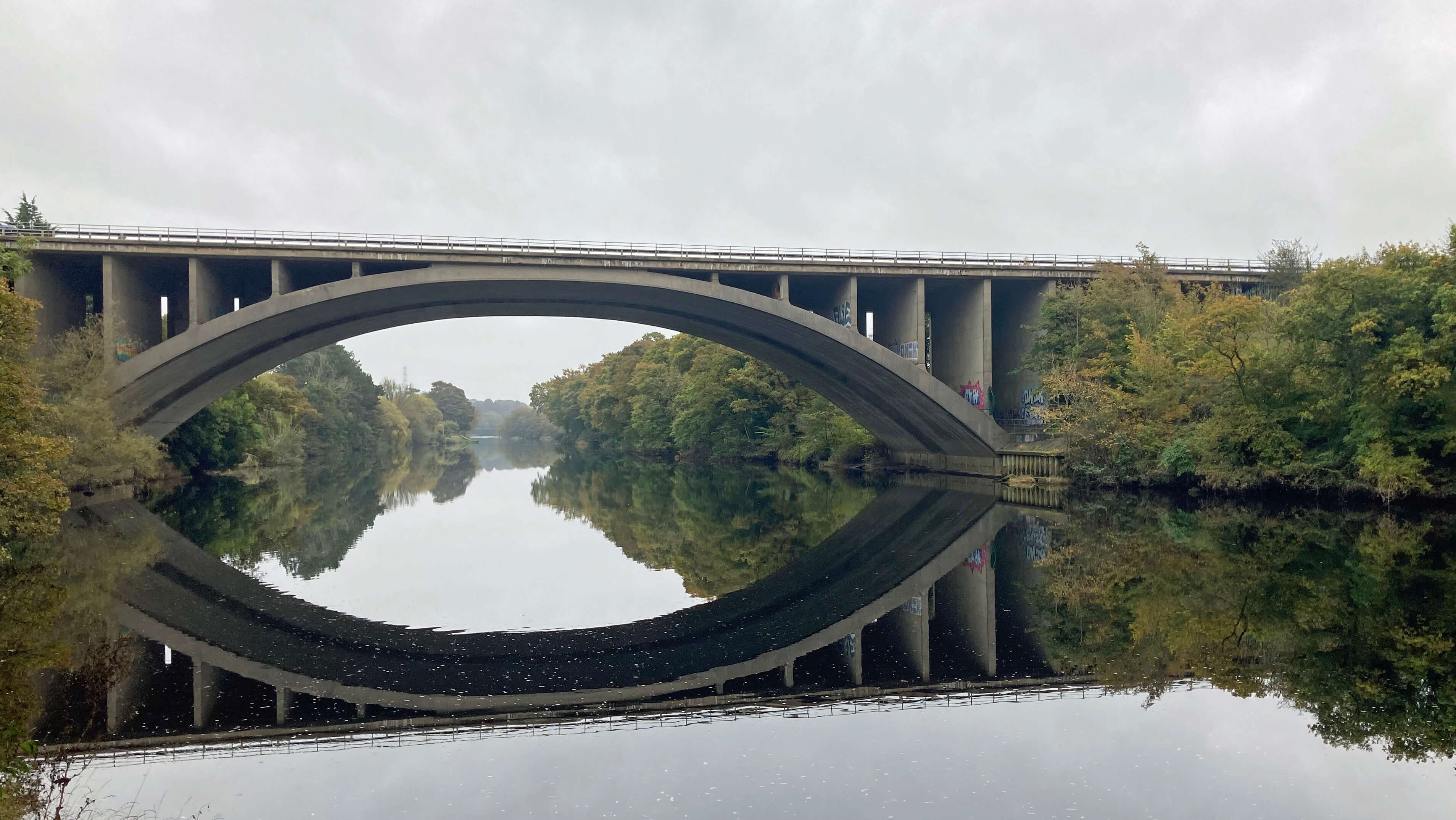
Left: The Lune Aqueduct (the anglers were above the second
arch); Right: The M6 bridge.
Beyond the motorway, the riverside is selfishly guarded by riparian owners and it is necessary to
walk on the road through Halton. It is a shame that the old core of Halton, with the church
and the old hall, is unpleasantly noisy and busy, with the narrow road now providing easier
access to the motorway. Eventually, though, it is possible to drop down to, but not cross on
this occasion, the Halton Bridge.
This rickety-looking structure was constructed in 1913 from the unwanted remains of a
rebuilt Greyhound Bridge in Lancaster. It cannot really be rickety because it withstood Storm
Desmond. The original bridge here was built in 1849 to provide access for Halton villagers
to Halton Station on the new railway line inconsiderately built on the other side of the river.
I have previously written that before this bridge was built workers on the railway
line who lived in Halton took a ferry across the river – until eight of them were washed away
in a flood. I cannot now find a source for this fact, if it is a fact (I vaguely recall it
was in a memoir of a Halton resident, a local vicar perhaps, of the time).
Wikipedia
describes this event – but quotes me as the source, which is a worry. When I have time, I’ll
have to go to Lancaster Library to search the pages of the 1840s Lancaster Guardian, for
such an event would surely be reported there. (… for commuting by ferry – 9)
During my search for this source I came across a photo of 1914 showing officials
inspecting salmon caught at Forge Weir, Halton. The text with the photo says that in 1826
1,300 lb of salmon were caught at Halton in two days (Alston, 1994), which is about as many
salmon as are caught in a whole season along the entire Lune now. I never knew that
commercial fishing occurred on this stretch of the Lune – albeit a long time ago. I assumed
commercial fishing was restricted to the estuary. There are plenty of old photos showing
fishermen at Sunderland Point and Glasson. (… for commercial fishing – 10)
I walked on to Forge Weir, through all the new housing that has engulfed the few
remains of the once-extensive Halton Mills. The river here is at its most turbulent in
the lower reaches of the Lune. It is therefore the best place for canoers and kayakers
to polish their skill. To make it more challenging, stone jetties have been built to
guide the water into narrower gullies. (… for canoeing and kayaking in – 11)


Left: Kayaking on the Lune (with the Lune
much less rapidsy than it often is); Right: The Halton Hydro.
Just below Forge Weir, a new building borrows water from the river. This is the Halton Lune
Hydro, said to be the biggest community-owned hydro-electric plant in England. (… for
generating hydro-electricity – 12) It began in 2015 and continues a centuries-long
tradition, dating back at least to 13th century corn mills, of using water here to generate power.
Halton Mills had effectively closed by World War II although Lakeside Engineering was based
here from 1948 to 2007. The building still bears this name although it has been converted into
a community space. (… for powering old mills – 13)
Above the weir the Lune becomes wide, deep and still again (under normal conditions).
On the opposite side, the bank seems reinforced by an insignificant wall. This is where water
from the Lune is extracted as part of the ‘Lancashire conjunctive use scheme’ to be transferred
to the River Wyre, nature having so badly designed things so that the Wyre has too little
water and the Lune too much. This is the scheme that caused the Abbeystead explosion in 1984,
killing sixteen people [53]. (… for extracting water to
transfer elsewhere – 14)
The path continues, despite being gobbled away by erosion, into woods.
It is in this stretch of river that I have seen otter, but not in recent years.
The return of otters to the Lune was much discussed but there has been little
mention of otters recently. Have we become accustomed to their presence or
have they disappeared again? Other riverine species, such as
kingfisher, sand martin, dipper, egret, and so on are more likely to be
seen. There are also species, such as bats, that are not exclusive to
but are fond of river habitats. I was once invited to observe all the bats
returning to their roosts at the Crook o'Lune – and advised to cover myself with an old mac.
Although I had never before been invited to stand
in someone's garden at five in the morning in a
shower of batpoo, I graciously declined. (… for observing riverine nature – 15)
The narrow path rises through the wood, crosses
the road and drops down to the Crook o’Lune, where to continue on the not-the-Lune-Valley-Ramble Ramble I have to
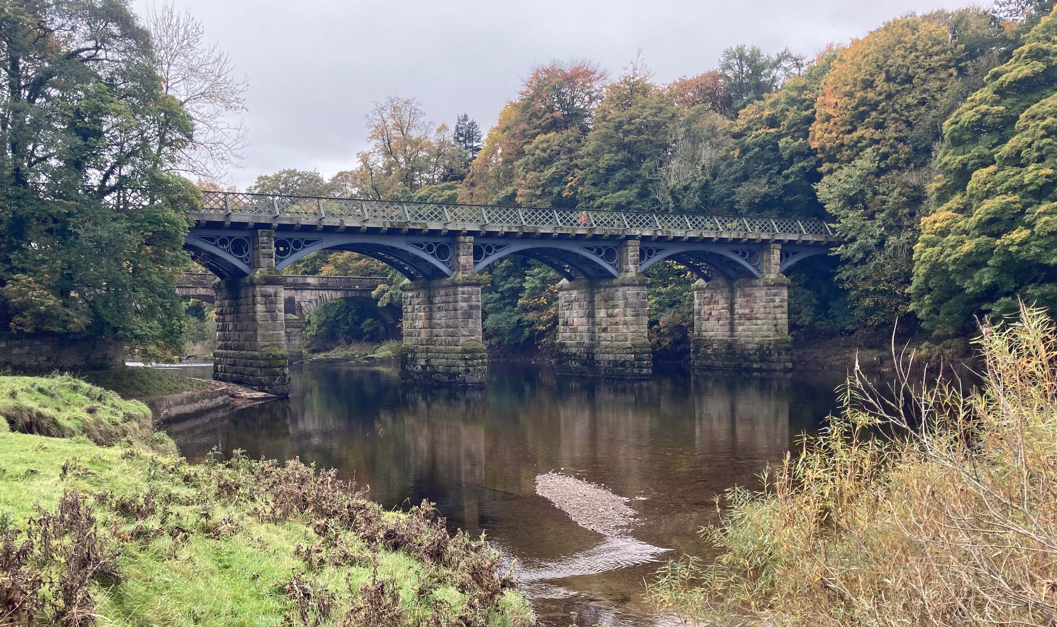
cross banks. The path curves under the old railway bridge, passing the well-known Crook o’Lune
picnic site. Although the Lune between here and Lancaster is generally peaceful there are, in
fact, few places where it is convenient and safe for youngsters to paddle – and even fewer where
it is wise for oldsters to swim. (… for paddling and swimming in – 16)
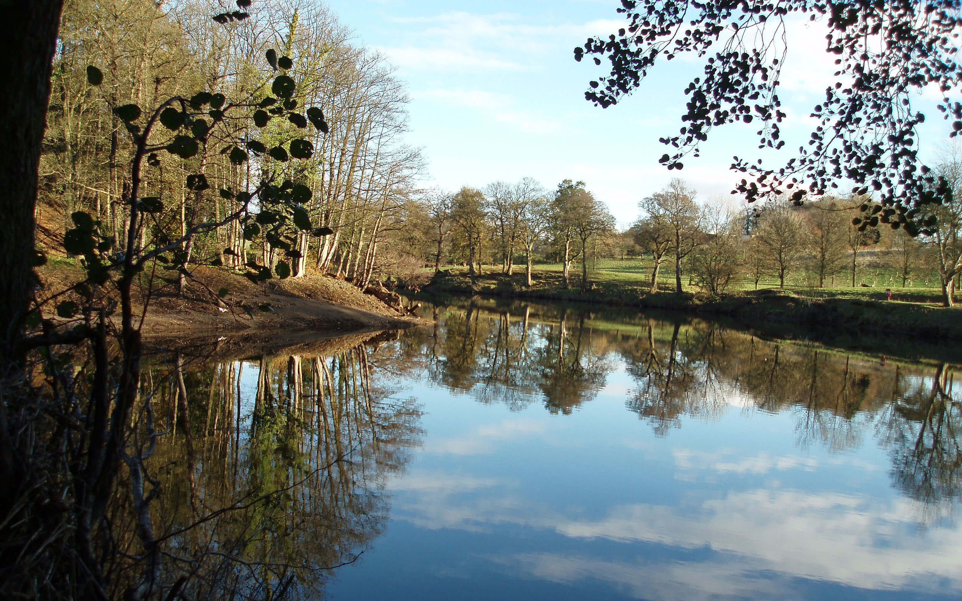
Left: The Lune at the Crook o'Lune (photo taken by Ruth and
used on the front cover of
The Land of the Lune; Right: Two of the three
bridges at the Crook o'Lune.
The Crook o’Lune is, of course, also noted for being the subject of a sketch by Turner
[83], who also produced sketches of and from the Lune Aqueduct
[72]. In general, the peaceful Lune attracts many artists and
photographers. (… for painting and photographing – 17)
Now on the south bank, on the final stretch for today, I passed where last year
United Utilities were carrying out a mysterious project to replace some ‘screen’s,
ostensibly to help the eels [207]. The region is still fenced
off although the work has presumably finished. These screens were apparently part of a
water outtake, for United Utilities to extract what becomes our drinking
water. (… for extracting water for us to drink – 18)
As promised, the clouds stayed low and grey.
Date: October 13th 2025
Start: SD476619, Lancaster bus station (Map: OL41)
Route: (linear) N over Millennium Bridge, NE, N – Lune Aqueduct – NE by
river – M6 bridge – E on road – Halton Bridge – E through Halton Mill – Crook o'Lune – NE on
south bank – Waterworks Bridge – S – Brookhouse
Distance: 7 miles; Ascent: 80 metres
[1]. A reader has directed me to this
website which gives details of a
'Lancaster Head of the Lune' event to be held on Sunday November 16th 2025.
[2]. Another reader informs me that I could add 'competitive
swimming' to the list of uses of the Lune because in the 1960s there was a 'Lune Swim' event,
involving a race from the aqueduct to the weir.
Home
Preamble
Index
Areas
Dales
Hills
Lakes
Places
Reserves
Rivers
Structures
Villages
References
Me
© John Self, 2018-

Top photo: Rainbow over Kisdon in Swaledale;
Bottom photo: Ullswater