
Home
Preamble
Index
Areas
Hills
Lakes
Dales
References
Me
Saunterings: Walking in North-West England
Saunterings is a set of reflections based upon walks around the counties of Cumbria, Lancashire and
North Yorkshire in North-West England
(as defined in the Preamble).
Here is a list of all Saunterings so far.
If you'd like to give a comment, correction or update (all are very welcome) or to
be notified by email when a new item is posted - please send an email to johnselfdrakkar@gmail.com.
207. Eel Entrainment by United Utilities
When you walk on a long-familiar path you notice small changes. On a walk from Brookhouse
along the river to the Crook oÆLune, I might notice that, say, a gate has been repaired or a
tree has fallen in the river. Very occasionally thereÆd be major changes that everyone would
notice, such as the laying of a gas pipe under the river. Overall,
though, the walk remains largely unchanged, a pleasant stroll, in fine scenery, with views
up the valley to the Dales hills û a walk that it is a privilege to be able to take from our
doorstep.
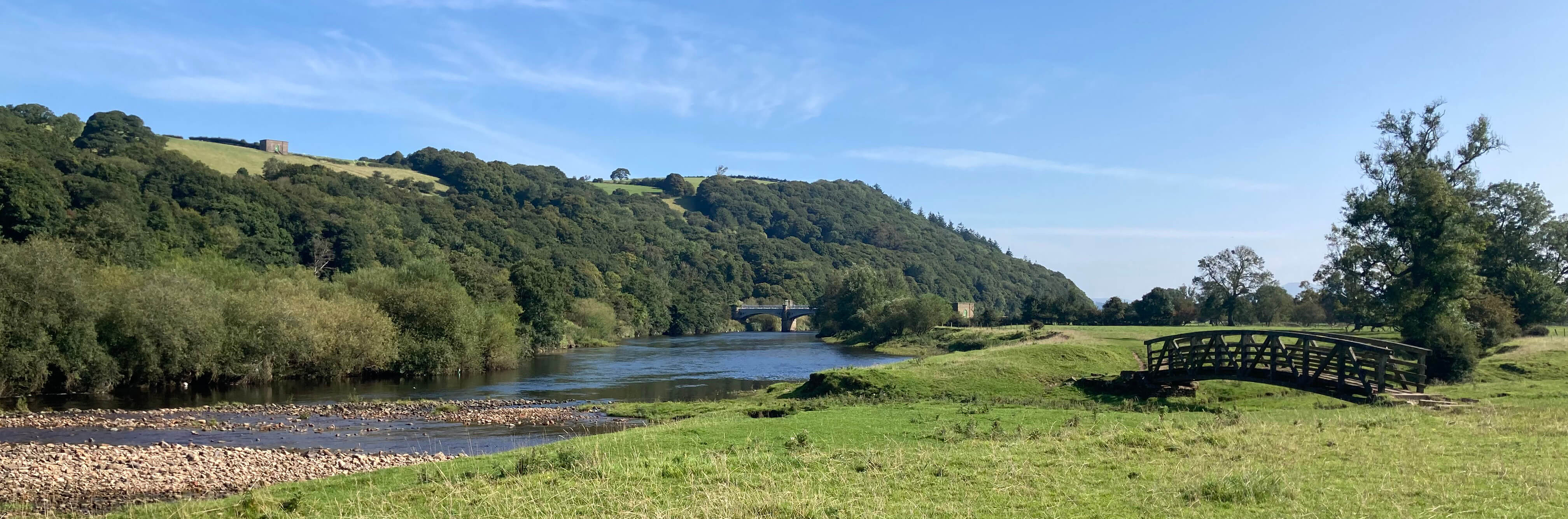
The Lune near the bridge over Artle Beck
On this occasion our path by the river was diverted around a fenced-off area within which
were several workersÆ cabins, a large yellow crane or digger, and a van saying ôUnderwater
Diving Barrowö on the side. Notices told us that this was a project financed by the
Environment Agency and United Utilities.
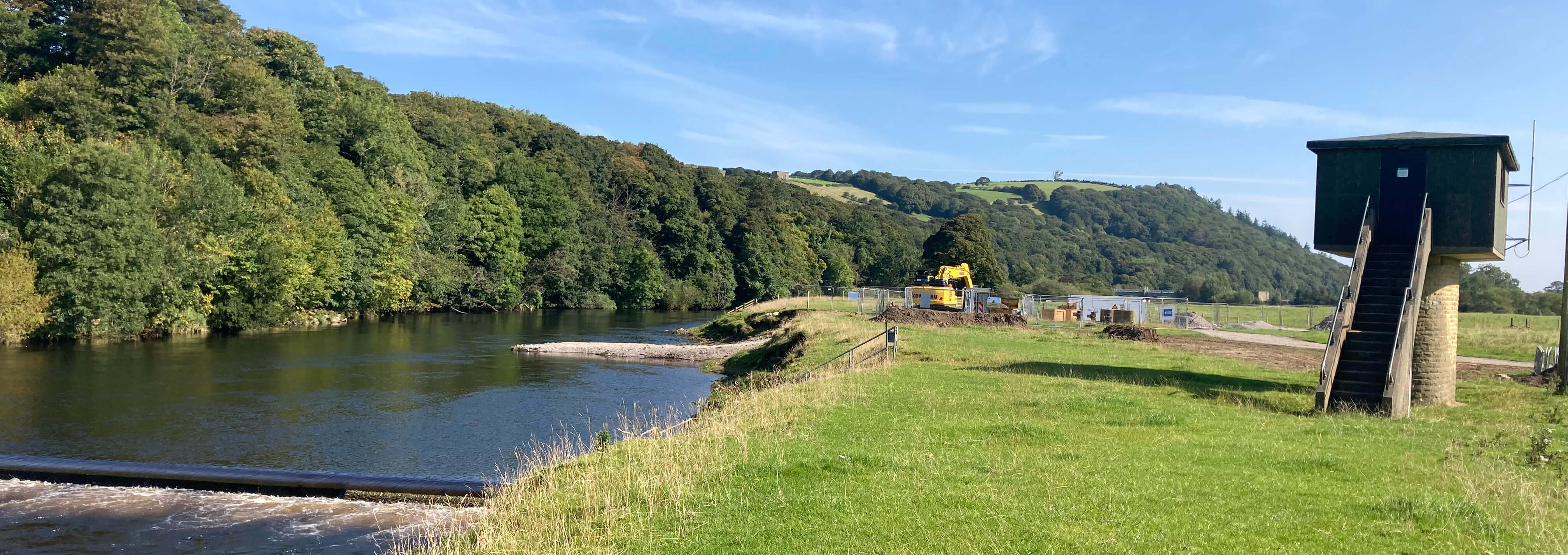
Just past the fenced-off area
United Utilities has been in the news recently, mainly because of its continued illegal pollution
(as described on the
'Save Windermere' website)
of the hallowed waters of Windermere, which it is apparently powerless and penniless to prevent.
In retaliation, United Utilities released a
news item
saying that wild campers on
its land were leaving rubbish and ôtrails of destructionö. I wondered what United
Utilities was up to here, by the Caton weir.
Strangely, an information board about this project is on the opposite bank. It says
that the work from May to October 2024 is to ôhelp eels/elvers move freely over the weirö by
replacing ôthe existing screens to ensure the eels/elvers have a safe passage through this
catchmentö. That all sounds commendable. The cash-strapped United Utilities and Environment
Agency have apparently made it a priority to help our beleaguered eels (especially the
young eels, the elvers), and they certainly need all the help they can get since the eel
is a æcritically endangeredÆ species, with its numbers having dropped by about 95% since
the 1980s.
However, despite what it says on the board, the work does not seem to directly involve
the weir but is being carried out about thirty metres upriver. If they were to remove
the weir then that would certainly help any eels. But the weir remains, fulfilling
whatever function that it has. Instead, the work involves replacing
some mysterious æscreensÆ. Where are these screens?
An online note
from Cheetham Hill Construction Ltd, who have been awarded a contract to carry
out work at the River Lune in Caton, appears to relate to this project. It says that three existing screens will
be replaced by ôHigh Capacity Intake Screens (2mm aperture size)ö in order to ôprevent
eel entrainment in the raw water intakes and to provide an improved migration passageö.
According to my dictionary, to æentrainÆ is ôto transport one substance, e.g.
small liquid particles, in another, e.g. a vapourö. In this case, then, the entrainment
involves the transport of eels in the 'raw water intakes'. And since it is to be prevented
then presumably it previously occurred.
It has long been the case that at low water some grill-like structure could be seen
in the middle of the bed of the river. Its function, if any, was a puzzle û but a
puzzle that couldnÆt be solved, so that after a while it was just accepted for being
there. This grill thing seems to relate to the screens being referred to, as a bank
has been built into the river to facilitate access to it.
The screens are, according to the Cheetham Hill note, to do with 'raw water intakes'. They may be
raw water intakes for United Utilities but for us they are clean water outtakes.
The Lune water is at least cleaner than that which United Utilities releases into
Windermere û and it is taken out of the river to be treated, presumably, to become
our drinking water. It was not said that the screens were damaged and
needed replacing. The emphasis on the ô2mm aperture sizeö suggests that the
previous screensÆ apertures were larger and permitted the passage of young eels.
So, has United Utilities (and its predecessor, the
North West Water Authority) been accidentally or
knowingly extracting eels for decades? If a large expensive project is now
necessary to protect the eels that remain then presumably there were enough of them
entrained that they could hardly be missed at the treatment plants.
When I was involved with the Lune Rivers Trust there were many discussions
about how to help eels. Much effort and cost was expended on eel passes (for example,
at the Caton weir) to enable eels to overcome barriers to their progress up the river.
These passes consisted of small pipes with bristles within, up which eels were
supposed to wriggle. It always seemed an optimistic hope to me but presumably
there is some evidence that it helped. But nobody ever said, ôWhy are we helping
eels pass the Caton weir when just upriver they are going to disappear into the water
outtakes?ö. Can it really be the case that, while people were
struggling to help eels that had spent
two years or more travelling 4,000 miles to arrive here, those eels were being sucked into these
water outtakes, without anyone knowing about it except perhaps United Utilities?
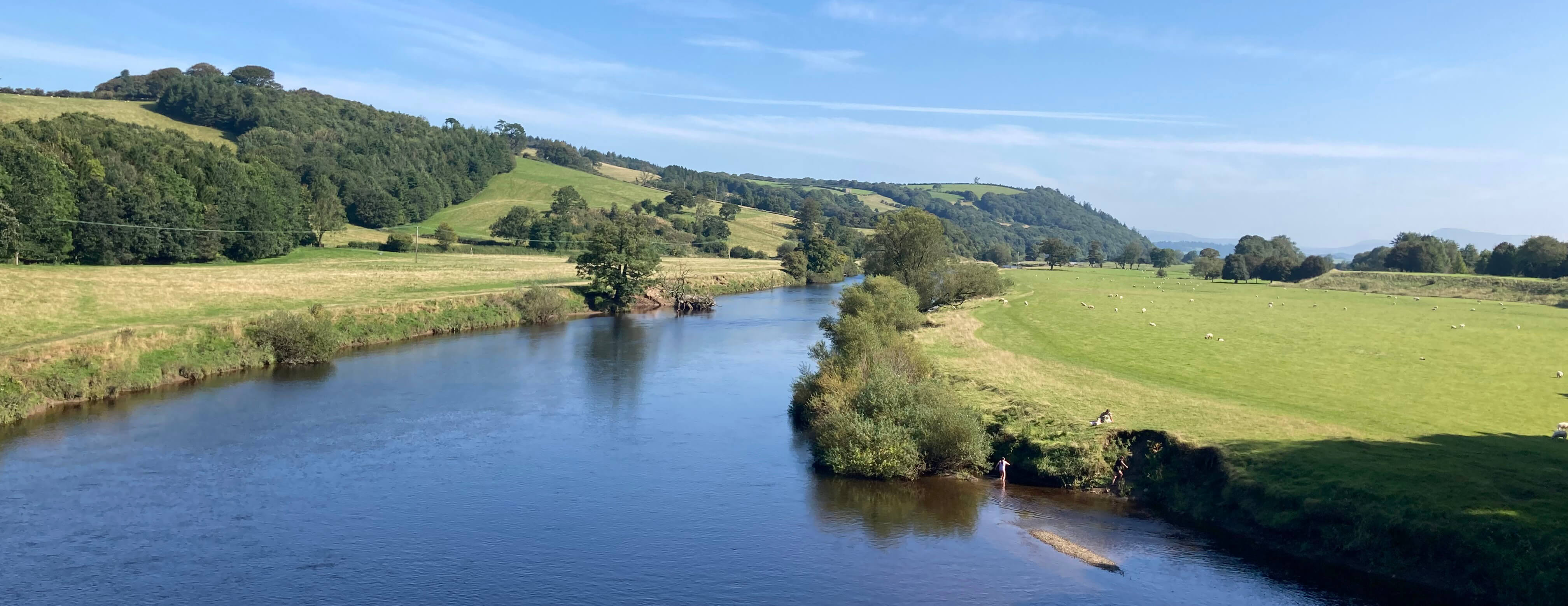
The Lune from the Crook o'Lune
Of course, it is possible that I have got the wrong end of the stick about this project
but until someone directs me to the right end I will remain sceptical about
United UtilitiesÆ belated recognition that it should help the eels.
Is helping eels all that there is to this
project? Is the information board a disingenuous diversion? Does it really
take five months to replace three screens? Do
they really need an underwater diving team for a river that anglers
stand in? Where do they dive to?
We walked on to the Crook oÆLune where we were disappointed to find that the
Woodies snack bar was closed, despite it being a sunny last weekend of the school
holidays. We were also disappointed by the rampant Himalayan balsam that continues
to spread along the riverside û but thatÆs another story. Perhaps if I didnÆt think about
the problems of eels, Himalayan balsam and suchlike
then IÆd enjoy these strolls even more, walking in blissful ignorance.

The Lune west of Waterworks Bridge
Date: August 31st 2024
Start: SD543644, Brookhouse (Map: OL41)
Route: N û Waterworks Bridge û SW on south bank û Crook oÆLune û NE
on north bank û Waterworks Bridge û S û Brookhouse
Distance: 5 miles; Ascent: 40 metres
Home
Preamble
Index
Areas
Hills
Lakes
Dales
References
Me
® John Self, 2018-

Top photo: Rainbow over Kisdon in Swaledale;
Bottom photo: Ullswater