Home
Preamble
Index
Areas
Hills
Lakes
Dales
Places
Map
References
Ramblings
Me
Drakkar
Saunterings: Walking in North-West England
Saunterings is a set of reflections based upon walks around the counties of Cumbria, Lancashire and
North Yorkshire in North-West England
(as defined in the Preamble).
Here is a list of all Saunterings so far.
If you'd like to give a comment, correction or update (all are very welcome) or to
be notified by email when a new item is posted - please send an email to johnselfdrakkar@gmail.com.
214. The Shining Levels of Morecambe Bay
Unless I sign up for a cross-bay walk led by the King’s Guide I will be unable to
describe in these pages the experience of one of the most celebrated walks in
North-West England. It is, of course, foolish to walk out into Morecambe Bay
unGuided. This is a pity because, being an asocial soul, I think I’d quite enjoy
standing in the middle of Morecambe Bay, surrounded by nothing but miles of glistening
mud, relishing the quiet and the solitude. Even if I did sign up for a Guided walk,
the company of scores of excitable others would ruin the quiet and the solitude.
So I am restricted to experiencing Morecambe Bay from its sides, by walking
along stretches of the 125-or-so-mile coast-plus-inlets, as I have at
Grange-over-Sands, Heysham and Knott End (Saunterings 52,
101 and 182). Today I set out for a
walk from Bolton-le-Sands to Morecambe, hoping that the openness of the bay would
enable me to make the most of the limited sunshine at this time of the year. After
I dropped down Mill Lane past the bungalows of Bolton-le-Sands a view of the bay
opened out. The remains of a sea mist sat upon the water, which was approaching
high tide, and above it rose the hills of the Lake District with only a few patches of
the recent snow left on Coniston Old Man and Fairfield.

From the marsh at Bolton-le-Sands, looking north (above) and south (below)

The vastness of Morecambe Bay is immediately clear. Morecambe Bay is always said to
be England’s second largest bay (after The Wash) although Wikipedia says that it is
the “largest expanse of intertidal mudflats and sand in the United Kingdom, covering
a total area of 120 square miles”. This suggests that we have a precise way to measure the
size of a bay but the border of a bay is not legally defined as it is for, say, a county.
A glance at the map suggests that the coastline from Blackpool to Fleetwood naturally
continues northward to Barrow, with the 15-mile gap between Fleetwood and Barrow forming
the mouth of Morecambe Bay.
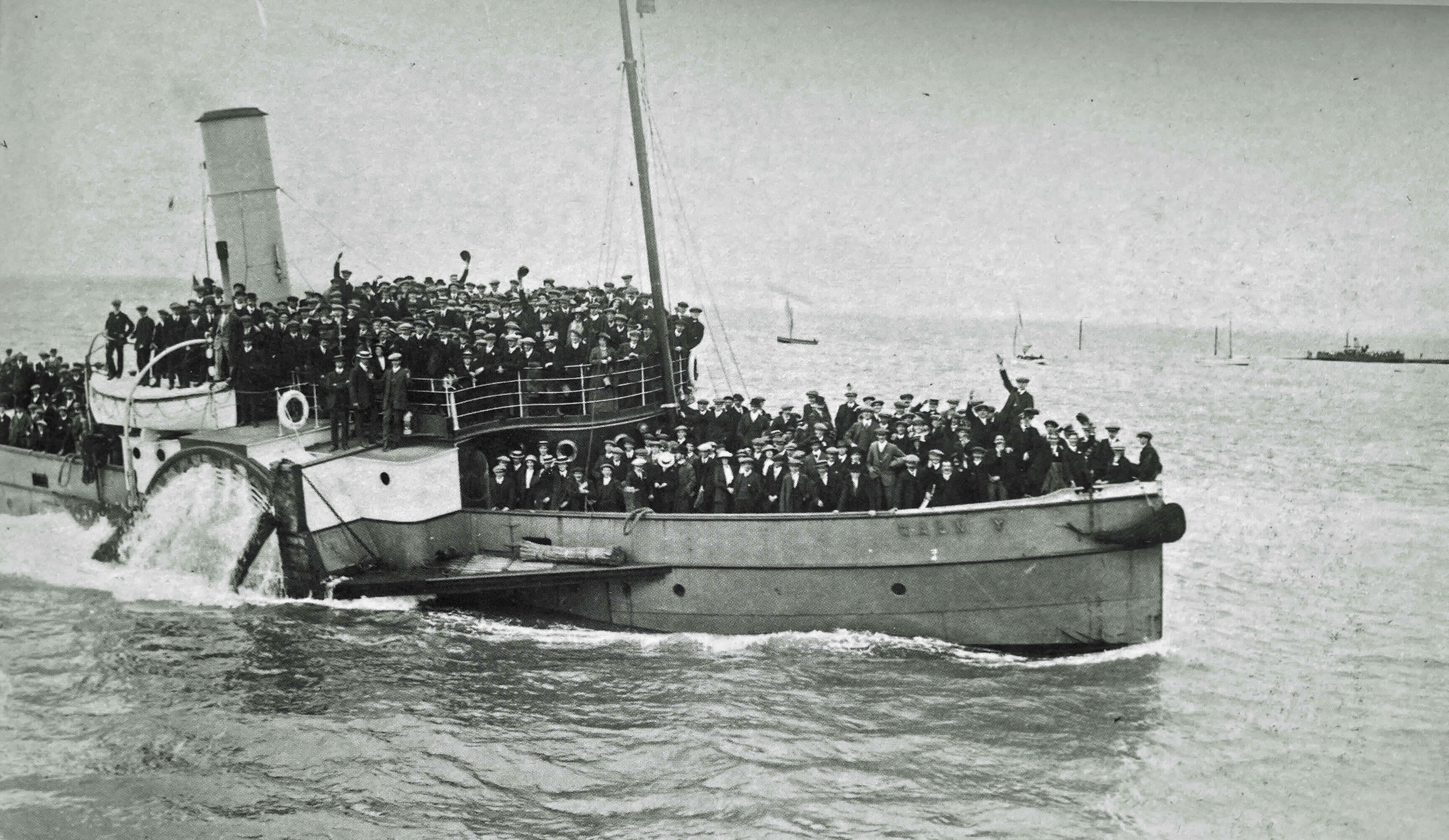
There used to be a good trade in ferrying people and goods across the bay’s mouth.
Furness Railways operated two steamers to provide a daily crossing, especially for
Blackpool holidaymakers seeking a day trip to the Lake District. The photo below left
shows football supporters being transported from Barrow to Fleetwood for a Blackpool game.
They look a jolly crowd – Blackpool games must have been more fun a hundred years ago than they are today.
The photo was taken by Edward Sankey (1870-1960 ish), a pioneering photographer
based in Barrow. He travelled on the boats taking photos of the passengers on their
outward journey and then developed the photos to sell to them on their return journey.
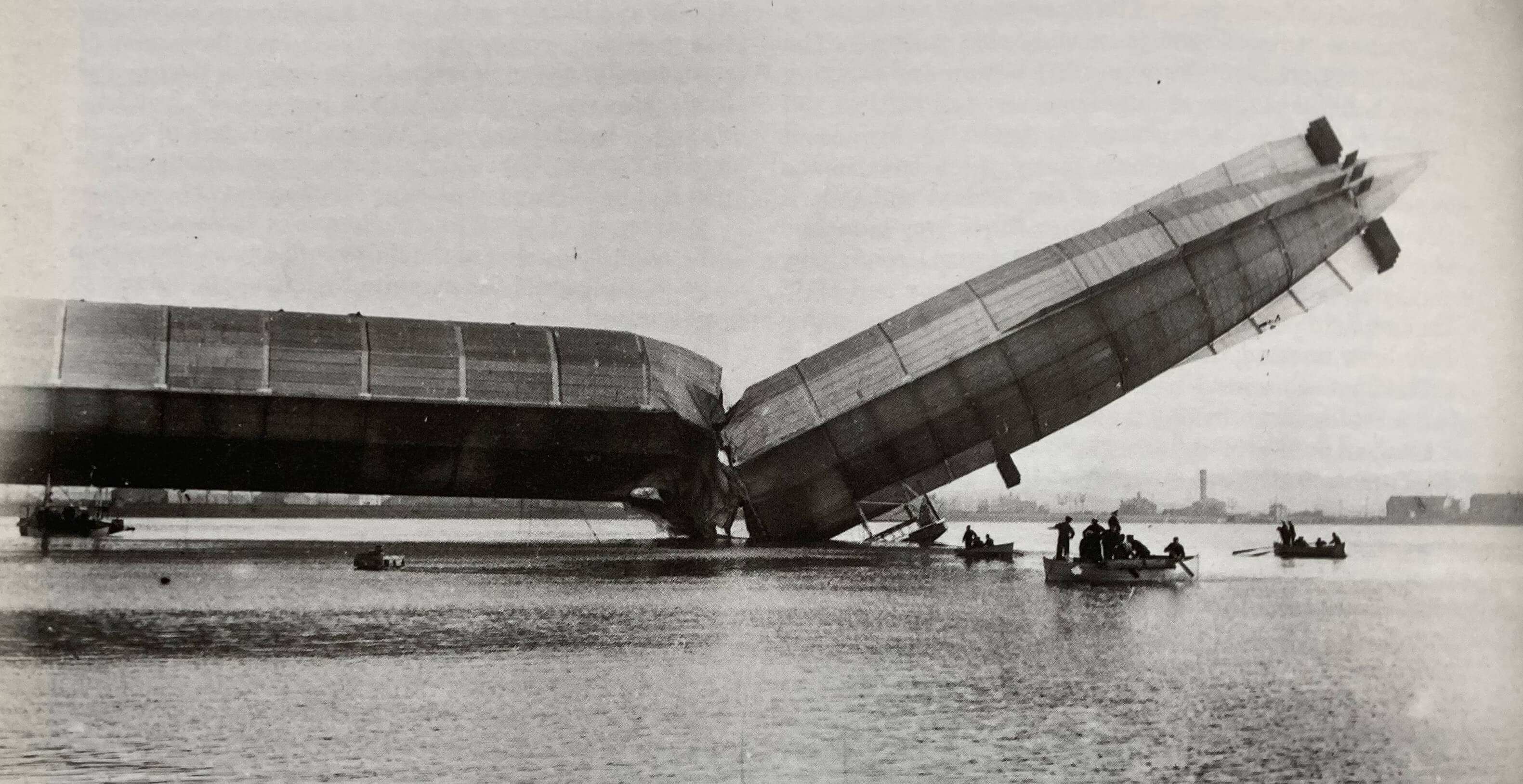
This, however, was really a side-line. His main business was to photograph the ship-building
activities at Barrow. He was there in 1911 to record the launch of the first British rigid airship
Mayfly and obtained a scoop when it broke its back (photo below right).
The First Sea Lord, Winston Churchill, said "The mishap which destroyed the Mayfly, or the Won't Fly,
as it would be more accurate to call it, at Barrow was a very serious setback to the development
of Admiralty policy in airships".


(Photos from Victorian Lakeland Photographers (Kelly, 1991))
I walked on above the marsh. A number of walkers were about, almost all with dogs, some
venturing out towards the water’s edge. However, the marsh looked quite waterlogged, with
many pools and inlets that would frustrate a walker (like me) aiming to walk briskly south.
The path rose up a small hill beyond Red Bank Farm, providing more extensive views over
the bay, and then more or less disappeared as it is squeezed between the railway line and
the water’s edge. The walking became somewhat difficult as the rounded pebbles were coated
with partially melted ice. It was naturally quiet, with only the unnatural sounds
from the railway plus an occasional ominous
rumble which I assumed was from jets over the Lake District. The sea-birds were also fairly
quiet, as the incoming tide ushered them onto the few rocky jetties.

From the pebbly beach, looking north (above) and south (below)

I reached the Morecambe promenade which I strolled slowly along, pausing often, basking in
the welcome sunshine, admiring the view, with the bay now almost full. I had a snack in Rita’s
Café, which all visitors to Morecambe should experience (once). The café has not changed
for decades. The pictures on its walls of Clark Gable, Marilyn Munroe, George Best and
so on have not been added to provide some retro ambience. They have always been there. The
vintage chairs and tables too. It’s still a cash-only café but they don’t insist on pounds,
shillings and pence. I cannot, in all honesty, recommend the cuisine but I like Rita’s
Café and would rather have a coffee there than in the Midland Hotel.
I wonder about the future of Rita’s Café and similar establishments in Morecambe.
Rita’s Café is right next to where Eden Project Morecambe is to be built. It does not,
however, provide the kind of service that Eden Project visitors will expect. I predict
that some speculator will make an irresistible offer for this prime site and then convert
it into a more upmarket concern – a prospect more likely perhaps since the redoubtable Rita died last year.
Being in no hurry to leave the sunshine, I walked out to the end of Stone Jetty.
Although it is only a few hundred yards long, it does create something of an impression
of being out in the middle of the bay. Grange-over-Sands and the Coniston hills seem
not far away, and the panorama continues to the east to include Ingleborough. A couple of
fishermen were at the end of the jetty but they were rather glum. They did land one
whiting while I watched – but so small that it was thrown back in. They bemoaned the
fact that there aren’t as many fish, or varieties of fish, as there used to be. As we
spoke we could see that although the bay was full of water there was not a single fishing
boat, or anything else, on it.

Boats at Morecambe (even if these boats set sail they wouldn't form much of a
fishing fleet)
To the south, glinting in the sun, was the bay horizon from Heysham to Barrow, a distance
of thirteen miles or so. Nowadays, if you see a map of Morecambe Bay in the paper it
will probably have a dotted line marking this horizon. This is not to indicate the limit of
Morecambe Bay but to show the line of the
latest proposal
to build a bridge across the bay. It presumably has to be here rather than from Fleetwood
to Barrow in order not to inhibit the trade of the growing port of Heysham.
The proposal is for a barrier plus road to extract tidal energy from the bay. Its
estimated cost is £8.5 billion. It is impossible for a lay person to say whether that cost
would be justified by the energy generated (sufficient for two million homes, it is claimed)
and by the reduced cost of travel between Heysham and Barrow. We can, at least, ask how
such a barrier would affect the unique nature of Morecambe Bay and what aesthetic impact such
a barrier would have. At some times of the year and from some points of the coast, the sun
sets majestically behind this Heysham to Barrow sea horizon. Who would want to see the sun
set behind the traffic of a road? However, I think we can relax because Eden Project
Morecambe is probably as much governmental largesse as Morecambe Bay can expect for several years.

The Heysham-Barrow skyline from the Stone Jetty
P.S. The ‘Shining Levels’ of the title is an allusion to The Shining Levels (Wyatt, 1973,
reprinted 2012), a book that has become a classic of Lakeland literature, describing as it
does one man’s retreat to the relative wild of south Lakeland.
The escape-to-the-wild genre is popular with readers who
dream of doing likewise but know they never will.
Date: January 16th 2025
Start: SD486684, Bolton-le-Sands bus-stop (Map: 296)
Route: (linear) N, W – Lancashire Coastal Way – SW along the Way – Rita’s Café –
NW – end of Stone Jetty – SW – bus-stop on Central Drive
Distance: 7 miles; Ascent: 15 metres
Home
Preamble
Index
Areas
Hills
Lakes
Dales
Places
Map
References
Ramblings
Me
Drakkar
© John Self, Drakkar Press, 2018-

Top photo: Rainbow over Kisdon in Swaledale;
Bottom photo: Ullswater


