
Home
Preamble
Index
Areas
Dales
Hills
Lakes
Places
Reserves
Rivers
Structures
Villages
References
Me
Saunterings: Walking in North-West England
Saunterings is a set of reflections based upon walks around the counties of Cumbria, Lancashire and
North Yorkshire in North-West England
(as defined in the Preamble).
Here is a list of all Saunterings so far.
Guaranteed ad-free, AI-free and free!
If you'd like to give a comment, correction or update (all are very welcome) or to
be notified by email when a new item is posted - please send an email to johnselfdrakkar@gmail.com.
242. Brock Valley Woods and Beacon Fell
The River Brock rises below Fiendsdale Head in the Bowland hills. It then flows
about fourteen miles south-west to join the River Wyre near St MichaelÆs. Half-way
along it passes through Brock Valley Woods, the largest area of continuous ancient
woodland in Lancashire. We set off north from the car-park at Brock Mill Lane
half-way along the woods, after being entertained by a nuthatch and several long-tailed tits.
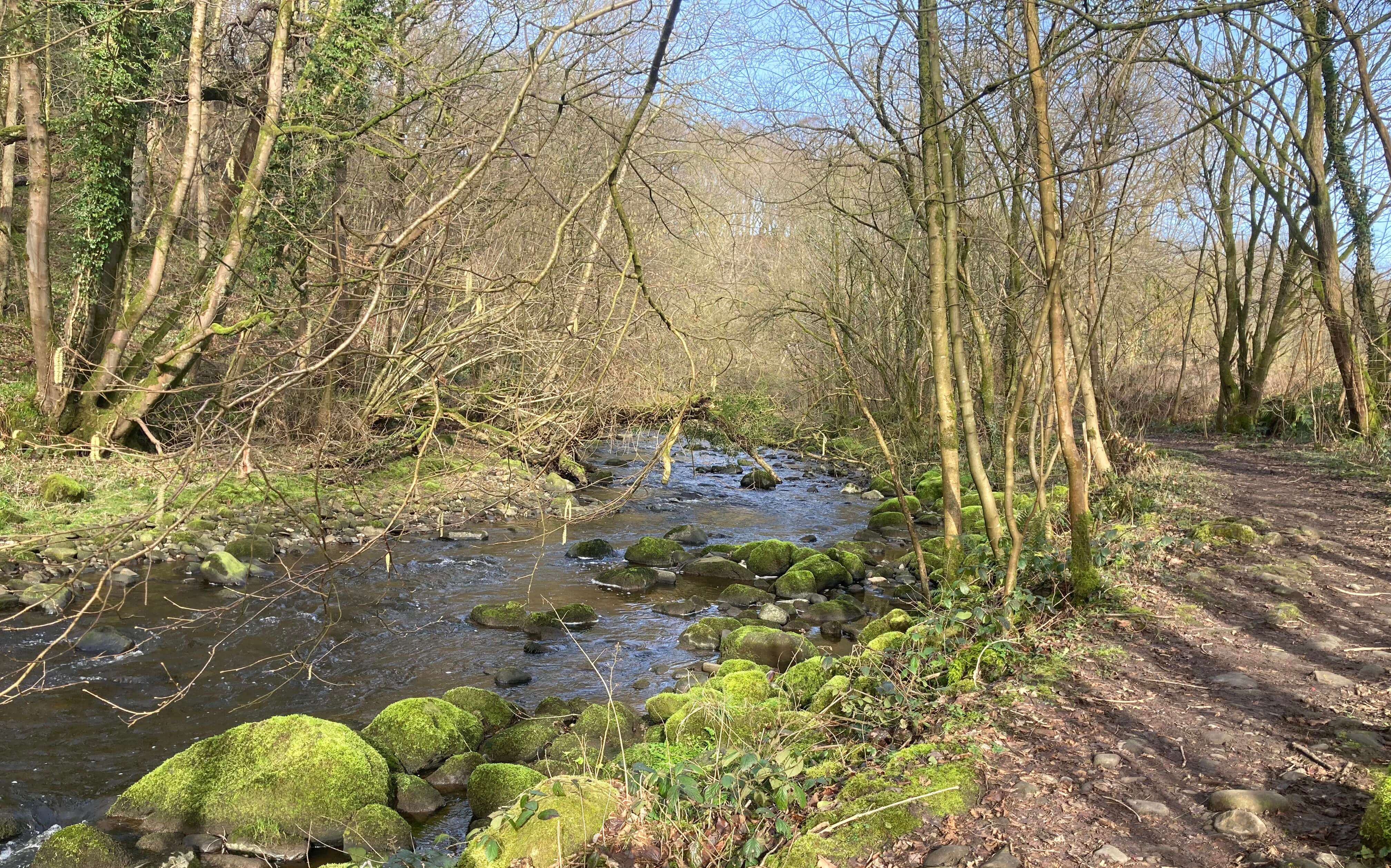
Brock Valley Woods
The path keeps close to the river, apart from crossing a couple of meadows. Whoever
is responsible for maintaining this path is making a sterling effort but the
dampness tucked away in this sheltered valley creates plenty of muddy challenges.
At one point an aqueduct crossed the river which reminded us of the Thirlmere
Aqueduct over the Lune ¢ and, checking later, it seems that this pipe-line does
indeed cross the Brock valley. It is a fine valley, with the river flowing
energetically and the trees of the old woodland standing proudly on steep banks.
A buzzard flew above but otherwise we didnÆt see much bird-life.
The path left the river to climb Snape Rake Lane. To begin with, the lane
is a rough, stony track with a stream running down it. It seems that some
vehicles manage this track, in order presumably to ford the river, but there are
signs at the top making it clear that cars are not allowed here, or even to park
where the track becomes a surfaced road.
At this point we had thought about continuing north by the river to Jack
Anderson Bridge but having struggled up to some height we didnÆt fancy a probably
muddy scramble back down to the river through the worryingly-named Boggy Wood,
especially since we now had open views northward to Fair Snape Fell and Parlick,
with a few patches of snow. We walked on across fields and along lanes towards
Beacon Fell.
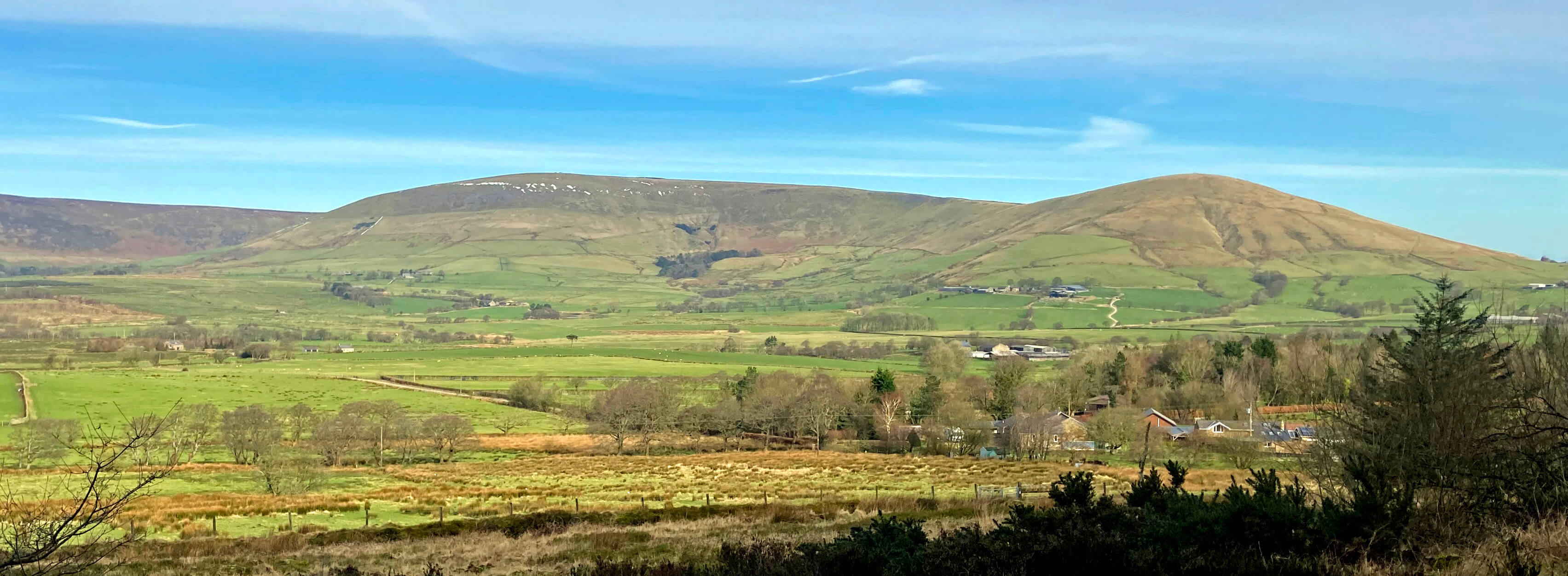
Fair Snape and Parlick
 This fell is marked on the OS map as Beacon Fell Country Park and given a special
Country Park symbol (shown right). What exactly is a Country Park? Do they have some
kind of official status? Are they legal entities like National Parks? Who
assigns the Country Park designation? Do Country Parks have some obligation
to us, the public?
This fell is marked on the OS map as Beacon Fell Country Park and given a special
Country Park symbol (shown right). What exactly is a Country Park? Do they have some
kind of official status? Are they legal entities like National Parks? Who
assigns the Country Park designation? Do Country Parks have some obligation
to us, the public?
It seems that many Country Parks were established after the Countryside
Act of 1968 under the auspices of the Country Commission. Most were set up by
County Councils, including Beacon Fell Country Park in 1970 by Lancashire
County Council, whose employees at the time were dedicated and enterprising
public servants. The general aim of Country Parks was to provide access, mainly for urban
dwellers, to countryside intermediate between the formal, landscaped parks
typical of towns and the wilder, more extensive tracts of National Parks. However,
as a history of Country Parks concedes,
there is no definition of what
constitutes a Country Park.
The Country Commission dissolved in 1999. A few of the hundreds of Country
Parks that were established have been adopted by Natural England. Others are still
managed by increasingly cash-strapped Councils, including Beacon Fell. In 2003 a
Country Parks Network was set up to help with the management of Country Parks and
that network passed from Natural England to Keep Britain Tidy in 2015. I rather
doubt that Keep Britain Tidy has adequate resources for this role. In any case,
tidiness is not what I look for in a Country Park!
As far as I can see, there is no obligation to follow a formal accreditation
procedure for would-be new Country Parks and therefore there is nothing to stop
land-owners calling their land a Country Park if they should wish. And if they are
setting up a rural tourist attraction there may well be advantages in awarding
oneself an impressive, official-looking, status. Google maps indicates about a dozen
Country Parks in north-west England (listed in the Appendix below) and some of them
look like new inventions to me.
Beacon Fell serves well as a prototypical Country Park as envisaged in 1968.
This is some roughish ground but it has well-maintained easy paths, plus benches,
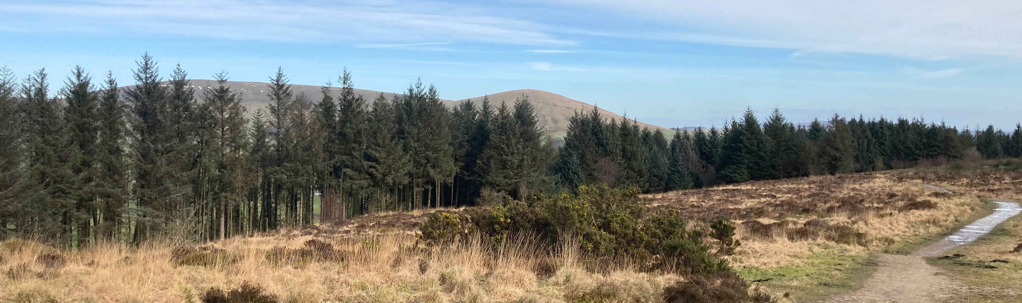
sculptures, a playground and car parks. As anticipated, the view from the top (267 metres)
was not as good as it was on the way up, because conifers have grown to hide much of it.
I hope thereÆs a plan to remove the conifers or at least replace them with native trees.
There were a good number of people about, it being school half-term, but there were
probably more dogs than people, one of whom (the dogs, that is) pinched one of our
sandwiches, which the dog-owner seemed quite unsurprised and unapologetic about.
View from the top of Beacon Fell
The cafķ being closed (a shame for a half-term Tuesday) we followed a path down that
took us through the garden of Salisbury House and we then headed west for some more
of the Brock Valley Woods. On the way we passed Cloggers Farm ¢ did they make clogs
here or at the nearby mill? The mill at Brock Bottom began in the 1790s as
a cotton mill and continued (on and off) until the 1930s. Apparently, the mill
continued as a cafķ and dance hall until the 1950s. I canÆt say that I saw any
sign of the old mill and associated cottages (I think the ruins are a little further
south).
We scrambled down another muddy path to Brock Bottom, crossed the footbridge,
and then walked serenely back to the car-park. This is a path that families clearly
enjoy. We passed a man trying to get his dog to retrieve a ball that he had thrown in
the river and which had sunk. Failing that, he was getting his son to paddle out
barefoot to fetch it. Later a tennis ball floated past us ¢ presumably another
ball thrown in the river that a dog hadnÆt retrieved. So I can imagine that this
is quite a busy family picnic area in summer.
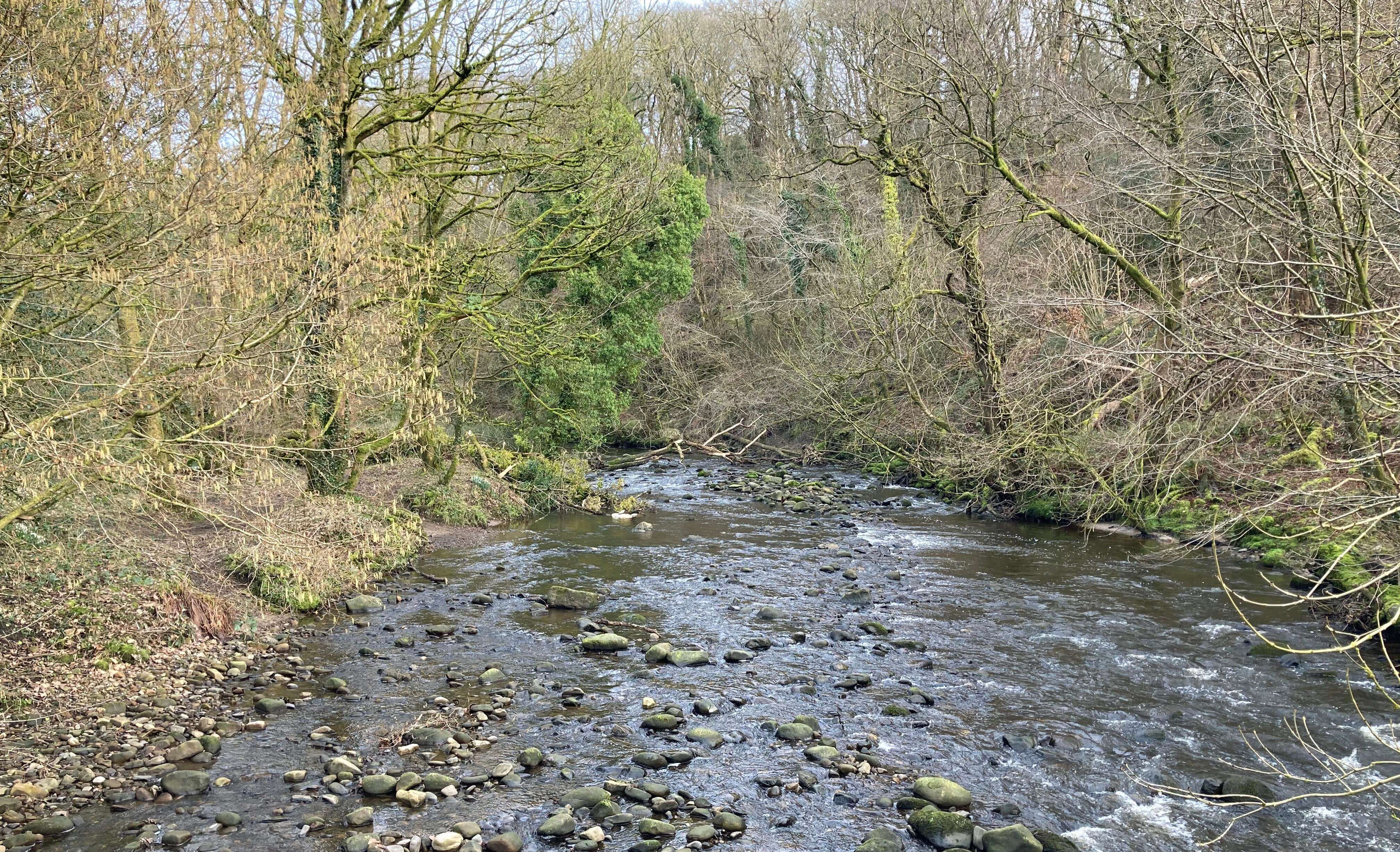
The River Brock from the footbridge at Brock Bottom
Appendix: Country Parks of NW England (according to Google)
Ģ Beacon
Fell Country Park.
Ģ Bowland
Country Park at Chipping seems to be an alternative name for the Bowland Wild Boar Park.
Ģ Dalemain
Country Park, near Penrith, has gardens and meadows around the historic mansion of Dalemain.
Ģ Hambleton
Country Park, Poulton-le-Fylde, is a park of ōluxury holiday cottagesö, open only to residents.
Ģ Lightwater
Tarns Country Park is a 5-acre site of ōluxury lodges and caravansö, four miles north of Kendal.
Ģ Longland
Lake Country Park mainly offers short walks around the lake.
Ģ Oaklands
Country Park is a caravan park (a limited company incorporated in 2015) at Great Strickland, near Penrith.
Ģ Thornton
Hall Country Park is a farm park leisure attraction in Thornton-in-Craven.
Ģ Witton
Country Park, near Blackburn, a large estate of mixed woodland, parkland and farmland, was
designated a Country Park in 1973.
Ģ Wycoller
Country Park seems to be a network of woodland walking paths.
Ģ Wyre
Estuary Country Park, south of Fleetwood, was established in 1991.
Ģ Yarrow
Valley Country Park, Chorley, a 700-acre site, was set up in 1987 on old industrial land and
is now an important wildlife resource.
Date: February 17th 2026
Start: SD548430, Brock Mill Lane car park (Map: OL41)
Route: E over bridge, N on riverside path ¢ Snape Rack
Lane ¢ E, S ¢ Middle Lickhurst ¢ E, SE, E, SW, SE ¢ Beacon Fell top ¢ SW ¢ Salisbury
House ¢ W, S, W past Lower Stanalee, N ¢ Brock Bottom ¢ N on west bank ¢ car park
Distance: 6 miles; Ascent: 200 metres
Home
Preamble
Index
Areas
Dales
Hills
Lakes
Places
Reserves
Rivers
Structures
Villages
References
Me
® John Self, 2018-

Top photo: Rainbow over Kisdon in Swaledale;
Bottom photo: Ullswater