
Home
Preamble
Index
Areas
Dales
Hills
Lakes
Places
Reserves
Rivers
Structures
Villages
References
Me
Saunterings: Walking in North-West England
Saunterings is a set of reflections based upon walks around the counties of Cumbria, Lancashire and
North Yorkshire in North-West England
(as defined in the Preamble).
Here is a list of all Saunterings so far.
If you'd like to give a comment, correction or update (all are very welcome) or to
be notified by email when a new item is posted - please send an email to johnselfdrakkar@gmail.com.
204. In the Dock at Glasson
There was nothing in the dock at Glasson.
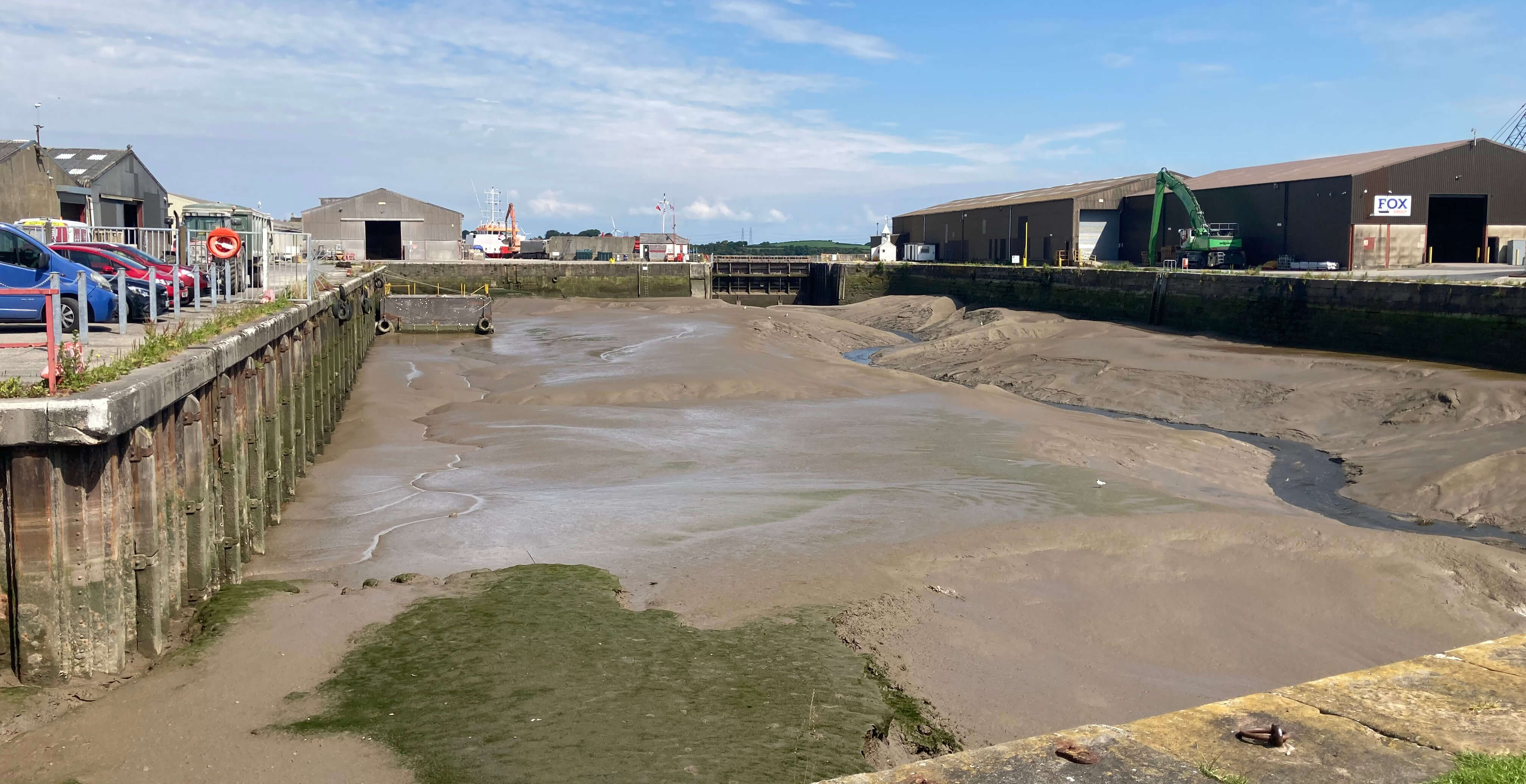
Glasson Dock
But I am getting ahead of myself. I reached Glasson Dock at the end of this walk.
I began from Stodday, walking along the old Lancaster-Glasson railway line, with occasional
wide views across the Lune estuary. I walked first under a double line of high pylons
from Heysham Power Station. I cannot see these pylons without thinking of the
poem The Pylons (1933) by Stephen Spender in which he accepts the intrusion of
new technologies upon the natural landscape:
Now over these small hills, they have built the concrete
That trails black wire
Pylons, those pillars
Bare like nude giant girls that have no secret.
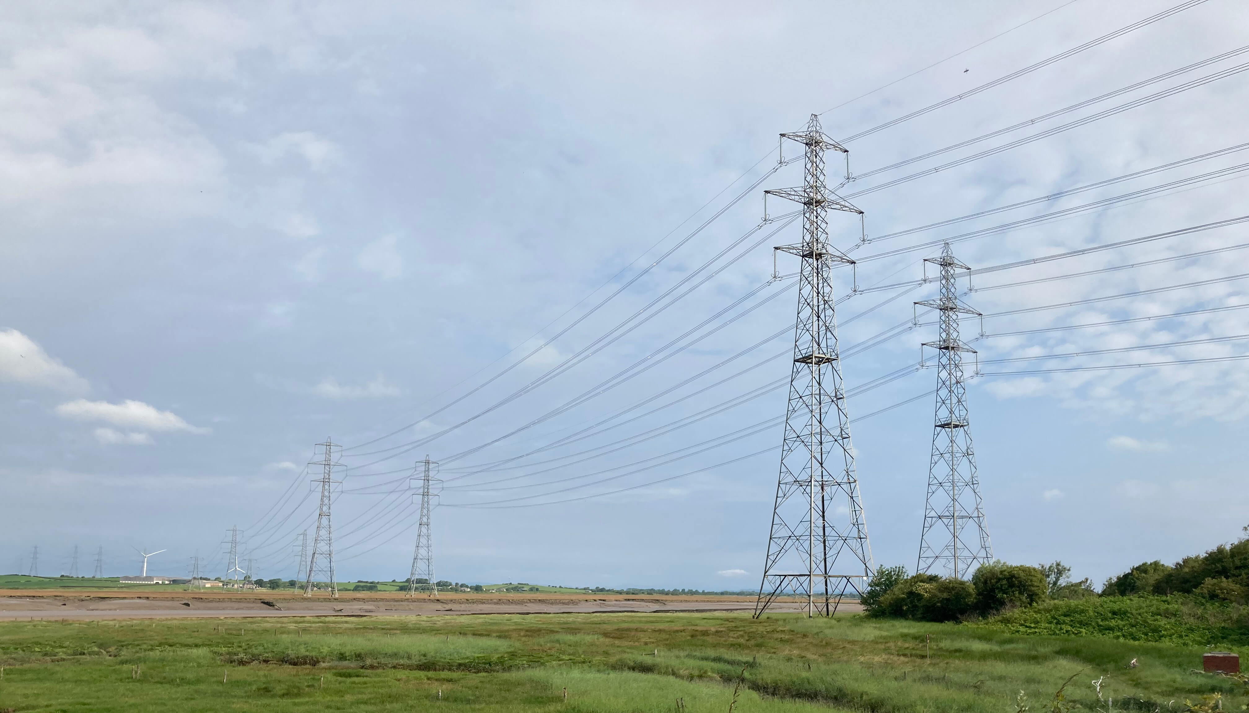
Nude giant girls!!
It was a pleasant walk to Conder Green, apart from the clegs or horse-flies. I wish
somebody would tell them that I am not a horse. They land quietly upon you and stay attached
as you walk along. After a while you feel an itchy bite. By then the cleg is so absorbed in
its blood-sucking that it doesn’t notice your hand approaching. I squashed a dozen of them.
If a member of an Insect Preservation Society should object then I’ll squash them too.
Conder Green doesn’t change much. The tide was out, leaving a few boats stranded
(they look like they probably always are). Swallows and house-martins swirled about.
Other birds poked about in the mud. The 17th century Stork Inn looks much as it always
did, after being restored following a fire in 2020.
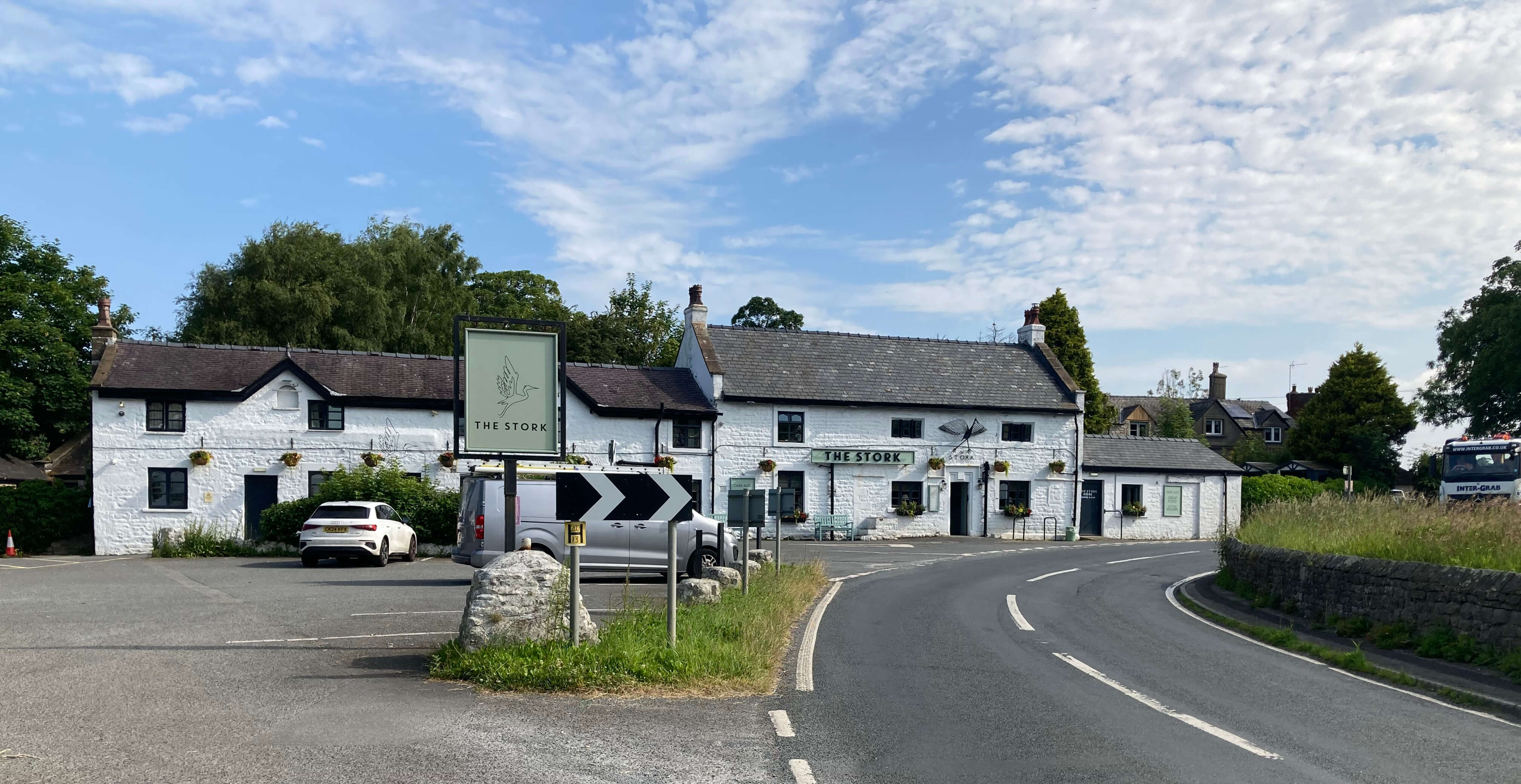
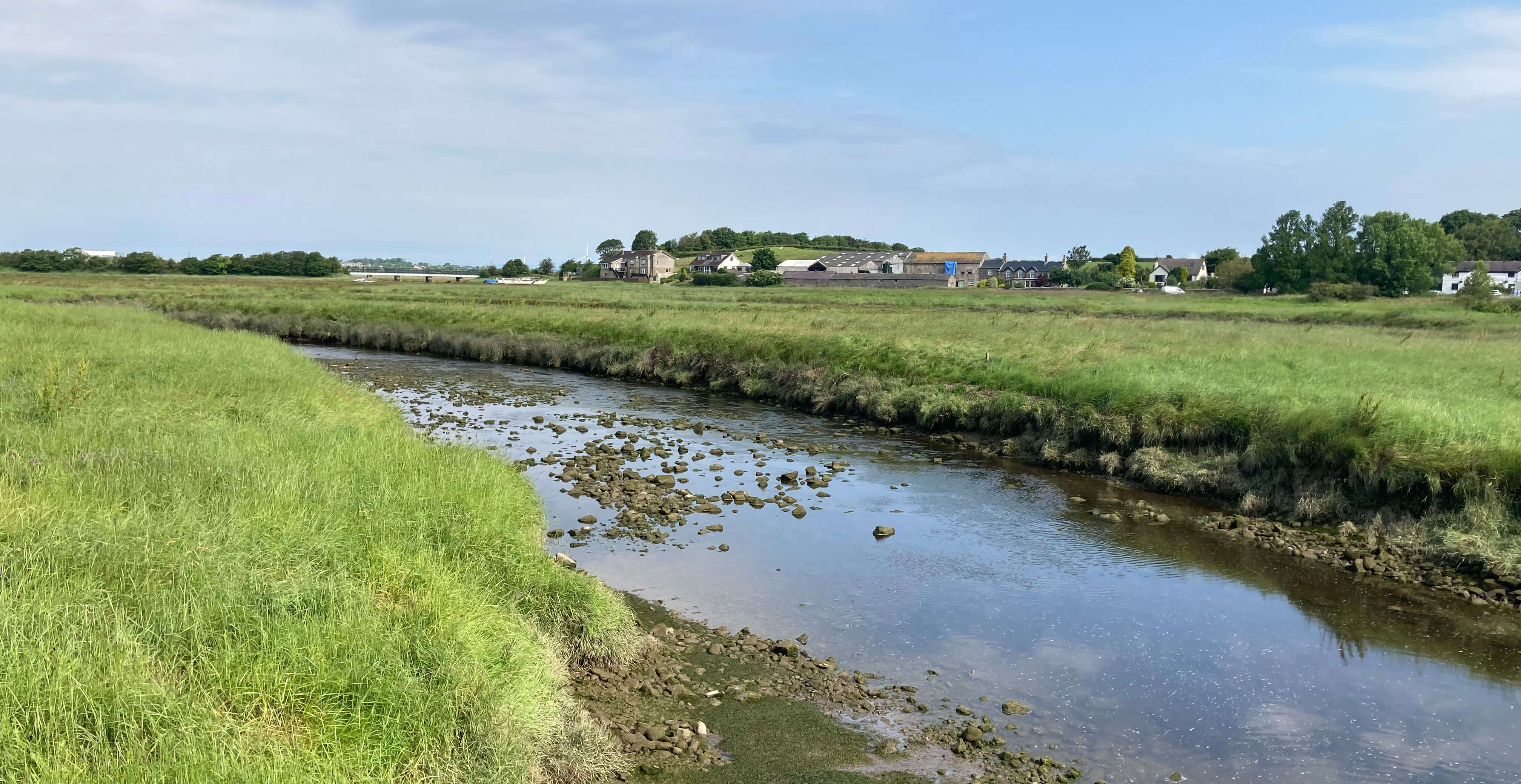
Left: The Stork, Conder Green; Right: Conder Green and the River Conder.
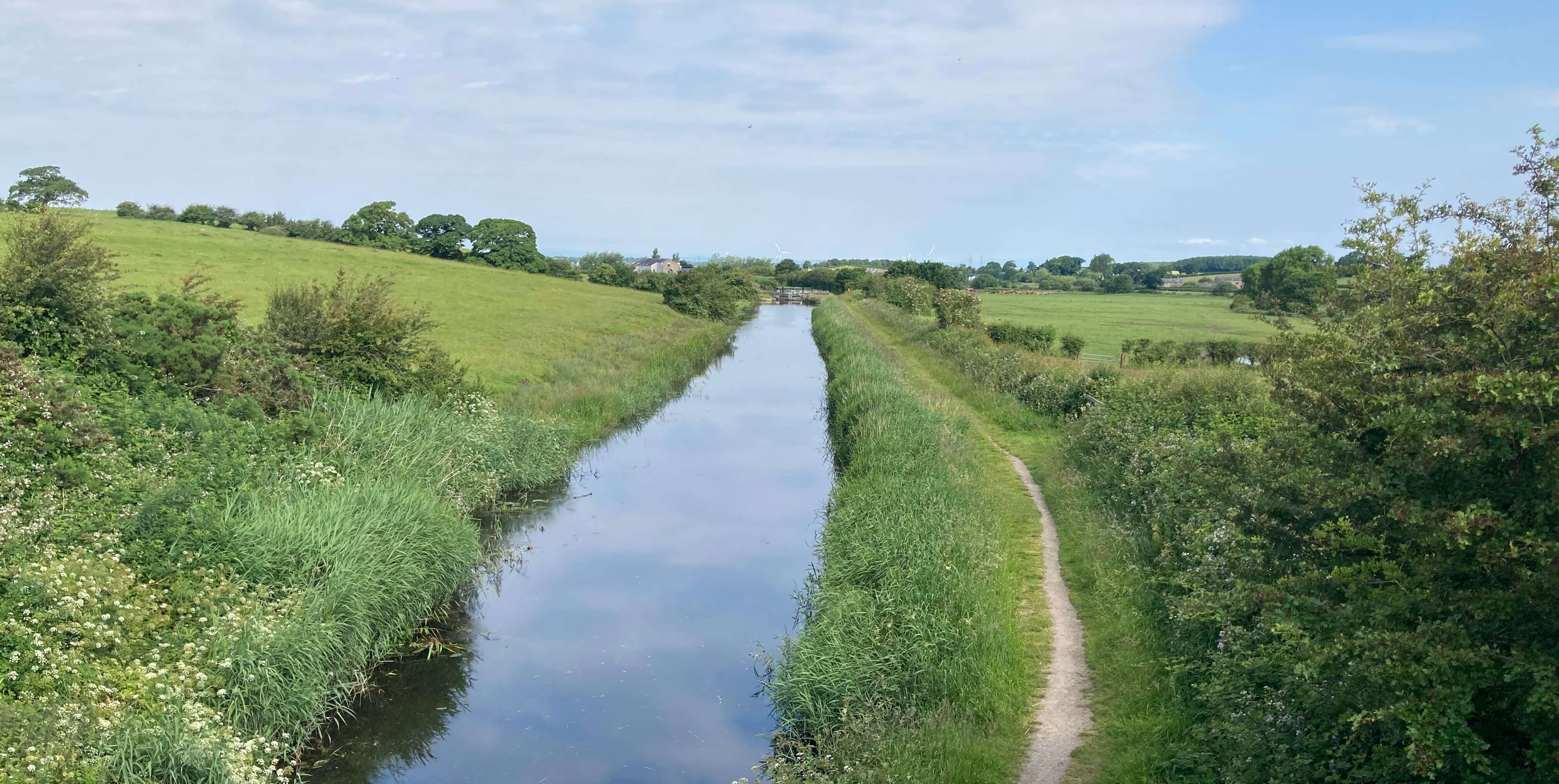
I walked on to Thurnham Mill to join the tow-path alongside the canal, a branch completed in
1826 to connect the Lancaster Canal with the new port of Glasson.
A heron watched me for quite a while from the safety of the opposite bank – and
vice versa. I clambered up where I don’t
think I was supposed to in order to cross Bailey Bridge. A stoat crossed it too,
unperturbed by me. By the bridge I noticed two concrete cuboids similar to those I
was puzzled by in [153]. Whatever they are precisely
for, they seem to be something to do with providing support for the canal.
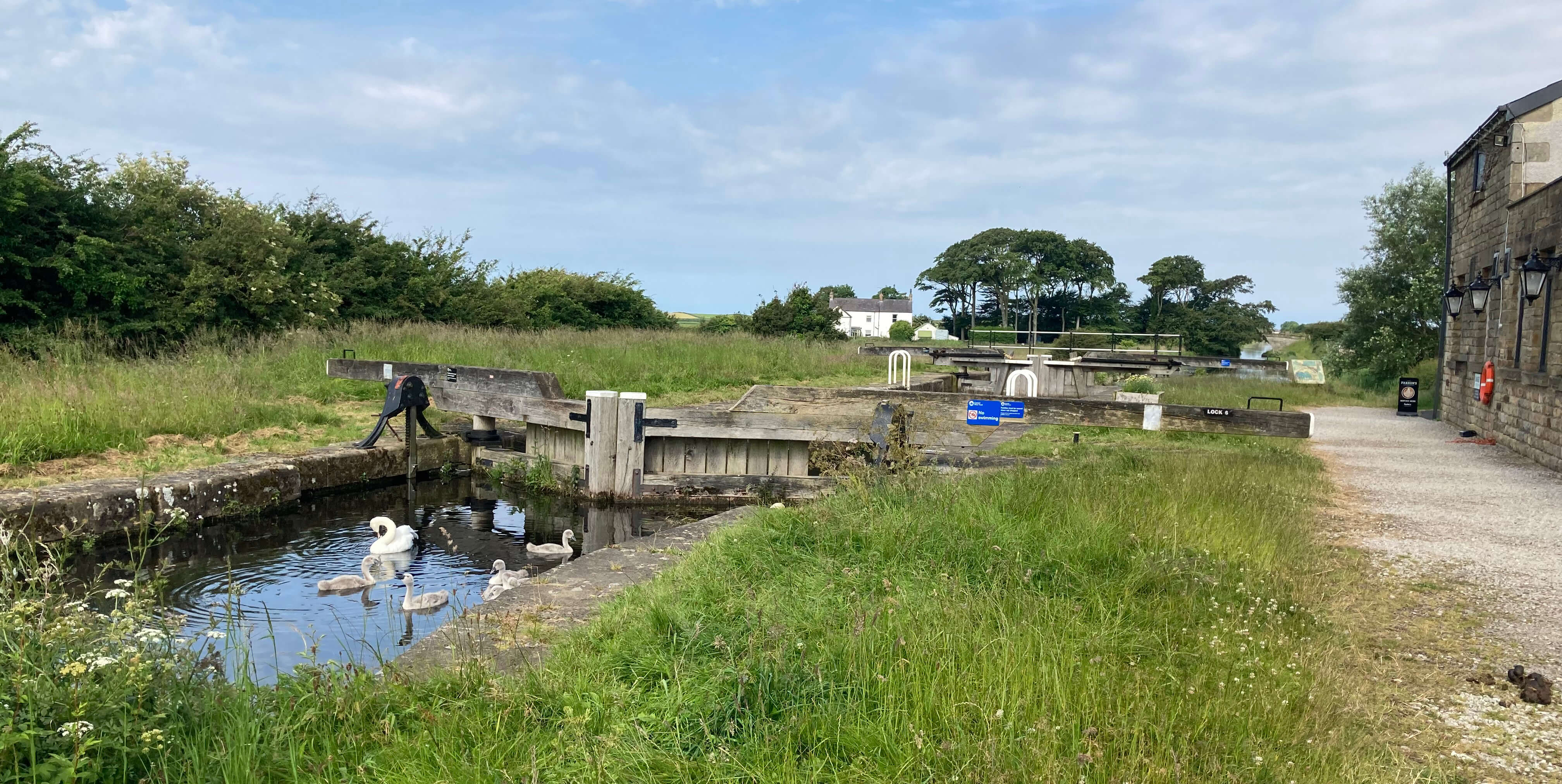
Left: Canal lock at Thurnham Mill; Right: Glasson Canal from Bailey Bridge.
Once over the bridge I headed for the Thurnham Hall Hotel and Country Club. The Country
Club used to be, and maybe still is, some kind of timeshare operation. I know that it
experienced turbulent times twenty years or so ago, with the managing director being
imprisoned for financial misdeeds, but all seemed calm now. It offers “60 luxurious
self-catering apartments”, within what looked a rather expensive set-up. I couldn’t
tell if it was flourishing.
 Right: Thurnham Hall.
The owners of Thurnham Hall describe it as a “12th century country house that
stands proudly in a stunning estate of nearly 30 acres”. Of course, the present
building is not of the 12th century. A rather detailed
history of Thurnham Hall
says that the original pele tower was built in the 13th century and “John de Harrington
in 1315 obtained leave to enclose a park at Thurnham from Thomas Earl of Lancaster”.
The hall only began to take its modern shape after the manor was acquired by the
Dalton family in 1556.
The Daltons were the largest land-owners in the region and held Thurnham until 1861
when the last lineal member of the family bearing the name of Dalton died – apart from
a period after 1715 when the hall had to be forfeited after the Daltons supported
the Jacobites. It was recovered by a payment of Ł6,000. After 1861 nobody
regularly resided at the hall and Hewitson (1900) commented that it was in a
"semi-ruinous state" and that he believed that "no attempt will be made to restore
the structure: rebuilding would, in fact, be less expensive than restoration."
The hall was, however, resuscitated in the 1970s, although we
can reasonably assume that much of the 19th century
hall was replaced.
From the hall I crossed the A588 and dropped down a little slope to reach the
vast flat area of Thurnham Moss (previously bog)
that the map tells me is all of four metres above sea level. I took a
bridleway into the middle of this area, feeling far from everything, although it wasn’t
entirely quiet as I could hear farm machinery rattling up and down various fields.
A swan flew over looking much less elegant than it does in water.
I emerged from the fields at Old Glasson, which was the original Glasson that
felt it necessary to add the Old when the new Glasson grew up around the dock. The
dock was built in 1787 as part of a new port to serve Lancaster, which boats could not
reliably reach. There was also a dry dock for ship building and repairs but that was
filled in in 1969.
A Visit Lancashire
website says that Glasson was "at its height
the largest port in the north west". They must have a narrow definition of the north west.
Nobody is in a hurry in Glasson. Cyclists and bikers gather around the snack
bar near the marina for a leisurely cuppa. There is nothing particular to do in
Glasson. Only one of the pubs (the Dalton Arms) is still alive. The Victoria Inn
is in a sad state. I seem to remember that it used to be possible to wander up
to and past the dock wall (although perhaps I was trespassing?) – but today it is
all fenced off. One sign on the fencing referred to the “Port of Lancaster
Commissioners 1750”. Do they still exist? Anyway, I couldn’t see if there was any
port-like activity on the seaward side of the dock. There was certainly none
within the dock.
In February 2024 the dock gate had become broken, stuck in the down position.
It was a matter of contention who was responsible for repairing the gate and for the costs
accrued by being unable to move boats in and out of the dock and marina.
It seems something of an oversight that this wasn't defined.
Now the Lancaster Port Commission, the Environment Agency, the Canal & River Trust,
Aquavista and the Lancashire Police can argue that they're not paying.
While the gate
stayed open Glasson residents were fearful of flooding at high tides. The gate now looks
to be in position although the dock doesn’t seem to be functioning yet.
Previously, I had described Glasson as “part port, part resort,
but not much of either”. As far as I could see, it’s not even part port at the moment. [1]
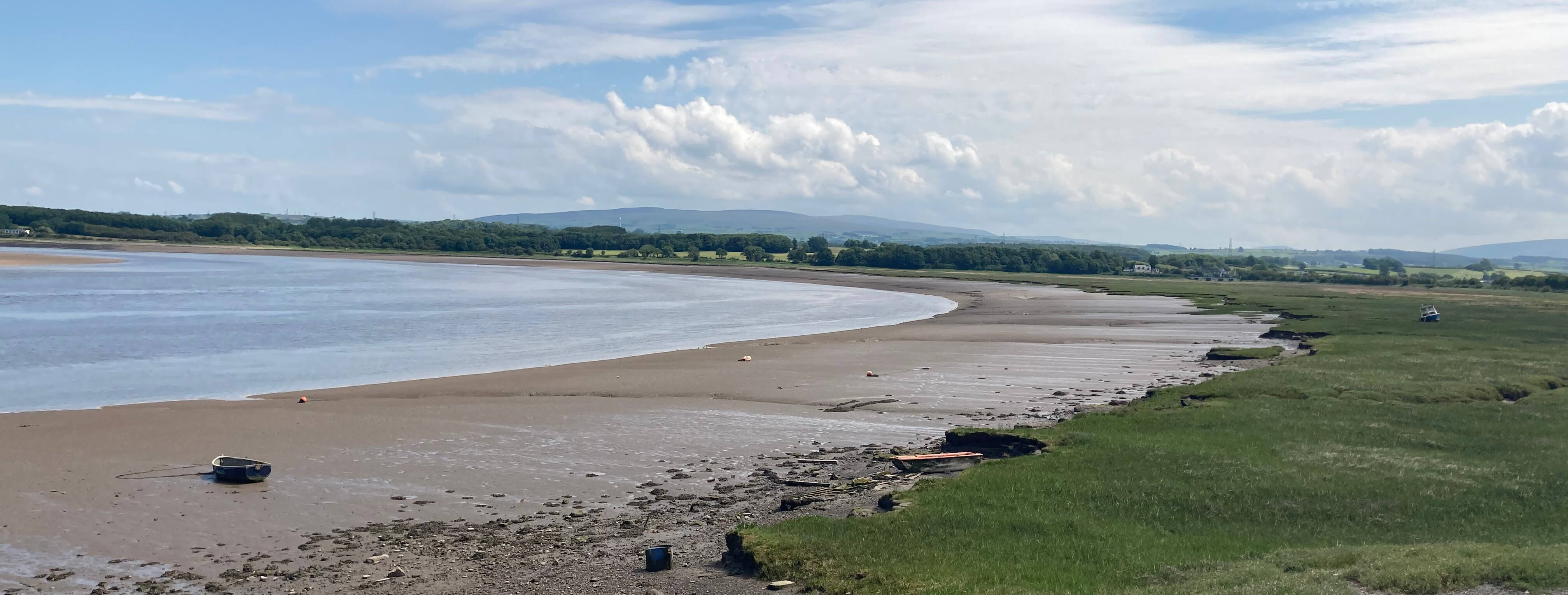
River Lune at Glasson
Date: June 25th 2024
Start: SD467592, Stodday (Map: 296)
Route: (linear) SW past Sewage Works – old railway line – S – Conder
Green car park – E, S, SE – canal – SE – Bailey Bridge – S – Thurnham Hall – W, N, NW on
bridleway, W – Dobs Lane – N – Glasson
Distance: 6 miles; Ascent: 30 metres
[1]. A reader gives more details of the present status of Glasson as a port:
"Although the activity in the basin is temporarily stopped because of the dock gate
situation, there is a lot of activity ‘port side’. I believe the dockside has now
been extended or is in process so that two boats can be loaded/unloaded at the same time.
There are a good number of mid sized cargo vessels arriving and leaving on the higher
tides throughout the year and I believe the cargo is mainly grain and gravel and the like."
Home
Preamble
Index
Areas
Dales
Hills
Lakes
Places
Reserves
Rivers
Structures
Villages
References
Me
© John Self, 2018-

Top photo: Rainbow over Kisdon in Swaledale;
Bottom photo: Ullswater