
Home
Preamble
Index
Areas
Dales
Hills
Lakes
Places
Reserves
Rivers
Structures
Villages
References
Me
Saunterings: Walking in North-West England
Saunterings is a set of reflections based upon walks around the counties of Cumbria, Lancashire and
North Yorkshire in North-West England
(as defined in the Preamble).
Here is a list of all Saunterings so far.
If you'd like to give a comment, correction or update (all are very welcome) or to
be notified by email when a new item is posted - please send an email to johnselfdrakkar@gmail.com.
202. Pausing at Garstang
The town of Garstang grew up around a crossing of the River Wyre midway between Preston
and Lancaster. It provided travellers on the north-south route, particularly in the
old coaching days, with a convenient place to pause and lubricate. Nowadays few people
pause at Garstang. They pass by on the M6 and West Coast railway to the east and on
the A6 to the west. I don’t blame them because even though I live only fifteen miles
away I have never heard of any attractions or events that have caused me to pause there either.
On the other hand, a town that has existed for over a thousand years (it is
mentioned in the Domesday Book as Cherestanc) and has a population of about 7,000
today must have some features of interest, so I set out to see them. First,
though, I took the opportunity to fill a gap in my wanderings along the Lancaster
Canal, namely, that between Bilsborrow and Garstang, having previously walked
between Galgate and Garstang
[153] and
between Bilsborrow and Preston [45]. I wanted to get into a walking rhythm that my legs
have missed in recent months.
I set off from near Bilsborrow with the A6 traffic creating a din to my left,
following the canal as it curved east so that the din was replaced by the roar of
the M6 traffic to my right. Occasionally the rattle of a train intervened. There
was some quieter traffic on the canal but not much.
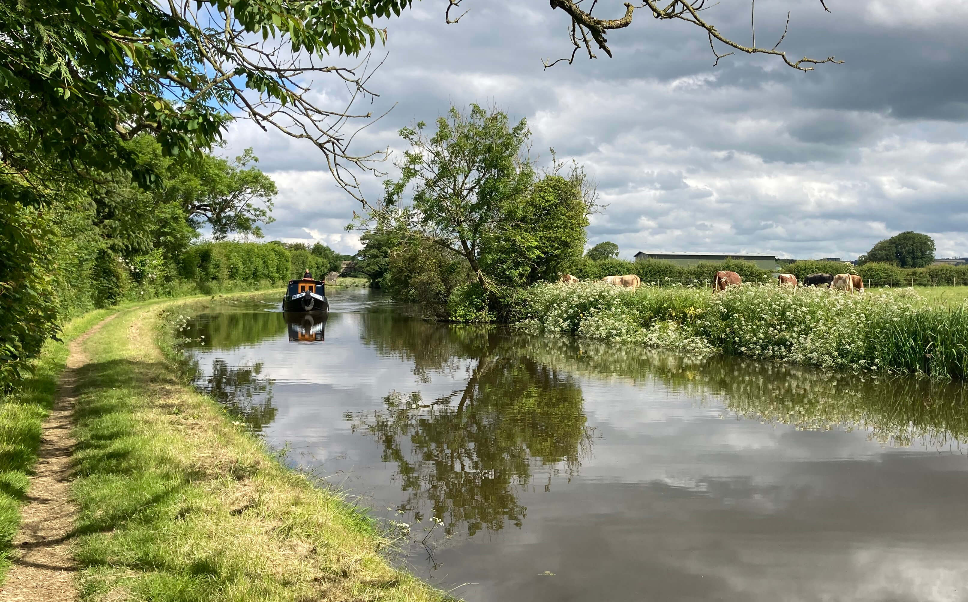
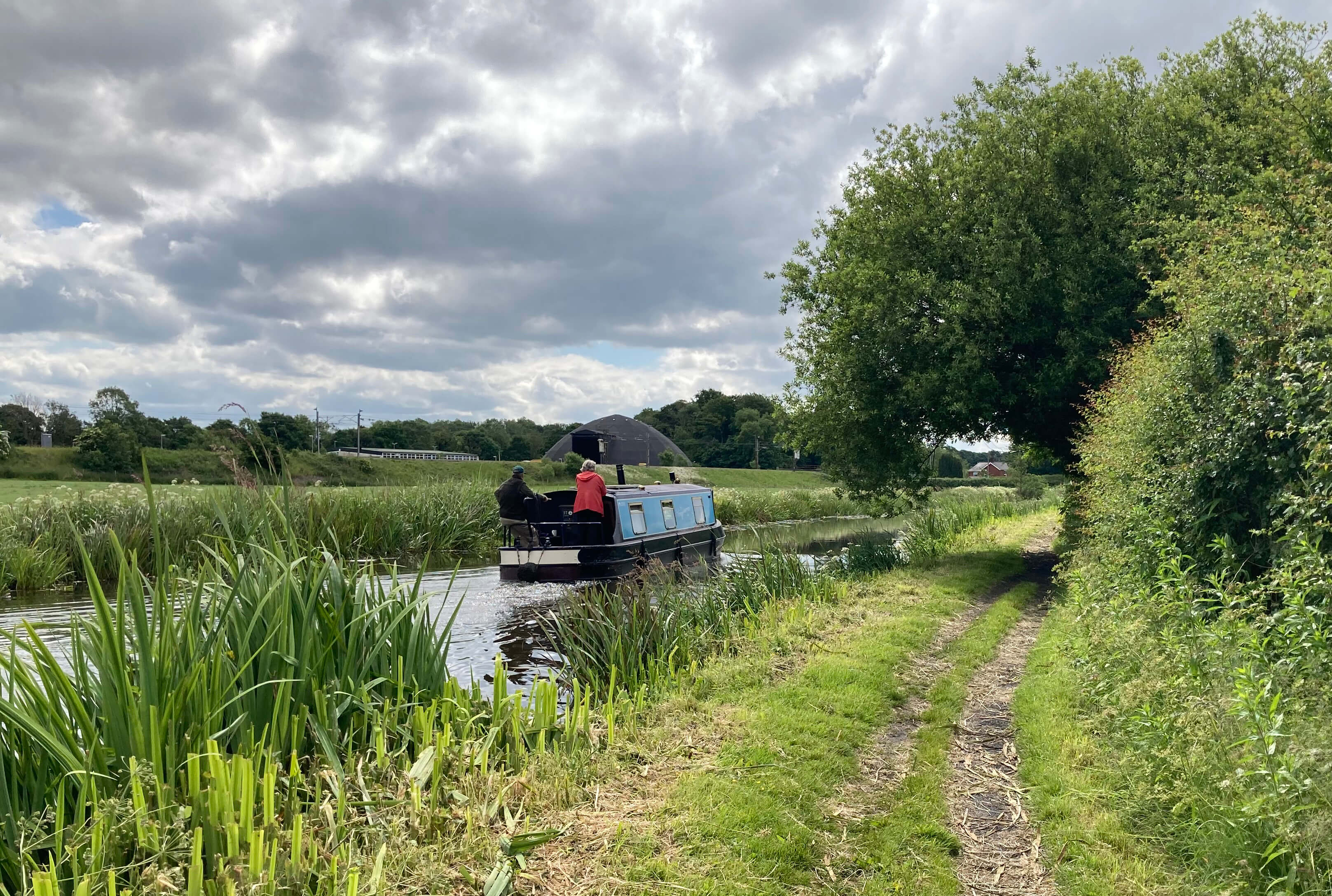
Canal boats on the Lancaster Canal
I had hoped that a steady tramp along the tow-path would provide a beneficial exercise
but it proved not to be the case. Walking by a canal can, of course, be a pleasant
experience, a quiet communion with nature. Unfortunately, after you’ve seen a few
ducks and ducklings and spotted a butterfly or two, fresh stimulation is hard to find.
The mind wanders – and turns in on itself. I began to realise that I was not walking
comfortably at all. My back is still a bit sore.
I can hardly believe that my innocuous-seeming slip on ice on January 17th (a date
engraved in my mind) is still causing problems five months later.
I have to press on, as I did along the canal. After a couple of miles I left
the canal at an unnamed but numbered (56) bridge to walk across some fields. It
would be generous to describe these fields as unappealing. They were freshly
manured, rutted with tractor tracks, had ‘beware of the bull’ signs (I saw no bull),
and had the M6 nearby. I sometimes wonder why I take on such self-imposed torture,
walking in such dismal places. I could be sitting at home, with a cup of coffee,
doing the crossword.
I had left the canal to see Greenhalgh Castle, one of Lancashire’s secrets.
It, or its ruins, are not even marked on the OS map. However, Castle Wood and
Greenhalgh Castle Farm on the map gave me a clue – and anyway old maps mark the ruins
as being just west of the farm.
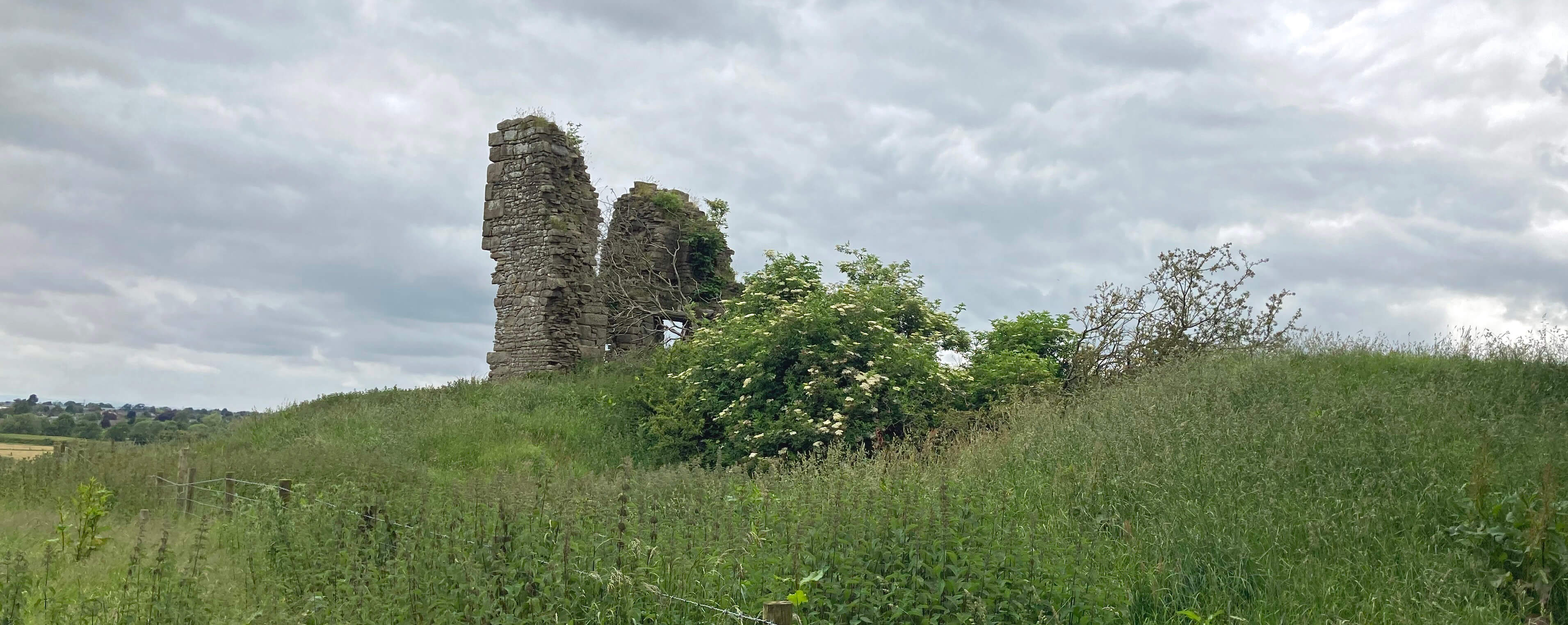 Left: Greenhalgh Castle.
Greenhalgh Castle had a well-documented but short life, for a castle. It was
built in 1490 for the 1st Earl of Derby after his assistance in defeating Richard III
in the Battle of Bosworth. (Perhaps someone can enlighten me as to why the castle was
called Greenhalgh Castle: was that the name of the region in the 15th century?) The
castle was effectively demolished in 1645 after the 7th Earl of Derby unsuccessfully
supported Charles I. Today only a part of one of the four corner towers still stands.
No effort has been made to enable anyone to see the remains. I could get a
passable photo only by clambering up a bank of nettles.
I walked on to Wyre Bridge. A plaque informed me that it was built
sometime to replace a bridge that
was built sometime to
replace a bridge that was built sometime to replace a bridge that … and so on back to the year ..
I forget the details.
I approached the centre of Garstang, where an information board
confronted me. My first impression was that there wasn’t much on it, which was
confirmed when, from a sense of duty, I walked around the loop that seems to
constitute the town centre. The town of Garstang has outgrown its centre. The suburbs
of perfectly respectable modern houses spread out, to be extended soon by another 250 houses
on fields west of the A6, and the residents surely cannot find all they need in the
centre of Garstang (unless all they need is pubs).
The information board mentioned a few buildings but I saw nothing special.
It all seemed so bland – nothing objectionable but little of interest – although I
did notice a group of Garstang Bloomers lovingly tending the flower beds.
Afterwards, I wondered what I had missed, so I checked the listed buildings of Garstang.
The assessors agree with me: there are no Grade I or II* buildings in Garstang.
For comparison, Kirkby Lonsdale, with a third of Garstang's population, has six such buildings.
As I wandered about the town I
noticed the almost uniform whiteness of my
fellow wanderers (I saw one black face). I checked later to find that, according to
the 2021 census, 98% of Garstang residents register as white (with only nine people
registering as black),
96% were born in the UK, 68% register as Christian and there are more
residents in the 70-79 age group than in any other 10-year age group.
For comparison, Preston has 68% white, 76% UK-born, 42% Christian,
with 20-29 being the most common age group. But Kirkby Lonsdale's figures are
similar to Garstang's.
I wondered what Garstang residents
did to amuse themselves. There’s a Scarecrow Festival soon – hardly an original idea.
And recently there was a Garstang Walking Festival. How can they sustain a week-long
series of walks around Garstang? – by travelling to places such as
Abbeystead [53],
Fleetwood [21],
Glasson [136],
Langdendale [180],
Nicky Nook [170],
Parlick [109] and
Pilling [112] – places that I have walked
without signing up to a Walking Festival.
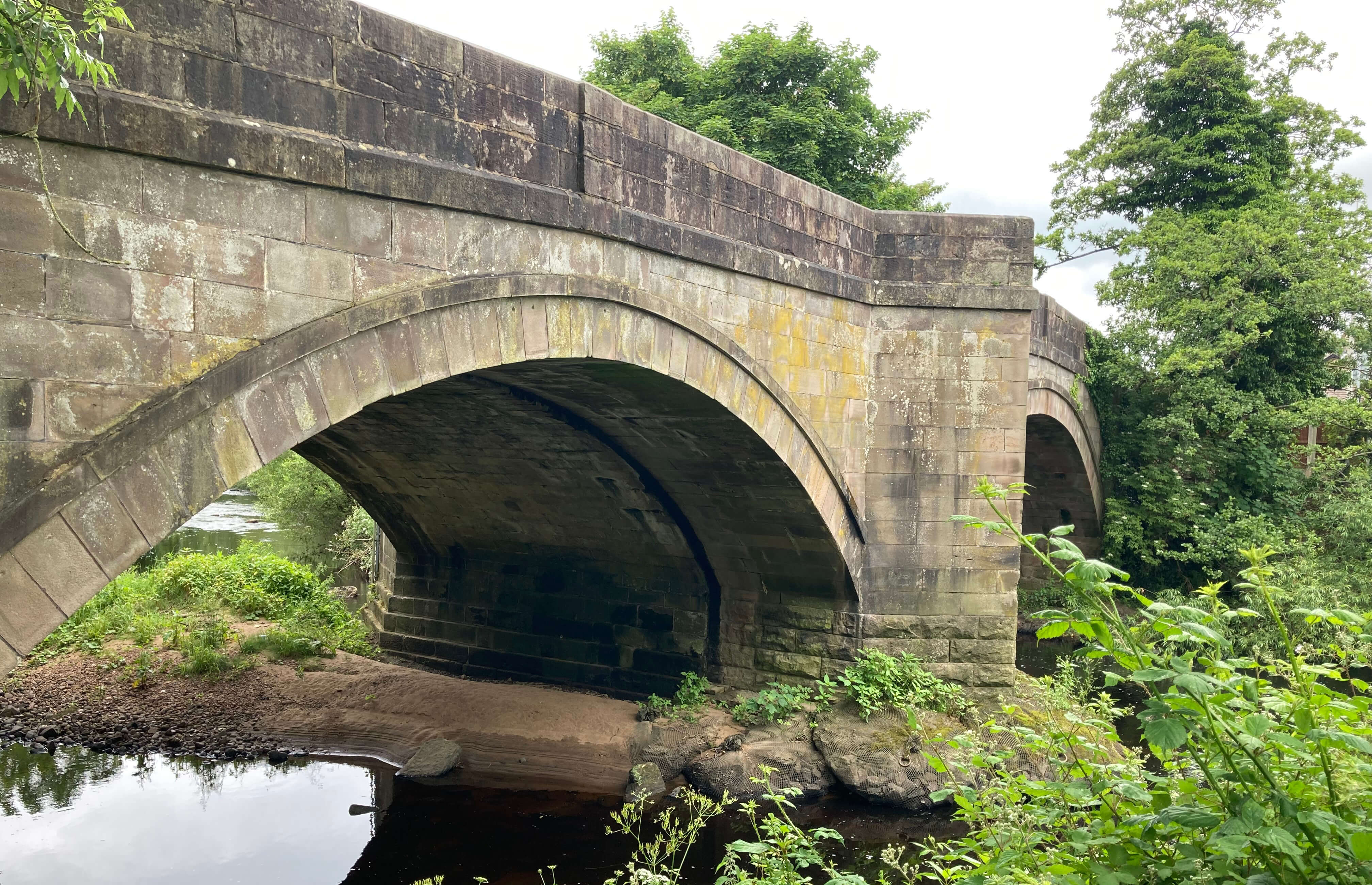
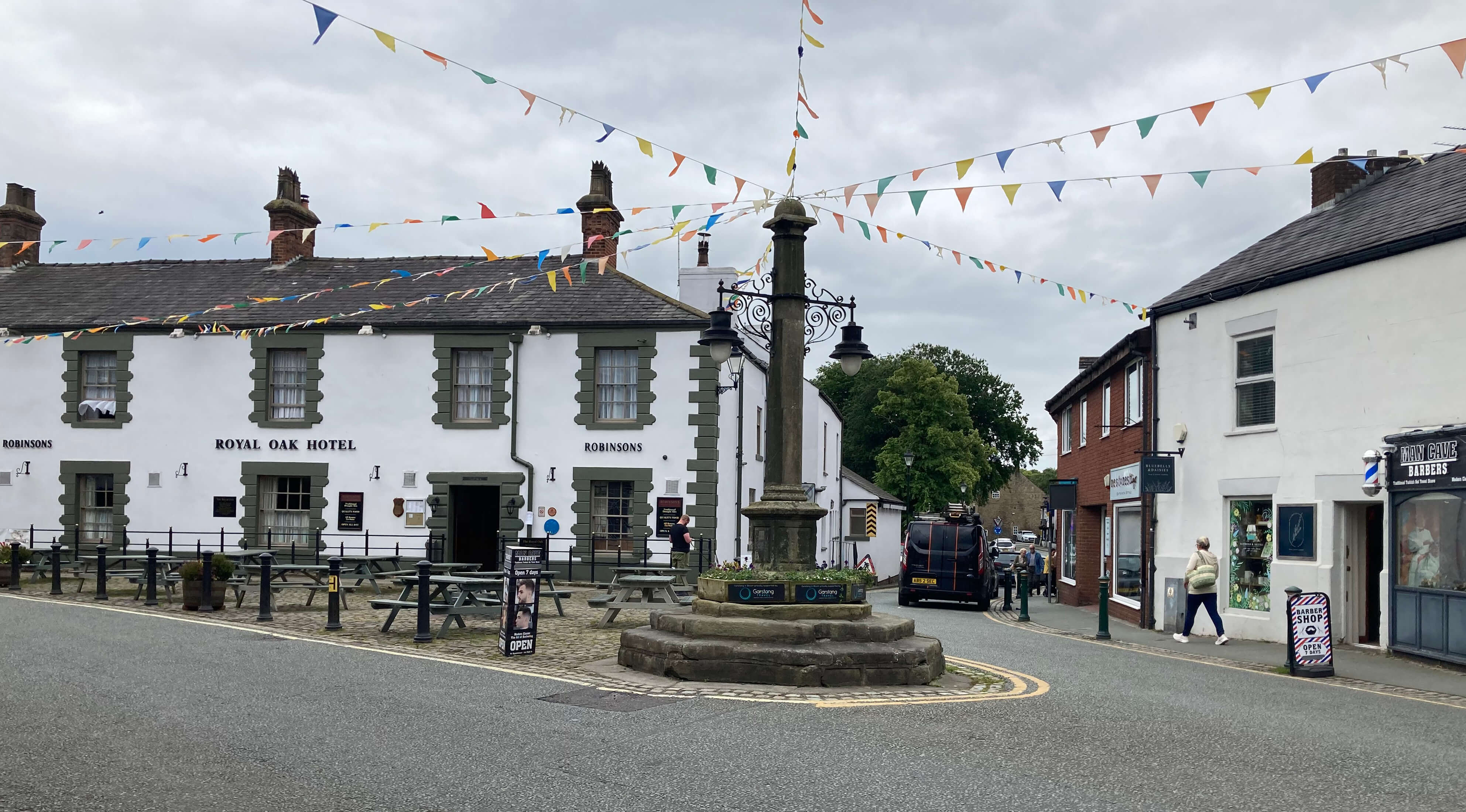
Left: Wyre Bridge;
Right: Garstang market cross.
Clearly, I was not in the right frame of mind to appreciate Garstang.
On reflection, I think I was depressed not so much by the bad back – as it's not
so bad really – as by the realisation that the back was not as good as
I had hoped and expected.
I was disappointed to be unable to give myself the all clear to go
walking far and high again.
Perhaps I'll be
restricted to short, flat walks for a while yet.
Or perhaps it's Saunterings that should be pausing in Garstang.
Date: June 12th 2024
Start: SD511410, A6 bus stop near Bilsborrow (Map: OL41)
Route: (linear) N on canal tow-path – canal bridge north-east of Dimples – NW,
curving west – Greenhalgh Castle Farm – W – Wyre Bridge – N and around – Garstang town centre
Distance: 5 miles; Ascent: 15 metres
Home
Preamble
Index
Areas
Dales
Hills
Lakes
Places
Reserves
Rivers
Structures
Villages
References
Me
© John Self, 2018-

Top photo: Rainbow over Kisdon in Swaledale;
Bottom photo: Ullswater