
Home
Preamble
Index
Areas
Dales
Hills
Lakes
Places
Reserves
Rivers
Structures
Villages
References
Me
Saunterings: Walking in North-West England
Saunterings is a set of reflections based upon walks around the counties of Cumbria, Lancashire and
North Yorkshire in North-West England
(as defined in the Preamble).
Here is a list of all Saunterings so far.
Guaranteed ad-free, AI-free and free!
259. New Landscapes in Bowland
After commenting on the unchanging nature of the Howgill Fells
[258], I have been thinking about recent
changes to more local and familiar landscapes. Anybody who
walks over familiar terrain will wonder: What has changed since
my last visit? What has changed since my first visit? Are the
changes for the better? What is changing right now? What will
change? What should change?
The Lake District, for example, has agonised over change
ever since Celia Fiennes (in 1698) and Daniel Defoe (in 1727)
dismissed it as barren, wild and scary. From Wordsworth trying
to stop the railways to modern-day thrill-seekers wanting zip-wires
in Elterwater Quarry there have always been disagreements about
the future of the Lakes. Today the Lake District is a proud
World Heritage Site, a designation that reflects its special
nature and a determination to protect it. Liverpool too was a
World Heritage Site – until it relinquished that status in 2021
because it redeveloped its historic waterfront. I doubt that the
Lake District authorities will carry out changes that would
result in it losing its World Heritage Site status.
It may be different for Bowland. For centuries it was
pretty much a world of its own. Nobody outside knew or cared
much about Bowland. Today it is hardly a prime tourist or walking
destination. Between my home on the northern edge of Bowland and
Slaidburn on the southern edge there is not a single facility
for visitors.
I set off uphill with a forecast of 40% chance of rain, which
perhaps meant that I had a 60% chance of staying dry, which is
perhaps as much as I can expect at this time of the year. Once
beyond the village I could see sheep in the first field basking in
sunshine – but beyond them ominous clouds over Ward’s Stone.
It was quite breezy, with overnight rain burbling down the roadside ditches.

Looking up the Littledale Road towards Ward's Stone
I noticed a sign at Ravenscar Farm. I have passed this sign hundreds
of times but never took any notice of it before. If a farmer puts up
a smart sign about his cattle then presumably there’s something special
about them. But what? Is there no end to the questions that befuddle
my brain? (Yes. There is no end.)


Left: The Ravenscar sign; Right:
Holstein Friesians (I assume).
As usual, I am sadly ignorant. There are, I read, over 1,000 breeds
of cattle. I might be bold enough to identify Belted Galloway, Highland
and Longhorn. And I’ve heard of Angus, Guernsey and Jersey. That’s
about it. Ravenscar’s cattle are Holstein Friesians, which is two
breeds for the price of one. I don’t know how the combined breed differs
from the individual ones but, judging from the photos, Holstein Friesian
is the most common breed hereabouts. I assume the ‘pedigree’ makes
Ravenscar’s cattle special.
I walked on up. The blackberries were over. After the dry
summer they never really started. The bracken was turning rusty and
losing the will to stand upright. The trees, however, were still
green, on the whole. I paused at the cattle grid to look back but
I couldn’t see Morecambe Bay or the Lakeland panorama. It was raining
there. Was it coming my way?

Looking back towards Morecambe Bay
Ten seconds later I had my answer. But I walked on as far as the track
down to the farm of Deep Clough, where I paused in the rain to contemplate the
actual and potential changes to the landscape ahead. To the north
is the highest point of Bowland, Ward’s Stone, below which lie heather-clad,
jumbled heaps of millstone grit, and below them lie the green pastures.
I thought about the words of Nan Fairbrother:
“To many of us in Britain, our countryside is the most
beautiful landscape in the world, [having] evolved as a varied and
harmonious whole by a long living together of man and nature in a
gentle climate. But the modern world is now destroying this countryside
inherited from the past; exploding the towns, swamping the villages,
tearing up the farmland and spattering the old harmonious landscape
with alien intrusions … and it is profoundly depressing. But in another
generation it will be disastrous, for by then the changes will have
spread to every mile of our highly populated island.”
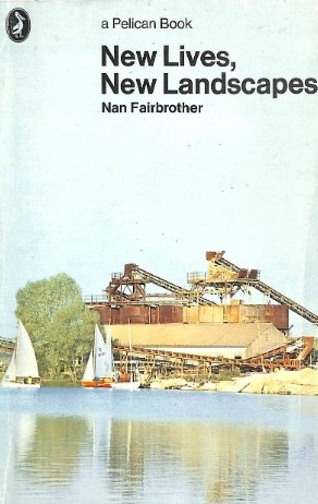 Nan Fairbrother (1913-1971) was an eminent landscape architect, the
author of influential books on landscape and land use. I am a
little uneasy with the concept of landscape architect. Landscape
is, for me, an interpretation that we place upon what we perceive,
at a distance, be it hills, lakes, factories, fields, windmills,
quarries, and so on. In this country any landscape has been shaped
by us over the centuries – but not usually with the aim of pleasing
me or you. A landscape architect is, I assume, concerned with
designing a (therefore artificial) landscape to please somebody.
Nan Fairbrother (1913-1971) was an eminent landscape architect, the
author of influential books on landscape and land use. I am a
little uneasy with the concept of landscape architect. Landscape
is, for me, an interpretation that we place upon what we perceive,
at a distance, be it hills, lakes, factories, fields, windmills,
quarries, and so on. In this country any landscape has been shaped
by us over the centuries – but not usually with the aim of pleasing
me or you. A landscape architect is, I assume, concerned with
designing a (therefore artificial) landscape to please somebody.
The words quoted above are from New Lives,
New Landscapes (Fairbrother, 1972).
I first saw the Ward’s Stone landscape in 1978, so it is now two
generations, not one, on from then. Also, I could see
much more than one mile of landscape, from White Hill over
Mallowdale Pike and Ward’s Stone to Clougha Pike. I should therefore
see today, according to Fairbrother, the disastrous result of changes since 1978.
So, what has changed? For a walker the main change is that
the area above the pastures is now all open access and not out of
bounds. There are more walkers along the ridge to the top of Ward’s
Stone but very few tackle the rough, off-track terrain. Anyway, the
open access status hasn’t affected the landscape, as seen from the track to Deep Clough.
The heather moors have been maintained as grouse moors,
although perhaps less so in recent years. I haven’t noticed any
heather burning recently. The shooters have upgraded the tracks
for their 4x4s but that isn’t apparent from a distance. There’s
also a shooting hut below Ward’s Stone which may not have been there
in 1978. It too cannot be seen, unless the sun reflects off its roof.
What else? A memorial cairn has been added to the top of
Mallowdale Pike but it cannot be seen from my vantage point, or
indeed from anywhere except right next to it. Only two farms are
in sight, Deep Clough and Haylot Farm. They have, no doubt, had
some maintenance since 1978 but they look much the same to me. The
wire fence to stop cattle and sheep straying onto the road is
post-1978 (because I can remember that running here used to require
some wariness about herds on and around the road). The small
conifer plantations above Deep Clough have, I think, diminished or
been left to fall down. I really cannot think of any other changes
to this landscape in the last nearly fifty years. Of course, this
is not to say that the present landscape is the ‘natural’ one. No
doubt, all these crags and fields were once tree covered.


The Ward's Stone ridge
So, what are we to make of the words of Nan Fairbrother? We could
simply say that she was wrong. That she was too alarmist and that
the changes then underway were never going to be disastrous for the
countryside. Or we could not take the ‘every mile’ literally and
accept that the gist of her argument was correct in that a great
many miles of our land have been ruined, if not the Ward’s Stone
landscape.
Or perhaps it’s the case that her words of warning were
heeded and the ruinous changes that she foresaw were never put into
effect. Fairbrother was not alone at the time in seeking to
‘save’ our countryside. Bowland had been made an Area of Outstanding
Natural Beauty (now called a National Landscape) in 1964 presumably
with that objective. Although the designation has no legal powers
to inhibit change, it has effectively done so through persuasion and education.
But not entirely so, for if we look in the opposite direction
to Deep Clough and Ward’s Stone, we can see changes on Caton Moor,
in particular, the windmills. This may be because Caton Moor is not
typical Bowland land, as the Ward’s Stone area is, and may therefore
be more easily sacrificed. If the AONB border had been drawn to exclude
Caton Moor then nobody would have been surprised.
Caton Moor was not a grouse moor (and still isn't, although heather is beginning
to spread there now that there are fewer sheep). The owner of the
Ward’s Stone land, the Duke of Westminster, would have wanted to
preserve his moors for grouse-shooting and would never have
contemplated windmills there, although being 200 metres higher they
would have been more effective than the Caton Moor ones.
The present Duke, who inherited the title in 2016, is a keen shooter,
representing Great Britain at international clay target competitions.
Perhaps he is less keen on grouse shooting?
Perhaps in fifty years time the next Duke won't want grouse moors.
It was too gloomy to drop down to the valley so instead I
turned to walk back, into the wind and the rain. The latter eased. I
was 60% dry by the time I reached home.

A look back to Ward's Stone
Date: September 17th 2026
Start: SD543644, Brookhouse (Map: OL41)
Route: SE on Littledale Road, E on Roeburndale Road –
track to Deep Clough – and back
Distance: 6 miles; Ascent: 260 metres
964 +458 /2400
Home
Preamble
Index
Areas
Dales
Hills
Lakes
Places
Reserves
Rivers
Structures
Villages
References
Me
© John Self, 2018-
Contact: johnselfdrakkar@gmail.com

Top photo: Rainbow over Kisdon in Swaledale;
Bottom photo: Ullswater