Home
Preamble
Index
Areas
Map
References
Me
Drakkar
Saunterings: Walking in North-West England
Saunterings is a set of reflections based upon walks around the counties of Cumbria, Lancashire and
North Yorkshire in North-West England
(as defined in the Preamble).
Here is a list of all Saunterings so far.
If you'd like to give a comment, correction or update (all are very welcome) or to
be notified by email when a new item is posted - please send an email to johnselfdrakkar@gmail.com.
39. Halls Galore by the Middle Ribble
Why are there so many Halls by the middle Ribble? I planned to wander about the River Ribble just below the point where it joins the River Hodder (from the Forest of Bowland) and the River Calder (from the Cliviger Gorge above Burnley) and I noticed from the map that there is a profusion of Halls in this region. A Hall is not a building with a defined function, like a church or a hotel. Anybody can call their house a Hall but the name generally implies a degree of distinctiveness and aloofness, which perhaps the original owners wanted to establish. Most Halls elsewhere are in or near villages but here they seem to be somewhat isolated. I thought I’d have a look at some of them.
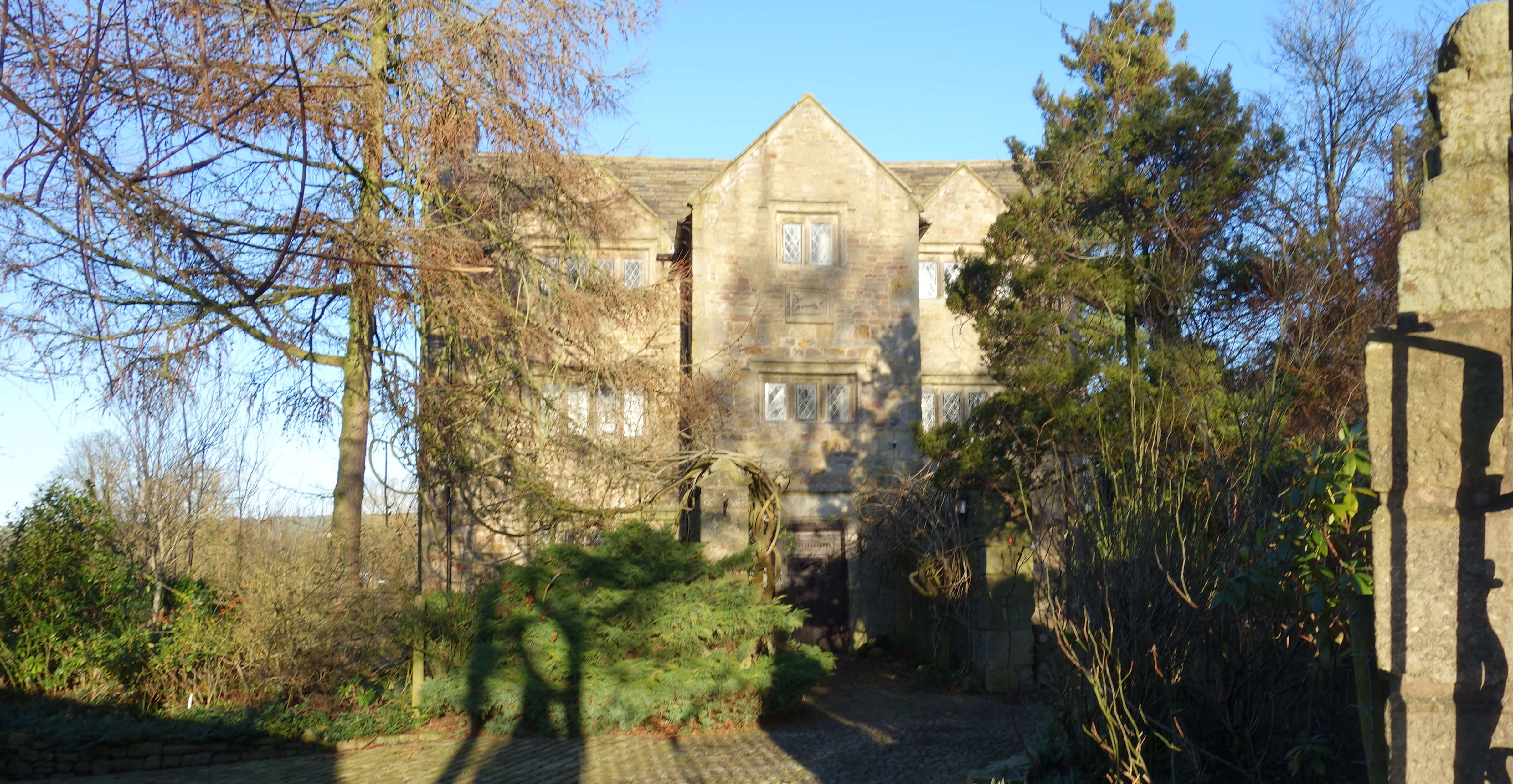
Left: New Hall.

First I reached New Hall, a name indicating a lack of foresight. It was built in 1665.
I suppose it was new relative to something. In general, I am not much interested in the history of a
building, which generally involves a tedious catalogue of the eminent families who lived therein and
the changes they made to it. I will give only a superficial impression, which is all anyone can do
without a close inspection, especially of the interior.
New Hall
is a characterful three-storey building, recently put up for sale. I couldn’t decide if it had new owners, or any residents at all, as it was rather shrouded by trees.
I walked on past the 1776 Ribchester Bridge to Salesbury Hall, which is not shrouded at
all but is within open parkland and is surrounded by the new Manor Court offices and other buildings.
The Hall itself is presumably on the site of the base for the original Salesbury Manor dating back to
the 12th century. I read that the previous Hall was demolished in 1883 but the present
Salesbury Hall
looks more modern than that to me.
I walked through Marles Wood, which is clearly a well-trodden path that must be muddy after
rainy periods, alongside the meandering River Ribble, a pleasant walk enlivened by a kingfisher, light
blue and flying straight and quiet. After a detour around the on-going work to replace the Dinckley
footbridge damaged in 2015 (£1.5m for a walkers’ bridge: thank you!), I reached Dinckley Hall – or at
least as near to it as the footpath allowed.
Dinckley Hall
was also recently for sale. The property
apparently dates back to the 13th century but clearly has been much changed. It looks ordinary now with
only the outline of a cruck frame suggesting antiquity and providing architectural interest.

The River Ribble and the new Dinckley footbridge
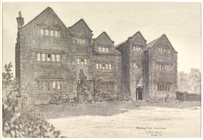
Right: Hacking Hall, as drawn by W. Fairclough in 1941.
(It was too shaded for me to take a decent photo.)

(Eventually) I found my way past the imposing mansions of the new Brockhall Village to return to the River
Ribble, to find Hacking Hall at the confluence with the River Calder. This is more like it:
Hacking Hall
is more of a prototypical ancient Hall. It was built in 1607, has three-storeys, five gables facing the
river, with many mullioned windows with three to six lights. The top storey windows appeared to be
boarded up, indicating that perhaps not all is well within the Hall. No doubt the Hall has been
restored since 1607 but this seems not to have affected its essential structure. However, I can’t help
wondering why any buyer would take on the challenge of Hacking or any other ancient Hall when
the mansions of Brockhall Village are available.
I now faced a rather dull walk south, away from the Ribble. It was enlivened by a large sign
detailing the many hazards (toxocariasis, neosporosis, sarcocystosis – ugh) that dogs and dog-owners
cause. There should be more of them – the signs, that is, not the dogs. I eventually reached where Hollin
Hall is marked on the map. I found a Hollin Hall Farm, of no distinction that I could see. It is no doubt serviceable as a farm but hardly a Hall.
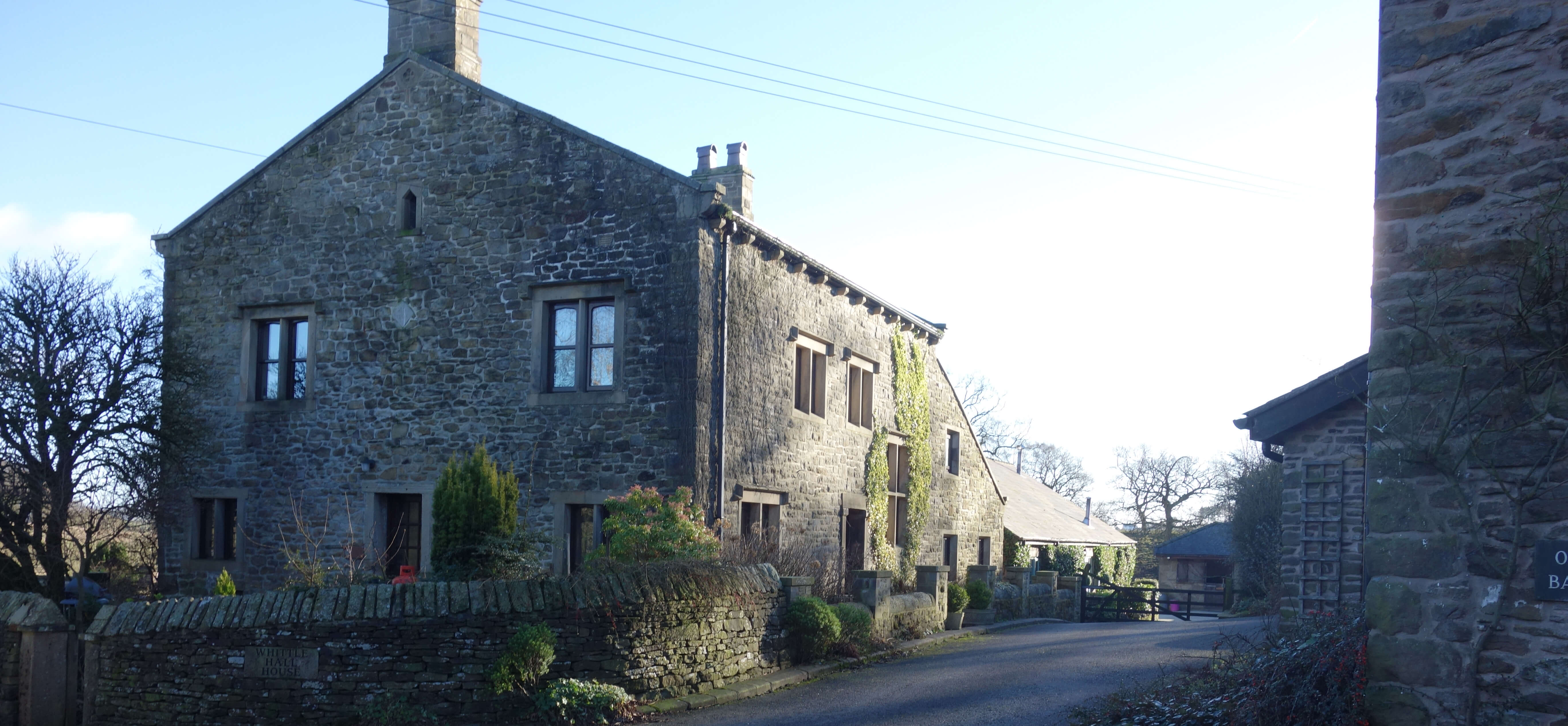
And so, on to Whittle Hall. This does not appear on the 1848 map, so I deduce that it is a
relatively new building. It seemed so to me, and modest, for a Hall. Perhaps the owners felt so too, as,
undecided whether it is a hall or a house, they call it both: Whittle Hall House.
Compensating for the
unexciting Hollin and Whittle Halls, I found myself on the lofty ridge of Billington Moor, an unexpected
bonus, for it provided wide-ranging views, to Blackpool Tower and Pen-y-ghent, some 25 miles away, as
well as of Pendle, a constantly reassuring presence throughout this walk. Closer below, the Ribble valley between Clitheroe and Preston was arrayed. It is still predominantly green but, of course, has many more buildings than in the days of the ancient Halls, plus the A59 and a railway.

Pendle from Billington Moor (and in the distance the hills of the Yorkshire Dales)
I dropped down to find Carr Hall. This is marked on the 1848 map but I suspect that nothing of that Hall remains. The building now called Carr Hall forms the large offices of MMB (Mott Macdonald Bentley). Next to it a building in the style of old halls has been built or is being built. Somebody has gone to considerable expense to restore this Carr Hall site but it added little to my survey of Halls.
I walked through Wilpshire and Salesbury towards the immodestly-named Lovely Hall. Here I made
the wrong decision. After so much road-walking I opted to walk across fields rather than continue on the
road. It turned out that I could see only the chimneys and roofs of Lovely Hall above the large barns at
its rear and so I can say nothing about it. However,
Lovely Hall
has also recently been for sale, so we can at least read the estate agent’s blurb.
Through Copster Green – which does indeed have a green, a long thin one, bumpier than any other I
have seen, between two rows of houses – I came to Copster Hall, on a rocky knoll.
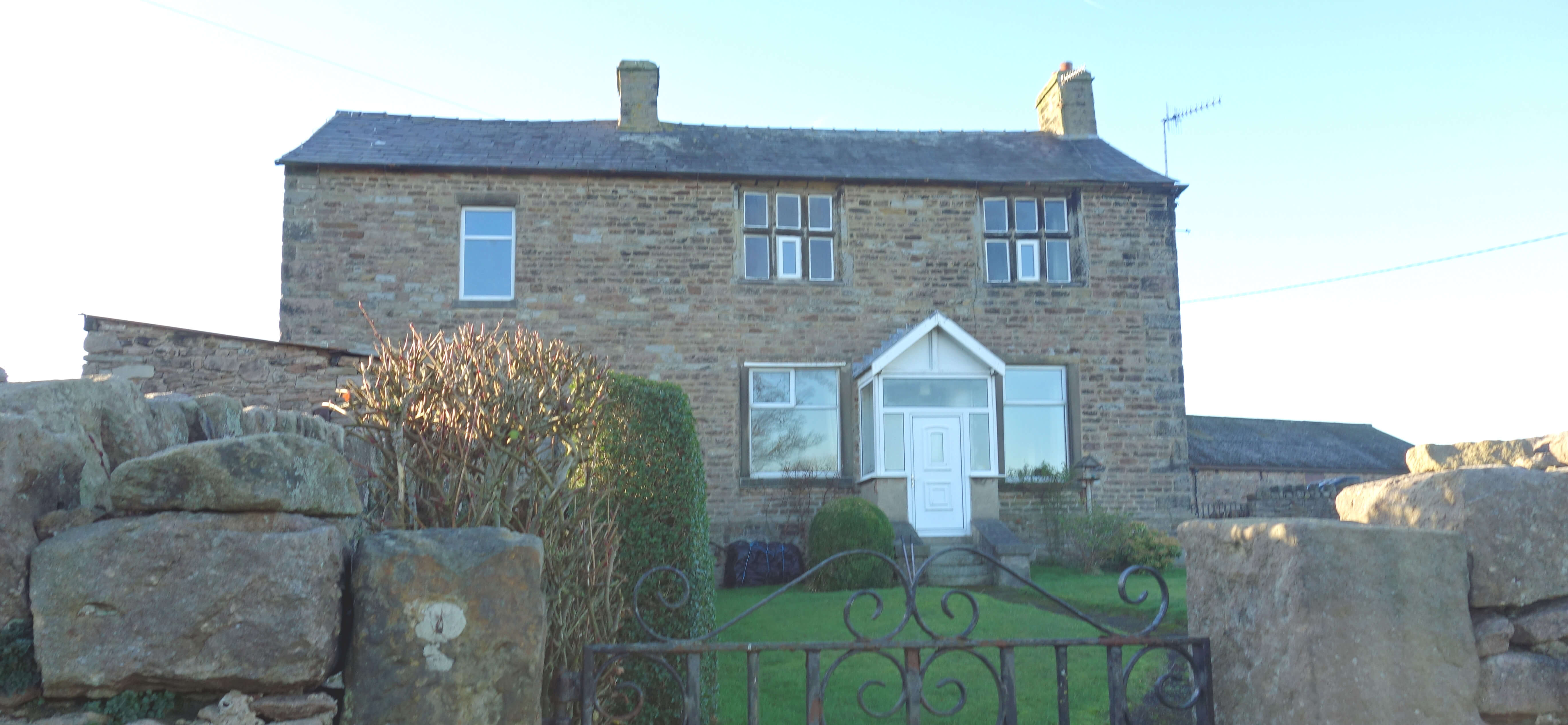
Copster Hall
is a 17th century farmhouse extolled by Historic England for, amongst other things, having “1st floor windows of 6 lights with ovolo-moulded mullions and transoms”. Two of those lights now have incongruous large white frames (I don’t think that is what ovolo-moulded means). Overall, though, Copster Hall seemed little different to hundreds of other farmhouses to me.


Left: Whittle Hall House; Right:
Copster Hall.
However, the nearby Bolton Hall was more appealing. The original
Bolton Hall,
of 1655, was rather small – by Hall standards – but looks to have been sympathetically extended, leaving the old Hall appearing much as it did, I imagine. The mullioned windows, still with diamond leading, have been distorted into a rather elegant bow. I see that the website referred to above comments on “inappropriate strap pointing”, which is barely identifiable from a distance by an amateur such as me. Since it seems to be well-known that strap pointing is bad for old stonework I wonder why it was used here.

Bolton Hall
I had three further Halls to the west (Oxendale, Osbaldeston and Showley) in mind if I had sufficient time, energy and enthusiasm at this point. I didn’t. Nevertheless, I claim a world record (ten, according to the map – and I’m not counting Brockhall Village) for the number of Halls visited on one walk. If anyone would like to claim the record from me they are welcome to it.
Date: January 17th 2019
Start: SD662348, car park south of Ribchester Bridge (Map: 287)
Route: N – New Hall, Ribchester Bridge – E – Salesbury Hall – NE by river – Dinckley Hall –
E through Brockhall Village –
Hacking Hall – SE – Chew Mill, Whalley Old Road – SW – Hollin Hall, Whittle Hall, Little Snodworth – NW –
Carr Hall, A666 – SW through Wilpshire, NW on B6245, N – Ashes Farm – NW – back of Lovely Hall, Copster Green
– N – Copster Hall – W –
Bolton Hall, B6245 – N – car park
Distance: 12 miles; Ascent: 180 metres
Home
Preamble
Index
Areas
Map
References
Me
Drakkar
© John Self, Drakkar Press, 2018-

Top photo: The western Howgills from Dillicar;
Bottom photo: Blencathra from Great Mell Fell


