The Land of the Lune
Chapter 5: Lower Rawtheydale and Dentdale
The Introduction
The Previous Chapter (Upper Rawtheydale)
The Next Chapter (Middleton Fell)
Deepdale and Dentdale
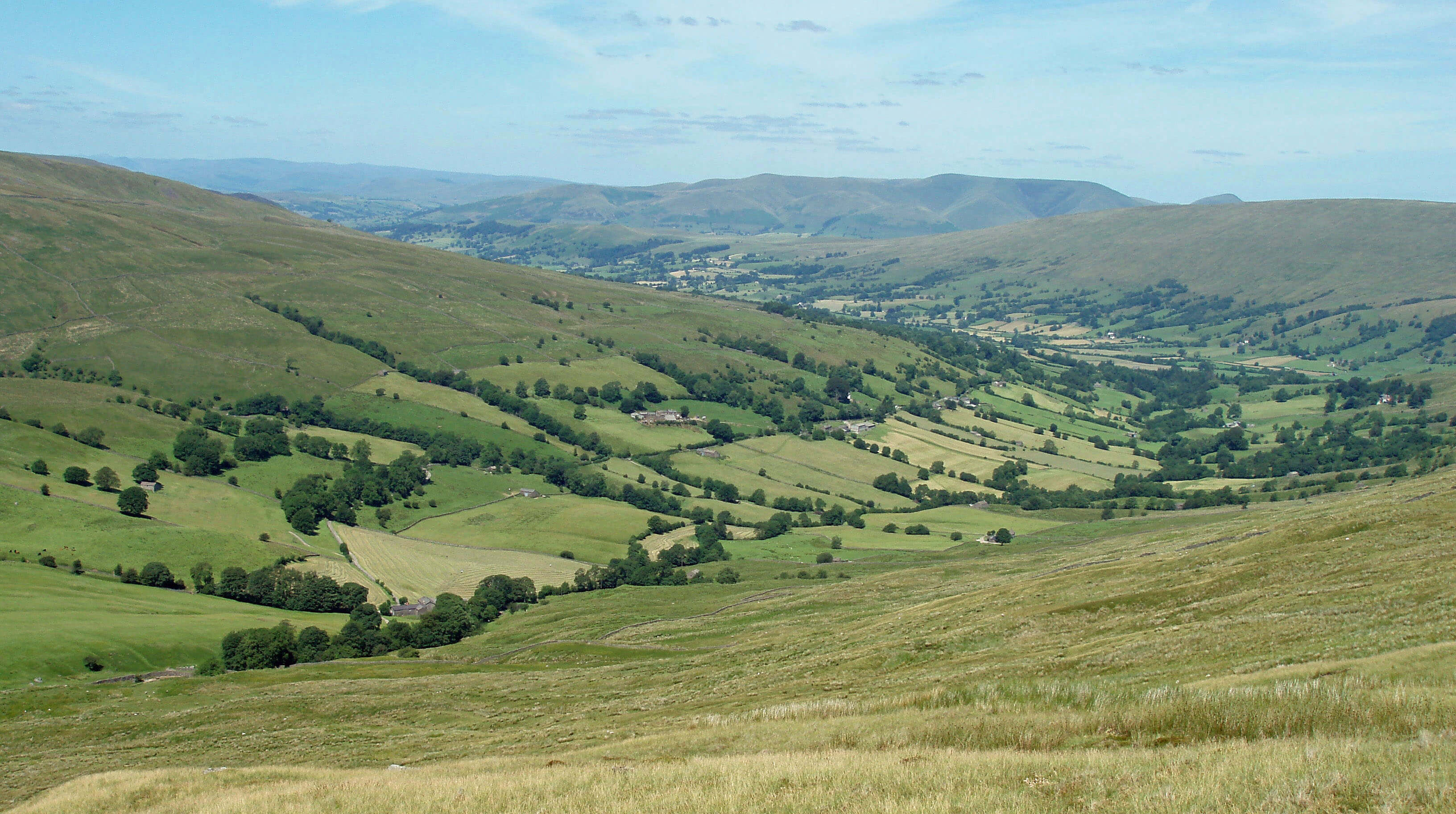
The Rawthey from the Clough ...
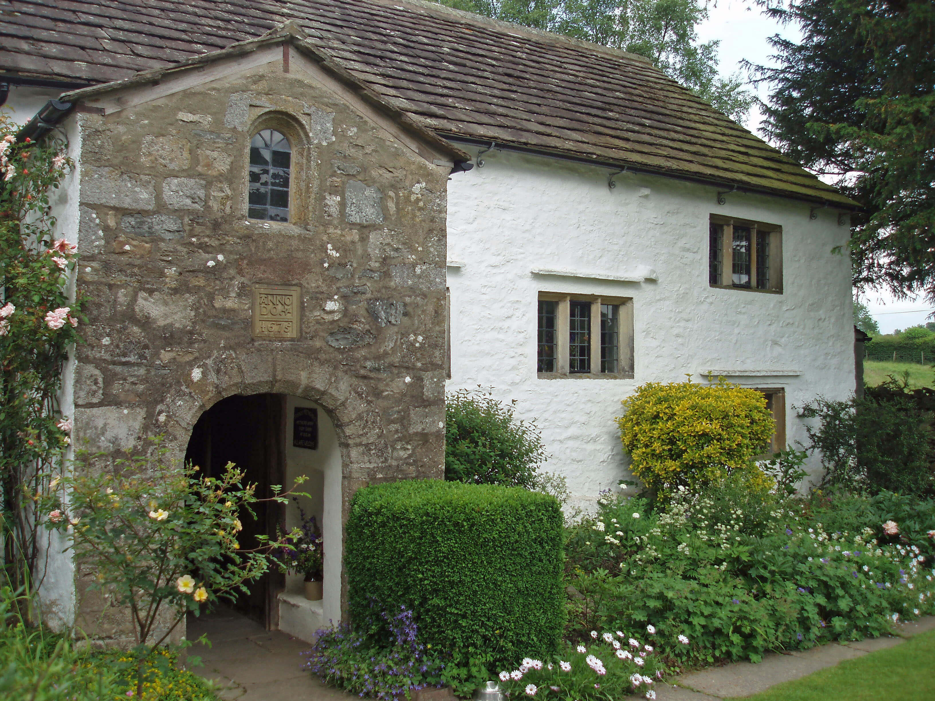
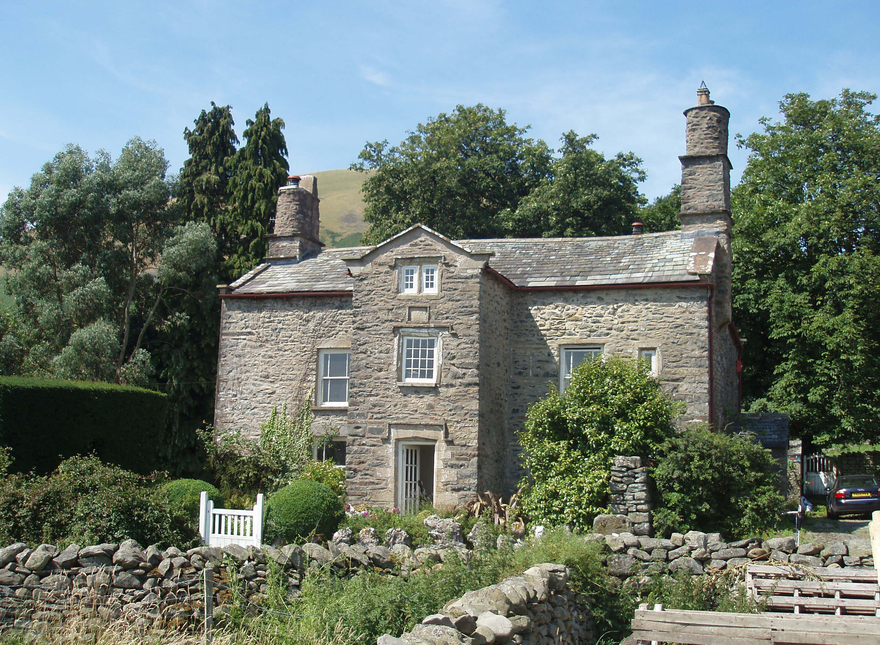 Right: Stone Hall, near Sedbergh
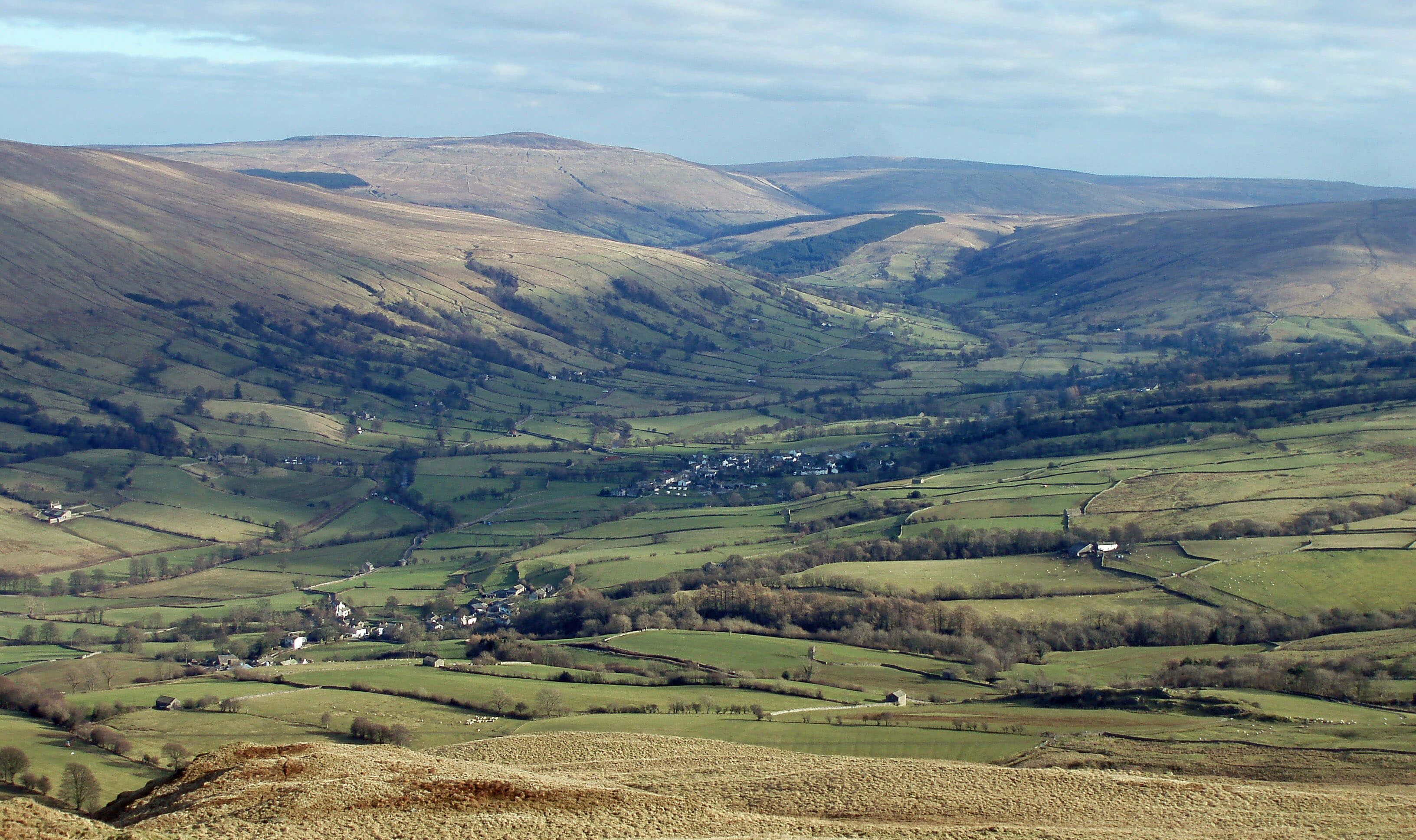
The Clough, having travelled much the same
distance as the Rawthey up to this point, almost
doubles the size of the Rawthey, which now
changes character and relaxes into a double bed, as
it were, some 50m wide. Opposite the junction is the
old Stone Hall, with a three-storeyed porch and large
round chimneys, the latter also to be seen at nearby
Hollin Hill. I have not seen such chimneys elsewhere
in Loyne and, being an inquisitive soul, I have tried to
find an explanation. I understand that they are ‘Flemish
chimneys’ and that there is a preponderance of similar
chimneys in Pembrokeshire, for some reason, and
presumably also in Flanders. Why they are here I have
been unable to discover.
On the outskirts of Sedbergh the Rawthey is joined
by Settlebeck Gill, which runs past the earthwork
remains of the Castlehaw motte and bailey. The motte,
at 9m high, must have been a good observation post. The
remains are on private land but seem in good shape, as
can be best seen from the slopes of Winder.
Sedbergh oozes contentment, and why not? Basking
below Winder, it gains strength from its one thousand
years of history, serenity from the playing fields of the
five-hundred-year-old school, and self-confidence from
its newfound status as a ‘book town’.
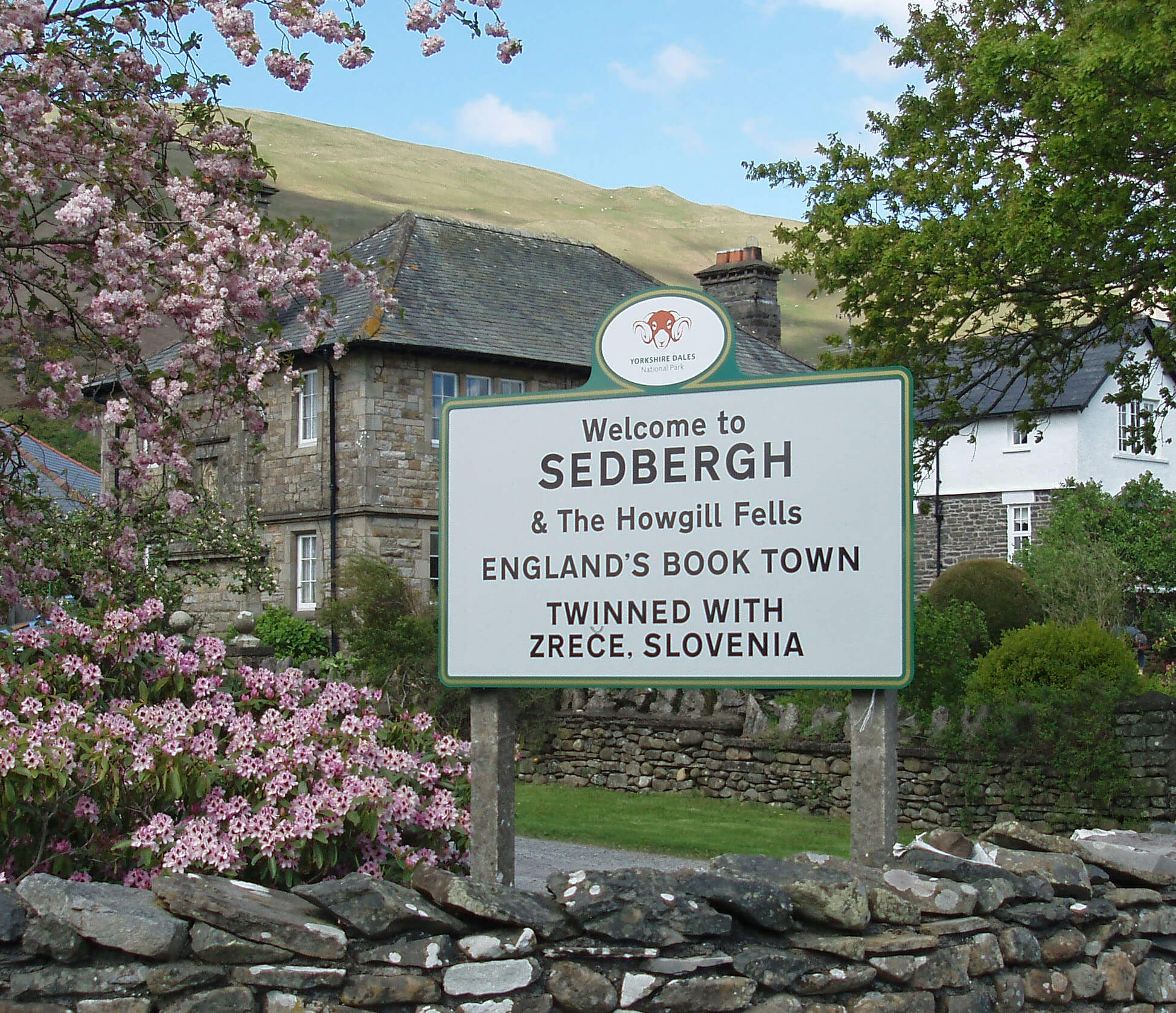 Left: Welcome to Sedbergh
Sedbergh was mentioned in the
Domesday Book of 1086 and Castlehaw
confirms its strategic importance, lying
near the meeting of four rivers, the Lune,
Rawthey, Clough and Dee. A market
charter was granted in 1251. St Andrews
Church has a Norman doorway and
lists vicars back to 1350 but was largely
rebuilt in 1886 (although the clock has a
date of 1866, for some reason). Within
the church are several plaques to local
notables, including John Dawson, an
eminent mathematician, born in Garsdale
and “beloved for his amiable simplicity of
character.” My favourite is that of the Rev.
Posthumus Wharton, who was headmaster
of Sedbergh School from 1674 to 1706.
Sedbergh School was established as a
chantry school in 1525 by Roger Lupton,
provost of Eton and born in the parish of
Sedbergh. After the Dissolution of the
Monasteries (1539), it was re-established as a grammar
school in 1551. The school has not always flourished:
in 1865, when it had only ten pupils, an inspection
considered that “it simply cumbers the ground”.
Amongst recent alumni are the rugby stars, Will Carling
and Will Greenwood. Although Sedbergh School is not
in the top division of independent schools, it is central to
Sedbergh’s image.
This image perhaps helped Sedbergh to persuade
itself to become England’s first book town in 2005
(the pioneering book town, Hay-on-Wye, being just
in Wales). Book town status is not formally defined:
what makes a place a book town is simply a decision
to proclaim itself one. By convention, a book town is a
small town in which little else happens apart from the
selling of old books. This description may deter non-bibliophiles but presumably Sedbergh hopes that overall
a boost will be given to the local economy and culture.
The obligatory Book Festival takes place in the autumn
and a more innovative Festival of Ideas in the summer,
although the latter lapsed in 2009, which is a shame as
we are all in need of good ideas.
Sedbergh’s self-image is also reflected in its
participation in 2004 in the BBC TV programme The
Town that Wants a Twin in which, over twelve long
episodes, Sedbergh auditioned four towns for the honour
of becoming Sedbergh’s twin. The citizens of Sedbergh
duly voted for Zrece of Slovenia. This one-way process
does not seem to reflect the spirit of twinning as an equal
partnership.
There are pleasant, well-used paths on both banks
of the Rawthey. At Millthrop Bridge we rejoin the Dales
Way, which follows the Rawthey for 4km before veering
north to join the Lune. As you might expect of a village
whose sign proudly calls it a “hamlet”, Millthrop itself
is a set of cottages too pretty for words – at least, any
words of mine.
After a further kilometre, the Rawthey goes over
a weir that was used to power Birks Mill for cotton
spinning and then, after a bend, is joined by the River
Dee from the south.
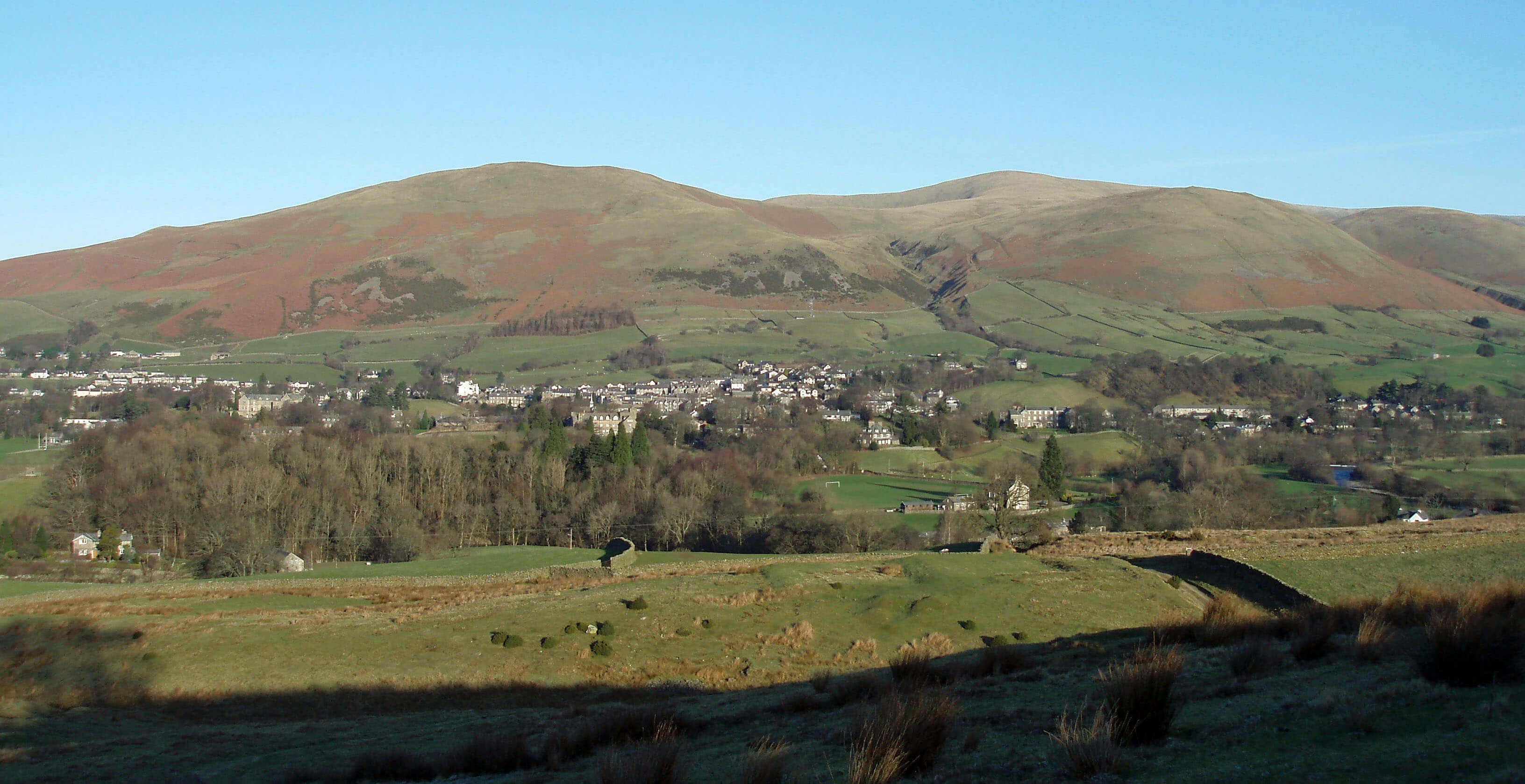
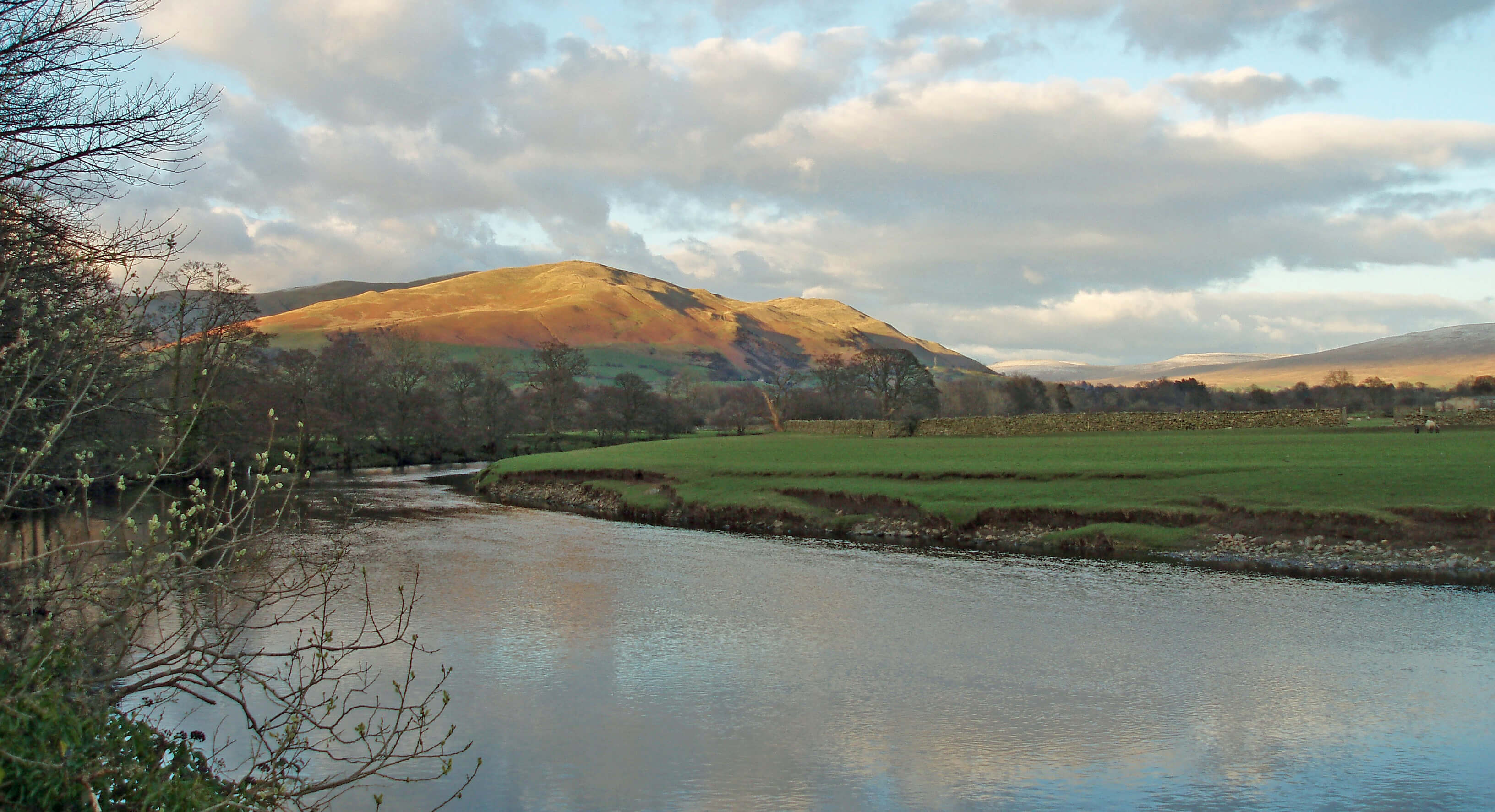
Sedbergh, with Winder, Arant Haw and Crook behind
The River Dee
The River Dee rises on Blea Moor and runs 20km
through Dentdale, many people’s favourite of the
Yorkshire Dales, even though it is now in Cumbria. Only
the very highest of the headwaters of the Dee on Blea
Moor are in North Yorkshire.
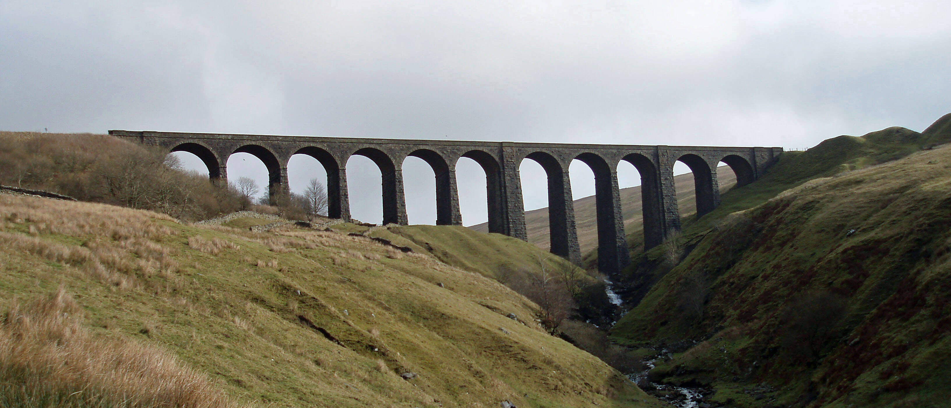 Right: Artengill Viaduct
There is only one feature of note on Blea Moor and
that we cannot see: the tunnel that runs for 2.5km under
it. This is for the Settle-Carlisle line, which continues
on the flanks of Wold Fell and Great Knoutberry Hill
over the impressive viaducts at Dent Head and Arten
Gill, built from 1870 to 1875. They have ten and eleven
arches, respectively, and are both over 30m high. Their
construction, in this high and remote terrain, was difficult
and hazardous. On one occasion, a flood caused by 6cm
of rain in 45 minutes drowned two people, buried a
horse and wagon in debris, and washed away several
bridges. Earlier, according to David Boulton’s booklet
Discovering Upper Dentdale, in 1752 an avalanche
killed seven people, which, I believe, makes that the
second worst avalanche in the United Kingdom. So,
although it is likely to be pastoral tranquillity when we
visit, the weather can be wild here.
The two viaducts are built of ‘Dent marble’, which
is actually a dark limestone. The marble was mined
locally until the 1920s and prepared at Stone House,
near Arten Gill. It was valued for ornamental masonry,
such as luxury fireplaces – indeed, being so valued, it
seems strange that such huge volumes were used in the
viaducts. No doubt, the convenience of being to hand
was the main factor. The previously rough track by Arten
Gill has recently been renovated to form part of the 350-mile Pennine Bridleway National Trail.
Dent Station is 2km north of Artengill Viaduct and
is a tribute to the engineer’s faith in the energy of the
residents in Dentdale. It is 7km from Dent itself and
the final kilometre up from Lea Yeat is very steep. The
station platform has a notice saying that, at 350m, it is
“the highest mainline station in England”. It is pleasing
that someone at least regards the Settle-Carlisle line as
a main line. The station is surprisingly neat, considering
the weather conditions, painted dark red, and gives fine
views into Dentdale. The old station building can be
rented for holiday accommodation, so you could enjoy
the view through its windows, obscured a little by “eciffo
tekcit” and “moor gnitiaw seidal”. The converted station
is now the proud recipient of a North West Tourism and
Leisure Award.
The road passing Dent Station is called the Coal
Road and the stretch on Galloway Gate is pockmarked
with disused coal pits. Coal mining stopped as soon as the
railway existed to deliver coal more cheaply. The name
of Galloway Gate tells us that it used to be a drove road.
It is hard today to imagine this clamour of activities high
up, at over 500m, on the now lonely and quiet moor.
Cowgill Beck runs from the area of the coal pits,
through Dodderham Moss, one of the conifer plantations
that disfigure Dentdale, past the entrance to Risehill
Tunnel on the Settle-Carlisle line, to join the Dee at
Cowgill. The foundation stone of Cowgill Chapel was
laid in 1837 by Dentdale’s most famous son, Adam
Sedgwick, who, although living in Cambridge, continued
to keep a fatherly eye on his chapel. Thirty years later,
Sedgwick led a campaign to parliament to have the name
of Cowgill Chapel restored when the curate changed it
to Kirkthwaite Chapel. He preferred the unpretentious
‘Cowgill’ and was angry at the misspelling of Kirthwaite,
the old name for the region. The curate, however, was
not to blame: the 1852 OS map has “Kirkthwaite”.
Adam Sedgwick (1785-1873) was born in Dent and spent
much of his youth scrambling over the fells collecting
rocks and fossils. From Sedbergh School he went to Trinity
College, Cambridge, where he became a fellow. He was
ordained in 1817, thus following the family tradition, as
evidenced by the many memorials in the Dent church.
In 1818, despite having no recognised experience of
fieldwork, he became Professor of Geology.
He duly set out to become a proper geologist. His
studies of the complex geology of the Lake District led to
a pioneering publication in 1835. He discovered the Dent
Fault, and the Sedgwick Trail in Garsdale is named after
him. He became president of the Geological Society of
London and organised many scientific activities.
Inevitably, he became embroiled in scientific debates
of the time, such as the Great Devonian Controversy,
concerning the mapping and interpretation of various
geological strata. Of more resonance today is his
disagreement with his ex-student Darwin over his theory
of evolution. To the author of Origin of Species, Sedgwick
wrote “I have read your book with more pain than pleasure.
Parts of it I admired greatly; parts I laughed at until my sides
were sore; other parts I read with absolute sorrow; because
I think them utterly false and grievously mischievous”.
What grieved him was the removal of the guiding hand of
God from the process of natural selection, which he could
not accept. This view endears him today to creationists,
although unlike many of them he did, as a geologist, accept
that the Earth was extremely old.
Sedgwick retained the warm-spirited generosity
attributable to his Dentdale upbringing. Although he lived
in Cambridge all his working life, he maintained his links
to Dent and in 1868 wrote A Memorial by the Trustees
of Cowgill Chapel that gives one of the best pictures of
Dentdale life at the time.
The Top 10 people in Loyne
Before you complain, yes, they are all men. Nominations of women are very welcome.
1. Adam Sedgwick (1785-1873), Dent, geologist.
2. John Fleming (1849-1945), Lancaster, electrical engineer.
3. Richard Owen (1804-1892), Lancaster, palaeontologist.
4. John L. Austin (1911-1960), Lancaster, philosopher.
5. William Whewell (1794-1866), Lancaster,
philosopher and scientist. (Whewell is said to have invented the word ‘scientist’.)
6. Reginald Farrer (1880-1920), Clapham, botanist.
7. James Williamson (1842-1930), the son, Lancaster, businessman and politician.
8. John Lingard (1771-1851), Hornby, Catholic historian.
9. William Sturgeon (1783-1850), Whittington, physicist.
10. Laurence Binyon (1869-1943), Burton-in-Lonsdale, poet.
In the valley the River Dee gathers the waters than
run steeply off the fells through deep gorges and cascades,
and proceeds serenely down its upper reaches from Dent
Head to Cowgill. The riverbed is mostly flat rock, which
the river seems to shimmer over, with occasional ledges
producing little waterfalls and, at Scow, a reasonably
large one.
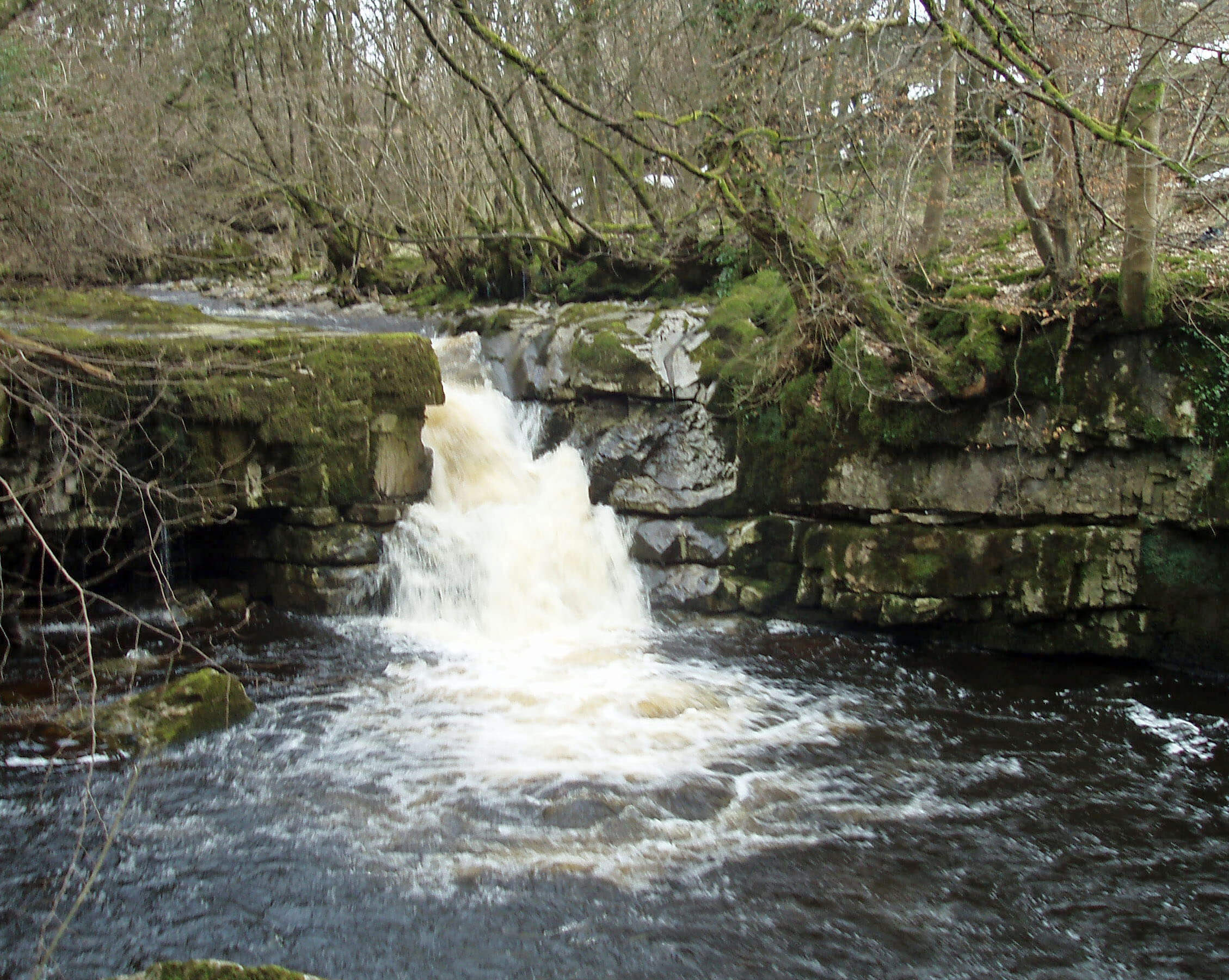 Right: Ibbeth Peril
As the Dee turns west, it enters a more turbulent
phase. If you investigate the river closely – for example,
around the Ibbeth Peril waterfall and along the stretch
between Lenny’s Leap, where the river narrows to run
in a gully 50cm wide, and Tommy Bridge – you may
notice that the volume of water does not always increase
as it flows west. Some of the clefts and holes that can be
seen in the limestone walls and bed of the gorge are large
enough to form caves, through which the river tends
to disappear. As you walk on the north bank towards
Tommy Bridge, water can be seen entering the Dee from
below the south bank, with no beck apparent in the fields
above.
The area forms the Upper Dentdale Cave System,
a Site of Special Scientific Interest. It is one of the best
examples of a cave system that had developed beneath the
valley floor and that has been broken into by the modern
river eroding its bed. The system extends for 1.7km in a
narrow band under the present river and includes a 30m
by 60m chamber. Under normal conditions, most of the
river is now underground and is modifying pre-existing
caves. The cave system is complex and needs experts
to investigate and interpret but, on the surface, we see
holes and caves, with water flowing into or out of some
of them.
Above the level of the floodplain Dentdale is lined
with farmsteads every 200m or so on both sides. Most
of the farmsteads are still actively farming, giving a
predominantly rural feel to the valley. Some have been
converted to holiday homes and some are derelict. The
most interesting of the latter is Gibbs Hall – a ruin now
surrounded by its offspring: Gibbs Hall Cottage, Little
Gibbs Hall and Gibbs Hall Barn. From the road two
windows with chamfered mullions and arched lintels
can be seen.
On the opposite bank is the imposing Whernside
Manor, originally and more properly called West
House, as it is not a manor house. It was built by the
Sill family, who not only became rich by exploiting
slaves in Jamaica but also employed slaves in Dentdale,
a practice continued long after they were supposed to be
emancipated. This is now a matter of shame for locals
although I overheard one in the Sun Inn who was either
proud that Dentdale had had the last slaves in England
or had imbibed too much of the esteemed local ale from
the Dent Brewery at Cowgill.
The name of Whernside Manor reminds us that the
Dee has been flowing around the broad northern slopes
of Whernside, the highest point (736m) of the Yorkshire
Dales, and gathering the becks that flow north from it.
Despite its height, there are few impressive views of
Whernside, the one from Dent across Deepdale being
as good as any. It is a ridge rather than a plateau or peak
and has few of the high-level cliffs that provide such
distinctive profiles to other Dales peaks.
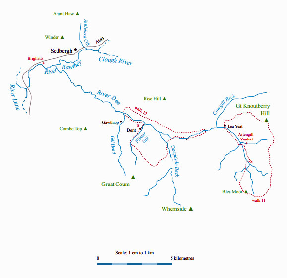
Walk 11: Upper Dentdale and Great Knoutberry Hill
Map: OL2 (please read the general note about the walks in the
Introduction).
Starting point: By Dent Head Viaduct (777845).
Some of this walk is on roads, but they are quiet ones and the easy walking there compensates for the difficult going
elsewhere. From Dent Head Viaduct walk on the road 200m northwest to Bridge End Cottage and then take the footpath opposite
that leads back to Dent Head Farm and past the entrance to Bleamoor Tunnel. Once out of the plantation and past the air shaft
cut across to the trig point on Blea Moor (535m) for a good view of Whernside and of the Settle-Carlisle railway line far below
behind you.
Make your way east as best you can (there is no path) to join the Dales Way at Blake Rake Road. Follow the way north by
Stoops Moss to reach the road. Turn right and take the path north that continues past Wold Fell (resist the temptation to conquer
Wold Fell: there is no identifiable top and walking is unpleasantly uneven, being on grassed-over limestone clints) to reach the
bridleway at the top of Arten Gill at the point opposite the track that leads to the Galloway Gate.
Turn right for 200m to take the waymarked path that follows the wall to the top of Great Knoutberry Hill (672m), from
where the peaks of Pen-y-Ghent, Ingleborough and Whernside are wonderfully arrayed and the outline of Wild Boar Fell is
impressive. Widdale Tarns can be seen to the north. Continue west by the fence past a family of cairns to the recently-improved
bridleway.
Follow this track for 600m north and then take the Coal Road west, having a look at the neat Dent Station on the way. At
Lea Yeat Bridge note the Cowgill Institute, a Quaker meetinghouse from 1702. Many farmsteads here served as meetinghouses
in the years after George Fox visited in 1652, on his way to speak at Fox’s Pulpit. Cross the River Dee and turn left to follow the
road back to Dent Head Viaduct, past (or not, if you wish) the Sportsman’s Inn, a 17th century establishment that regards grouse
shooters as sportsmen. If energy permits, a detour to look at Artengill Viaduct is worth it.
Short walk variation: There are two obvious shorter walks. One is to follow the long walk as far as the road north of Stoops Moss
and then turn left for 1km to Dent Head Viaduct. The other, for a medium length walk, is to continue as for the long walk past
Wold Fell to reach the Arten Gill track and then to turn left to Stonehouse Farm (2km) and south along the road to Dent Head
Viaduct (2km).
It is usually assumed that Whernside’s name derives
from the querns, or stone mills for grinding corn, that
were extracted from its slopes. However, Harry Speight,
in his 19th century guides, says that it comes from the
Anglo-Saxon word for ‘warn’, since anyone on the
ridge, which separated the Anglo-Saxons to the east
and the Norse to the west, could give warnings. At least
this draws attention to the differences east and west of
Whernside: the Anglo-Saxons were arable farmers and
lived in small villages; the Norse were sheep farmers
who preferred isolated farmsteads.
Deepdale Beck is a substantial tributary of the Dee
that drains the basin that lies north of the ridge separating
Deepdale from Kingsdale. Deepdale itself is a rarely
visited dale, quieter even than Dentdale and with, as
the name would suggest, a deeply incised valley. Its
hay meadows are a Special Area of Conservation under
European law. The road over to Kingsdale is not often
travelled but those who do tackle it are rewarded with a
roadside view of Lockin Garth Force.
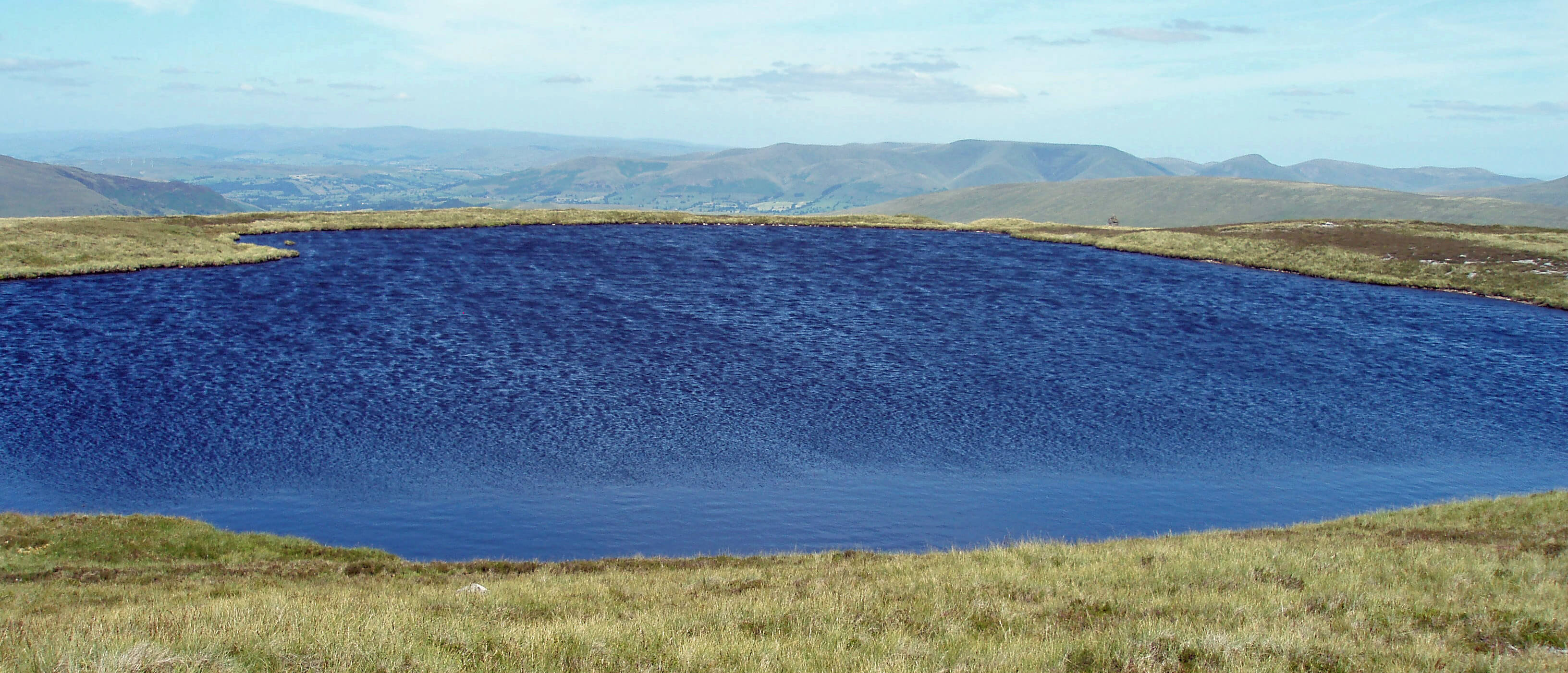 Right: One of the Whernside Tarns
The Craven Way, an ancient track linking Dent
and Ingleton, leads around Whernside, reaching a
height of 540m. The walk from the Craven Way past
the surprisingly large Whernside Tarns provides a good
ascent of Whernside. Combined with a drop down to the
Kingsdale road and then a walk through Deepdale, it
gives an excellent all-day expedition from Dent.
The River Dee begins to behave itself, flowing
steadily over an even bed, as it passes north of Dent,
the centre of Dentdale. The Domesday Book records
Dentone, which became Dent Town, and now plain Dent
– although it is far from plain: its narrow, cobbled streets
and whitewashed walls provide a distinctive, attractive
character.
The Church of St Andrews has Norman foundations
and was largely rebuilt in the 15th and 17th centuries. The
floor around the altar is paved with Dent marble, both
the black and grey versions. Next to the church is the
old grammar school (now a private home), built in 1604
from funding provided by Dentdale benefactors. The
school closed in 1897 but the governors still meet for
the enjoyable task of distributing money from the still-existing charities to local pupils.
Like all grammar schools, Dent’s existed to educate
young men in the delights of Latin and Greek grammar.
Young women were trained in more practical skills,
amongst which knitting was the most renowned in
Dentdale. Girls were sent, not always willingly, to Dent
from around the region to learn the art. The activity
peaked in the 18th century when socks and gloves were
supplied to the army. The narrow streets then appeared
narrower still because the houses had over-hanging
galleries where people sat to knit and chat.
On the streets today is the Sedgwick Memorial,
a huge Shap granite boulder, in honour of Adam
Sedgwick. The Dent Fault that runs through Dentdale
partly accounts for the differences between east and
west Dentdale. To the east, becks cut deep gills in the
V-shaped valley and the fields are large and walled; to
the west, the slopes are gentle with fields hedged and
with deciduous trees.
In 2006 the Flinter Gill Nature Trail and the Dent
Village Heritage Centre were opened, the latter helping
immensely to clear the attics of local farmsteads. In fact,
the leaflet for the nature trail existed before the trail did,
showing it to be a fine piece of creative literature, with
waulking, deiseal, sniggin, Dancing Flags and a Wishing
Tree. Its wishful thinking is symptomatic of a problem
with the tourist industry, upon which Dent now depends:
it is liable to ruin the very things that appeal to tourists
in the first place.
Self-defeatingly, Dentdale sells itself as ‘the hidden
valley’. It can be entered by the railway and by five
narrow roads (from Rawtheydale, Garsdale, Ribblesdale,
Kingsdale and Barbondale), all of which feel like back
entrances. It should be a green, restful haven but the
more we are persuaded to visit it the less hidden it will
become. In the summer the cobbled streets are already
thronging with people and cars. There seems little need
for artificial trails or for the air of desperation that
pervades Dent’s publicity.
Flinter Gill provides a pleasant stroll along a stony
track by small waterfalls but if the crowds are encouraged
there it will soon need litter bins, barriers (to stop people
slipping on the dangerous ‘dancing flags’), and so on.
The 1km trail ends at a “magnificent viewpoint” where
a toposcope tells us what we can see, leaving the fells
above still empty for those with a bit more energy.
Above this point, Flinter Gill runs from the northern
slopes of Great Coum (687m), an underrated hill that
displays its great coum or cirque towards Dentdale. All
three north-facing slopes of Dentdale have their cirques,
gouged out in the Ice Age (Middleton Fell has Combe
Top and Combe Scar; Whernside has Combe and Combe
Bottom) but Great Coum is the most impressive. The
southern ridge of the cirque, past the old quarry where
Dent marble was also mined, is the best ascent. The view
is excellent, from Whernside nearby to the Howgills and
the Lake District in the distance and to the south the
lower Lune valley.

 Left: The Megger Stones
Right: Whernside from the Occupation Road
Below Great Coum, on a rise overlooking Dentdale,
stand the Megger Stones, a group of ten or so cairns
showing varying degrees of competence at cairn-building.
The Megger Stones are just above the Occupation Road
or Green Lane, as the OS map calls it. It is named from
when the fells, used for common grazing, were enclosed
or occupied in the 1850s. It may be assumed to be an
ancient track, like the Craven Way, but it is not marked
on an OS map of 1853. It reaches a height of 520m
around the head of Deepdale and, although rutted and
muddy, provides a fine high-level walk.
From the Occupation Road we have a good view of
Rise Hill, which some call Aye Gill Pike, although there
is nothing pikey about it. It rises gently and uniformly
north of Dentdale like an enormous backcloth, to reach
556m. Although the ridge now has stiles over the many
walls it is no great pleasure to walk its boggy length. If
you must conquer it, a frontal assault is possible from
a permissive path that runs north through Shoolbred
(northeast of Church Bridge). At the eastern end of the
ridge, the OS map indicates “Will’s Hill or Peggy’s Hill”.
Did Will and Peggy really argue over the ownership of
this dismal hill, which is actually more of a morass?
The Dee flows west to Barth Bridge, below the small
village of Gawthrop, and by the Helmside Craft Centre
to the north and Combe Scar to the south, and on to Rash
Bridge. Here, we pause to point out a general problem
concerning the maintenance of bridges. Bats like to
roost in crevices under bridges and they are protected
by law, it being illegal to damage or destroy bat roosts.
Fifteen roosts were found under Rash Bridge in 1994, so
delaying repair work. The bats subsequently returned,
although they did not after similar repair to Barth Bridge
upstream.
[Update: I think that the Helmside Craft Centre has closed
and the building is now a B&B.]
By Rash Bridge is an old woollen spinning mill.
There was an even older corn mill here, as there are
records of one being demolished in 1590 after a dispute
over whose land it was on. Before food was readily
transported, cereals were grown locally, as oats were
part of the staple diet. The ownership of corn mills was,
therefore, an important matter. The Normans required all
grain to be ground at the lord of the manor’s mill and
not within individual households, which obviously gave
power to the lord and his manor. The custom gradually
lapsed and the corn mills that survived into the 18th and
19th century were often converted for textiles and other
uses.
After a further 2km, the Dee joins the Rawthey, by
the narrow Abbot Holme Bridge.
Dentdale from Combe Scar, with Great Knoutberry Hill in the distance
Walk 12: Middle Dentdale
Map: OL2 (please read the general note about the walks in the
Introduction).
Starting point: Dent (704872).
The character of Dentdale is best appreciated in the valley, so this walk is on the lower slopes, with an optional extension to
a medium height, to provide good views of the dale.
Walk through Dent, keeping left past the church, to Church Bridge and then turn left to follow the Dales Way west for 2km
to Barth Bridge. At Barth Bridge take the footpath north to High Barth and then follow this path that winds its way east through
a series of farmsteads (including High Hall, Scotchergill and Peggleswright) to Bankland. You will become well practised at the
art of locating and passing the various stiles.
Now walk east for a little over a kilometre on the quiet road past Gibbs Hall to Ibbeth Peril waterfall. Cross the footbridge
(behind the lay-by just east of the waterfall) and then take the equally quiet road west for 1km to Rise View, where you drop down
to the footbridge over the Dee and then continue on the north bank to Tommy Bridge.
Cross the bridge and continue southwest to Bridge End, at which point you have a choice. If the pubs beckon, continue along
the Dales Way to Church Bridge and Dent.
Otherwise, cross Mill Bridge over Deepdale Beck and immediately take the footpath (signposted “Deepdale Road 1/4m”)
south to Scow (about 1km). Turn right to Peacock Hill and then take the wide path of Nun House Outrake that leads up to Green
Lane, which gives good views of Dentdale and of Rise Hill opposite. Take this track west and after 2km turn down by Flinter
Gill, to return to Dent.
Short walk variation: Walk to Church Bridge and turn east along the Dales Way. Walk for 2km to Bridge End. From there, pick
up the last part of the long walk, that is, south to Scow, along Nun House Outrake, Green Lane and Flinter Gill to Dent.
The Rawthey from the Dee
Right: Brigflatts
Beyond a bridge for the old Lowgill-Clapham railway
line, the Rawthey passes near Brigflatts, a building
invariably described as the oldest Quaker meetinghouse
in northern England (a rather odd claim as ordinary
farmhouses were used as meetinghouses). Brigflatts was
built in 1675, when Quakers were still being persecuted
and meeting surreptitiously. Whether Brigflatts was
overtly declared to be a Quaker meetinghouse in 1675,
I don’t know, but as George Fox stayed there in 1677
its function could hardly have been a secret. Today its
peaceful sturdiness seems to embody some of the tenets
of Quakerism although the earlier Brigflatts probably
did so better, as until 1881 there was a soil floor across
which water from the nearby pond flowed.
Brigflatts inspired the greatest work of the
Newcastle-born, modernist poet Basil Bunting (1900-1985), who described himself as having been “brought
up entirely in a Quaker atmosphere” but who was not a
Quaker himself. The poem Briggflatts, written in 1966,
is described by the Oxford Companion to English
Literature as “long, semi-autobiographical and deeply
Northumbrian” (although Brigflatts was never in
Northumbria).
After passing another Hebblethwaites and the
Holme Open Farm, the Rawthey is joined by Haverah
Beck, which runs past Ingmire Hall in the narrow finger
of land between the Rawthey and the Lune. Ingmire Hall
was the seat of the Otway family from the 16th century
or earlier. Sir John Otway was an eminent lawyer during
the Civil War (1642-51) and, as a Roman Catholic, was
sympathetic to the problems of the Quakers and provided
them with valuable legal advice. The hall passed through
the female side to the Upton family of Cornwall. After
acquiring two hyphens, a descendant, Mrs Florence
Upton-Cottrell-Dormer, became a benefactress to
Sedbergh, donating Queen’s Gardens and the cemetery.
Beyond Middleton Bridge, the Rawthey, at last,
reaches the Lune.
Two views from the same spot by the Rawthey, as it approaches the Lune:
Above: North to the Howgills. Below: South to Middleton Fell.
The Introduction
The Previous Chapter (Upper Rawtheydale)
The Next Chapter (Middleton Fell)
© John Self