The Land of the Lune
Chapter 4: Upper Rawtheydale
The Introduction
The Previous Chapter (Western Howgills and Firbank Fell)
The Next Chapter (Lower Rawtheydale and Dentdale)
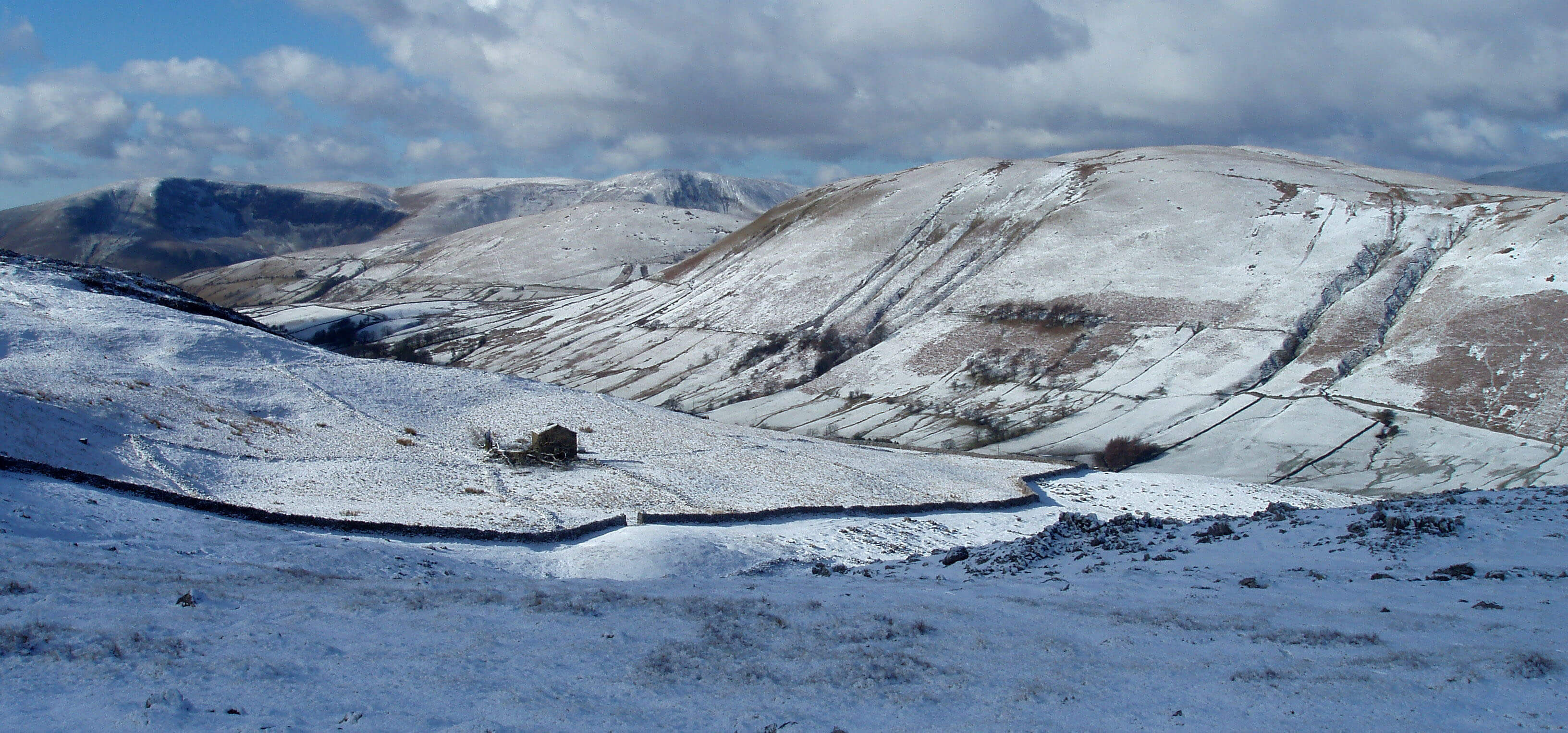
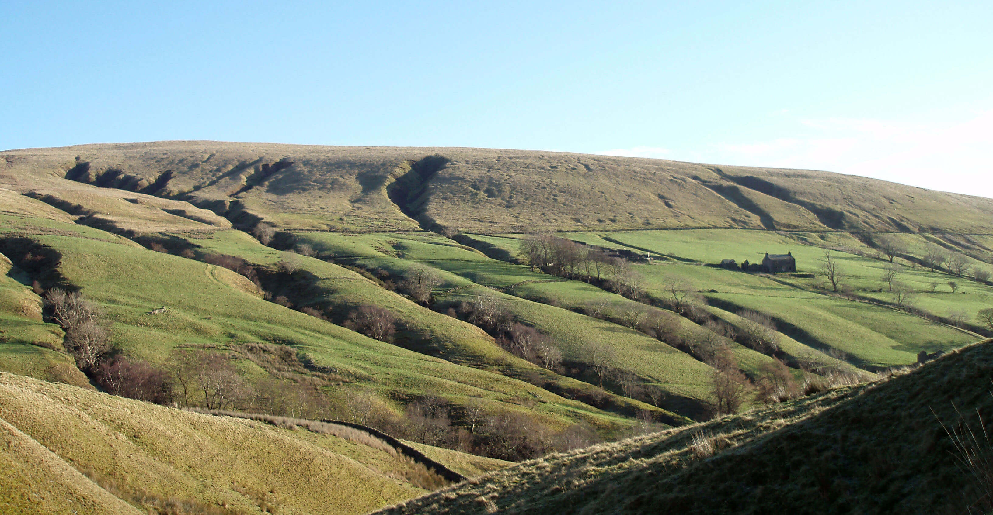
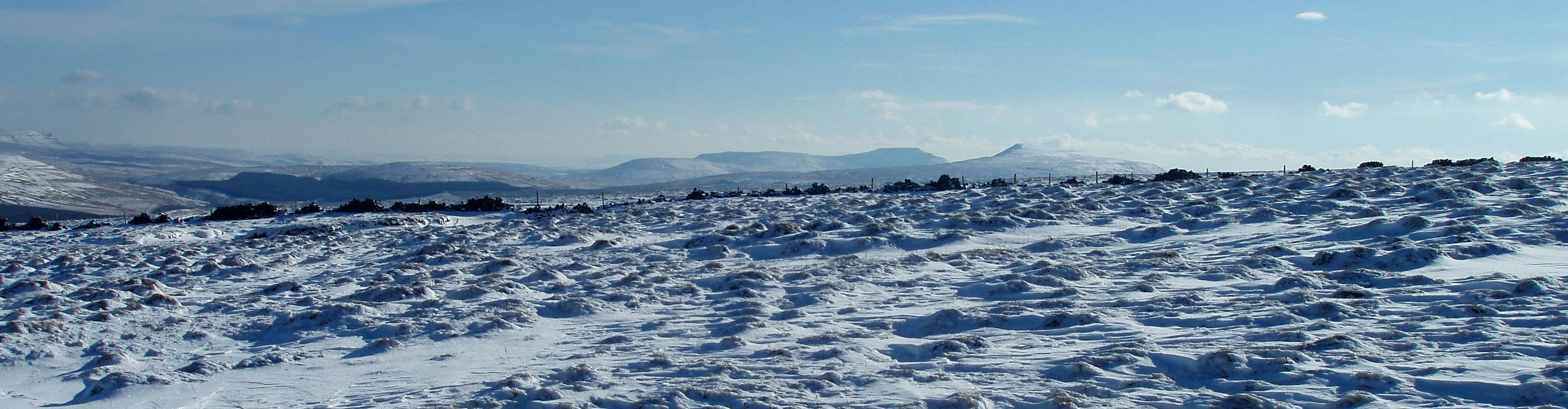
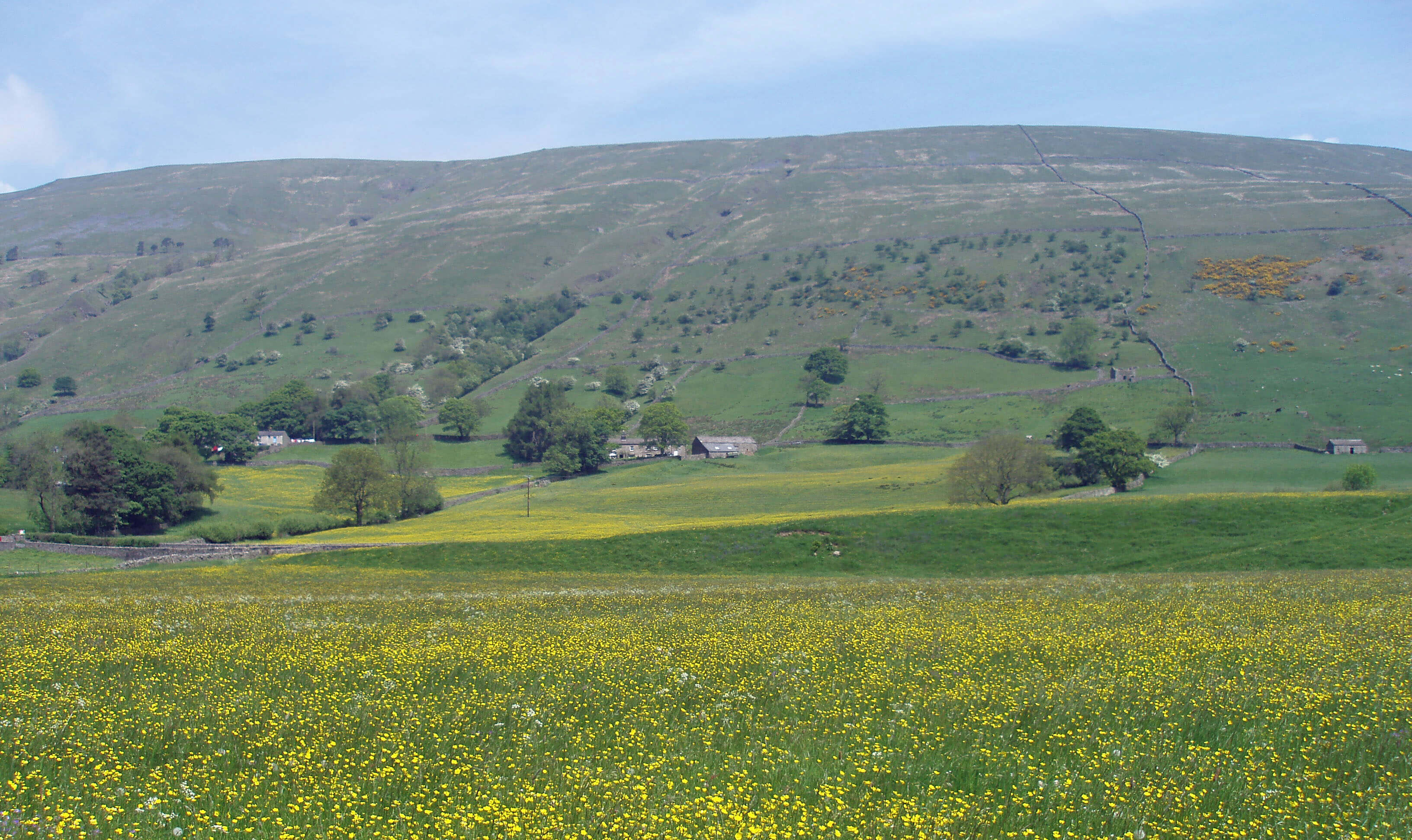
From Fell End Clouds towards Cautley Crag
The River Rawthey ...
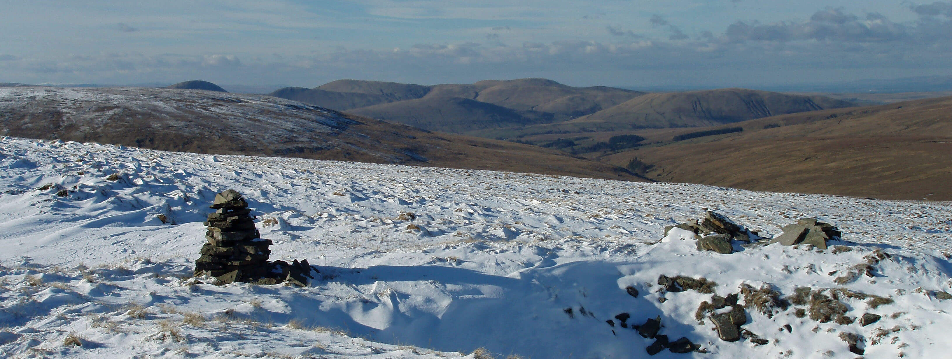
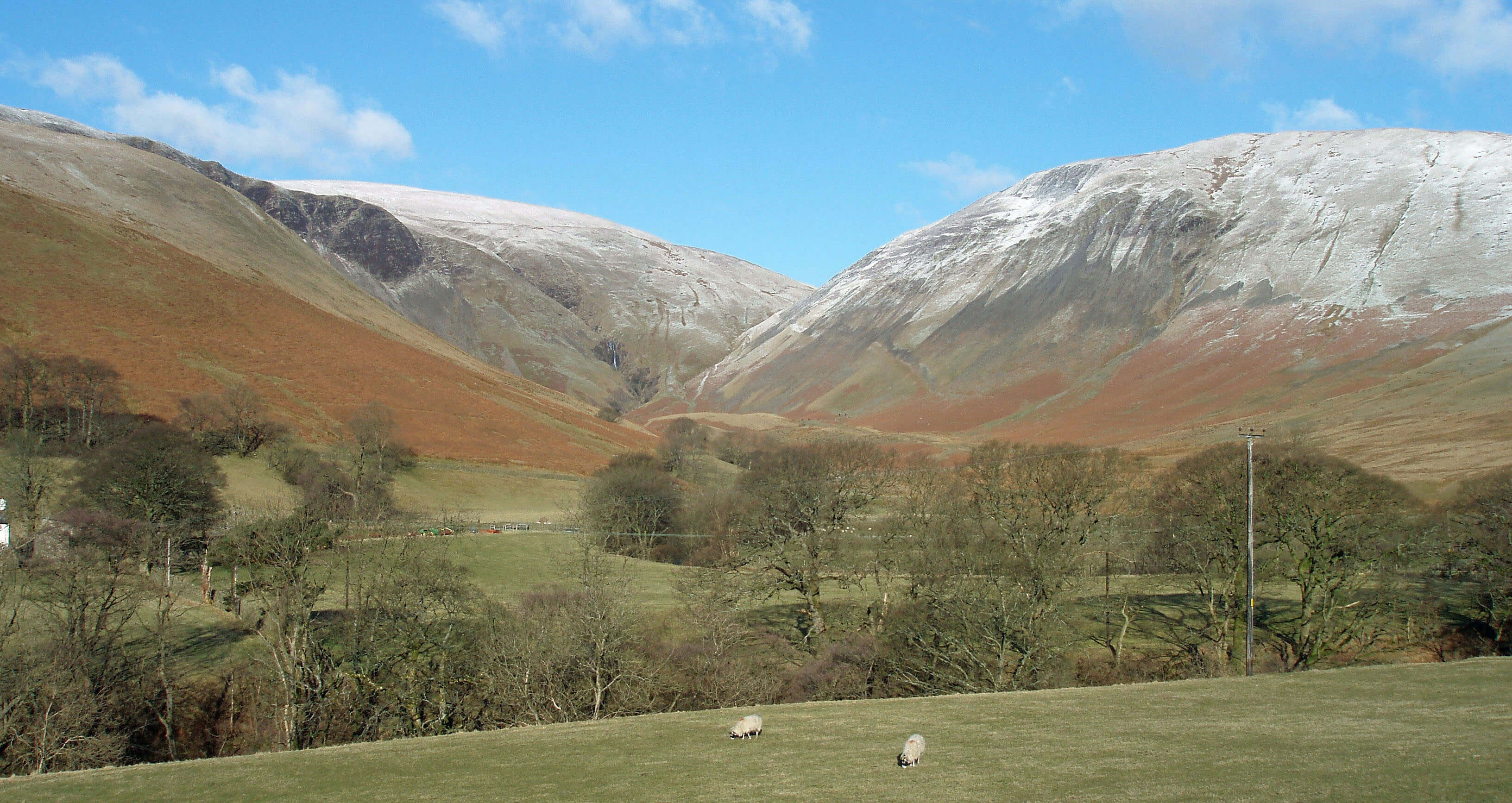
 Left: From Baugh Fell over Rawthey Gill to the Howgills
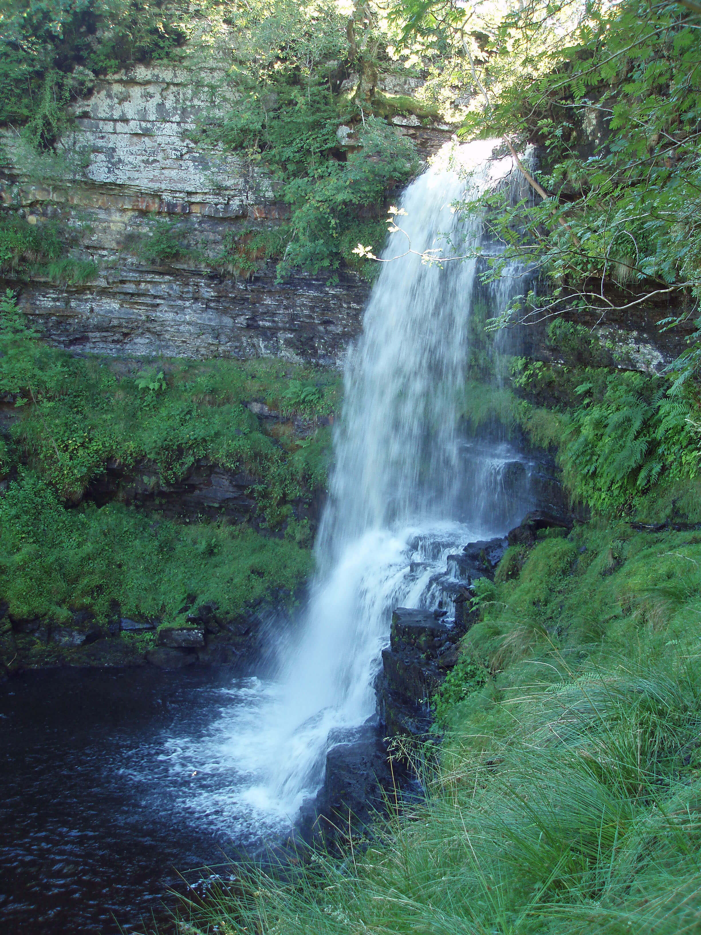
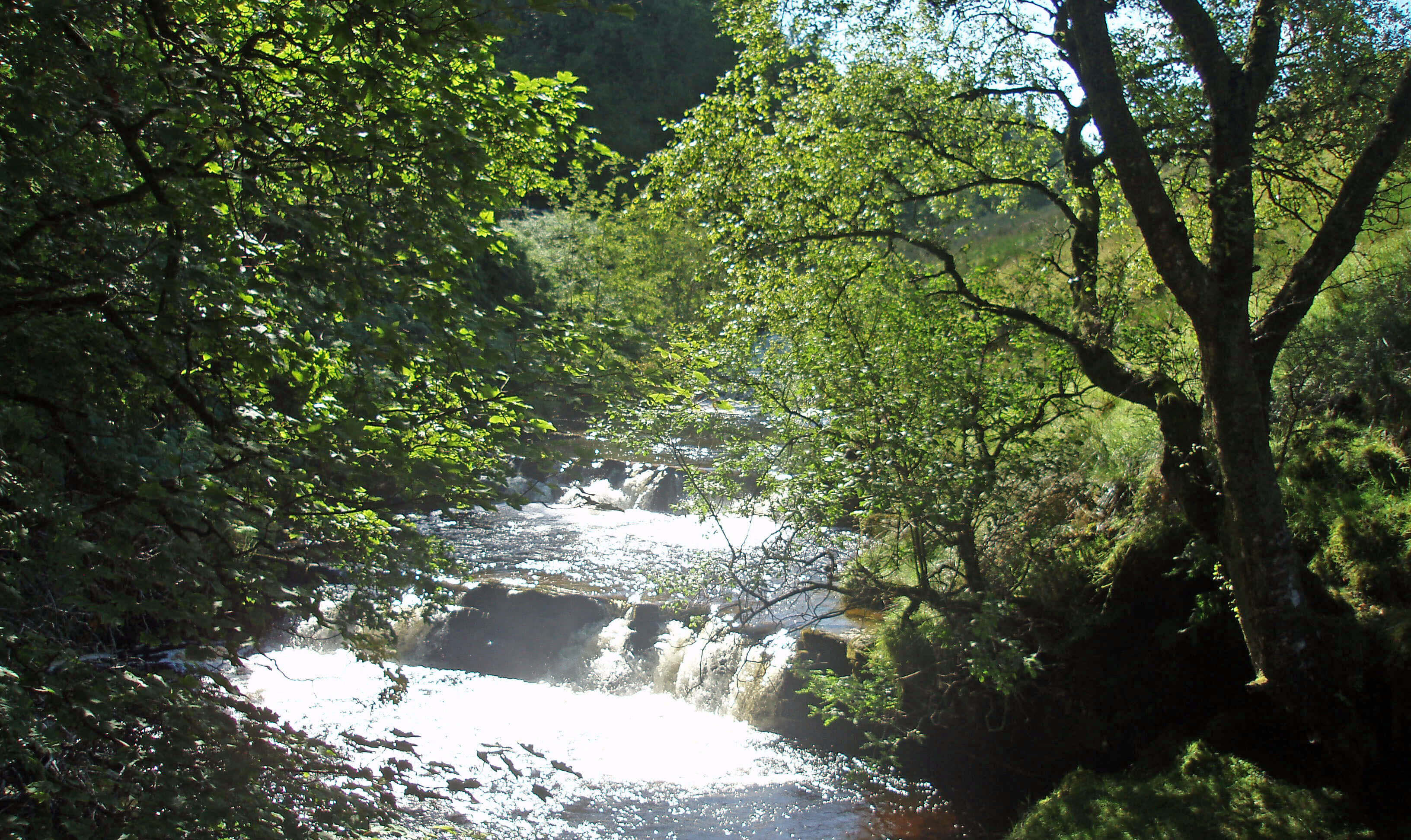
Right: Rawthey (or Uldale) Force
Like the Lune, the Rawthey first flows north (as
Rawthey Gill off Baugh Fell) and then swings west
and south. Baugh Fell is the largest mountain of
Loyne, in terms of volume, that is, not height, occupying
the huge expanse of high ground between the A683, the
A684 and the Rawthey-Grisedale valley. It is one of the
least visited of the peaks of the Yorkshire Dales and
understandably so, because it is surrounded by many
more attractive challenges.
It is pudding-shaped, with the unappealing
characteristic, for a walker, of being relentlessly uphill
from whichever direction you tackle it and of having a top
that is always over the horizon. There is little of interest
above 400m. And when you reach the top, you cannot
be sure that you are there. The trig point at Knoutberry
Haw is, according to the OS map, 2m lower than the
unmarked, gentle summit at Tarn Rigg Hill (678m).
Some would say that Baugh Fell is pudding-textured
too but that is an exaggeration. Yes, it tends to be wet
and there are peat mounds to negotiate but thereís plenty
of grass and the top is a rough, stony plateau. Still, it is
one of those mountains best tackled when the ground
is frozen solid and thereís a layer of snow to hide the
desolation.
Baugh Fell is not the most exciting fell but it does
provide a magnificent view in all directions: circling
from the north Wild Boar Fell, Mallerstang, Great
Shunner Fell, Pen-y-Ghent, Pendle, Ingleborough,
Whernside, Great Coum, the Lakeland Peaks, and the
Howgills. The views of Whernside and Great Coum are
particularly striking. From other directions they appear
unremarkable but from here they have majestic profiles.
After 3km Rawthey Gill turns a left angle, becoming
the River Rawthey, to run through a limestone gorge
and over a series of waterfalls, one of which at least
deserves a distinctive name. Some call it Uldale Force
but Uldale seems to be the area north of Holmes Moss,
with Uldale Gill further north still. Whatís wrong with
a simple Rawthey Force? Anyway, the 10m waterfall is
quite the equal of more illustrious waterfalls that we will
meet later.
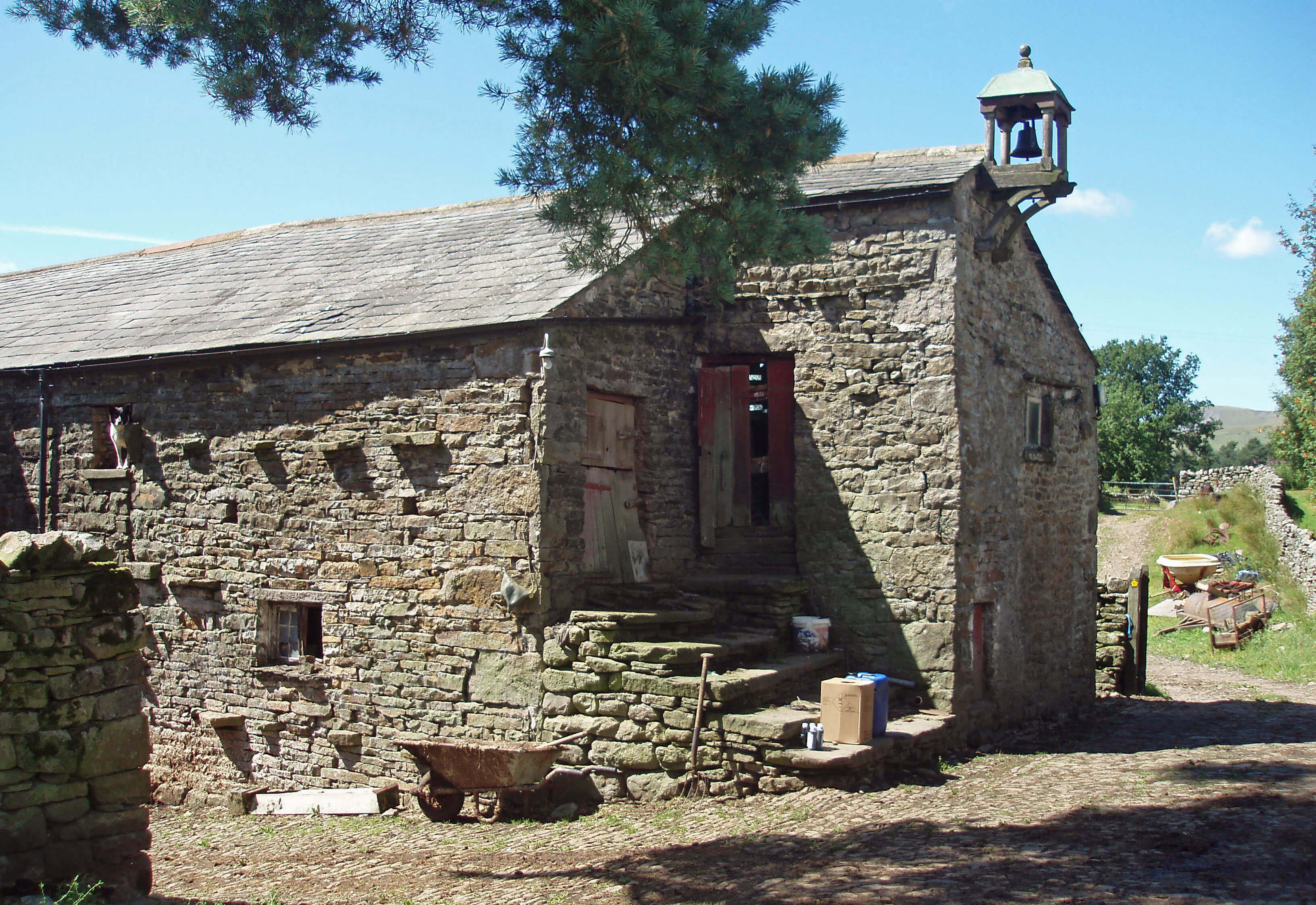 Left: Needle House barn (spot the dog)
Whin Stone Gill, Blea Gill and Needlehouse Gill
(which begins as Uldale Gill) join the Rawthey off the
western slopes of Swarth Fell, which is one of those
underrated hills that suffer by comparison with a near
neighbour (no, not Baugh Fell ñ Wild Boar Fell to the
north). At 681m, Swarth Fell is higher than the Howgills
and Baugh Fell and, with a flattish top and crags to
the east, has the characteristic shape of the peaks of
the Yorkshire Dales, although it is only half within the
National Park.
Swarth Fell also has the distinction of lying on the
ënational divideí of England. From its southern ridge,
waters to the east flow (via the River Ure) to the North
Sea and waters to the west flow (via the Lune) to the
Irish Sea. The eastern boundary of Loyne forms the
national divide for about 8km, over Widdale Fell to
Great Knoutberry Hill and Wold Fell.
 Right: Lower falls of the Rawthey near Needle House
Needlehouse Gill runs in a narrow valley, over
waterfalls and past caves, by Needle House and
Uldale House, two of a line of farmsteads among the
small conifer plantations on the northern slopes of the
Rawthey. There are actually two rather fine houses at
Needle House and surely the only barn weíll see with
a belfry. Uldale House farms 2500ha on Baugh Fell
Common and the farmer there, Harry Hutchinson, is
the chair of the Federation of Cumbrian Commoners,
formed in 2003 to help ensure that policy-makers
understand the importance and complexity of farming
on common land. Currently, there is concern that the
Countryside Stewardship Scheme, which pays farmers
to greatly reduce sheep numbers in order to enhance the
environment, will threaten the commons sheep grazing
tradition.
Rawthey Cave, in which have been found human
remains from about 1500 BC, is on the south bank of
the Rawthey, on the slopes of Bluecaster. The old track
across the flank of Bluecaster drops down to the river,
where, as you would expect, there used to be a bridge
ñ a bridge of some importance, it would seem, since in
1586 Queen Elizabeth wrote to those responsible for its
upkeep saying that ìshe marvels at their negligence in the
execution of her former orders concerning the rebuilding
of Rawthey Bridge.î Perhaps the word ëexecutioní
spurred some action.
The old bridge is no more but thereís a fine newer
one 50m downstream, built in 1820 with a single semi-circular arch. Thereís a minor puzzle here. It is said that
two childrenís faces were carved in the bridge. There
seems to be space for a rectangular display on the
two sides of the bridge but perhaps the displays have
fallen out. On the west side there is a face, but that of a
bewigged gentleman, it seems to me. On the east side,
there are what, if viewed generously, could be two eyes
and a nose. What it means, if anything, is a mystery.
Just below the bridge the nicely named Sally Beck
enters the Rawthey.
Sally Beck
Sally Beck arises 4km north in the fields above
Studfold. Under normal conditions, it receives
numerous becks flowing from Harter Fell on the west
but nothing at all from Fell End Clouds on the east.
This is because the Clouds are formed of limestone, into
which rainwater disappears.
The limestone does not really form terraces like we
saw on Orton Scar because it is too distorted. It occurs
as small cliffs and scattered, rocky outcrops. There are
two well-preserved limekilns, with evidence of old mine
workings, and in the middle of the Clouds thereís an
intriguing enclosed field containing the ruins of old walls
(shown in the photograph at the beginning of this chapter). The Clouds have been made a Site
of Special Scientific Interest, mainly because of their
flora, which, because the Clouds are heavily grazed, is
largely restricted to the recesses of the grikes. There are,
for example, seventeen species of fern, including the rare
rigid buckler fern, holly fern, and green spleenwort.
To the south of Fell End Clouds, Clouds Gill makes
a brave effort to cross the limestone to reach Sally Beck.
Most of the time it fails but sometimes, judging by the
erosion, it succeeds with a vengeance. It flows from
Sand Tarn, a perhaps unexpected oasis just below the
Wild Boar Fell trig point.
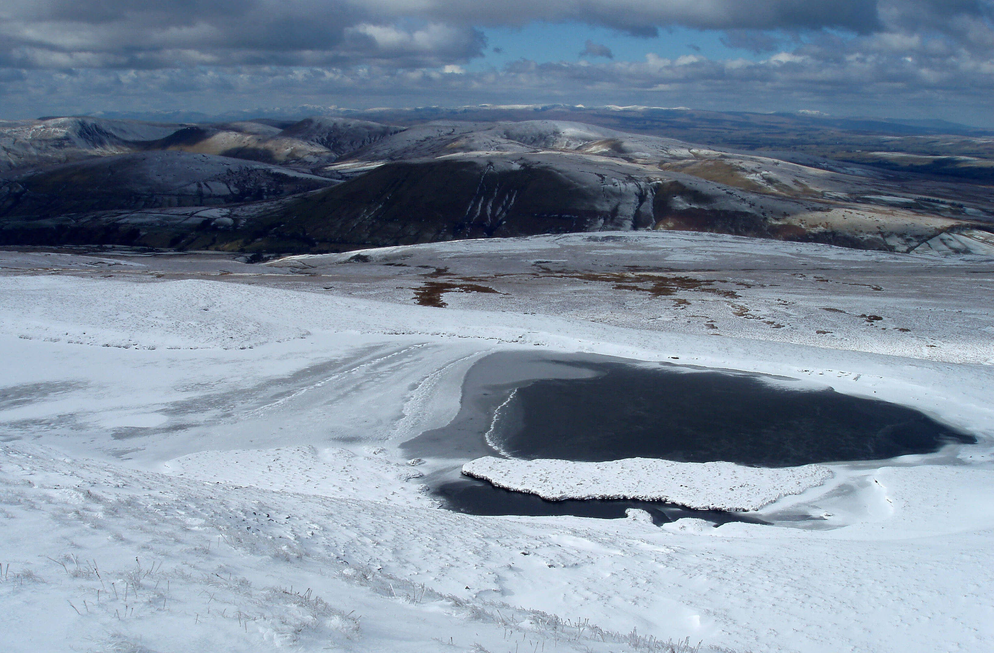
Sand Tarn, with Harter Fell (with its Five Gills) beyond, and beyond that Green Bell, with Randygill Top,
Kensgriff and Yarlside to the left, and with the Lake District hills in the distance.
The Top 10 lakes in Loyne
(Are there 10 lakes in Loyne?)
1. Sand Tarn, Wild Boar Fell
2. Greensett Tarn, Whernside
3. Sunbiggin Tarn
4. Whernside Tarns (could count as four?)
5. West Baugh Fell Tarn (a good view, at least)
6. Kitmere (but can hardly see it)
7. East Tarns, Baugh Fell (another five or more?)
8. Terrybank Tarn
9. Island Pond, Quernmore
10. The Lake, Clapham Beck (but itís artificial)
(Only just.)
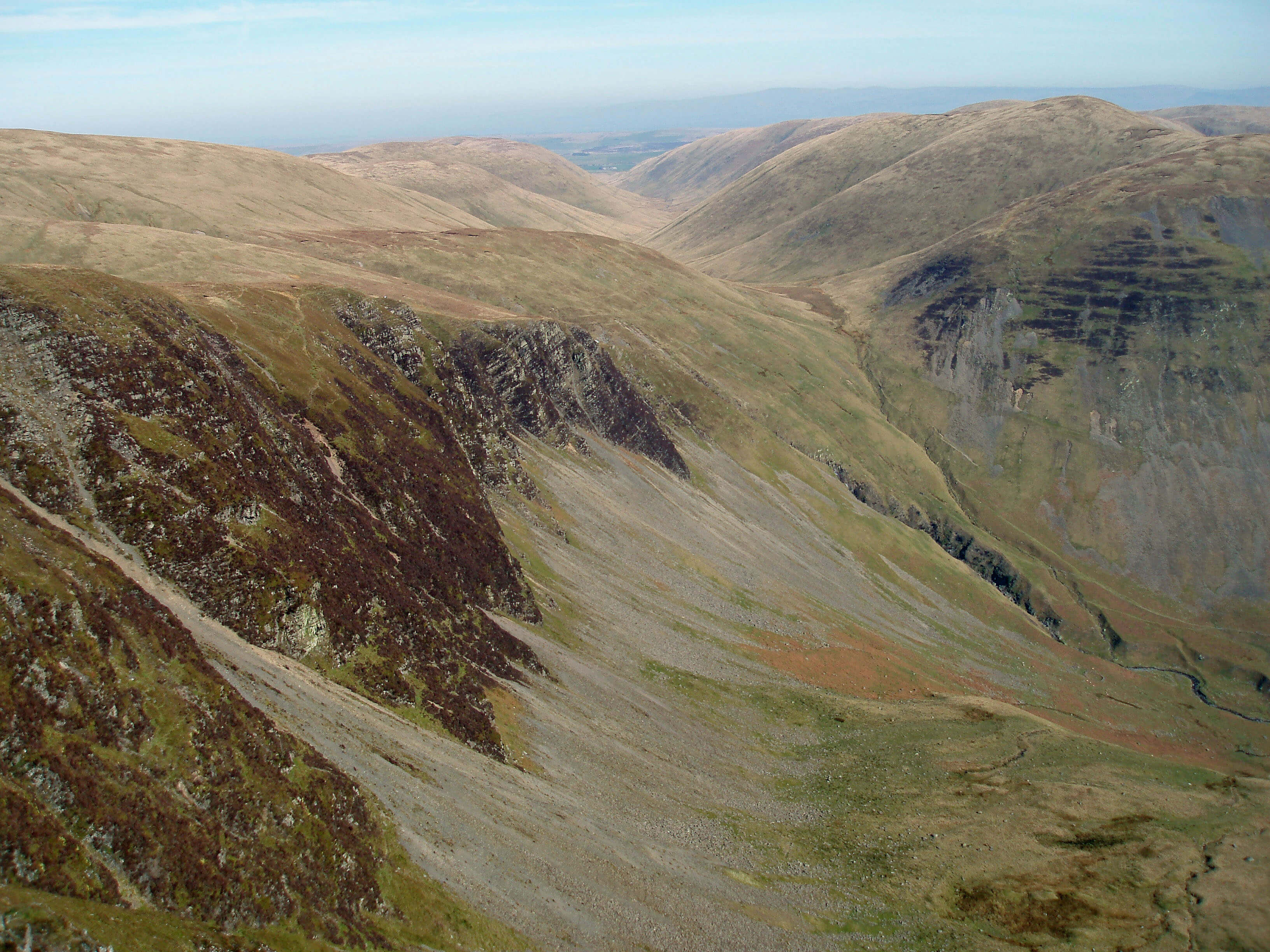
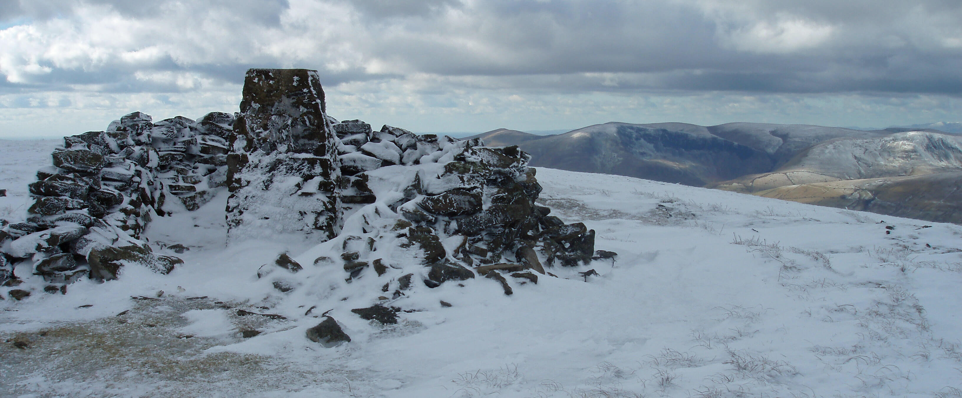 Right: Wild Boar Fell trig point, looking towards Cautley Crag
At 708m, Wild Boar Fell is the highest hill we have
met so far ñ and the most dramatic, although admittedly
most of the drama is on the eastern slopes, which are
within the Eden catchment area. The broader, western
slopes drain to the Lune, via the Rawthey.
Wild Boar Fell has a flat top, with many cairns.
Those on the eastern rim provide marvellous views
into Mallerstang and across to the hills of the Yorkshire
Dales. The trig point is on the western edge and provides
a unique viewpoint down onto the Howgills, giving a
wonderful impression of the rolling contours.
Wild Boar Fell is so called because the last English
wild boar fell here, or so it is said. In case you should
be sceptical, we are given a date and perpetrator for the
deed: 1396 and Sir Richard Musgrave of Hartley Castle.
If doubts still remain, then weíre told that his tomb in
Kirkby Stephen church was found to contain a boarís
tusk. But your clinching counter-argument is that there
are wild boars in England now.
As Clouds Gill passes the limestone it reaches an
appealing high-level road that was the original road but
is now a quiet by-way above the A683. It is open to the
fell, has wide grassy verges, and has a line of farmsteads
most of which are being revitalised as holiday homes.
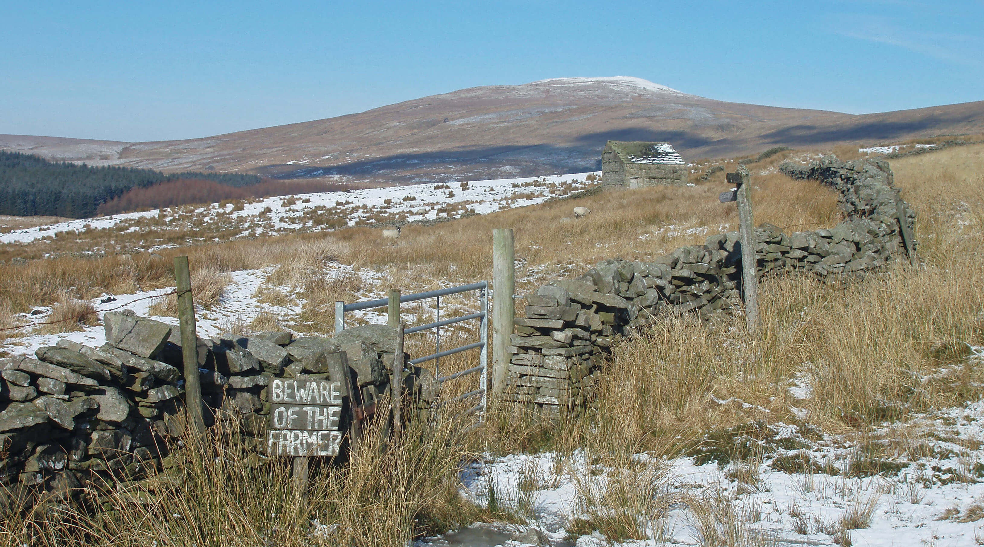
Cold Keld, for example, offers guided walking holidays.
To the south is Fell End bunkhouse, which is owned by
the Bendrigg Trust, a charity offering outdoor activities
for disabled people. Foggy Hill, however, is a tractor
outlet, judging by the score or more shining new in the
yard. By the road there is a paddock with a signpost
announcing ìQuaker Burial Groundî. It is completely
empty (on the surface). This takes the Quakerís unfussy
approach to burial close to its logical conclusion, which
it would reach if the signpost were removed.
 Left: Sally Beck (centre) joining the Rawthey (running from right to left)
A farm name of Streetside and one further north of
Street Farm and the name of Bluecaster will provoke
speculation that this is the line of a Roman road. As far
as I know, there is no evidence on the ground for this, but
on the other hand it is certain that the Romans had major
and minor roads, as we do, and it would be surprising if
they did not take a short cut through Rawtheydale to get
between their forts at Brough and Over Burrow.
On the fell opposite thereís a rougher track that goes
up to Sprintgill and Murthwaite, home of the Murthwaite
fell ponies, except that, being semi-wild in the Howgills,
they hardly have a home. Their owner, Thomas Capstick,
is a renowned photographer of fell ponies.
As Sally Beck makes its way to the Rawthey we
might pause to reflect on the significance of what we
have seen on Baugh Fell, Swarth Fell and Wild Boar
Fell. The craggy tops differ from the rounded hills of the
Howgills. They are of millstone grit, below which is a
layer of shale and sandstone above a limestone base. The
limestone gives rise to caves and potholes, which are
absent from the Howgills. Clearly, the geology of Baugh
Fell, Swarth Fell and Wild Boar Fell is different to that
of the Howgills. As we concluded when we similarly
reflected at Orton, we must be on the line of a geological
fault. In fact, this is the line of one of Britainís most well
known faults, the Dent Fault.
The Dent Fault is the most important geological feature
of the Loyne region. It runs north south for some 30km
roughly between the two Kirkbys (Stephen and Lonsdale),
splitting the northern half of Loyne in two. To the west are
the rounded Howgills of Silurian rock (about 420 million
years old); to the east are the horizontal limestone scars of
the Dales (some 100 million years younger).
The line of the Dent Fault is, of course, not a
hypothetical line like the equator that one might imagine
standing astride. It is a line of weakness in the earthís
surface that, over a long period about 300 million years ago
and with tumultuous forces, caused the rocks to the west of
it to rise about 2km compared to the rocks to the east. It is
considered the best example in England of a reverse fault
(as opposed to a normal fault, where rocks move down).
In the eons afterwards the western rocks have been eroded
to roughly the same level as the eastern rocks. But along
the fault-line there were and remain complex distortions of
the rocks. This explains also the line of quarries along the
fault, as various exposed minerals were mined.
We will cross the line of the fault again later as we
follow the Clough River, the River Dee and Barbon Beck.
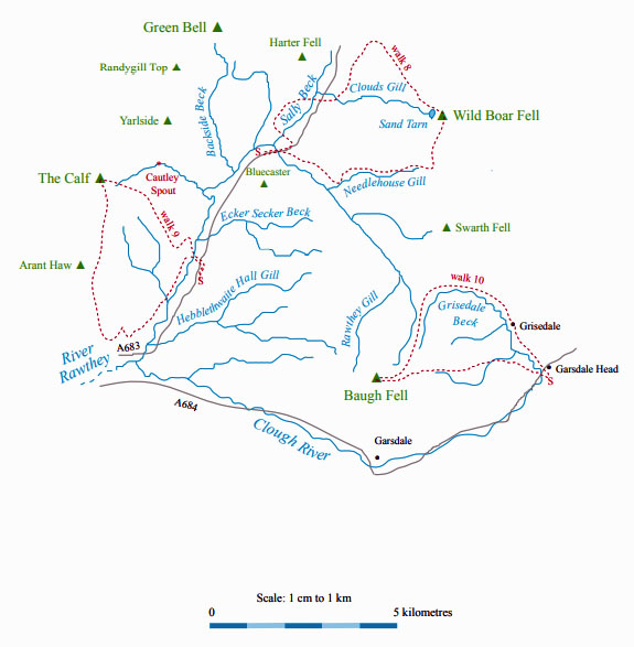
Walk 8: Fell End Clouds, Wild Boar Fell and Uldale Gill
Map: OL19 (please read the general note about the walks in the
Introduction).
Starting point: A large lay-by on the A683 near Rawthey Bridge (712978).
Cross the bridge, walk 400m along the A683, take the footpath left up to Murthwaite and continue to Sprintgill (with views
of Wild Boar Fell to the right). At Low Sprintgill, drop down to cross the A683 and take the track past the ruins of Dovengill to
reach the by-road. Walk north and 200m past Cold Keld take the track passing between two prominent limekilns. Continue up the
track past the enclosed fields to Dale Slack to reach the fell above the limestone.
Now it is a long, pathless walk to the top of Wild Boar Fell, gently sloped apart from the sharp climb above Sand Tarn.
Aim to the left of the two cairns on the horizon. From the trig point there are views across the rolling Howgills to the Lake
District peaks. Stroll over to the cairns on the precipitous eastern edge and admire the breath-taking view into the Eden valley of
Mallerstang. To the right, you can see Pen-y-Ghent, Pendle, Ingleborough and Whernside.
From Wild Boar Fell head south to the saddle below Swarth Fell, with a small tarn. Turn west to follow Uldale Gill down,
keeping high on the northern bank, to avoid too much up and down. Cautley Crag is straight ahead. Just before Grain Gill joins,
a beck can be seen issuing from a cave halfway up the south bank of Uldale Gill.
After crossing Grain Gill, keep to the right of the wall that takes you southwest. Follow the wall to the right of a small
plantation to reach the road. Turn left and follow the track across Needlehouse Gill. As the path swings down among trees, look
out to the right for a footbridge across Needlehouse Gill (there seems not to be a footpath sign). Cross the footbridge and follow
the footpath that goes through Needle House, New House, Tarn and Wraygreen. Follow the road back to Rawthey Bridge.
Short walk variation: Walk through Murthwaite and Cold Keld to Dale Slack, above Fell End Clouds, as for the long walk. Now
follow the contour south for about 3km to reach Grain Gill and the wall north of Needlehouse Gill. Then follow the last part of the
long walk through Needle House to Wraygreen and Rawthey Bridge. If the walk south along the contour seems to be loo long, it
is always possible to shorten the walk by dropping down west to The Street and following it southwest to Rawthey Bridge.
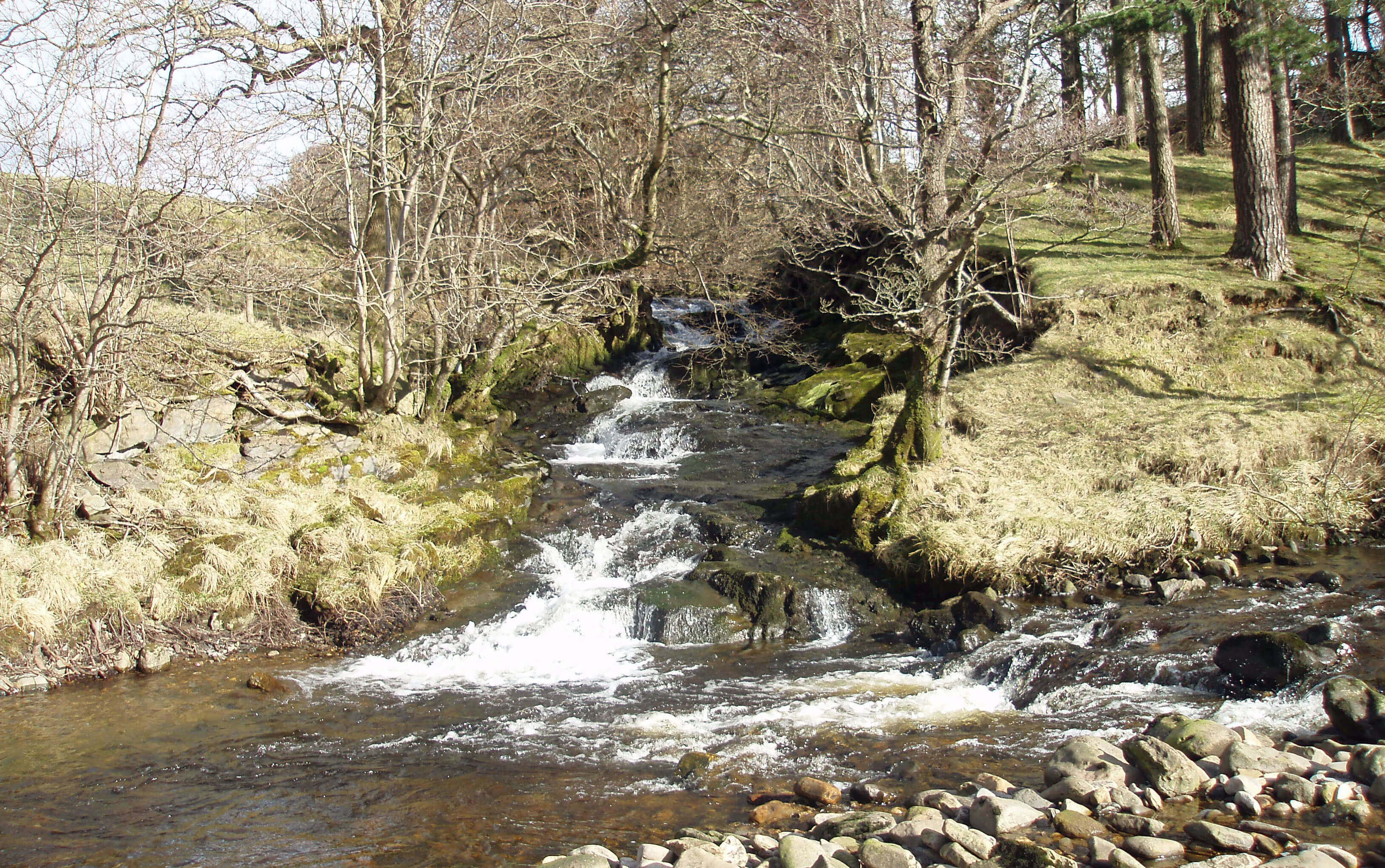
The Rawthey from Sally Beck ...
As the Rawthey swings south it passes Murthwaite
Park, the only sizable area of ancient woodland in
the Howgills. The scrubby birch, hazel, ash and alder are
still home to red squirrels although perhaps for not much
longer as on two recent occasions I think I glimpsed grey
squirrels as well. But perhaps I am unduly pessimistic:
I understand that the present cull of grey squirrels is
beginning to bring red squirrels back to the Howgills
area.
Many becks from the eastern Howgills and West
Baugh Fell join the Rawthey as it continues south through
luxuriant green pastures. Wandale Beck runs from
Adamthwaite, an isolated farmhouse that has the honour
of being the habitation nearest to the Luneís source,
just 2km southeast of Green Bell. The next significant
tributary, Backside Beck, runs, appropriately, from the
back side of Green Bell. All the Howgills, therefore,
except for a small part northeast of Green Bell, is within
the Lune catchment area. The farmstead of Mountain
View, above Backside Beck, is abandoned, but what can
you expect of a place called Mountain View? It has to be
something like Cobblethwaite to survive up here.
Wandale Beck and Backside Beck are notable
for exposures of fossil-rich Ordovician and Silurian
rocks along their beds, of great interest to geologists.
According to the Site of Special Scientific Interest
description ìthe Cautley Mudstones of Rawtheyan age
are of a dominantly dalmanellid-plectambonitacean
assemblageî, which is more than I could ask for.
Looking across Backside Beck from the slopes of Yarlside to Wandale Hill
Within the Rawthey valley there are a few
farmsteads, a garage and the Cross Keys Inn. The inn
was originally a farmstead called High Haygarth (Low
Haygarth continues nearby as a horse-breeding farm). It
is older than the date (1730) newly installed over its door.
An earlier ownerís wife, Dorothy Benson, a Quaker who
had been imprisoned in 1653, was later buried (after she
died, of course) under what is now the dining room. High
Haygarth became an inn in the 1800s, probably after the
road was re-aligned in 1820 to run past it rather than
over Bluecaster. It was converted to a temperance inn in
1902 and left to the National Trust in 1949.
Below the Cross Keys Inn, Cautley Holme Beck
joins the Rawthey from within the great bowl of Cautley
Crag and Yarlside. The becks that run east from The
Calf create Cautley Spout, a cascade of 200m in all,
with a longest single fall of 30m. Some guides assign
various superlatives to Cautley Spout ñ for example,
that it is Englandís highest waterfall. It would take
an odd definition for any such objective claim to be
sound. It is safer to be more subjective, by saying that
Cautley Spout provides the best long-distance view of
any English waterfall ñ from Bluecaster, for example.
However, from afar, you see only the last of a series of
cascades. The full set can be seen only from the slopes of
the unnamed hill south of Yarlside. Dominated by grass,
the Howgills are generally of little botanical interest
but the Cautley Spout ravine, well-watered, sun-facing
and protected from grazing, has a number of unusual
plant species, such as alpine ladyís mantle, otherwise
restricted in England to the Lake District. Perhaps the
protected bowl around Cautley Holme Beck encouraged
the Iron Age settlements for which, for the only time
within the Howgills, the OS map uses its special font
for antiquities.
Cautley Spout (centre, to the right of Cautley Crag) from Foxhole Rigg
The Top 10 waterfalls in Loyne
1. Cautley Spout, Howgills
2. Black Force, Howgills
3. Rawthey (Uldale) Force
4. Thornton Force, Ingleton
5. Gaping Gill, below Ingleborough
6. Force Gill, Whernside
7. Ibbeth Peril, Dentdale
8. Docker Force, Birk Beck
9. Taythes Gill, Baugh Fell
10. Clough Force, Grisedale
 Right: Cautley Crag - and, beyond Cautley Spout, Bowderdale
Cautley Spout is at the northern end of the 1km cliff
face of Cautley Crag, formed by the erosion of an Ice
Age cirque. The crag face is too unstable to be walked
upon or climbed but it is the most impressive cliff in
the Howgills. At close quarters, the cliff face is less
fearsome than it seems: it is not as vertical as it looks
from a distance and the ominous dark is due to heather,
not rock, which is a pale grey, as the scree slopes show.
The tributary of Ecker Secker Beck, like all the
becks that drain west off West Baugh Fell and cross the
Dent Fault, has eroded deep ravines and formed a series
of small waterfalls as it crosses tilted, fissured rocks.
The unusual exposed rock formations in Taythes Gill are
well worth a visit, even for the amateur geologist. For
the professional, they are essential; for it is here that the
fine detail of upper Ordovician rock (420-440 million
years old) may be unravelled. The trilobite fossils first
found here are used as the standard by which the same
layers are identified elsewhere.
Some expertise is also required to appreciate Ecker
Secker Beckís other notable feature, the meadows near
Foxhole Rigg that have been made a Site of Special
Scientific Interest because they are a rare example of
unimproved, traditionally managed grassland. The
list of herbs and grasses that grow here reads like the
index to a botanical encyclopedia. If you can tell a hairy
ladyís mantle from an opposite-leaved golden saxifrage,
then this too is worth a visit. Lacking geological or
botanical expertise, we may simply enjoy the views
across to the eastern Howgills, with Cautley Crag
centre stage, and count the great
spotted woodpeckers, which, on
a bright November day, seemed
plentiful.
Further south, where
Hebblethwaite Hall Gill crosses
the Dent Fault, the line of the
fault is indicated by a series of
shakeholes. As these form in
limestone, the fault must run just
to the west of the line of holes. To
the east of the fault, on a plateau
between the rough sheep grazing
land and the green cow pastures,
some of the exposed rock strata
are almost vertical, indicating the
geological stresses of long ago.
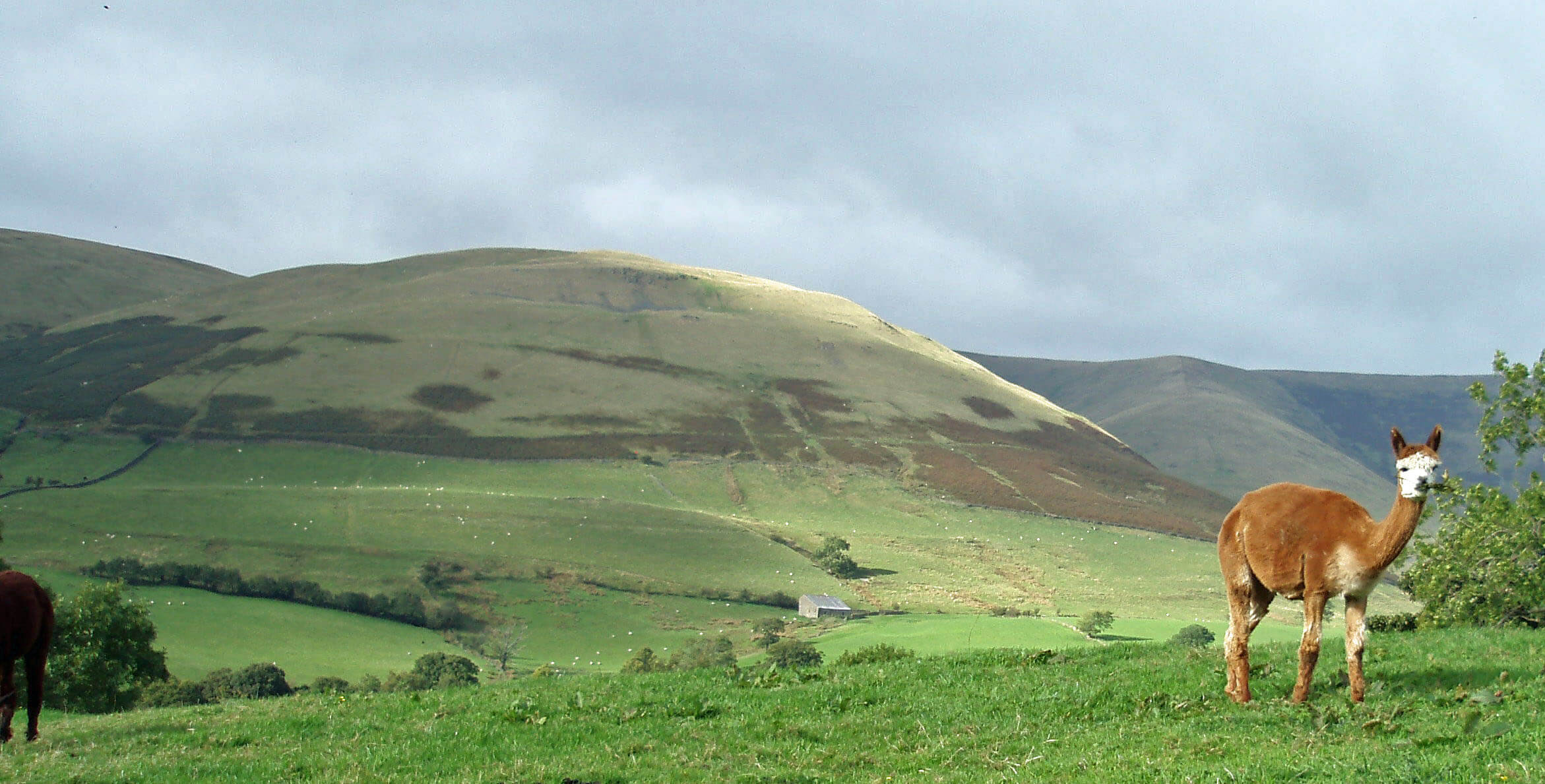 Left: Alpaca at Ghyllas, with Knott and Fawcett Bank Rigg beyond
Hebblethwaite is an ancient
name for the district. A Richardus
and Agnes de Hebletwayt are
listed in the Poll Tax of 1379
and a will of 1587 refers to
ìthe Mannor or Graunge of
Hebblethwaiteî. Hebblethwaite
Mill was built in the 1790s and
was one of the first to use the
new wool carding machines, powered by a water wheel.
The Woodland Trust now manages Hebblethwaite Hall
Wood, which is a 1km long strip of ancient oak and ash
woodland alongside the beck that tumbles in a deep,
dark ravine over many small waterfalls. A permissive
path by the beck provides a short walk, best appreciated
on a winterís day, when the leaves have fallen.
If you follow the path down from the hall you may
need to rub your sheep-sated eyes as you approach the
farmstead of Ghyllas. What you see are not sheep at
all but alpaca. Ghyllas is leading a Why Not Alpacas?
campaign ñ and, if the farmers are happy, why not
indeed? Alpacas certainly have more spirit and charm
than sheep. They make a soft humming noise and if
in the mood they orgle (an orgle is a kind of orgasmic
gargle). More to the commercial point, alpaca fibre is
valued for the lightness and warmth it brings to winter
clothing.
Shortly after the Hebblethwaite Hall Gill merger,
the Rawthey passes under Straight Bridge and after a
further 200m, the major tributary of Clough River joins
the Rawthey.
Walk 9: The Calf via Great Dummacks
Map: OL19 (please read the general note about the walks in the
Introduction).
Starting point: A lay-by opposite St Marks Church (691946).
We have nearly completed our circuit of the Howgills and I have not yet provided a walk to its highest point, The Calf
(676m). Since The Calf is at the centre of the radiating ridges, many walks are possible. The two ëtourist routesí (not that there
are many tourists) are from Sedbergh over Winder and from Cross Keys Inn past Cautley Spout. Our expedition is intended to
provide a greater variety of walking than is usual on the Howgills.
Before setting off, note the ridge on the western horizon: that is your immediate objective. Walk 200m north along the A683,
cross the footbridge at Crook Holme, and take the higher of the two paths north to reach the CRoW land. Walk north for a short
distance, past gorse bushes, and then cut diagonally back to reach Fawcett Bank Rigg.
Now it is relentlessly uphill along a grassy ridge but not too steep for comfortable walking. There is no hurry: stop often to
admire Rawtheydale below and Wild Boar Fell beyond. Continue to the edge of Cautley Crag, and not one step further: the best
view in the Howgills is suddenly revealed. Skirt the edge a little distance and then make your way across to the Calf trig point,
visible 1km to the west. This involves a little scrambling up, down and over grass tussocks.
From The Calf follow the main ridge south for 3km to Arant Haw, below which you swing south off the path to Crook
(1km distant), where there is a large cairn. Descend the slope south: it is steep but not too difficult. Look at the fields below and
compare carefully with your map to identify where the public footpath begins: thereís a stile in the corner of the field (666931).
Then take the path northeast through Ghyll Farm, Stone Hall, Hollin Hill, Ellerthwaite, Thursgill and Fawcett Bank (noting
the fine bridge over Hobdale Beck). A further km beyond Fawcett Bank you reach the path back to Crook Holme, the footbridge,
and the starting point.
Short walk variation: Follow the long walk as far as the edge of Cautley Crag. Then turn west over Great Dummacks for nearly
1 km to reach the fence that drops south to Middle Tongue. Continue on the Middle Tongue ridge until you reach the confluence
of Hobdale Gill and Grimes Gill. Cross the latter and continue east to drop down (avoiding gorse bushes) to the track from which
you reach the Crook Holme footbridge.
Clough River
 Right: Pen-y-Ghent (far left), Ingleborough and Whernside (to the right) from East Baugh Fell
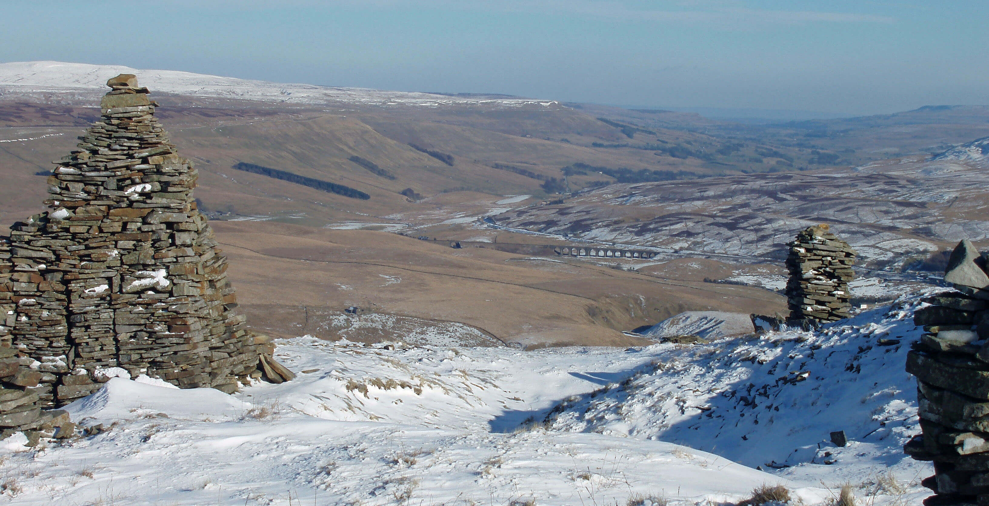
Clough River begins to adopt its name at Garsdale
Head, 15km east of Sedbergh, after gathering the
becks that flow off East Baugh Fell and south Swarth
Fell through the secluded valley of Grisedale. We can
regard the westernmost of these becks, Grisedale Gill,
to be its source. Grisedale Gill and Haskhaw Gill set off
north from Tarn Hill on East Baugh Fell a few metres
apart before going their opposite ways, Haskhaw Gill
joining the Rawthey. Their waters then complete semi-circuits of Baugh Fell, before re-uniting near Sedbergh.
The only feature on East Baugh Fell is Grisedale
Pike, where a dozen or so cairns form a prominent
landmark at an excellent viewpoint into Grisedale and
upper Wensleydale. A cairn usually stands alone, as a
guide to shepherd or walker, and so when they occur in
a cluster and presumably had some function beyond that
of mere guide, it is natural to wonder what that function
might have been. The cairns are very old but they seem
not to have had any function such as has been proposed
for standing stones such as Stonehenge. Their position,
at this precise location, surely reflects aesthetic values of
long ago, which are not so different from our own.
Dandrymire Viaduct from Grisedale Pike
As Grisedale Gill swings east it enters The Dale that
Died, as Grisedale was called in a book and television
documentary of that name in the 1970s. In the previous
few decades all but one of the farmsteads in the dale
were deserted and left to fall into ruin, the families
there no longer able to cope with the economic hardship
of farming life. Abandoned and derelict, Grisedale
no doubt enabled a romantic tale to be told of human
struggle against adversity.
But the funeral rites were premature. Not only does
the one remaining farm appear to be flourishing, but also
many of the ruins have been, or are being, revitalised.
For example, Fea Fow is in fine fettle: it is a Grade II
listed traditional farmhouse, built in the 17th century and
renovated to retain many original features, now with a
new role as a holiday cottage.
One may lament the passing of a time when a family
could live off a small patch of land in such an isolated
location. On the other hand, Grisedale is much too fine a
valley to be forgotten. Its fields, all above 350m, provide
a sheltered haven ñ or even heaven, for those who like
the quiet becks and limestone crags within the high
moors. As long as the new developments are in keeping
with the traditions of Grisedale ñ as they appear to be ñ
they must surely be welcomed as Grisedale evolves into
a new role.
 Right: A considerate warning on the footpath into Grisedale
After gathering a few more becks from East Baugh
Fell, Grisedale Beck becomes Clough River and passes
over Clough Force, a neat, curved waterfall only 3m or
so high. Just below the A684 the Clough is joined by
Black Gutter, which leaves Garsdale Low Moor heading
purposefully towards Wensleydale only to swing west
at Dandry Mire. According to experts, all the becks that
flow east off Baugh Fell used to join the River Ure but
were blocked by glacial debris and so were diverted west.
At the watershed of Dandry Mire thereís an impressive
12-arched viaduct, which provides our first encounter
with the famous Settle-Carlisle railway line. It is a mire
indeed for the original plan to build an embankment had
to be abandoned when the earth tipped here just sank
into the bog.
The Clough heads west through the valley of
Garsdale, perhaps the least highly regarded of all the
Yorkshire Dales, at least, by tourists. It is a narrow
valley so enclosed by the steep, grassy, featureless
slopes of Baugh Fell and Rise Hill that in winter the sun
can barely reach. The busy A684 runs by the Clough,
crossing it eight times in all.
The conifer plantations in Garsdale have been made
a Red Squirrel Reserve, one of sixteen set up in 2005
by the North of England Red Squirrel Conservation
Strategy. It is thought that the numbers of red squirrels
have increased as the conifers have reached maturity,
providing the cones upon which red, but not grey,
squirrels thrive.
There are a few footpaths in the dale but they cannot
be linked to make a good long walk. Many of them
appear unwelcoming and under-used, giving the walker
the feeling of trespassing. Although the slopes of Baugh
Fell and Rise Hill are CRoW land they are tantalisingly
out of reach above the pastures: a walker must enter at
the eastern or western end and it must be rare indeed
for anyone to find the incentive to walk the slopes
from one end to the other. On a recent occasion when
I walked in Garsdale the A684 was closed because the
Clough had washed some of it away, which was much
appreciated. The footpaths, by-roads and quiet A684
could be combined to provide a rare, blissful experience:
an indication of what Garsdale once was and could be.
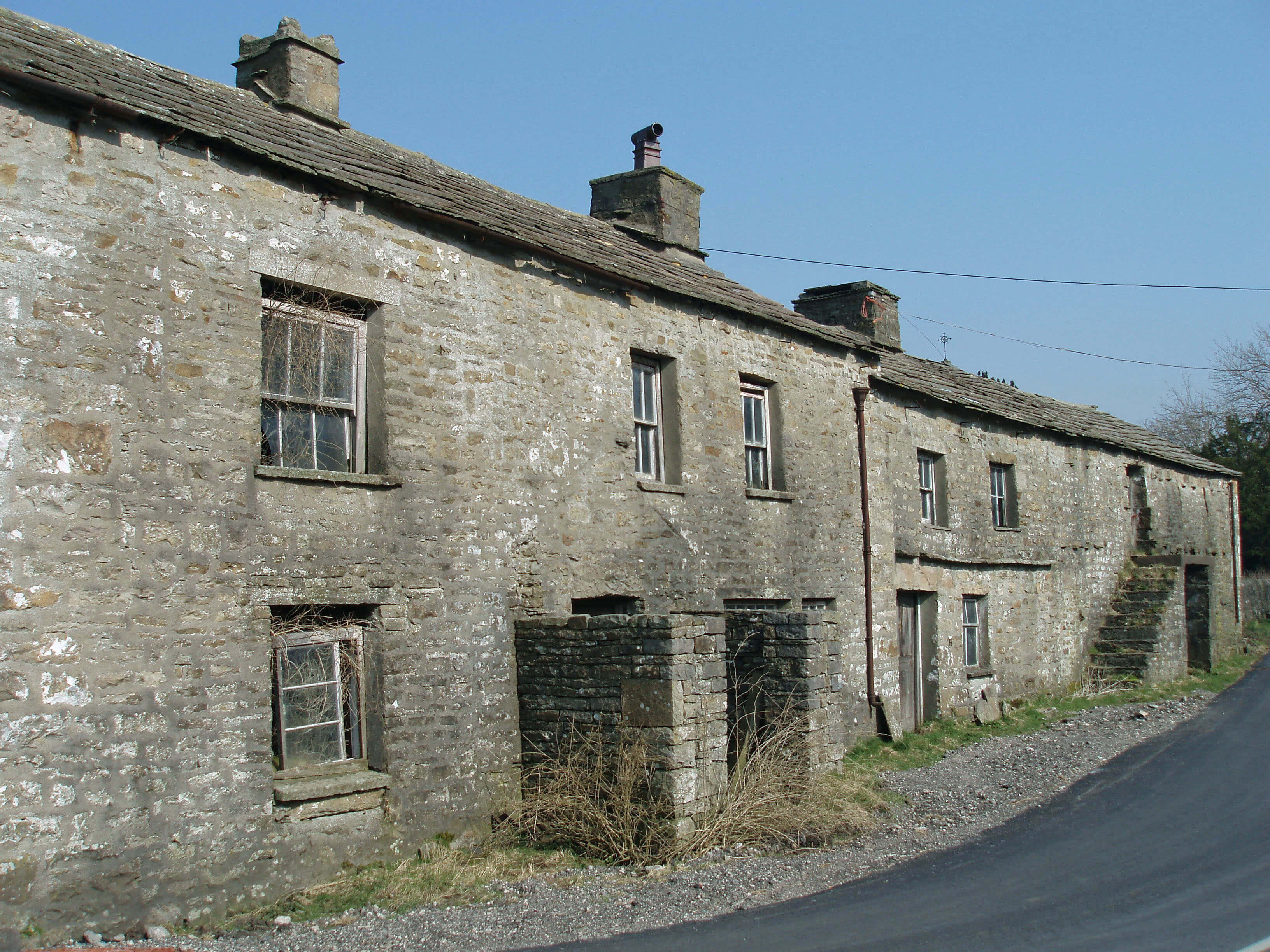 Left: A once-fine but now derelict homestead in Garsdale
There is not much to cause a tourist to linger,
although rural architecture is always interesting. Some
houses are converted long barns but
many follow the standard design of
three windows up, two down, with
a door and porch between. Dandra
Garth, by the bridleway to Dentdale
and now rather enclosed, has character.
Swarthgill House is startlingly white.
But Paradise (East, West, Middle and
High) is somewhat optimistic.
The village of Garsdale consists
of little more than a row of cottages,
called The Street. Thereís a Primitive
Methodist Chapel (1876, when the
Settle-Carlisle line was built), now
a Mount Zion Chapel, at Garsdale
Head, and in the village another
Primitive Methodist Chapel (1841)
and the Anglican Church of St John
the Baptist (1861), next to the site of
a medieval church, and further on a
Wesleyan Methodist Chapel (1830),
and at Bridge End another Wesleyan
Chapel (1868), now a barn, and
at Frostrow yet another Wesleyan
Chapel (1886).
 Right: Baugh Fell from lower Garsdale
Methodism, like Quakerism, had
and has a particular appeal to non-conformist northerners. It is a more
visible presence in Loyne because,
clearly, Methodists, unlike Quakers,
believed in their chapels and the
19th century was a safe time to build
them. Even in the remotest regions we
come across sometimes tiny chapels,
to which itinerant preachers came to
give enthusiastic sermons.
At Danny Bridge, as the Clough
emerges from the confines of Baugh
Fell and Rise Hill, it runs beside the
Sedgwick Trail across the Dent Fault.
A detailed leaflet should be obtained
from Sedbergh Tourist Information
Centre in order fully to appreciate
the significance of the viewpoints but
even without it the transition across
the Dent Fault, from the contorted
Carboniferous limestone to the older
Silurian rocks, should be clear: roughly
where the wood opposite ends there is
an abrupt change from a rocky gorge
within sloping limestone to a shallow,
broad valley with rocks 100m years
older. Above the trail on Tom Croft
Hill there is a fine view of the ìnaked
heightsî (copyright Wordsworth) of
the Howgills. I donít know who Tom
Croft was but if he lived in Tom Croft
Cave on the Sedgwick Trail he was
exceedingly small.
The Clough runs between the
gentler slopes of Dowbiggin and
Frostrow and, just before it enters the
Rawthey, passes Farfield Mill, an arts
and heritage centre in which a range
of artists (such as weavers, furniture
makers and textile workers) work in
open studios. Built in 1836, it had
functioned as a woollen mill until
it closed in 1992, after which it was
bought and restored by the Sedbergh
and District Buildings Preservation
Trust.
The Settle-Carlisle railway line is the most spectacular
in England. It runs for nearly 120km, with 325 bridges,
21 viaducts and 14 tunnels, on a route through some of
the finest scenery of northern England. It was completed
in 1876, after 6Ω years building, at a cost of £3.5m and
many lives. It is regarded as the last great Victorian railway
engineering project.
The 15km of the line that is within Loyne includes
four dramatic viaducts and two long tunnels and is all at a
height of 300m or more, providing fine views of the dales
and hills (except when in the tunnels, of course).
In the 1980s there were plans to close the line: freight
traffic was diverted, passenger services were withdrawn,
and the infrastructure was allowed to decay. However, after
a long, high-profile campaign the line was reprieved, which
pleased tourists and also freight operators, who came to
value it as an alternative to the crowded west coast main
line. In 2005 it found an additional role: to carry six trains a
day bringing coal from Scottish mines to Yorkshire power
stations.
Walk 10: Grisedale and East Baugh Fell
Map: OL19 (please read the general note about the walks in the
Introduction).
Starting point: Near Garsdale Station (787917).
Cross the A684 and take the clearly signposted path to Blake Mire. Continue to Moor Rigg and then follow the road to East
House and the track past Fea Fow to Flust. At Flust take the higher of the two paths, continuing on the contour west. The path
gradually becomes less distinct, as it passes lines of shakeholes.
Note the deep gully of Rawthey Gill ahead: your aim is to reach between the two gullies east of it, Haskhaw Gill and
Grisedale Gill. At that point, it becomes clear that the former flows west and the latter east. There is a cave marked on the OS map
at the strategic point but donít worry unduly about locating it ñ it refers to one of the many shakeholes.
So far, it has been a pleasant stroll through the hidden valley of Grisedale but now you must summon the energy to walk up
the watershed between the two gills. Eventually, a cairn will come into view on your right. Keep to the left of the cairn, proceed
to the wall and follow it to the top of Tarn Rigg Hill. The panorama is wide but note especially the view of Whernside, 10km
south.
Return east by the wall for 1km and continue in its line, leaving it as it bends to the right. This takes you directly to the cairns
of Grisedale Pike, with a view of Dandrymire Viaduct and upper Wensleydale.
Aim towards the viaduct and, keeping to the CRoW land, reach Double Hole Bridge. Keep on the right bank of Stony Gill
to pass Clough Force and then, after reaching the road at Clough Cottage, walk back towards Garsdale Station.
Short walk variation: A short walk does not permit the long tramp up Baugh Fell. Instead, we must content ourselves with an
exploration of Grisedale. Follow the long walk as far as Flust and then take the lower of the two paths, to the ruin of Round Ing.
Then turn east to return via West Scale and East Scale to the road at Moor Rigg. From here you could return the way you came,
or follow the road (very little traffic) over Double Hole Bridge for 2km to the Old Road and then cross the A684 at Low Scale,
returning via High Scale.
The Introduction
The Previous Chapter (Western Howgills and Firbank Fell)
The Next Chapter (Lower Rawtheydale and Dentdale)
© John Self