The Land of the Lune
Chapter 2: Shap Fells and Birkbeck Fells
The Introduction
The Previous Chapter (Northern Howgills and Orton Fells)
The Next Chapter (Western Howgills and Firbank Fell)
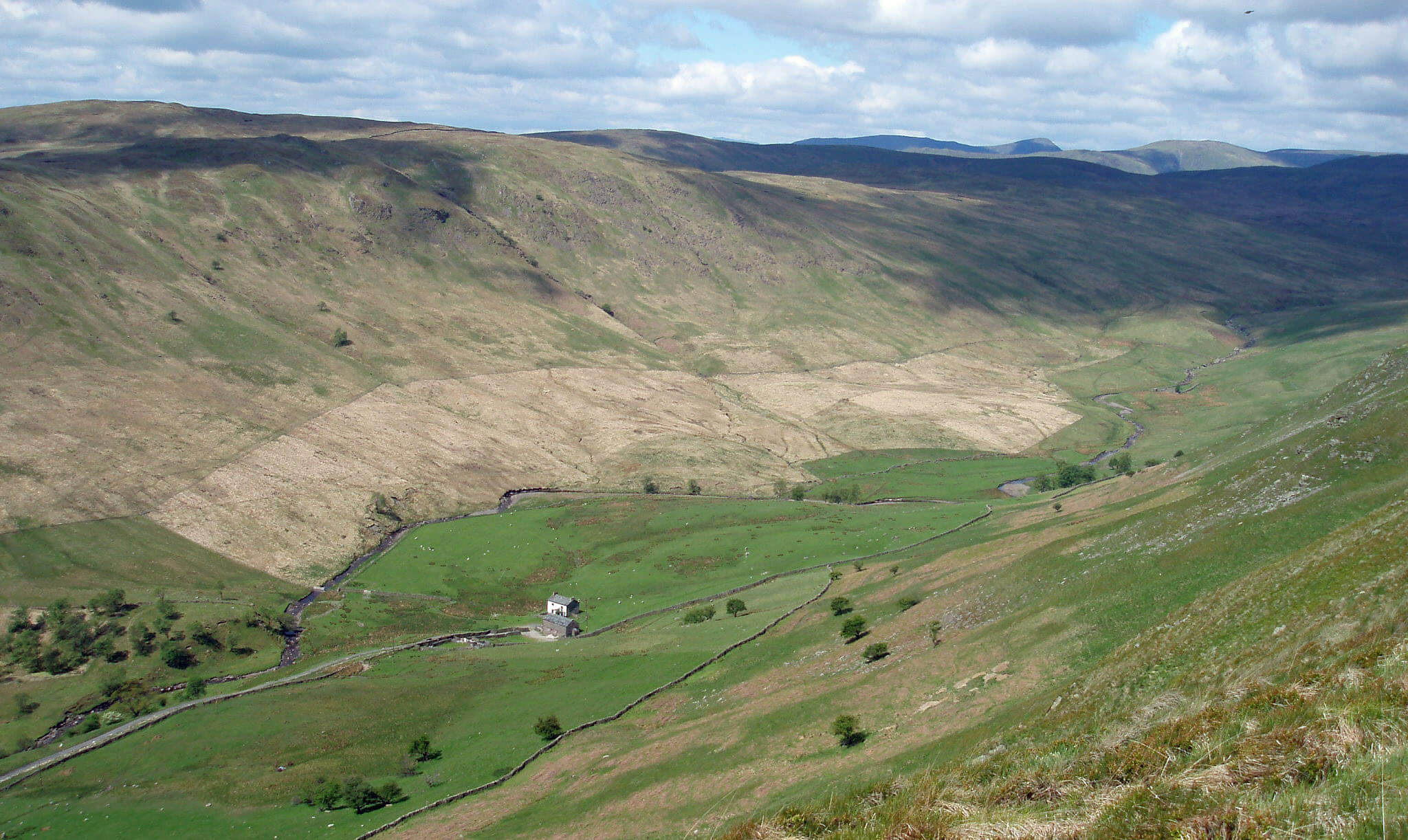
Upper Borrowdale from High House Bank
Birk Beck
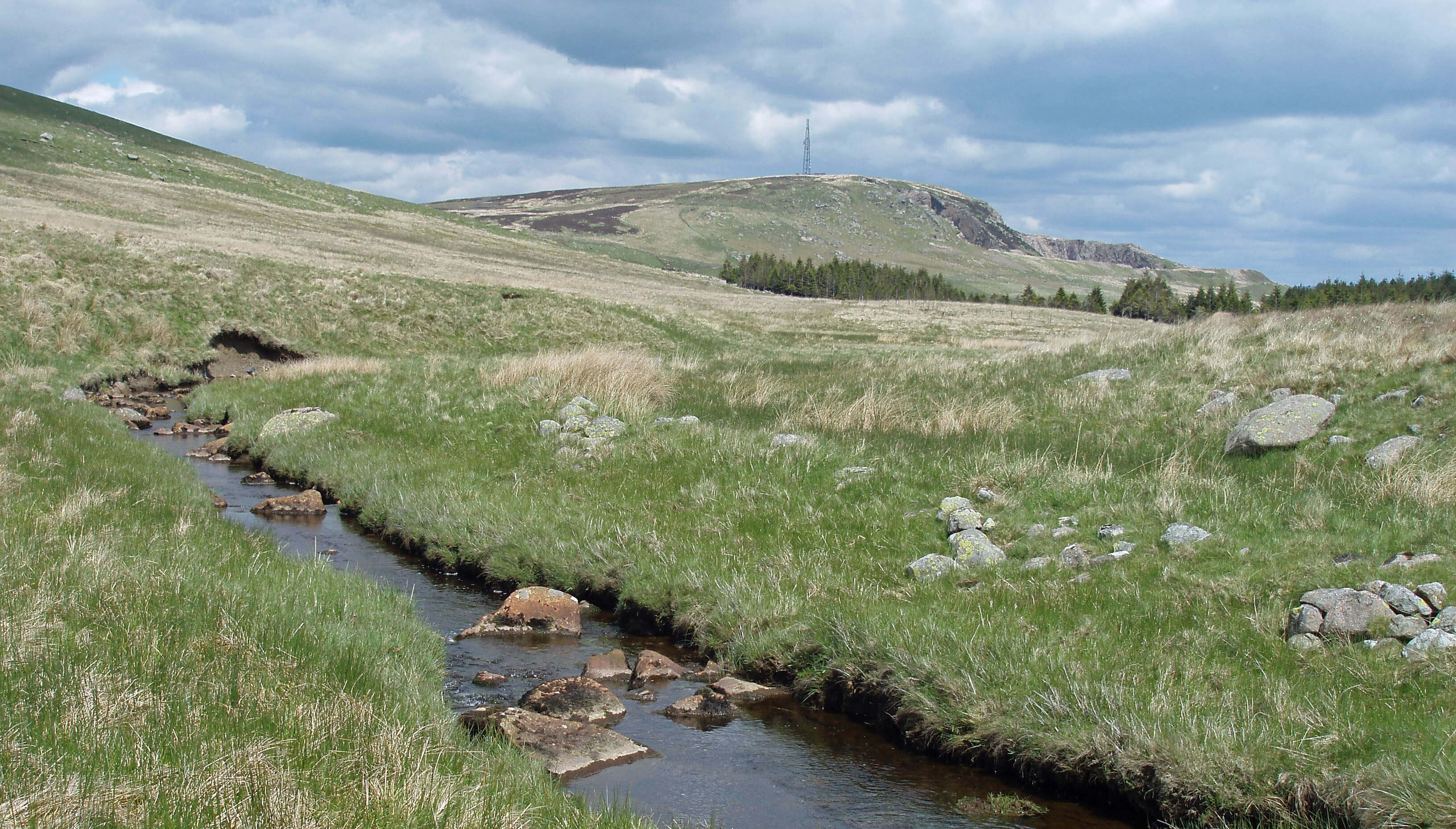
 Left: Wasdale Beck below Shap Pink Quarry
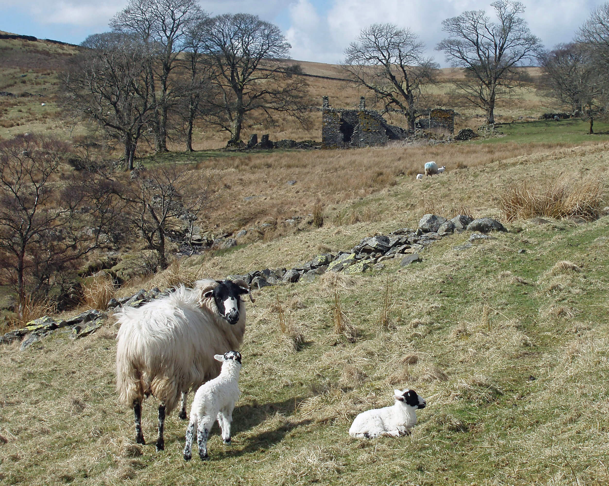
Right: Sheep and ruin by Eskew Beck
Birk Beck arises in Wasdale, as Wasdale Beck,
below Great Yarlside, which at 598m and 14km
from the junction with the Lune is only a little
lower and nearer than Green Bell. The most prominent
feature of this region is the cliff face of Shap Pink Quarry,
the existence of which tells us that there are locally rare
and valued rocks. There is an exposure of ‘Shap granite’,
an igneous rock with, amongst many other minerals,
crystals of orthoclase feldspar (potassium aluminium
silicate) so large that they may be studied with the naked
eye. Large pink boulders can be seen in the surrounding
fields and, as we saw, some made their way to the stone
circle near Orton.
The Shap granite is an uprising of the granite that
underlies the Lake District. It is seen in the western
Lakes around, for example, the more famous Wasdale.
This prompts consideration of how our Wasdale relates
to the Lake District. The Shap Fells are officially part
of the Lake District National Park, the eastern border of
which is the A6, but lovers of Lakeland tend to ignore
them. For example, Wainwright’s classic seven volumes
on Lakeland include a volume on the Eastern Fells and
another on the Far Eastern Fells but still do not go far
enough east to include the Shap Fells.
He argued that the Lakeland fells are “romantic in
atmosphere, dramatic in appearance, colourful, craggy,
with swift-running sparkling streams” but that the Shap
Fells have a “quieter and more sombre attractiveness”.
But then Wainwright loved a scramble: anywhere where
it was possible to settle into a brisk walking rhythm was
usually described as dull or tedious. Rather ironically,
the fact that the Shap Fells are in the National Park is
now being used to try to extend the boundary yet further
eastwards to include similar terrain.
[Update: The 2016 changes to the National Park boundaries
did indeed move the eastern border even further east, to the M6 rather than the A6, thus including
the Birkbeck Fells, Bretherdale and lower Borrowdale.]
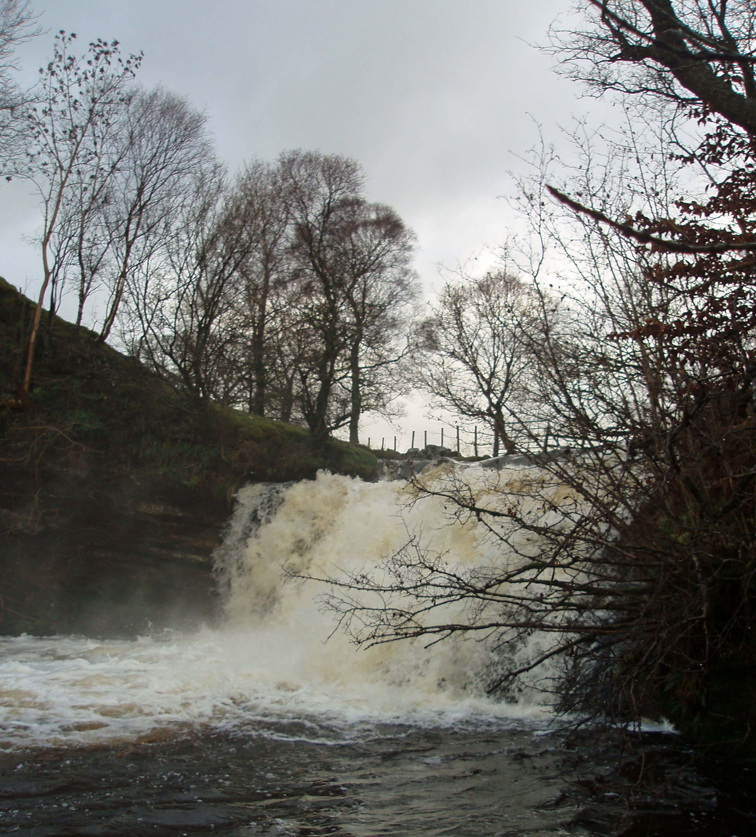 Right: Docker Force (Birk Beck may be only a tributary of the Lune but up to this
point the Lune has been tame in comparison)
South of the granite intrusion, the Shap Fells
bedrock is of the Silurian slates and grits that underlie
the Howgills. Here, however, deep peat gives blanket
bog, with some heather moorland. The variety of upland
vegetation supports breeding waders (curlew, lapwing,
redshank, snipe) and raptors (peregrine falcon, merlin),
although not very many, as far as I have seen. There’s
also a herd of red deer.
The headwaters of Wasdale Beck run off the slopes
of Great Yarlside and Wasdale Pike, heading northeast
to meet Longfell Gill, which passes the brother quarry,
Shap Blue Quarry, which mines darker shades of granite.
At the junction is Shap Wells Hotel, built in 1833 for
visitors, including royalty, to the nearby Shap Spa.
The beck, now called Birk Beck, passes Salterwath,
a farmstead that lends its name to Salterwath Limestone.
This first came from quarries 1km to the east, now
beyond the railway and motorway, and more recently
from Pickering Quarry 4km north. The limestone, which
is blue-grey when quarried and polishes to a brownish
shade, is a fine building and paving stone.
Below the 5m waterfall of Docker Force, Stakeley
Beck and Eskew Beck join Birk Beck off Birkbeck Fells,
a dull triangle of common land between the A6, M6 and
Bretherdale, heathery to the north and grassy to the south.
There’s a good path from Ewelock Bank to the highest
point, Crag Hill (400m), but the top is disappointing as
it is little higher than nearby hillocks, lower than the A6
and surrounded in all directions by higher fells. Still, it
provides reasonable views of those fells, especially the
Cross Fell range and the Howgills.
Birk Beck runs past the small, secluded communities
of Scout Green and Greenholme. It is hard to imagine
now that they once lay on the route of an important
drove road. Then, when there was no M6 or railway, it
would have been quiet enough to hear the approaching
clamour of a thousand cattle and accompanying
throng; at the villages, excitement would grow –
perhaps the visit coincided with a local market,
with a lively exchange of beasts; the drovers
would eat and drink (it was thirsty work); maybe
the cattle would be penned overnight; and then
the whole procession would move on to the next
stop a few miles along.
The drove roads were, of course, not roads
as we know them. They were wide tracks, often
on high ground, partly for the free grazing there
and partly to avoid the risk of ambush. A drover
was a person of prestige and responsibility.
The annual pilgrimage of cattle from Galloway
to the south for sale or for fattening in the
milder climate occurred for centuries before
the railways made the practice obsolete. The
drove roads were not restricted to cattle: they
became the standard route of passage for people
transporting other essentials of life, such as
wool, coal and salt.
Surviving drove roads are characterised by
their wide margins. The routes of the Galloway
Gate (the name of the drove roads between
Scotland and northwest England) through Loyne
can be traced by place names (e.g. Three Mile
House, reflecting the typical distance between
stops) and inn names (e.g. Black Bull, Drover’s
Arms). The Galloway Stone, a large Shap
granite boulder north of Salterwath, probably
had significance for drovers.
More recently, Scout Green and Greenholme
became known to railway enthusiasts as locations
to view trains struggling up from Tebay to Shap.
South of Greenholme, at Dorothy Bridge, Birk
Beck is joined by Bretherdale Beck.
Bretherdale Beck
Bretherdale Beck runs between the A6 and M6 in the
valley of Bretherdale, which was quiet and ignored
until it came into the public limelight after a proposal to
erect 27 wind turbines, 115m high, in a 6km by 2km area
on its southern ridge. The proposal for what came to be
called the Whinash Wind Farm was eventually rejected
by the Secretary of State in 2006 because “the Whinash
site is an important and integral part of a far-reaching
landscape which is highly sensitive to change”.
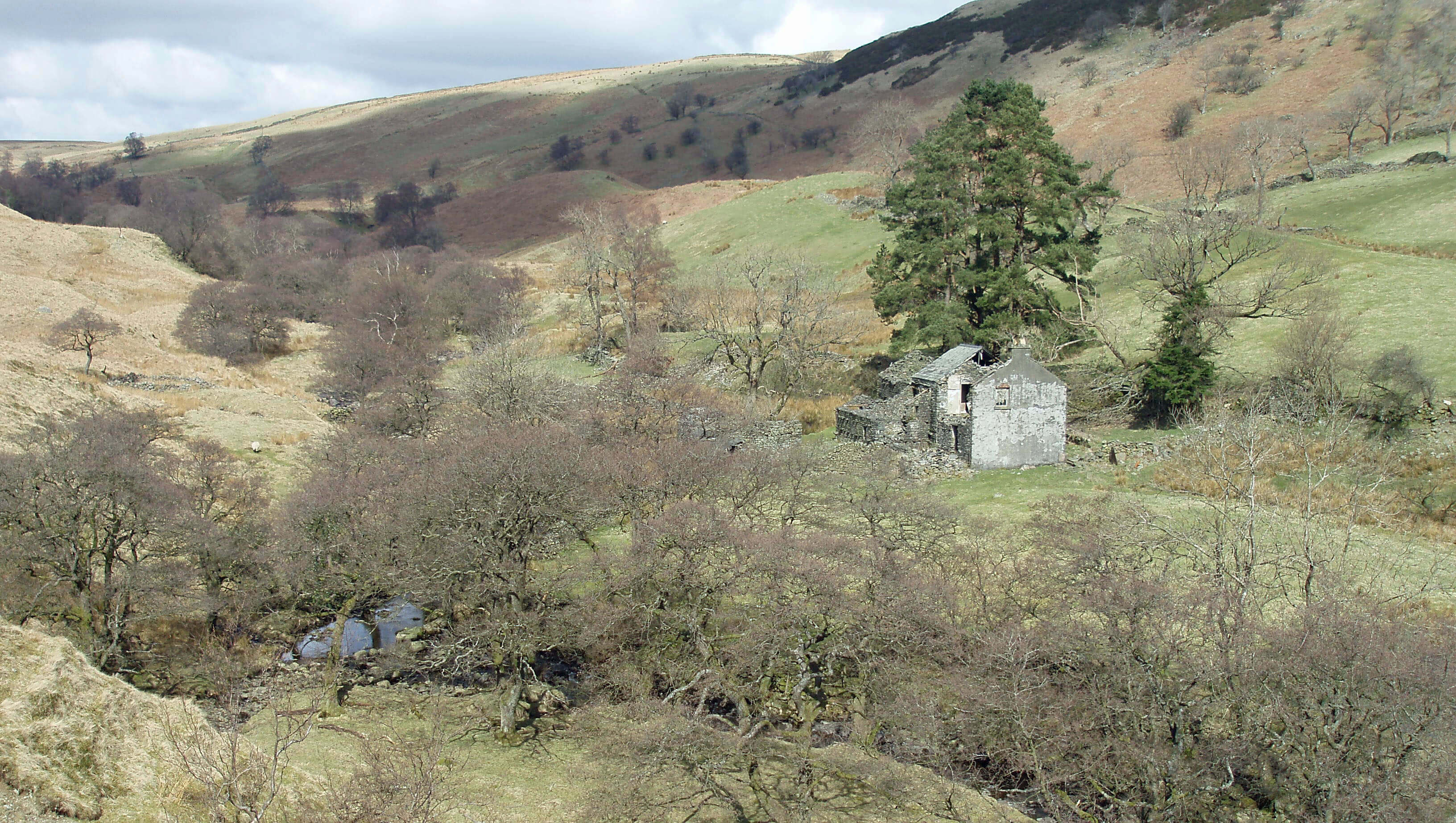 Left: Derelict Parrocks in upper Bretherdale
The proposal for what would have become England’s
largest land-based set of wind turbines became a test
case for the conflict between protecting the landscape
and securing renewable energy. Many factors provoked
heated debates – too many to summarise here – but
one that, judging from the 127-page inspector’s report,
seems to have been decisive is that the wind turbines
would have impacted on views from the Lakes and Dales
National Parks, from Orton Fells, and from locations
further north. So, the views of Whinash were apparently
more important than the merits of Whinash itself.
It is difficult to argue for those merits: “People love
Bretherdale for its wild, open solitude” … “But nobody
ever goes there” … “But if they did they’d love the
solitude.” How bleak and empty does a region have to be
to be appreciated for that very bleakness and emptiness?
How much intrusion can an empty region absorb before
losing its emptiness? This is an argument not just for
Bretherdale: many parts of Loyne appeal because so few
people go there.
The proposers argued that the wind turbines would
increase the number of visitors to the area. The head of
onshore wind for the British Wind Energy Association
expressed incredulity that anyone should wish to visit
other than to see the turbines: “You’re not going to get
visitors within earshot of the M6 any other way. It’s
barren moorland. Why would people want to walk there
otherwise?”
The debate about Whinash was obfuscated by
opinions that the National Park boundaries might or would
soon change. In particular, some professed to believe
that the Birkbeck Fells, Bretherdale and Borrowdale
were about to become part of the Lake District National
Park – and of course it is unthinkable to have wind
turbines in the Lake District. At the moment, the Lake
District is ringed with wind turbines but there are none
within its boundaries. On the other hand, the proposal,
if approved, might have prevented the Birkbeck Fells
joining the Lake District or might have set a precedent
for further wind turbines in the Lake District.
[Update: As said in the update above, the
Birkbeck Fells, Bretherdale and lower Borrowdale are now within the National Park.]
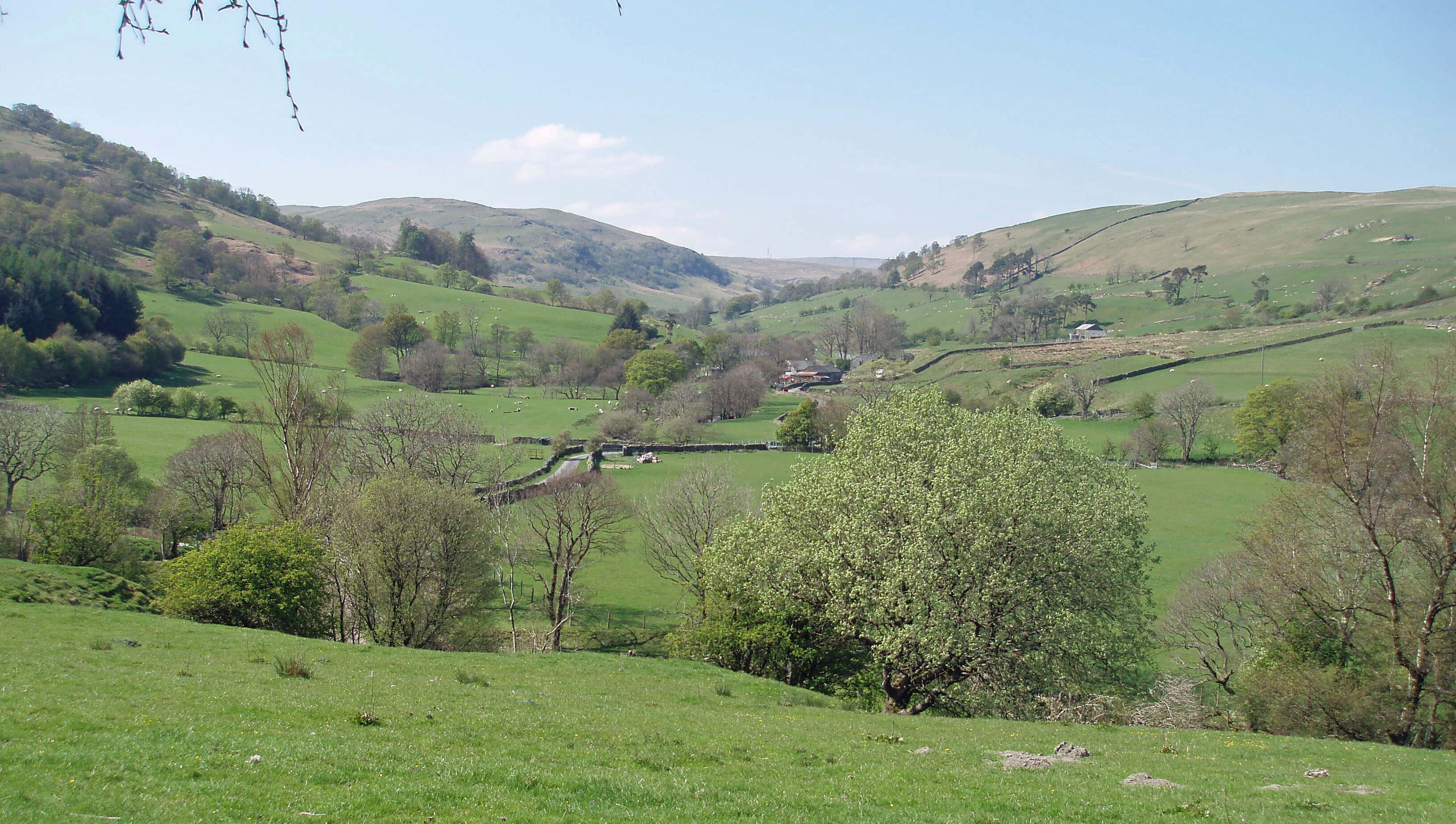 Right: Lower Bretherdale, looking west
A further issue was that all but three of the proposed
27 turbines would have been on common land, which
raised the question of possible interference with the
rights of commoners. Much of the higher land of Loyne
remains as traditional common land but its legal position
is muddled. All common land belongs to an owner (here
the Lowther Estate) not to the commoners. It is the
owner’s prerogative to make proposals about the land.
While the commoners argued that there would be a loss
of grazing rights the inspector did not agree with them.
In fact, he considered that the commoners would benefit
from easier access along the new tracks.
Among those who contributed to the debate were
long-established groups such as Friends of the Earth
and English Nature and newly created ones such as
Friends of Bretherdale. Bretherdale never knew it had
so many friends. The valley today has many abandoned
farmsteads, which visitors, if there are any, might find
charmingly derelict. But each of them was the home,
perhaps for centuries, of families that were forced, in
despair, to abandon their houses and their livelihoods.
Where were the friends when these families needed
them? Are a few wind turbines so much more important
than the ruination of people’s lives? Again, these are
questions not just for Bretherdale. Loyne is and always
has been predominantly rural and many communities
continue to struggle to find a role in the 21st century.
As far as Bretherdale is concerned, all is far from
lost. Although it may be too late for higher Bretherdale,
except perhaps some buildings of Bretherdale Head,
from Midwath Stead downstream there has been some
reinvigoration. For example, Bretherdale Hall has been
renovated despite uncertainty about the wind turbines.
Midwath Stead itself seems a lively group of homesteads,
with, according to its sign, “free range children”.
Overall, it is a pleasant, sheltered valley, with rocky
outcrops on the surrounding hills and an unobtrusive
conifer plantation with other natural woodlands.
Below Midwath Stead some of the fields are, like those
near Raisbeck, traditional unploughed meadows and
consequently rich in grasses, herbs and flowers.
After the Bretherdale Beck junction, Birk Beck
proceeds uneventfully for 2km past Low Scales farm
and under the three-arched Birkbeck Viaduct to join the
Lune.
The Lune from Birk Beck ...
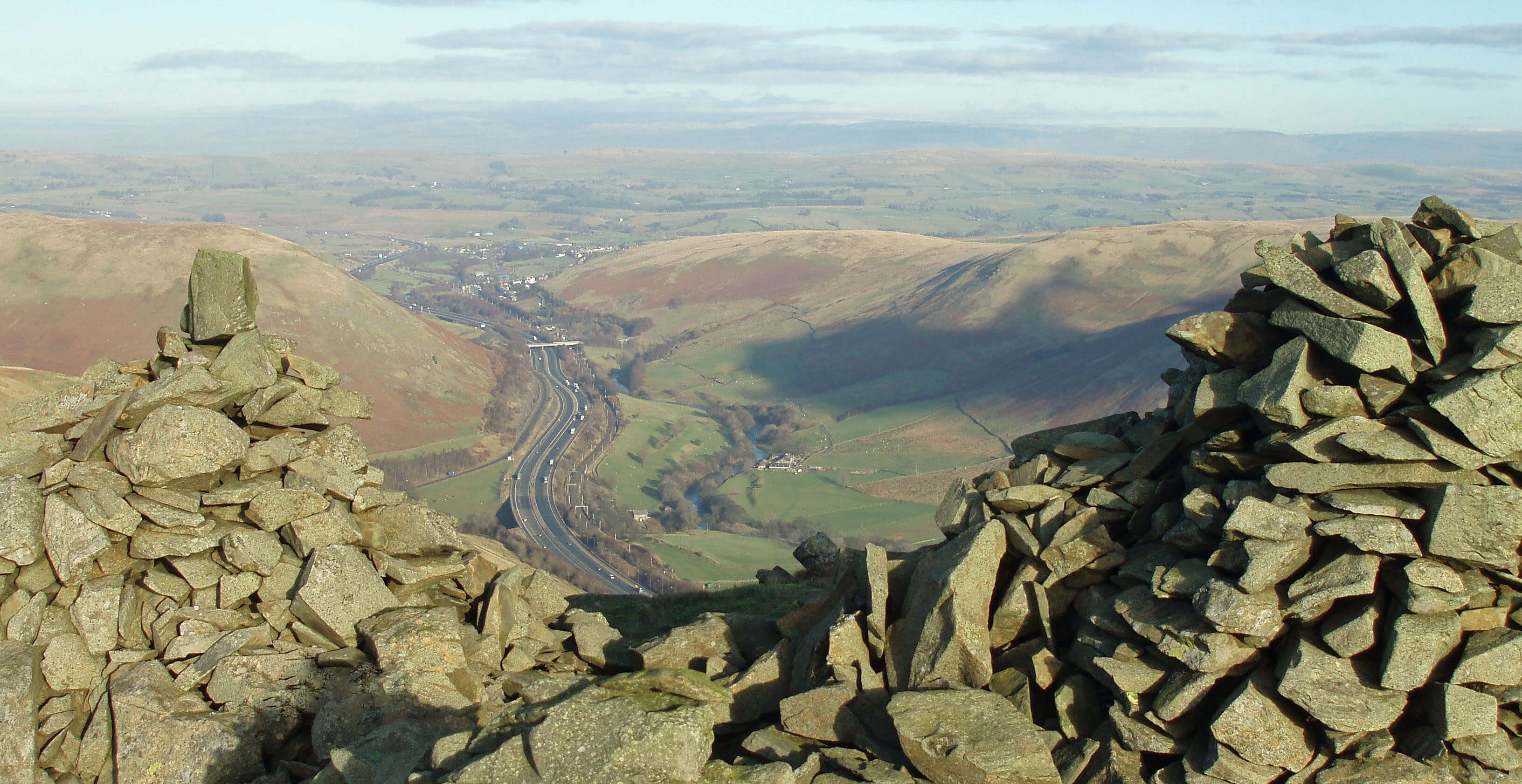
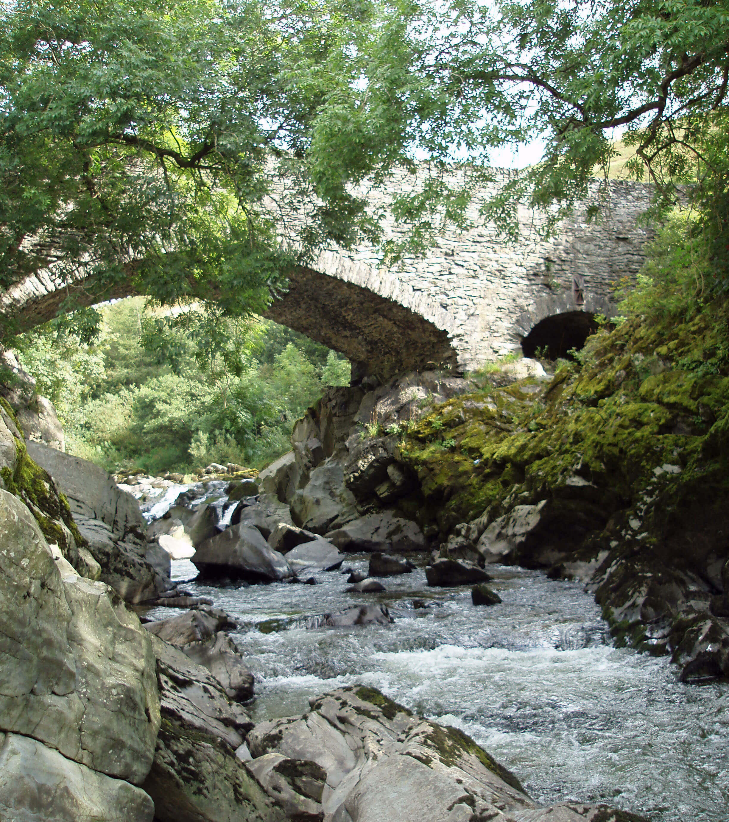 Left: The Lune Gorge from Great Coum, Grayrigg
Right: Lune’s Bridge
At their junction Birk Beck and the Lune are much
the same size and if the matter hadn’t been pre-empted by the naming it might have been unclear
which was the tributary. They meet head on and as a
significant, placid river run south, heading for a narrow
gap, extravagantly called the Lune Gorge, between steep
hills. This gap is an obvious transport corridor, as the
Romans recognised with their road from Carlisle and
as the drovers appreciated in the Middle Ages. More
recently, the A685, the railway and the M6 motorway
have squeezed themselves into the gap but only after it
had been widened by blasting away the side of Jeffrey’s
Mount.
The lines of transport jostle the Lune for space.
Within 3km, the Lune is crossed nine times: four times by
the M6, twice by the railway, once by the A685 and twice
by footbridges. This is not the most soothing section of
the Lune. Visually, the Lune is pleasant, running over a
wide stony bed, bleached white in summer. Aurally, the
M6 dominates.
Sadly, there is no space left for National Cycle
Route 68 (the Pennine Cycleway), England’s longest
leisure cycle route, which was opened in 2003 and runs
for 570km between Derby and Berwick-on-Tweed.
Within Loyne it runs from Orton to Sedbergh, through
Dentdale, and on to Ingleton and Clapham. Here it is
forced to share 1km with the A685. The cycleway is
described as 20% traffic-free trails and 80% quiet lanes
and minor roads. The A685 is neither.
The Lune is joined from the west by Roundthwaite
Beck, which runs from Roundthwaite Common. The
beck passes Roundthwaite Farm, which is the home of
the Lunesdale fell ponies, about forty of which browse
the fells between Bretherdale and Borrowdale. The
Lunesdale ponies have roamed the common since the
stud was established in 1958 and have become known
as a prize-winning breed. For example,
in 2008 Lunesdale Lady Rebecca was
Supreme Champion at the Fell Pony
Society Breed Show.
Fell ponies are hardy, strong,
active, versatile, stubby, sure-footed
horses, usually black but sometimes
grey, brown or bay. They are on the fells
all year. The fell pony originated on the
moors of northwest England and is one
of nine native breeds in Britain. It was
used as a draught animal and packhorse
since Roman times and was the main
form of transport during the Border
conflicts. The passing of these roles led
to a severe decline in numbers, only
arrested recently by its popularity for
leisure and competitive riding, although
it is really a working breed. The fell
pony is still listed as endangered by the
Rare Breeds Survival Trust.
Tucked between the M6, railway
and A685 bridges is the first distinctive
bridge across the Lune, Lune’s Bridge.
A document of 1379 refers to a
“Lonesbrig” here but the present bridge
is of the 17th century or later. This
attractive bridge is perched across rocks
where the Lune narrows. There are two
arches, the smaller one so high that the
Lune can surely never reach it. Today,
the bridge leads to a memorial stone for
four rail track workers who were killed
near here in 2004 by a runaway trailer
from Scout Green.
The Lune runs through a calm,
open section that once was a quiet
haven between steep hills, and is joined
from the west by the sizable tributary of
Borrow Beck.
The M6 motorway in the Lune Gorge cannot be ignored
so let us try to make a virtue of necessity: it is, after all, the
recipient of a Civic Trust award, the plaque (which was
in the A685 lay-by below Grayrigg Pike until removed
or stolen in 2008) saying “This award for an outstanding
contribution to the appearance of the Westmorland
landscape relates to the 36 miles of M6 Motorway between
the Lancaster and Penrith bypasses”. This contribution will
not be appreciated at the level of the Lune. Distance lends
enchantment and you really need to view the M6 from
Grayrigg Pike, Blease Fell, Linghaw or even further away.
The A6 route via Shap, reaching 424m, was notorious
for its bad visibility and winter conditions. The 1962 report
on the proposed Lancaster-Penrith M6 route whittled the
possibilities down to three: the A6, the Lune Valley, and
the Killington routes. Of the two Lune Gorge routes, the
Killington route was preferred to the Lune Valley (phew!),
although a cost-benefit analysis found the A6 route better
than both. The Killington route was selected because of the
A6 weather problems and because the necessary tunnels
would have “placed restrictions on the movement of
dangerous goods” (?).
So Killington it was. The design and engineering
problems were immense. The A685 was re-aligned; long
constant gradients were designed, reaching a maximum
height of 315m; 77 bridges were needed (plus three for
the A685) – and all intended to blend into the landscape.
Construction began in 1967 and the motorway opened in
October 1970. By now millions of travellers on the M6
have admired the Howgills, but how many of the few of us
on the Howgills have admired the M6?
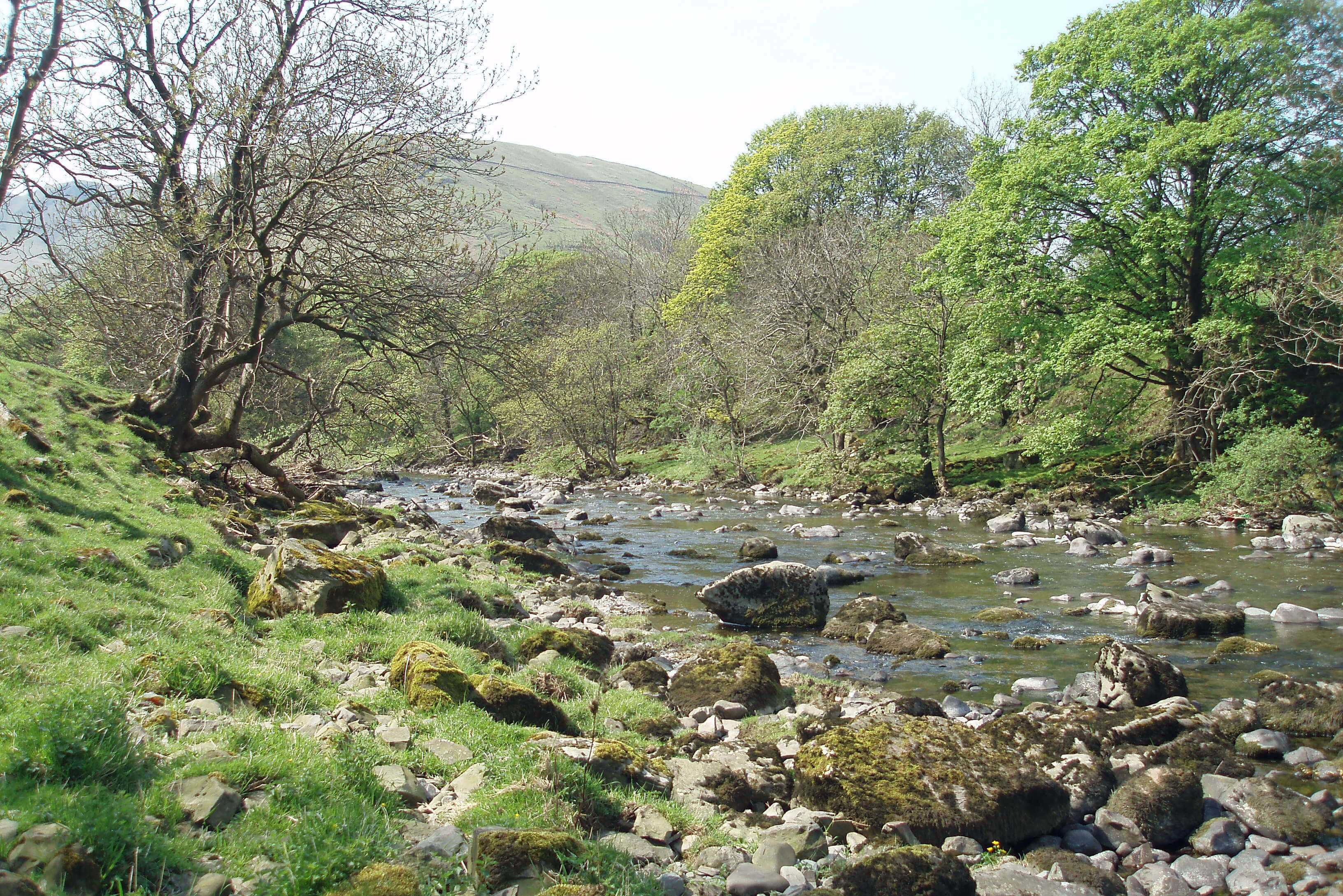
The Lune below Jeffrey’s Mount
Walk 3: Roundthwaite Common and Bretherdale
Map: OL19 and OL7 (please read the general note about the walks in the
Introduction).
Starting point: Roundthwaite, where the bridleway to Borrowdale swings southwest (609033).
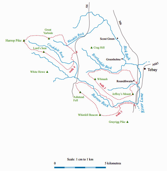
This is a walk over the area that might have been sacrificed for the Whinash Wind Farm. Follow the bridleway southwest
and immediately after the gate, take the path half left directly up the slope to Jeffrey’s Mount. Continue beyond the small pile of
stones at the top for a little way in order to rest while watching the busy motorway traffic far below.
When you are ready, head west along the ridge over half a dozen gentle rises, including Casterfell Hill, Belt Howe,
Winterscleugh and the highest point, Whinash (471m). In places there is a path but it doesn’t matter much as there are no fences
and it is easy going on grass, with good views into Borrowdale. Almost certainly, Lunesdale fell ponies will be seen on the
common.
When you reach Breasthigh Road, an ancient, deeply grooved track over the ridge, follow it to the right. At Bretherdale
Beck you might like to detour north briefly to see the derelict Bretherdale Head. Follow the quiet road to picturesque Midwath
Stead, with its small bridge.
Continue along the road (very little traffic) past Bretherdale Hall, and then take the footpath through Bretherdale Foot and
Dyke Farm (where the owner assured me that there will soon be signs to help you locate the path) to Pikestone Lane. Turn right
on the lane and walk for 2km to Roundthwaite.
Short walk variation: Between Belt Howe and Breasthigh Road there is no way off the fell to the north and so the only short walk
possible is to follow the long walk up Jeffrey’s Mount to Belt Howe and then take the bridleway back to Roundthwaite. If this
walk is a little on the short side for you, you could continue on the CRoW land over Roundthwaite Common as far as you wish
and perhaps drop down to the bridleway via the Blea Gill waterfalls.
Borrow Beck
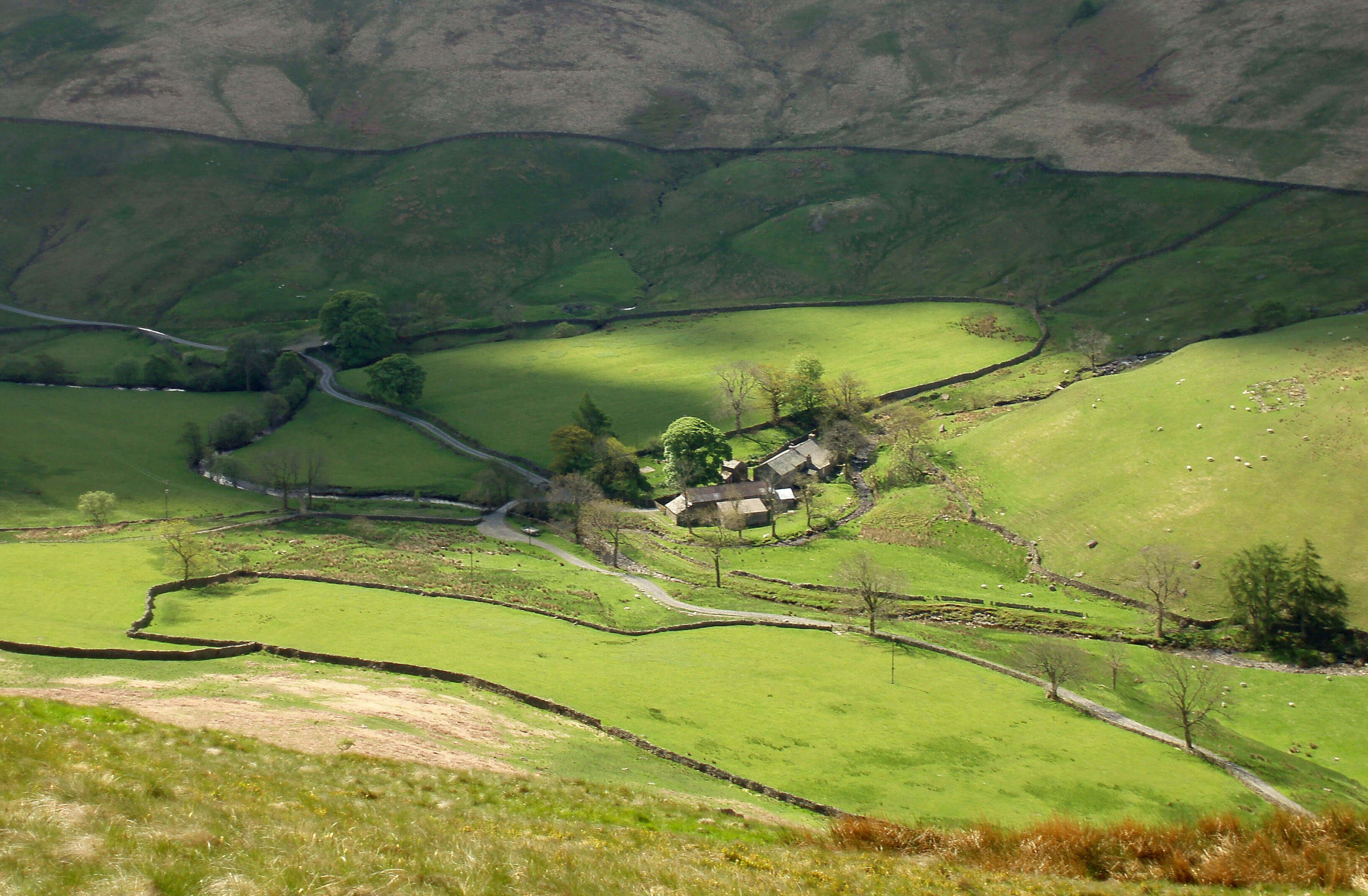
Borrowdale Head from High House Bank
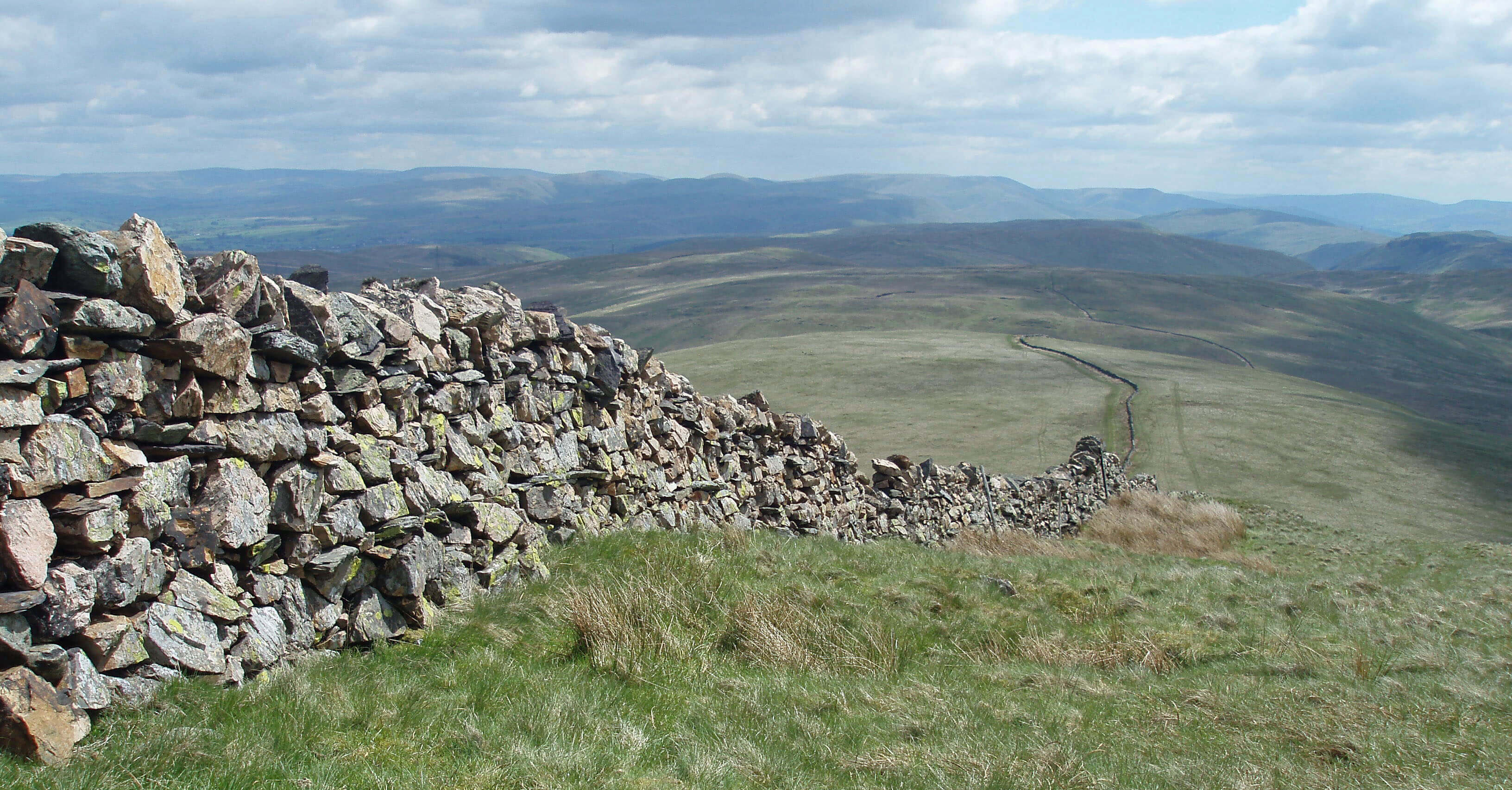 Right: The wall from Great Yarlside to Little Yarlside
Borrow Beck runs for 10km east from between
High House Fell and Bannisdale Fell through
Borrowdale, the most beautiful valley in Loyne despite
being split in two by the A6. Upper Borrowdale is within
the Lake District National Park and has some of the
character of Lakeland valleys. Unfortunately, there is
no footpath in upper Borrowdale, which therefore can
only be appreciated by walking the long, grassy ridges
on either side.
[Update: All of Borrowdale is now within the
Lake District National Park.]
Just below High Borrow Bridge, Crookdale Beck
joins Borrow Beck. This junction illustrates the difficulty
of determining the source of a watercourse. Upper and
lower Borrowdale are aligned so well that it seems
obvious that the same beck, Borrow Beck, flows through
them both. But Crookdale Beck has a much higher and
more distant source, below Harrop Pike (637m), than
Borrow Beck and at the junction ought to be regarded as
the senior partner.
Perhaps aesthetics play a part because Crookdale
is such a dreary valley that no beck would want to be
born there. There are twelve million visits to the Lake
District National Park each year and approximately none
of them involve an outing to Crookdale. Above Hause
Foot, there is little of interest to a visitor not fascinated
by varieties of grass and herb, only the modest crags of
Great Yarlside breaking the monotonous, peaty slopes.
Hause Foot is on the turnpike route before the A6
was built in the 1820s. A steep curve up the northern
slope can be traced, reaching 440m, with the route
continuing north over Packhorse Hill and south to High
Borrow Bridge. This route played a key part in the 1745
incursion of Bonnie Prince Charlie. When his army
began to retreat, bridges such as High Borrow Bridge
were demolished ahead of it to hamper its struggle over
the Shap summit, after which the Scottish army was
defeated in its last battle on English soil.
In a lay-by on the A6 there is a memorial to drivers
over the A6 Shap summit, but the A6 is far from forgotten
and unused today. There is no memorial to the souls
who tackled the turnpike route. It too is not unused as it
forms part of the 82km Kendal to Carlisle Miller’s Way
footpath, opened in 2006.
Walk 4: Upper Borrowdale, Crookdale and Wasdale
Map: OL7 (please read the general note about the walks in the
Introduction).
Starting point: A lay-by at the A6 summit (554062).
As we have Loyne becks from the Lake District, we must have a walk within the Lake District! This is a long, arduous,
isolated walk over grassy and sometimes boggy ridges.
Go west through a gate and under two lines of pylons to reach the old turnpike route. Go south through two gates and at the
third follow the wall down to Crookdale Beck. Cross it and head up High House Bank. At a small cairn there’s a good view into
Borrowdale.
Follow the ridge west. A faint path becomes clearer after Robin Hood, where a good cairn marks another viewpoint. Continue
to Lord’s Seat. Sadly, there is no sight from here of the fine cairn on Harrop Pike to inspire you, but make your way northwest
around crags and peat-mounds (there is no path). Keep well to the left so that you can use the fence to guide you to the top.
After all this effort, the view of the Lakeland hills is disappointing. Only Black Combe, the Coniston range, and a glimpse of
Harter Fell and High Street can be seen beyond the nearer hills. There’s also a view into Mosedale and Sleddale, where you may
be lucky to see red deer. No lakes can be seen apart from a bit of Wet Sleddale Reservoir to the northeast. The view eastwards is
better: a panorama from Morecambe Bay to Cross Fell, with the Howgills prominent.
From Harrop Pike, follow the fence east to Great Yarlside (easy walking here). At the junction follow the fence left, not the
wall right. Follow the right fence at the next junction. After a short while, a plantation comes into view half right. Make a beeline
(no path) across Wasdale, with Shap Pink Quarry to your left, to the right hand corner of the plantation and then across the field
to the lay-by.
The reward for this walk is that you can afterwards boast to Lake District fans that you did Borrowdale and Wasdale in one
day.
Short walk variation: It is possible to have a shorter walk but not really a short walk, once you embark on Crookdale. You could
forgo the pleasure of reaching Harrop Pike by contouring round from Lord’s Seat to Great Yarlside – but don’t cut directly across
Crookdale, as it’s a bog. From Great Yarlside, you could avoid walking in Wasdale by following the wall over Little Yarlside.
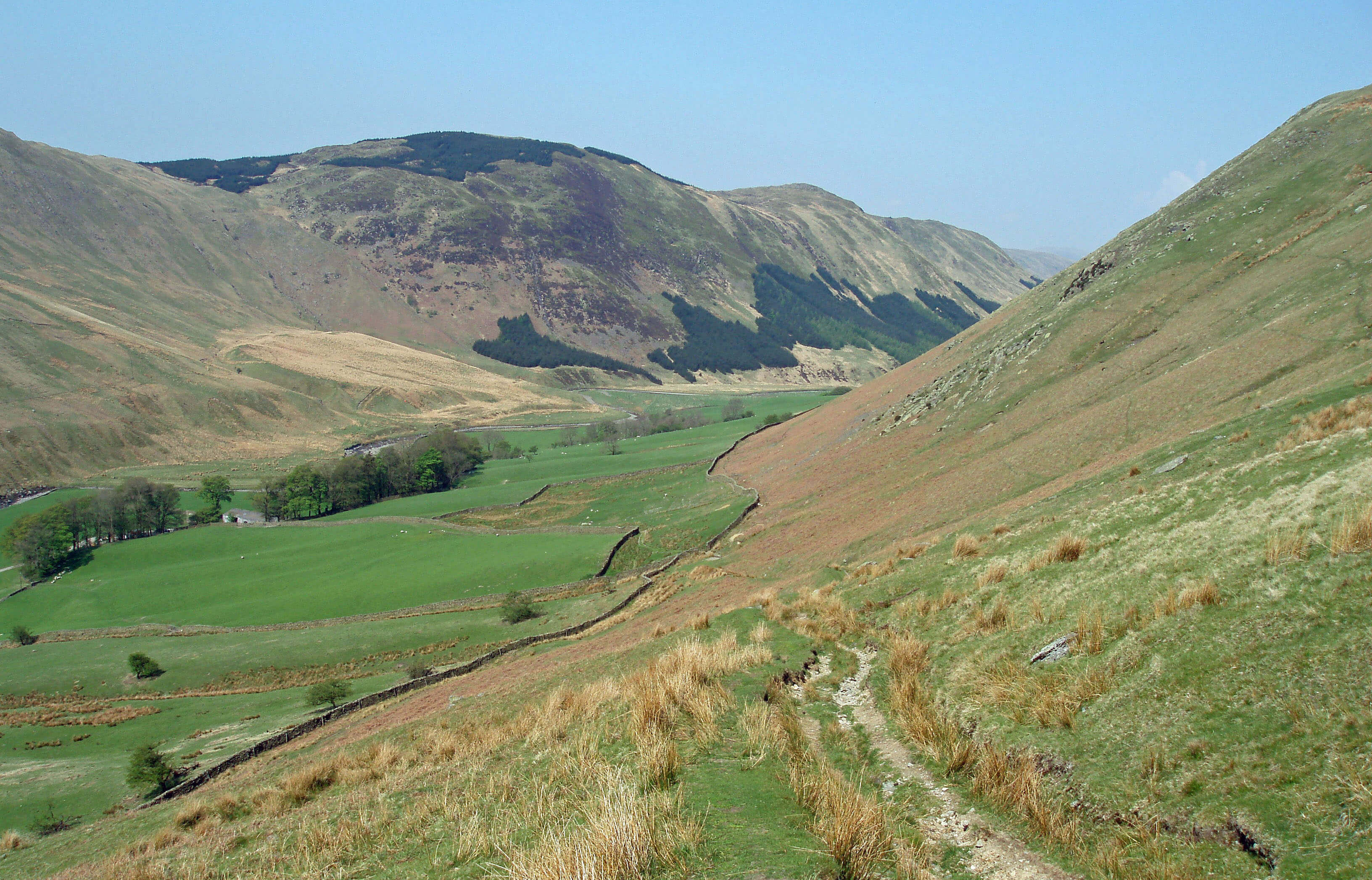
Lower Borrowdale, above the farm of Low Borrowdale
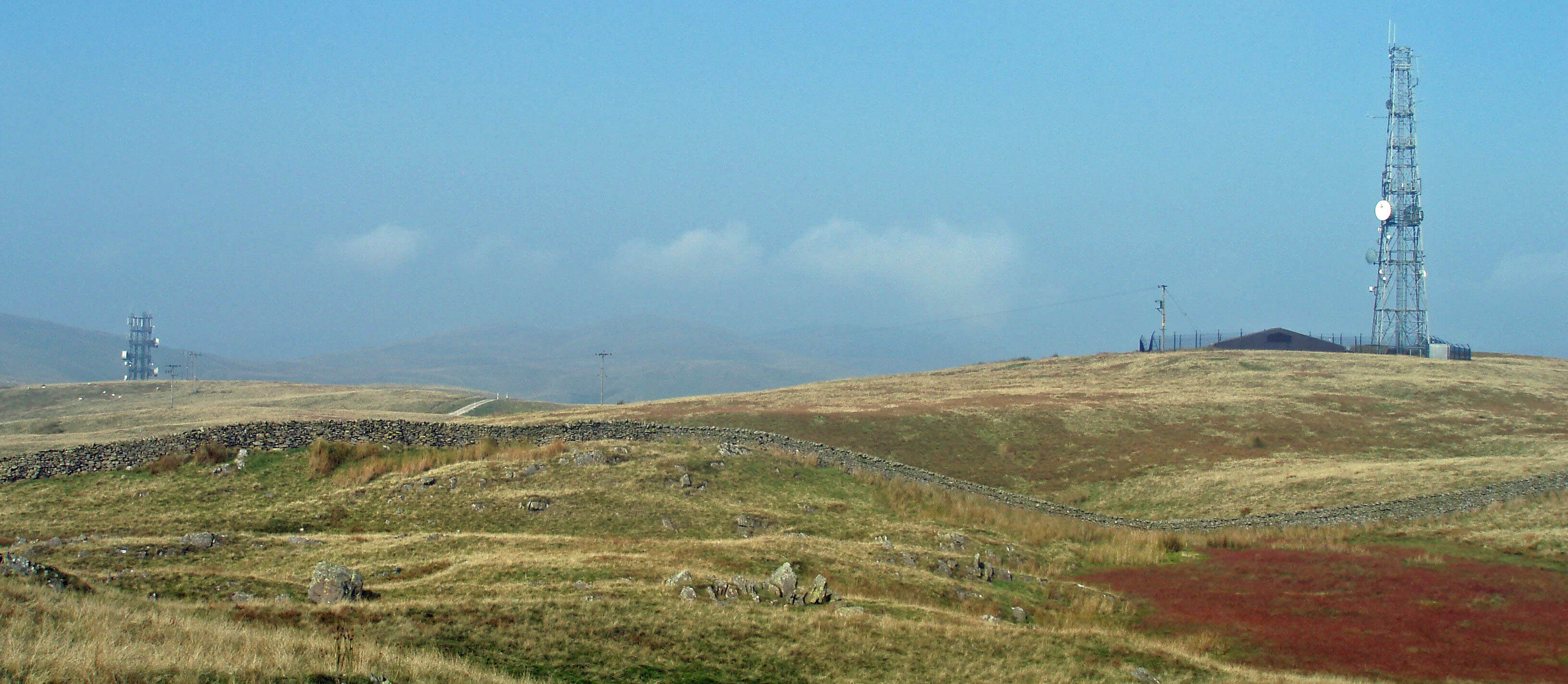 Right: Whinfell aerial and repeater station
Below High Borrow Bridge, Borrow Beck enters
lower Borrowdale, a serene valley enclosed by steep,
grassy slopes, with occasional rocky outcrops, the
ridges on both sides undulating over a series of gentle
summits reaching almost 500m. The farmstead of High
Borrowdale was derelict for many years until bought in
2002 by the Friends of the Lake District, perhaps as a
ploy to help prevent the building of wind turbines on
Whinash. Many saplings have been planted beside the
beck and the barns have been restored but the farmstead
itself remains a ruin, now tidy rather than derelict.
Low Borrowdale continues to farm the lower valley
in splendid isolation although it was sold in 2008 to
Natural Retreats, a Manchester-based company that
aims to build luxury holiday ‘eco-parks’ alongside all
fourteen national parks. To nobody’s surprise, a planning
application duly followed: to build 29 timber lodges and
7 holiday cottages. This would, of course, disturb the
serenity of the dale, although Natural Retreats naturally
claims otherwise. The application, which is opposed by
the neighbours, the Friends of the Lake District, was
rejected by Eden District Council in 2009, which, it is to
be hoped, should be the end of the matter.
It is a merciful mystery that Borrowdale has escaped
significant change for so long. The Romans and the
drovers did not find use for an east-west path through
Borrowdale but it is surprising that a road joining the Lune
valley and the A6 was never contemplated. Although the
planners’ suggestion that Borrowdale become a reservoir
and the recent Whinash Wind Farm proposal were both
thwarted, the southern ridge, Whinfell, has been less
successful in avoiding modern intrusions. Historically,
Whinfell had a beacon to warn of Scottish invasions and
it is perhaps to be expected that the ridge should now
be adorned with its 21st century equivalents, a repeater
station and aerial. I actually rather like them. Not in
themselves attractive, they enhance their surroundings
(rather like Marilyn Monroe’s beauty spot).
Walk 5: Lower Borrowdale
Map: OL19 and OL7 (please read the general note about the walks in the
Introduction).
Starting point: Where a side-road leaves the A685 for Borrowdale (607014).
Walk west along the road that skirts Borrowdale Wood until it becomes a track and after a further 0.5km (at 594014) take a
path leading south up through a sparse, old woodland. Eventually, views into Borrowdale open out and the repeater station, with
the aerial to the left, comes into view.
From the repeater station, walk to Whinfell Beacon (good view over Kendal), Castle Fell, Mabbin Crag and Ashstead Fell.
The cairns on the peaks can be seen ahead and the footpath is clear except for a short section in the plantation below Mabbin Crag.
From Ashstead Fell, drop down towards the A6 and take the path northeast to Borrow Beck. Walk east on the south bank for 2km
and cross the bridge leading to High and Low Borrowdale. Continue back by Borrowdale Wood.
Those of boundless energy may extend the walk into a ridge horseshoe by walking up Breasthigh Road (by fording Borrow
Beck or, if that is not possible, crossing it at Huck’s Bridge) to the ridge above Borrowdale Edge, dropping down the bridleway
to Low Borrowdale.
Walks may equally well start at the A6 end, where there are two lay-bys close by Huck’s Bridge.
Short walk variation: Any walk along the length of the Whinfell ridge cannot be considered a short walk. Shorter walks than
the above can be devised by noting carefully the positions of the two bridges, the plantations and the other footpath (from
Roundthwaite) into the valley, and the extent of CRoW land. There are crags on the valley slopes but, if necessary, they can be
negotiated with care. The best and least risky route is to follow the long walk as far as Whinfell Beacon, to proceed to the wall
gate on the way to Castle Fell, and then to turn right to Shooter Howe. A modest scramble will bring you down to Borrow Beck,
which you then follow east.
The Introduction
The Previous Chapter (Northern Howgills and Orton Fells)
The Next Chapter (Western Howgills and Firbank Fell)
© John Self, Drakkar Press


 Left: Wasdale Beck below Shap Pink Quarry
 Right: Docker Force (Birk Beck may be only a tributary of the Lune but up to this
point the Lune has been tame in comparison)
 Left: Derelict Parrocks in upper Bretherdale
 Right: Lower Bretherdale, looking west

 Left: The Lune Gorge from Great Coum, Grayrigg


 Right: The wall from Great Yarlside to Little Yarlside

 Right: Whinfell aerial and repeater station
