Home
  Preamble
  Index
  Areas
  Map
  References
  Top10s
  Me
  Drakkar
Saunterings 21-30
Saunterings is a set of reflections based upon walks around the counties of Cumbria, Lancashire and
North Yorkshire in North-West England
(more details of my ‘North-West England’ are given in the Preamble).
If you'd like to give a comment, correction or update (all are very welcome) or to
be notified of new items as they appear - please send an email.
     Latest (with a list of all Saunterings so far)
     31 - 40
     30.   Dunsop Bridge, Whitewell and Duchy-land
     29.   The Quiet End of the Ribble Way
     28.   Broughton Moor, or What's Left of It
     27.   The Footpaths of Anglezarke Moor
     26.   A Booze by Any Other Name
     25.   Mysterious Harkerside Moor
     24.   Up Ingleborough with the Holiday Crowds
     23.   The Kentmere Diatomite
     22.   In the Lancashire Yorkshire Dales
     21.   The Fortunes of Fleetwood
     1 - 20
30.  Dunsop Bridge, Whitewell and Duchy-land
Driving south through the Trough of Bowland recently I noticed, just past the Smelt Mill Cottages, a black ‘Duchy of Lancaster’ sign. Continuing through Dunsop Bridge and Slaidburn and back over Bowland to Bentham, I did not notice a sign to say that I was leaving Duchy of Lancaster land. So, a question arises: where exactly does Duchy-land begin and end in Bowland?
I looked for an answer on-line. There are maps of almost everywhere – but not, it seems, of Duchy-land. I did, however, discover a few other things about the Duchy. Before, I had been aware of some odd facts that add to the gaiety of life – that the Queen is the Duke of Lancaster and that a so-called Chancellor of the Duchy of Lancaster is a member of the British Cabinet, for no obvious purpose. We tend to assume (well, I do, I suppose) that anything that’s been around for a long time is part of the natural order of things. The Duchy of Lancaster has been around since the 14th century. But why? I live near Lancaster and feel I ought to know. As far as I’m aware, there are only two Duchies in England: Lancaster and Cornwall. Why is that? Why don’t all the other Dukes (and we have plenty of those) have Duchies? Or if they do why do they keep so quiet about them? Who’s heard of a Duchy of York?
I found that the Duchy of Lancaster owns Lancaster Castle and five rural estates in Lancashire, the largest of which (2,447 hectares or 9.4 square miles) is the Whitewell Estate, the one that I had driven into. The Duchy assets have a value of £534m and bring an income of over £20m a year, mainly from those rural estates. How is that possible? The Whitewell region is mainly farmland and farmers always give me the impression that they struggle to make ends meet. How exactly can regions like the Whitewell Estate contribute millions of pounds to the Duchy? The EU Common Agricultural Policy grants over £300,000 a year to the Duchy of Lancaster. Large though that amount is, it is still only a fraction of the total income. The EU grant is, of course, from tax-payers’ money. Perhaps we also contribute somehow to the rest of the Duchy’s £20m a year.
I wrote to the Duchy asking if they could kindly send me a map of the Whitewell Estate, to aid me in my researches. Alas, it was “not the Duchy’s policy to provide members of the public with estate plans”. There’s a surprise. But why not? It’s not as if the Duke is ever resident there. Is it so unreasonable to want to know if I was walking on land owned by my local Duke? The Duchy’s letter referred me to the Land Registry. I grappled with its website but gave up. It’s one of those websites that has to exist but is designed to be unusable. People who own a lot of land don’t want people who don’t knowing how much they do.
Totridge from near Hareden Bridge
So I set out in the hope of determining the boundaries of the Whitewell Estate myself. I parked just beyond
the Duchy sign, by the bridge to Hareden Farm, and even from the car I was struck by the morning clarity of
the autumn colours. I headed to Dunsop Bridge where I found black Duchy signs on the Post Office, Mill House,
Bridge Cottage, and so on. I deduce that the Duchy owns Dunsop Bridge. I saw nobody I could ask about Duchy-land,
so I walked south alongside the River Hodder enjoying an absurdly warm day for October. I battled up
Kitcham Hill, which seems to have no use for man or beast. If the Duke earns any income from this land then
she’s a better man than me. The hill is not very high (283 metres) but it has an intriguing nobble on top and a stand of Scots pine that makes me wonder if they have been planted here (and if so why) or if they are remnants of woodland that used to be more widespread.
I called in at The Inn at Whitewell. This has a black Duchy sign on its outside wall and photos of
the Queen and Prince Charles on its inside walls, so I would surely get my answers here. However, I was
discombobulated by the glances I received. The place was almost full, and it was midweek and hardly time for
lunch yet. Or luncheon, as the menu says. The menu, incidentally, gave me an inkling of where much of the
£20m comes from. Everybody except me was dressed to the eights (I am giving you a precise measure on the sartorial scale and avoiding exaggeration). The average age of the diners was 103. I was astonished that they were all inside, some huddled by a fire, when it was a glorious day outside. Perhaps there was a touch of autumn dew on the outside seats.
I sidled back out but on the way slipped into the wine shop (an inn with a wine shop!). Knowing nothing about wine, I could not inveigle myself into the two lady assistants’ attention, so I came right out and asked them about the Duchy. They knew less about Duchy-land than me. The only precise information offered was that Browsholme Hall (which is a little south of where I had walked) is part of the Duchy estate. I have since checked and believe that I was misinformed.
I escaped over the stepping stones, which was fun, and continued a fine walk among the farmland and
woodland below Fair Oak Fell and Whitmore Fell. The sun still shone and there was now almost a summer haze diluting the autumn colours. The path provided fine views, including from the partially felled Whitemore plantation, across the green Hodder valley but Pendle beyond was only dimly discernible. On the farmland between Dunsop Bridge, Whitewell and Hareden I did not see a single Duchy sign, although the farms must surely be within Duchy-land.
The Hodder valley from west of Whitewell, Dunsop Bridge to the
left and Kitcham Hill to the right
On the way back, I couldn’t help mulling over that £20m. The Duchy’s
financial report
says that the Duke “voluntarily pays tax on the income which she receives from the Duchy of Lancaster”. Voluntarily! As though we should be grateful for that. I should hope that tax is paid on £20m income that is hardly earned. What about other estates? Say, the Duke of Westminster’s Abbeystead Estate, which I also drove through and which is a larger chunk of Bowland than Duchy-land. Does this Duke somehow ‘earn’ millions from his Bowland estate? How much tax does he pay on it, voluntarily or not? We really have little idea how the other half-a-percent live, do we?
    Date: October 10th 2018
    Start: SD644507, Hareden Bridge  (Map: OL41)
    Route: E – Closes Barn – SE – Dunsop Bridge – E, S by Hodder – Burholme – SE –
Kitcham Hill – SE by Crimpton Brook – W – Whitewell – W, NW – New Laund – W, N, W, N – Whitemore – N –
Hareden Farm – NE – Hareden Bridge
    Distance: 9 miles;   Ascent: 180 metres
    Fraction of 5x5 km squares visited so far: 69/400
29.  The Quiet End of the Ribble Way
Some walkers advocate urban walking. This is not just because they don’t have fields, hills and
valleys nearby. They have convinced themselves that urban walking has its own benefits. The
90% of us who live in urban regions have a duty, they say, to investigate whatever is within our walking range. Shops, churches, streets, slums, palaces … all can be visited without the danger of becoming stuck in a bog or falling off a cliff. Urban walkers may indulge a fascination with local history and architecture, with areas of dereliction seemingly of particular appeal. Although many cities have developed without the notion that people might choose to walk about them, recent renovations of canals, old railway lines and riversides have provided avenues of relative peace for walkers. They have also provided havens for wildlife and indeed the concentration of it within urban patches of greenery may surpass that now remaining in the uniform, sterilised fields of our countryside.
I began this saunter with some urban walking of my own. From Preston bus station, an iconic building in its own right,
I headed through the traffic and Saturday shoppers, past some fine municipal buildings and down Fishergate.
Beyond the railway station stood the sturdy, red County Hall. Housing the Lancashire County Council offices, it confirms that Preston is the administrative centre of Lancashire, with Lancaster retaining the honorific title of ‘county town’.
At the end of Fishergate a melange of roundabouts, bridges and flyovers ensured a cacophony from
which I expected to escape by joining the
Ribble Way and following it towards the estuary. The Ribble Way
is a 70-mile path between the source of the River Ribble above Ribblehead and not quite the estuary but Longton, where the Ribble meets the River Douglas. Although it seems more natural to me to walk down with a river, the Ribble Way is usually described as starting at Longton. I suspect that this is so that walkers don’t skip the Preston-Longton section, thereby depriving Longton of the walkers’ custom.
As I walked west the roar of traffic gradually subsided to a hum. I anticipated rural tranquillity thereafter but I was disabused in two ways. First the horizon became infested with pylons – I counted about fifty of them. When pylons first appeared in the countryside about a hundred years ago there were, of course, objections. However, some people professed to like them. In fact, there was a group of ‘pylon poets’ who expressed admiration for pylons and other technological innovations. Today we see protests only when pylons are proposed within revered landscapes, such as the Lake District. On the whole, we see pylons but no longer notice them. We cannot help but notice them on this section of the Ribble Way: we walk right by them.
The second intrusion came from the north bank of the Ribble. The air gradually became filled with the
noise of scores of motorbikes on the
Preston Docks Motocross
track. It is not a karting track, as marked on the OS map, and it is longer than indicated there, extending for a mile or so to Savick Brook. I have tried to think of a simile (angry wasps, farting tubas) to convey the impression of this noise but none do it justice. You’ll just have to imagine the continuous, intermingled vrooms of many bikes as they raced round bends and over humps, a noise that accompanied me unabated for an hour or more. The noise is particularly annoying because you can’t really see what is causing it. There is an occasional glimpse of a bike flying over a hump but you can’t see enough to engage with the activity or to appreciate whatever skill is necessary. As far as I could tell, the bikers were not organised at all, as they would be for races, say. They just seemed to be speeding about at random.
I am not implying that this activity should not be allowed. Clearly, hundreds of people were enjoying themselves
on the north bank, whereas on the south bank there was only me and two women with a dog. Even in silence I don’t
think we’d be having much fun. There was little to see. Ahead the horizons were flat, with only a distant indication of Warton and Lytham and no real view of the sea. To the left were ordinary farming fields, none rising to more than 5m or so. To the right, the Ribble flowed slowly seawards within its banks of the usual flood detritus. It was only the levee that I was walking on that provoked any thought. It is surely not natural and yet it seems far wider than it needs to be. It must have been a prodigious effort to build it.
From the Ribble Way, near the River Douglas, looking west
From the Ribble Way, near the River Douglas, looking east
The motorbike noise did not begin to fade away until the path turned south as it reached the River
Douglas. Looking back through the pylons and beyond Preston I could see the Pennine hills and envy the walkers thereon. Longton Marsh is marked as open access land but it lacked allure so I ignored it and pressed on to the end of the Ribble Way. From here I tackled more urban (or suburban) walking to get back to Preston. The roads became progressively noisier but I am not complaining. It’s what you expect of roads heading towards a city. The few lulls in the traffic noise were filled by the distant vrooming.
I passed through Longton and Hutton both, I’m sure, fine places to live, if you need to commute to Preston.
Shops, pubs, garages, and so on – but I saw nothing of distinctive interest that would cause me to encourage anyone
to visit. I entered Penwortham, separated from Preston only by the Ribble. I noticed a line of shops that all
seemed to offer cosmetic services. Is it possible nowadays to make a living by treating lashes and brows?
What’s wrong with our natural lashes and brows? Can men have their lashes and brows treated? I would hope so in this
day and age. Yes, this urban walking certainly stimulates thoughts that do not occur on a mountain top.
    Date: October 6th 2018
    Start: SD542297, Preston bus station  (Map: 286)
    Route: SW – Penwortham New Bridge – N, W, S along Ribble Way –
Dolphin Inn, Longton – NE, E – Longton – NE – Hutton, Penwortham, Preston bus station
    Distance: 13 miles;   Ascent: 20 metres
    Fraction of 5x5 km squares visited so far: 65/400
28.  Broughton Moor, or What's Left of It
It is not easy for a walker to avoid the slate mines and quarries of the Lake District. There were
over 250 of them. I say ‘were’ because only a few of them are still working. On this saunter I
set out not to avoid the slate mines and quarries but on the contrary to seek out Broughton Moor Quarry,
four miles south-west of Coniston. According to the
Burlington Stone webpage, this is Cumbria’s
largest quarry, although different definitions of ‘largest’ allow competing claims. The current status of any quarry is always a matter of doubt, with quarries opening and closing as the demands and costs change. I wandered up to see if Broughton Moor Quarry was still in action.
The quarry itself was surrounded by large overspills of discarded rock. Within the rim I
could see half-a-dozen cars and trucks but there was no sight or sound of quarrying activities. I was
most disappointed. I had hoped for a few blasts at least. Perhaps they don’t blast every day but even
so the quarry seemed dormant. The quarry cliff-faces and the main ground area of the quarry looked as smooth as if they were man-made. This is not because the quarry-workers are particularly tidy but because slate cleaves so precisely and so evenly.
Broughton Moor Quarry
This slate is of the Borrowdale Volcanic group, of the Ordovician period of 400-450 million years ago. My naive image of volcanic rock is something hard and knobbly, like basalt. How come volcanic slate cleaves so well? Well, the answer is partly that it wouldn’t be called ‘slate’ if didn’t cleave well. The question really should be: how come some volcanic rock cleaves so well? And the answer to that is that not all volcanic rock is formed, like basalt, from cooling lava – some is formed from fine-grained ash, and I assume it is this which becomes slate, through some metamorphic process.
The Broughton Moor Quarry is relatively new. The Romans used Lake District slate, as did several medieval monasteries (Cameron, 2016). The first recorded reference to a Lake District slate mine is in 1283, referring to one at Sadgill in Longsleddale. By the 1600s there were slate mines at Borrowdale, Coniston, Kentmere, Langdale and Tilberthwaite. However, the Broughton Moor Quarry started, in a small-scale way, only in the mid 19th century. It subsequently closed and then re-opened and developed, from the 1920s, into the largest slate mine in England.
The quarry lies on a north-east to south-west band of light green slate that includes, for example, Bursting Stone Quarry near Coniston. Most of the Coniston quarries, familiar to all walkers on the direct route up The Old Man of Coniston, lie on a band of silver-grey slate and are now closed. However, Broughton Moor Quarry is alive, although inactive when I passed by. Its slate is of too high a quality to be used for ordinary tiles, as most slate used to be. It is mainly used for decorative flooring or wall cladding.
I wonder if there are plans to extend the quarry along the band, to create a huge
gash across the Furness fells between Broughton and Coniston. If so I wonder how the UNESCO
World Heritage Committee reviewing the Lake District’s recently-acquired status as a World Heritage Site (WHS) would react. The Committee has already placed Liverpool on its list of sites in danger of losing its WHS status because of the plans to develop its waterfront. It would probably be appalled by the thought of more mining in the Lake District, since it specifically mentions mining as a potential threat to WHSs. However, mining is a long-established part of that heritage, longer established even than the sheep-farming tradition that is considered to make a valued contribution. The imperious World Heritage Committee needs something on the agenda for its annual meetings. They’re not junkets, oh no. I picture the committee (with its 21 representatives from Angola … to Zimbabwe) earnestly pontificating on the slate mines of Furness. Anyway, I admit to a certain fondness for quarries, especially ones that are making a lot of noise. They add authenticity and provide ‘proper jobs’. Not everybody in the Lake District can make a living by selling Mrs Tiggy-winkle dolls.
As I climbed White Maiden (608m) I found that I was lacking in energy. With no path, it was
a scramble over rocks and bracken, head down, with little view all the way. However, it all seemed
worth the effort at the top (a great phewpoint!
[
19]) as the vista opened out,
with the Scafell peaks ahead. It was a bright clear day, with views of the Isle of Man, across
Morecambe Bay to Blackpool, and to Ingleborough and the Pennines in the distance, of Pillar, Scafell,
and Bowfell in the middle distance, and of Black Combe, Dow Crag and The Old Man of Coniston nearby.
Dow Crag and The Old Man of Coniston from White Maiden
The Scafells from White Maiden
Here I would like to say thank you to our indefatigable friend, Mr Wainwright – not for his catalogue of 214 peaks
(everybody has thanked him for that) but for not including White Maiden in his list (Wainwright, 1955-66).
He didn’t even include it in his subsequent list of ‘outlying fells’ (Wainwright, 1974). He considered the
Walna Scar track from Coniston to Seathwaite to be the southern limit of his Lake District even though it is
six miles north of the National Park boundary. He described the moor south of Walna Scar (the one that I had trekked
across) as “featureless and dreary”.
It is comments like this that lead me to feel that Wainwright’s much-vaunted love of Lakeland was
too narrow and too obsessive. He sought to provide meticulous details of scrambles up the highest peaks.
He devoted thirty pages to The Old Man of Coniston and Dow Crag but to him the nearby Broughton Moor was
dreary and White Maiden was of no account. It is only my opinion, of course, but the moor-grass, autumn
bracken, scattered rocky scars, squelchy bits, sheep, birds (including snipe), flowers (no doubt more in summer),
antiquities, views, and, yes, quarries, old and new, make this region perfectly characteristic of Lakeland. Still, he helped to ensure that I had White Maiden and its views all to myself.
Now invigorated, I walked over to White Pike (598m), where the view is perhaps even better as more of the
enchanting Duddon valley is revealed. And then on to Caw (529m), which feels higher to climb than it looks like it
should. Here I sat with my sandwiches and a bird’s eye view of the valley. Nowadays, Google Earth has taken away
some of the magic of aerial views, but Google Earth is not live. I could watch the gentle activity in the valley – farmers
in fields, campers coming and going, cars slowly moving along the Duddon valley and crawling up the Hardknott Pass (although, on reflection, that was probably from White Maiden).
From Caw I walked to Stephenson Ground, over the River Lickle, through the forest, across a narrow bridge at derelict Appletree Worth, along a forest track, to emerge on Hummer Lane near the quarry entrance. On the road a cyclist stopped to say “that’s a cracker, isn’t it?” as he admired the view of The Old Man. I reflected that over the quarry I could see White Maiden and White Pike where three hours ago I was admiring even better views of The Old Man and much else besides. The quarry was still quiet.
Broughton Moor Quarry, White Pike, White Maiden, Dow Crag and The Old Man of Coniston
    Date: September 28th 2018
    Start: SD271935, layby on A593 just south of Old Rake  (Map: OL6)
    Route: NE, W, N up Green Rigg Bank – NW – White Maiden – W –
White Pike – SW – Caw – S, SE – Stephenson Ground, Appletree Worth – SE, NE, E along Hummer Lane, SW - layby
    Distance: 9 miles;   Ascent: 480 metres
    Fraction of 5x5 km squares visited so far: 63/400
27.  The Footpaths of Anglezarke Moor
There seems to be no end to the Associations, Authorities, Boards, Commissions, Committees,
Councils, Groups, Societies, and Trusts that are valiantly trying to safeguard our environment.
So how come our environment is in such a pickle? On this outing I came across another Society
new to me. I had walked across Anglezarke Moor, passing the
Pike Stones
(a Neolithic chambered long burial cairn),
the
Devil's Ditch
(an extended Neolithic boundary), and
Round Loaf
(a late Neolithic or Bronze Age tumulus). Where would be without our dedicated antiquarians? Without them, I am sure that I would pass almost all such structures without noticing anything special.
Round Loaf, with Winter Hill in the distance
At the top of Great Hill (not really that great: it’s only 381 metres) I found a sign erected by the Peak & Northern Footpaths Society (PNFS). A fine sign it is too – metallic, green with white letters, rectangular and with a logo top left, a number (527) and a date (2016). Perhaps it’s a bit over the top – or at least too near the top. A sign would be more useful where we might go astray: I doubt that many people reach the top of Great Hill having lost their bearings. But I must not quibble. The PNFS says that it is “promoting the interests of public footpath users in the North Midlands and North West of England”. Well, that includes me and I must therefore be grateful to it. Why haven’t I come across it before?
I left Great Hill setting off south along a path of large flagstones that somebody (PNFS?) has considerately laid here. In a stiff breeze, I sailed along, compared to the plod over the boggy moor. There was little to detain me. The nearby moors were of no particular interest and the distant views were not exceptional, although I could make out the outline, through the moisture in the air, of the Welsh mountains. Straight ahead the view was dominated by the multitude of aerials on Winter Hill. I turned west at Will Narr, and walked past Higher and Lower Hempshaw’s, which are both derelict and have been so for some time, judging by how little is still standing. I was tempted to avoid the damp-looking Sam Pasture by following the track visible to the north but then I would have missed almost treading upon a snipe. At Simms (also long derelict) I found another PNFS sign (number 260, dated 1977).
I have now studied the
Peak & Northern Footpaths Society
website and I conclude that the reason I had not heard of it is that its notion of the ‘North West of England’ does not coincide with mine. It has erected nearly 500 signposts and the most northerly of them is at Lowgill, between Lancaster and Settle (and that is the only one more northerly than where I live). It has no signs within the Lake District and Yorkshire Dales. The large majority are in the Peak District. This reflects its history. The Society was formed as The Peak District and Northern Counties Footpaths Preservation Society in Manchester in 1894 and is said to have evolved from The Manchester Association for the Preservation of Ancient Public Footpaths of 1826. It claims to be “the oldest surviving regional footpath society in the UK”. So, for nearly 200 years the Society has been worrying about our footpaths.
I assume that PNFS is independent of the national
Open Spaces Society,
which was founded in 1865 as the Commons Preservation Society, which amalgamated with the National Footpaths Preservation Society in 1899. Although the last-mentioned society disappeared in name, there are still many local ‘footpath preservation’ societies in England. Perhaps we need a footpath preservation society preservation society. Anyway, I am sure that they all do a worthy job in view of the problems that footpaths face – some natural (such as erosion, subsidence and landslips) and others man-made (such as obstructions like barbed wire, electrified fences, crops, buildings and gates).
However, judging only from its website, the PNFS seems somewhat geeky to me, and I should know. Why carefully number the signs, as though they are works of art to be collected? Why list them (40 bridges, 8 fingerposts, 5 plaques, 479 signposts, 2 toposcopes) so lovingly, all with 10-figure grid references and photographs? Why revere the oldest of them, as though they are valued antiquities? Is PNFS more fixated on the footpath ‘furniture’ (the signposts and so on) than on the footpaths themselves? How does a relatively small group of volunteers “monitor, protect, and improve the footpath network” of such a large area? How does it decide where to erect its (relatively expensive) signs? It may seem that 479 signposts is plenty but they spread thinly over all our footpaths. I said above that PNFS was formed in 1894 but the website insists on details – it “was formed officially at a meeting held at 7pm on Thursday 16th August 1894 in the Young Men's Christian Association Hall, Peter Street, Manchester”.
Still, the PNFS and like-minded Societies do at least prompt us to reflect upon our footpaths. Who is legally responsible for erecting and maintaining signposts? Or is it up to volunteers? Is it illegal to remove or deface a signpost? Local authorities have a statutory duty to indicate the route of a right of way where it leaves a metalled road but I don’t know what the law says once we are away from the road – probably nothing, judging by the variety and arbitrary nature of the signposts I see. The PNFS website says that “the law requires that local authorities consult us when they consider diverting or closing a right of way”. That ‘us’ is ambiguous. Do they mean ‘us, the public’ or ‘us, the PNFS’? It surely cannot be the latter. My local authority is just within what PNFS defines as ‘our region’ but I doubt that it has even heard of PNFS. Why should it consult a group of volunteers based in Stockport?
The more I read about PNFS and its signposts the less I like them. I see that PNFS has recently
placed its first signposts, eight of them, in the Forest of Bowland (three by Brennand Farm, three at Whitendale and two by Langden Brook).
Who does PNFS think it is, muscling into the relative wilderness of Bowland with its gaudy intrusive eyesores? I hope we can prevent PNFS invading the Lakes and Dales. Who are PNFS to tell me to “control your dog, leave no litter”? I have no dog – and I regard their signposts as litter. I don’t want PNFS encouraging dog-owning, litter-bearing, signpost-needing Mancunians to Bowland. Bowland is for walking connoisseurs, like me.
Great Hill, with the PNFS signpost/eyesore
I note that only two of the fourteen Officers and Trustees of PNFS are women. That is commendable. PNFS is a group of volunteers and I expect that, like most charities, it is short of them. However, the ladies of the North Midlands and North West England have more sense. The PNFS may fondly number its signposts but surely it is the days of signposts that are numbered. We have sat-navs telling drivers where to go. It is only a matter of time before walkers will be able to plug into their ear a virtual co-walker who will tell them where to go.
    Date: September 13th 2018
    Start: SD619175, on Moor Road  (Map: 287)
    Route: E, SE – Pike Stones – NE – Rushy Brow (where I realised
I’d forgotten to turn the car lights off!) – W, back to Moor Road – NE – Hurst Hill, Round Loaf, Great
Hill – S over Redmond's Edge – Will Narr – W – Higher Hempshaw's, Simms, Lead Mines Clough – NW – Jepson's Gate, Moor Road
    Distance: 8 miles;   Ascent: 170 metres
    Fraction of 5x5 km squares visited so far: 59/400
26.  A Booze by Any Other Name
This outing wins the prize for the most attractive set of place-names encountered. In general, the Yorkshire Dales has such a rich heritage entangled within its place-names that it can be hard for experts to decipher them. There may be embedded information about natural features, about people, about local fauna and flora, about local folklore and about practices at the time the name was bestowed. To complicate matters further, the spelling of the place-names may well have evolved over the centuries. And, of course, sometimes there may be no meaning to a name at all.
The first name encountered, Langthwaite, presents little problem. It is composed of two components common in North-West England: ‘lang’ being the Old English (and modern Scottish) for ‘long’ and ‘thwaite’ being Old Norse for ‘clearing’. The name therefore seems to date from the arrival of the Vikings in the 10th century.
I wouldn’t like to be driven to Booze. The narrow, steep lane up peters out into a rough track
before it reaches the hamlet of a dozen or so buildings, some even with roofs. I have read several times
that ‘Booze’ derives from an Old English word meaning ‘the house on the curve of a hill’. That’s a lot
of meaning to pack into one syllable. Was the concept of a house on the curve of a hill so crucial to
the old English that they needed a special word for it? If so then I’d expect to see more Boozes about but,
as far as I’m aware, this is the only one. I don’t know who first came up with this suggestion, and what evidence there is for it, but perhaps everybody since has just repeated it. [In the 13th century Beaula, a woman of easy virtue, lived here. The men of the region used to say “I’m just going up to Beau’s”. And the name Booze stuck. I have added that in the hope that some lazy cut-and-paste browser will extract it and it will become a definitive statement of fact.]
The view from Booze towards Calver Hill
Next we walked up Slei Gill, past the dereliction of old lead mines, along a good walking track. ‘Gill’ is another Old Norse word, this time for ‘ravine’, as indeed Slei Gill is. I have been unable to find any suggestion for a meaning of ‘slei’. [The beck above is called Slack Wife Gill, which perhaps refers to Beaula. Clearly, as the beck flows through the ravine it has caused severe erosion and lost several letters.]
We emerged onto a moorland plateau and found a grassy short-cut over to a new shooting lodge on the Moresdale Road track. We were not tempted to walk up the boringly-named Peat Moor Hill. [This name was invented by a minion in the Ordnance Survey office who felt that he couldn’t just leave a blank space on the map.]
We strolled down the track, below Langthwaite Scar, around Shaw Farm, over Low Moor, and towards the tiny village of Whaw. Now there’s a name to conjure with. What could it mean, if anything? We have other ‘haw’s in the Dales, where the ‘haw’ is assumed to be from the Old English word for ‘view’. I doubt that Whaw is derived from this ‘haw’ as Whaw is rather tucked down to provide a view. According to the respected Hartley and Ingilby (1956), Whaw is from the Norse and means ‘the enclosure near the fold where sheep are milked’. That’s even more meaning for one syllable! [‘Whaw’ is in fact an old Yorkshire dialect word, a contraction of ‘where’t heck are we?’.]
The view towards Whaw in Arkengarthdale
Whaw is by Arkle Beck, that is, the Old Norse stream of some old Norse man called Arkle or Arkil or some such. And hence the delightful name of ‘Arkengarthdale’ is a portmanteau of Old Norse for ‘the valley’ of ‘the enclosure’ of Arkle. We have therefore encountered a set of Old English and Old Norse names, with the exception of dull Peat Moor Hill. However, there are no –ham, –ton or –leys of Old English origin. Perhaps these suffixes required villages of some size, and there are none of those in Arkengarthdale, and there never were. Even at the peak of the lead mining industry, the population of Arkengarthdale was only 1,200 or so. According to Hartley and Ingilby (1956), this had dropped to 300 in 1951, although it may have perked up a little since then.
Below Eskeleth Bridge we passed the imposing Scar House, which looked dormant, with large blinds drawn
over the windows. The absence of footpath signs around the house excuses a wander around its gardens. I read that
Scar House
is a shooting lodge owned by the Duke of Norfolk (the Duchess, if there is one, doesn’t get a
mention) and that “the gardens of Scar House were initially designed for the ladies of the shooting
parties to stroll in whilst the men shot”. That’s a lot of strolling. And a lot of building, for a
shooting lodge. I picture the guests enjoying grouse omelette for breakfast, grouse paté for luncheon,
and roast grouse for dinner, with lead shot garnishing, all accompanied by Famous Grouse whisky. According to the website referred to, an East Arkengarthdale Common Committee was set up in 1999 to preserve black grouse on the moors. I have not been able to find out if it was successful – but I doubt it. We saw red grouse a-plenty, but no black grouse. But I mustn’t allow the thought of grouse-shooting to tarnish an excellent, varied walk in fine scenery.
Somebody once said that a rose by any other name would smell as sweet. I don’t believe it. If Booze were called, say, Boghole (a place near Inverness) then it wouldn’t be half as attractive. Not to me, anyway.
    Date: September 6th 2018
    Start: NZ004025, Langthwaite  (Map: OL30)
    Route: E – Booze – NE, along Slei Gill – N – bridleway – SW,
N, W – Stang Lane – N, E – Shaw Farm – SW – Green Bank – SE – Eskeleth Bridge – SE (past Scar House), S – Langthwaite
    Distance: 9 miles;   Ascent: 210 metres
    Fraction of 5x5 km squares visited so far: 57/400
Footnote: As a bonus, we were treated to a wonderfully vivid rainbow as we left Swaledale:
Rainbow over Kisdon from near the Butter Tubs
25.  Mysterious Harkerside Moor
Even experts find the structures on Harkerside Moor mysterious so what chance have I got? A walk up to have a look at them at least promises fine views of Swaledale, and I can certainly appreciate those.
We crossed the Reeth suspension bridge, built in 2002 to replace its predecessor washed away in a flood, to head for
Maiden Castle. Experts don’t seem to agree
on much about Maiden Castle – but most think that it was not a castle, although the Ordnance Survey marks it as an
ancient fort. Being half way up a slope, it cannot have had a defensive purpose as it would have been easy to attack
from the upper side. The structure is tadpole-shaped, with a roughly oval head about 100 metres long surrounded by a
ditch two or three metres deep and with a 100 metre long tail formed by an avenue east of two lines of stones, about
six metres apart, that experts
assume to have been walls. There’s a large mound at the end of the avenue but that may have not been part of the original
structure. I don’t know if this Maiden Castle has been definitively dated but it seems to be assumed to be of Iron Age. The distinctive avenue is enigmatic and the overall function of the structure remains unclear. Whatever it was for, it certainly took some work to build it.
Calver Hill from near Harkerside Place
Fremington Edge and Reeth from Harkerside Moor
We walked up to High Harker Hill to admire the views across to Calver Hill and Fremington Edge, with Reeth neatly embosomed between them. The relatively flat lower grazing fields for sheep and cattle were of a deep green. Swaledale may be claimed to be the ‘best’ of the Yorkshire Dales in many respects but nobody can deny that it is the greenest. We wandered east to find the Long Scar dyke. This massive earthwork runs for a mile or so and consists of a deep ditch and a rampart built along a natural slope. It may be Iron Age too and was presumably built for defensive purposes.
Harkerside Moor from Reeth
Next we came across a most peculiar structure. It consisted of a line of small circular enclosures, of more recent vintage I would say than the castle and dyke. The enclosures were too small to be for animals. Perhaps they were observation posts, where sentries could look out for invading forces. Those forces must have been formidable to warrant such defences. The miles of surrounding scorched earth may be evidence of previous battles – or perhaps was intended to improve the view of the sentries. Today the enclosures provide privacy for anyone caught short on these open moors, and I always avail myself of the opportunity if I can.
We then headed north-east towards what is marked on the map as an ancient hut circle, although some consider it to be a stone circle. The proliferation of new paths made it hard to follow the paths and bridleways marked on the OS map, and various old mining remains didn’t help matters. In short, we became a little lost and didn’t manage to locate any circle. There were many white stones lying about haphazardly, some even fortuitously forming a sort of circle, if you were being generous.
Perhaps it is better not to worry our heads about these mysteries and to just enjoy the scenery. Everywhere you look on the map there’s something to provoke the inquisitive. John Moss’s Chair? Blue Ball? Nanny Ward’s Well? Wildgoose Trials? Jabz Cave? At least I can have a stab at the derivation of the name of the prominent White House on the slopes of Fremington Edge.
    Date: September 5th 2018
    Start: SE034993, by Reeth School  (Map: OL30)
    Route: SE, SW (over bridge) – Harkerside Place – S, W –
Maiden Castle – E, SW – High Harker Hill – E – Long Scar, Grovebeck Gill – NW, N – Bleak House – N – bridge
– NE, NW – Reeth School
    Distance: 6 miles;   Ascent: 285 metres
    Fraction of 5x5 km squares visited so far: 54/400
24.  Up Ingleborough with the Holiday Crowds
A popular walk is popular for a reason. Just because the last bank holiday of the year, with only one
day with a good weather forecast, will cause crowds of people to tackle Ingleborough that is no
excuse not to join them. What's more sensible, on a day of compulsory holiday idleness, than to wheeze and stagger up a mountain and, with luck, to hobble back down again? So, with our car undergoing prolonged intensive care, we took the bus to Ingleton.
It was a fairly early start and we saw nobody on the Fell Lane track for a while, apart from a couple
of men already on the way down (show-offs). Then we were overtaken by a few walkers – but some were running (cheats). There were a fair number of people on the Ingleborough (723m) plateau, enjoying the fine
views of Pendle, the Lake District, Whernside and Pen-y-ghent. I have little to add to what has already been
written (sometimes by me, for example,
here on page 130) about the top of Ingleborough, and we have been there
before a few times, so I won’t dally about here and we didn’t dally about there.
Whernside from the Fell Lane track up Ingleborough
We headed down to Little Ingleborough and Gaping Gill, passing a growing stream of walkers puffing on their way up.
It was all quite sociable. One or two warned us not to say “not far now” but mostly it was a sunny, holiday “hi”,
and one woman asked us to confirm that they were indeed Lake District hills that she had skilfully espied off to
the left. We had anticipated that a winch would be operating at Gaping Gill, as it usually is on bank holidays,
but there was nothing happening. We hadn’t planned on going down Gaping Gill ourselves (see
here as well, page
155) but we had imagined lounging around, amused by people descending into and emerging from the great abyss.
Ingleborough from Little Ingleborough
On the way down from Ingleborough we realised that because we had come by bus we didn’t need to return to Ingleton, as we had intended without thinking about it. We could continue to Clapham and get the bus there. That had the advantage of allowing us to walk through the gorge of Trow Gill, past Ingleborough Cave (with Beck Head nearby, where the Gaping Gill water emerges to form Clapham Beck) and along the trail through Clapdale Wood – a walk that Wainwright (1970) describes as “a classic”. We could then promenade amongst people who had no need of walking boots, backpacks, or walking sticks with integrated GPS and wi-fi.
We emerged from the wood to find that there is now a kiosk demanding £1 payment. In Wainwright’s day it was 6d (2½p) – and you could easily avoid finding someone to pay it to. But then Wainwright did have to pay for the bus.
    Date: August 25th 2018
    Start: SD694730, Ingleton Tourist Information Centre  (Map: OL2)
    Route: (linear) E, NE on B6255 – Fell Lane – E, NE – Crina Bottom, Ingleborough – S –
Little Ingleborough – SE – Gaping Gill, Trow Gill – SE along Clapdale Drive – Clapham
    Distance: 8 miles;   Ascent: 575 metres
    Fraction of 5x5 km squares visited so far: 53/400
23.  The Kentmere Diatomite
Kentmere Tarn is unique in the Lake District in three ways. First, it is the only body of water in
the National Park that is both a mere and a tarn. At least, I cannot think of anywhere else that has
both ‘mere’ and ‘tarn’ in its name, but I stand to be corrected. If the name ‘Kentmere’ referred to
a ‘mere’ then it can only have been this one, as there are no others in the valley apart, now, from
the reservoir built in 1848. For my first sight of Kentmere Tarn I walked from Staveley on the open lanes and
tracks on the eastern slopes, rather than on the dark, enclosed road by the River Kent, and
scrambled up Millrigg Knott. The becks on the way were refreshingly alive, stirred into action by
the first real rain for months, and as I stood at the Knott I could see that more rain was falling
on the tops to keep the becks lively.
Kentmere Tarn from Millrigg Knott
Kentmere Tarn’s second unique property is that it is the only tarn to have disappeared and then
reappeared in a different place. This story may be told through the comments in contemporary guide
books. Otley (1823) wrote that “Kentmere Tarn, bordered by morass, and Skeggles Water … are neither
of them possessed of any striking features.” Ford (1839) said that “Kentmere Tarn … is one mile long,
and cannot be approached except at one point, owing to the swampiness of its margin.” So, in the early
19th century a boggy Kentmere Tarn existed. However, Martineau (1855) said that a visitor “will look
for Kentmere Tarn and wonder to see no trace of it. It is drained away; and fertile fields now occupy
the place of the swamp.” Baddeley (1880, 1922) wrote that “many people, on entering the valley, will
ask, why Kent
mere? … There is no mere at all.” Martineau and Baddeley knew why there was no tarn (or
mere). In about 1840 a channel had been dug at its foot, so that the waters would drain away to leave
good farming land where the tarn was. Or so it was hoped. The land, however, gradually returned to
bogginess.
I could not appreciate this from Millrigg Knott, so I pressed on to Kentmere village, past the prominent, damp-looking St Cuthbert’s and various isolated homesteads, some looking less naturally integrated into the hillside than others, and up towards the Kentmere Hall pele tower, currently under repair (isn’t it always?). The path on the western side of the tarn is disappointingly separated from it. The tarn seems to be reserved for anglers and it is impossible to see it at close quarters without trespassing. It looked surprisingly deep.
The village of Kentmere

The land would no doubt have continued to become boggier after the failed attempt to drain it but for the
discovery there in the 1920s of diatomite. I had assumed that diatomite was a kind of rock, on the
basis that most things ending in –ite are rocks. However, the
Gregory (2000)
history of the extractive
industries of Kentmere tells me that “the material consists of the microscopic skeletons of water-plants,
as many as 60 million to a cubic inch, which flourished in clear cold water at the end of the Ice Age.
It has remarkable insulation properties, especially for very high industrial temperatures when calcined
and ground, and it has other uses as an inert filtration medium, for industrial filling and polishing,
and in the manufacturing of explosives.” This diatomite is therefore much younger (at 12,000 years) than the volcanic and sedimentary rocks (at 300-500 million years) that form central Lake District. Is 12,000 years long enough for a sediment to become rock? Probably not, as I see that the material is sometimes referred to as diatomaceous earth.
This diatomite was valuable enough to be mined, or at least scooped, from what had been the bed of the old tarn. So, that’s the tarn’s third claim to fame: it was the site of England’s only diatomite works. This prompts the question: why? Why was diatomite formed only here? Or does it in fact exist in other tarns and lakes? If it does then why wasn’t it mined there too, since, according to
Nicholson (1977), diatomite had become “commercially the most important deposit still being worked in the inner Lake area”? At its peak, the annual production was 10,000 tons (Gregory, 2000).
However, the diatomite extraction became uneconomic, as is the fate of all mines, and the Cape
Asbestos Company abandoned it in about 1980. The old work-site has not been abandoned. There are now large green warehouses, with signs in five languages, and warnings not to take photographs. It had not occurred to me to take photographs of large warehouses but now I was tempted. There was no sound of activity. It seemed rather mysterious. I understand that the owners, Hollingsworth & Vose, make “synthetic electrostatic non woven materials for air filtration” but I don’t know why they make them in this out-of-the-way location.
So, upstream of Hollingsworth & Vose, nature has reasserted its claim to what was always a boggy area and is even more so now, after up to 10,000 tons a year have been extracted. And so Kentmere Tarn returned. It is now thinner and a bit further north than it was in 1800 – but I expect that it is still working on it.
Walking along the lane I had an encounter with a hare. I saw it loping towards me, so I stopped.
It came to within five metres, stopped, turned, and loped ahead of me. It did so for some time. Perhaps
hares are not great leapers, able to jump walls and fences at the road-side. Then a car came from the
opposite direction. The hare loped to within five metres, stopped, turned, and loped ahead of it. It
loped to within five metres of me, stopped … and so on … as the car slowly approached me. When the car
stopped fifteen metres ahead of me, the hare ran back and forth, faster and faster, within its five metres between us. It then took a flying leap over a high wall.
    Date: August 16th 2018
    Start: SD470984, Staveley  (Map: OL7)
    Route: N – Barley Bridge – N on Hall Lane – Park House – N, W – Millrigg Knott –
NE – bridleway – NW – Long Houses – N – Kentmere – W – Kentmere Hall – S through Hall Wood, by
Kentmere Tarn – Works – S – Sawmill Cottage, Browfoot – SE on Browfoot Lane – Staveley
    Distance: 9 miles;   Ascent: 180 metres
    Fraction of 5x5 km squares visited so far: 49/400
22.  In the Lancashire Yorkshire Dales
When the Yorkshire Dales National Park was designated in 1954 its western border was made to coincide with the border of the county of Yorkshire. Obviously, it would be silly for places not in Yorkshire to be in the Yorkshire Dales. In 1974 the counties were re-defined. Parts of the Yorkshire Dales, such as Dentdale, found themselves now in the new county of Cumbria. Parts of ‘old Yorkshire’ which were deemed surplus to the requirements of ‘new North Yorkshire’ were transferred to ‘new Lancashire’, which was itself a shrunken version of ‘old Lancashire’, with large areas now in ‘new Merseyside’, ‘new Greater Manchester’ and ‘new Cumbria’. In 2016 the Yorkshire Dales National Park fought back: it annexed sizable areas of Cumbria and even a part of Lancashire.
All of which shows that the lines we draw on maps are administrative conveniences that may have
little to do with the nature of the land itself. I planned to walk in that part of Lancashire that is
now within the Yorkshire Dales, reflecting on how it compares to the part of the Yorkshire Dales that
lies on the other side of the hill, in North Yorkshire. I set off from Cowan Bridge, entering the
National Park at the old railway bridge, and passed the open parkland of Leck Hall, the seat of the
5th Baron Shuttleworth, who is a Knight Commander of the Royal Victorian Order, a Knight of St John, a
Knight of the Reliquary, and a Knight of the Order of the Garter (I made up one of those, sorry).
More to the point, our good man is the Lord Lieutenant of Lancashire, which means that he is the Queen’s representative in Lancashire. Do you think he minds living in the Yorkshire Dales?
There are two walls up Ireby Fell that gradually converge to meet at a point just south of the top of Gragareth. The right-hand wall is the Lancashire – North Yorkshire boundary. Half-way up the long slope I encountered various shakeholes, the one of Ireby Fell Cavern being of some size. This is, of course, a sign that I was walking over limestone. The region of famous potholes (such as Jingling Pot and Rowten Pot) in the North Yorkshire Kingsdale to the east extends across Ireby Fell over Leck Fell to the west, where there are other famous potholes (such as Lost John’s Cave and Lancaster Hole). Clearly, geographically, these fells belong together. I peered into the Ireby Fell Cavern pothole. Peering into potholes is a curiously unsatisfying activity – there is never anything to see of the ‘wonders’ underground and I know that I will never want to see those wonders anyway.
From half-way up Ireby Fell, towards Kirkby Lonsdale (middle distance) and the Lake District (far distance)
The long walk up Ireby Fell is not as tough as it used to be. Shepherds nowadays use quad bikes, not legs, to get up the hills and their tracks form fine walking paths, provided they are heading in the right direction. It was very quiet on the fell, with only the occasional swallow twittering by. I might have thought I’d lost my sense of hearing if it weren’t for the sound of my own footsteps. At the join of the two walls there is a stile – but it is beyond the join and no help at all. A wall had to be climbed, and it had to be the left one, to ensure that I stayed in Lancashire.
Ingleborough and the farm of Braida Garth in Kingsdale, from the stile at the walls' junction
Gragareth has a rounded top, unlike its neighbour Ingleborough, with its millstone grit cap. Gragareth (627m) is
lower than Ingleborough (723m) and is more like Park Fell (563m) to Ingleborough's north, with the Yoredale series of
limestone, shale and sandstone all the way up. From Gragareth I headed west to the cairns of the
Three Men of Gragareth and then cut north across Leck Fell to Ease Gill.
Normally, Ease Gill collects the water from the slopes of Crag Hill and Great Coum and gradually loses it as it disappears
through its limestone bed at about the 350 metre contour. There’s usually a mini-waterfall at Cow Dub and an eerily dry valley
below that. However, because of the long, dry spell there was hardly any water in Ease Gill to start with, and so I could
not entertain myself by investigating the beck coming and going. Just like Kingsdale Beck in the neighbouring valley, Ease
Gill normally repeatedly appears and disappears, and eventually re-emerges (in Ease Gill’s case, as Leck Beck) when the
water meets impenetrable lower rocks.
The dry valley of Ease Gill
At Cow Dub I saw a sign for the
Lancashire Way,
which is another Recreational Route I’d never heard of. I have since studied the route of
this Way and I am appalled to see that at this point the path proceeds on the western slope above Ease Gill.
This is in Cumbria! Ease Gill here is the Lancashire – Cumbria boundary. How can a so-called Lancashire Way – "showcasing
Lancashire, it’s scenery, it’s history, it’s people" – encourage walkers to walk in Cumbria?
I myself was careful to stay on the east bank, or to walk on the eastern half of the dry river bed when the
bank was impassable. I found it slow going, and when I got lost in bracken (twice) I was hardly going at all.
I began to fear that I’d miss my Cowan Bridge bus – and buses here are few and far between. I would have liked
to explore Ease Gill Kirk and the ancient Castle Hill but I had three miles to hurry through. I thus completed
a ten-mile walk within Lancashire and within the Yorkshire Dales. This is possible only on Ireby Fell and
Leck Fell.
    Date: August 9th 2018
    Start: SD635765, Cowan Bridge  (Map: OL2)
    Route: E – Leck Church – SE – Todgill Farm, High Barn – E – Stirragap – NE
until walls meet – N – Gragareth – W – Three Men of Gragareth – N – Ease Gill – SW, W – Ease Gill Kirk – S, SW – Leck,
Cowan Bridge
    Distance: 10 miles;   Ascent: 540 metres
    Fraction of 5x5 km squares visited so far: 47/400
21.  The Fortunes of Fleetwood
I approached Fleetwood on the Knott End ferry. Somebody has to. The ferry is struggling to continue.
I hope my £4 helps. At the moment it is the only regular ferry still functioning in North-West England, with the
Windermere one closed for repairs. It has run since 1894 and has recently been
saved for the next eight
years. At the Knott End end there is a statue to L.S.Lowry, who painted
The Jetty at Knott End,
showing the ferry considerably busier than when I took it. There were only five of us.
Prominent from the ferry is the North Euston Hotel, which played a foundational role in the
history of Fleetwood. In 1830 the peninsula between the River Wyre and Irish Sea was a tract of sand
dunes inhabited by rabbits and sea-birds. It was owned by Peter Hesketh, based at Rossall Hall on the
western coast. An extensive flood in 1833 somehow prompted, or at least did not deter, a vision: he would
build a new town on the peninsula, which he named Fleetwood – and while he was at it he re-named himself
as Peter Hesketh-Fleetwood. This town would flourish as a sea-port through being on the route of travellers
between London and Scotland. They would take the train from Euston, stay at Fleetwood’s North Euston Hotel
(which was completed in 1841), and continue on a steamer to Scotland.
Fleetwood from Knott End, with the North Euston Hotel behind the ferry
Unfortunately, there was a flaw in this vision. Travellers, having reached as far as Preston, preferred to continue on
the train to Scotland, once it was possible to do so, rather than detour to Fleetwood. Who could have foreseen that? By the time of the first direct trains from London to Scotland in the 1850s a rather grand Fleetwood had been built, with three lighthouses, a market, a custom house and a port. Hesketh-Fleetwood had retired, virtually bankrupt, to Brighton. The North Euston Hotel closed as a hotel in 1859, becoming a School of Musketry, which sounds exciting. However, it returned to being a hotel in 1898 and seems to have survived as such ever since.
With the travel trade ended, the people of Fleetwood needed to find some other means to live. Well, there
was now a port, so Fleetwood developed as a cargo port. A dock was opened in 1877. Unfortunately, the growth of
other cargo ports in the north-west and the construction of the Manchester Ship Canal, completed in 1894, largely
put paid to that. The focus switched to fishing. Fleetwood duly developed into one of the largest fishing ports
in the country, employing over 9,000 people at its peak in the 1920s. Unfortunately, we and in particular Fleetwood,
lost the Cod Wars, which ended in 1976. Today there are few fishermen in Fleetwood, although there is still a
Fisherman’s Friend,
the manufacturer of which is now the town’s largest employer. The dock and port facilities could still be used
by ferries to Ireland and the Isle of Man … for a while.
I went first to have a look at what was left of all this maritime activity. I headed to the Maritime Museum. It was closed until 10.30 (why?), so they will never know if I would have paid the £3 to enter. I wandered through the old dock area towards the Wyre estuary. This is not an activity I would recommend, unless you are fond of wire fences. There is a great variety of them to prevent you walking where you oughtn’t.
First I passed a large derelict area that was presumably the loading area for the ferries. Perhaps the area is
being left because of a
forlorn hope
that the sea ferries may return to Fleetwood. I crossed the small dock area, which seems to be entirely for recreational boats,
and found a path on the landward side of the salt marshes. I followed it south for some way. The marshes were purple with
sea lavender, with many butterflies, including dark common blues, about. I became aware that the bank to the right had
gained a high wire fence and that the creeks to the left were filling with tidal water. Surely, I thought, the path
must lead somewhere – somewhere away from the salt marshes that is. But it ended at a water-filled creek, so I hurried back.
I came upon the Fleetwood Marsh Nature Park. It’s great to have a nature park but it’s a bit perverse to insist
that people drive to it. The mile-long road to it from the A585 has no footpath, as I found out. There are 25,000 people
in Fleetwood and they could all walk to this park. Instead, people drive to it, with their dog, and, job done, they
collect it and drive home. I walked past the rubbish tip, sewage works and recycling centre and by several low-lying caravan
parks. I lost the footpath by Rossall School and found myself within its grounds, where I could inspect more wire fences.
I am glad that I accidentally trespassed, as the school has interesting buildings and history. The idea for the school came from the owner of the North Euston Hotel who in 1844 realised that he needed to attract more visitors to the area. It was originally a brother school to Marlborough College and it flourished sufficiently for the Queen to visit to mark its 150th anniversary in 1994. However, it didn’t seem in top-notch order on my passing visit.
I eventually reached the new promenade with its high flood-protection barrier. A flood in 1927 put 90% of the town
under water. A building expansion in the 1960s was, predictably, in the low-lying western part of the town. Consequently,
a flood in 1977 affected more buildings than the 1927 one, even though it was a smaller flood. I expect preparations are
in hand for the 2027 flood. The new high barrier is considerably higher than the low barrier further north, which I assume
the engineers are confident the sea will not sneak behind.
Rossall Point Observation Tower, completed in 2013
Fleetwood from Rossall Point
Since the 1840s Fleetwood had had an eye on the tourist trade. More recently, it has needed to fix two eyes upon it. Late in the day – in fact it was the very last seaside resort to do so – Fleetwood built a new pier in 1910. Unfortunately, it is hard for Fleetwood to compete with the multifarious attractions of Blackpool that had developed just down the coast. Those seeking more dignified relaxation may look wistfully across Morecambe Bay to the mountains of the Lake District – but would probably prefer to be amongst them, not separated from them. Fleetwood has the requisite smattering of tourist attractions – beach (moderately sandy), golf course, bathing pools, and so on – none too gaudy, plus some fine buildings, somewhat spoiled by a large brown shed, of indeterminate function, that occupies a prominent position below the Mount.
I know that I shouldn’t believe everything in Wikipedia but even so I was alarmed to read in its
description of Fleetwood
that Bill Bryson, in his
Notes from a Small Island (1995), wrote that the vast bay is “easily one of the most
beautiful in the world, with unforgettable views across to the green and blue Lakeland hills.” I was alarmed because
the words in the book (on page 273) refer to Morecambe, not Fleetwood. Bryson visited Morecambe and Blackpool but
gave Fleetwood a miss. I wonder if the Wikipedia comment is the result
of an act of desperation in the Fleetwood tourist office. If so, things must be bad if they need to steal from Morecambe.
Overall, then, Fleetwood seems an unfortunate town. Whenever it tries to stand on its own two feet circumstances conspire to knock it down. Perhaps it’s not always bad luck. The railway station closed in 1966, the last deep-sea trawler left port in 1982, the ferry to the Isle of Man closed in the 1990s, the pier was demolished after a fire in 2008, and the container service to Northern Ireland ended in 2010. However, there is still the ferry. There were fifteen of us on the return crossing.
    Date: July 26th 2018
    Start: SD346485, by the Knott End Ferry  (Map: 296)
    Route: W over ferry, S on road, E past Dock – salt marshes near Kirk Scar –
S for 2 km, N for 1 km – W, SW past caravan park – A585 – S, W
past Fleetwood Farm – Rossall School – W – promenade – N, E along promenade – S up the Mount – N,E on road – Ferry
    Distance: 8 miles;   Ascent: 10 metres
    Fraction of 5x5 km squares visited so far: 44/400

     20.  
On the Sunny Side of Pendle
     19.  
Viewpoints around Keswick (part 2)
     18.  
Viewpoints around Keswick (part 1)
     17.  
Sheep-Wrecked Matterdale?
     16.  
The Wildflowers of Sulber
     15.  
On the Hobdale Fence
     14.  
Logging Along the Cam High Road
     13.  
The Cairns of Grisedale Pike
     12.  
Uplifted by High Street
     11.  
The Struggle over Boulsworth Hill

     10.  
The 'Hillfort' of Addlebrough
     9.  
"The Prettiest Mere of All" Lakeland
     8.  
What Price Catrigg Force?
     7.  
Castling in Cumbria: From Brougham to Lowther
     6.  
The Count of Flasby Fell
     5.  
Circumperambulating Stocks Reservoir
     4.  
In a Flap at Bolton-le-Sands
     3.  
Zipping around Thirlmere
     2.  
The Dentdale Diamonds
     1.  
The Taming of Caton Moor
     (and here's some I did earlier)
     
Pre-Saunterings
Home
  Preamble
  Index
  Areas
  Map
  References
  Top10s
  Me
  Drakkar
    © John Self, Drakkar Press, 2018
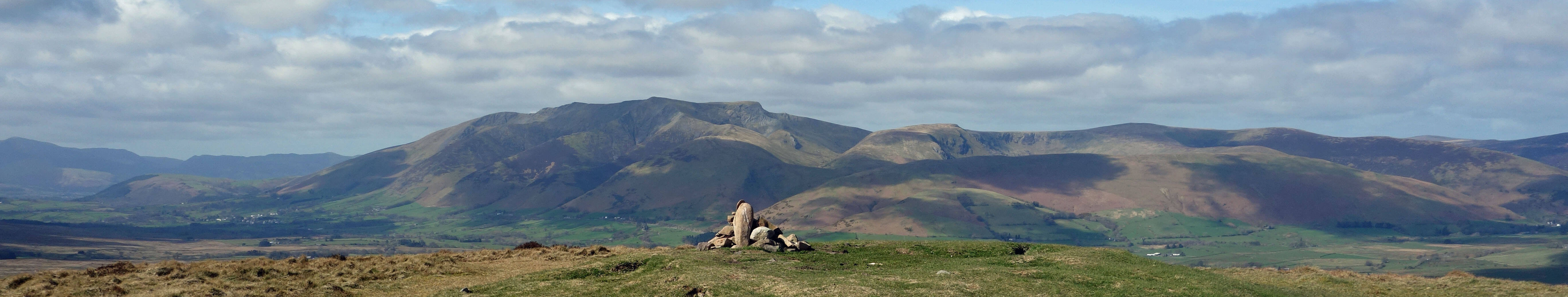
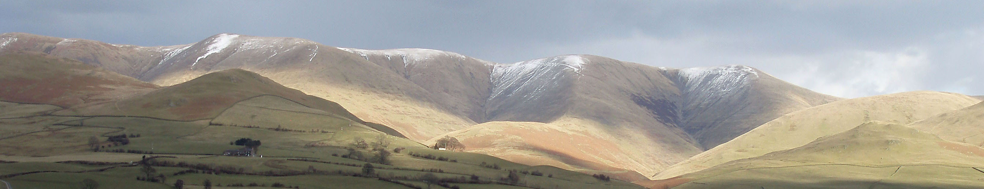
Top photo: The western Howgills from Dillicar;
Bottom photo: Blencathra from Great Mell Fell