Home
Preamble
Index
Areas
Map
References
Me
Drakkar
Saunterings: Walking in North-West England
Saunterings is a set of reflections based upon walks around the counties of Cumbria, Lancashire and
North Yorkshire in North-West England
(as defined in the Preamble).
Here is a list of all Saunterings so far.
If you'd like to give a comment, correction or update (all are very welcome) or to
be notified by email when a new item is posted - please send an email to johnselfdrakkar@gmail.com.
This is one of several relatively short items about local walks during the first
coronavirus lockdown, April - May 2020.
80. The Caton Moor Hares
The allowed duration of our daily walk was not specified in the instructions of March 23 or the
subsequent legislation. No medical expert has given a view (as far as I am aware) but Michael Gove
has (March 30): “Obviously it depends on each individual’s fitness but I would have thought that for
most people a walk of up to an hour, a run of thirty minutes … is appropriate”. If a celebrity such as
Sophie Raworth (BBC news presenter and marathon runner) can blatantly describe
online
a one-hour run in London then perhaps a nonentity (used to five-hour walks) can surreptitiously describe
up-to-two-hour walks about Brookhouse. If a one-hour walk on the streets of London is risky then a two-hour walk is doubly so. However, it is different walking about Brookhouse. After ten minutes walking I can be in open countryside and moorland, away from any habitation. I would see very few people, if any, and if I do there is plenty of space to keep away from them. I could walk for miles without touching anything. I may be safer on the moor than I am in my own house. So I hope that a two-hour walk is ok – but is that
wishful thinking?

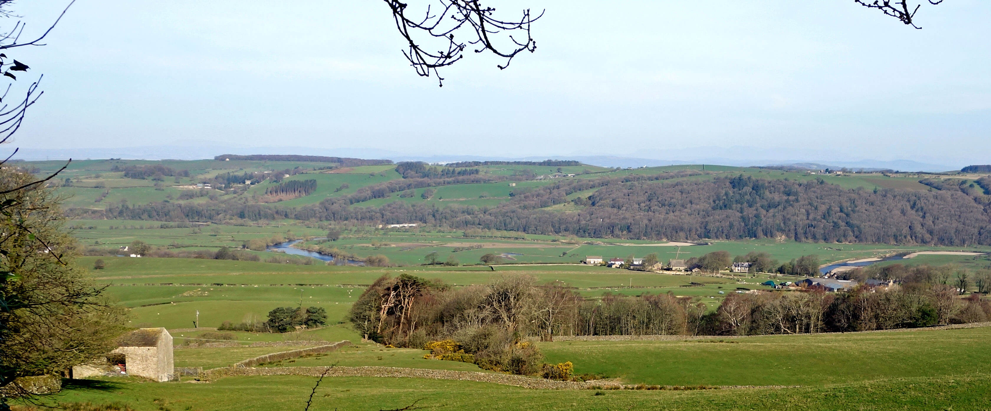
The Lune valley from Quarry Road
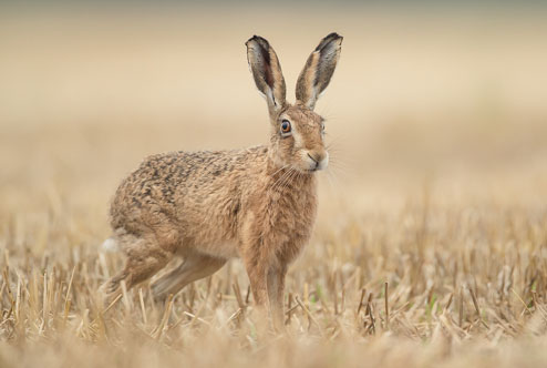
 Right: Brown hare (Photo: The Mammal Society).
It was a little hazy as we set off but it was a natural haze with none of the contrails that criss-crossed our skies in days that now seem long ago. We headed up Quarry Road to the windmills in order to look out for hares. We had seen one yesterday as we walked up the track from Moorgarth that sadly no longer continues as a permissive path up to the moor, where in the past I have more often seen hares. I once watched four hares running in great loops about the moor, like excited children in a school playground, pausing when their paths crossed for high-fives or fisticuffs.
The number of brown hares in Britain is thought to have dropped by over 80% in the last century. They must
have been numerous when, as mentioned in
Sauntering 71,
1,215 hares were killed by a group of eleven shooters in one day in 1877. It is hard to imagine
seeing 1,215 hares, let alone shooting them. It is still legal to shoot hare (in fact,
hare is the only British game species without a close season), although I don’t know why
anybody would want to. They can’t be much of a pest to farmers, their meat doesn’t appear
on menus much nowadays, and I don’t know what ‘fun’ there is to be had in shooting them.
It is mainly changes in farming practice, rather than shooting, that has reduced the number of hares. We now have large fields with a monoculture of grass, not the diversity that hares need, with fewer hedgerows and uncultivated areas for the hares’ young to lie low. The rough, long, scrubby grass of Caton Moor may be ideal for them, although they are generally considered to be lowland animals.
We completed the circuit around the upper windmills, accompanied by the usual curlews, lapwings, osytercatchers and skylarks, plus, oh no, a single jet sneaking and streaking high across the sky. We had an invigorating walk in a pleasant, stiff breeze, with good but not perfect views (the Lake District hills were just a faint, grey outline), but on this occasion we saw no hares. Wildlife cannot be seen to order. Hare yesterday, gone today.

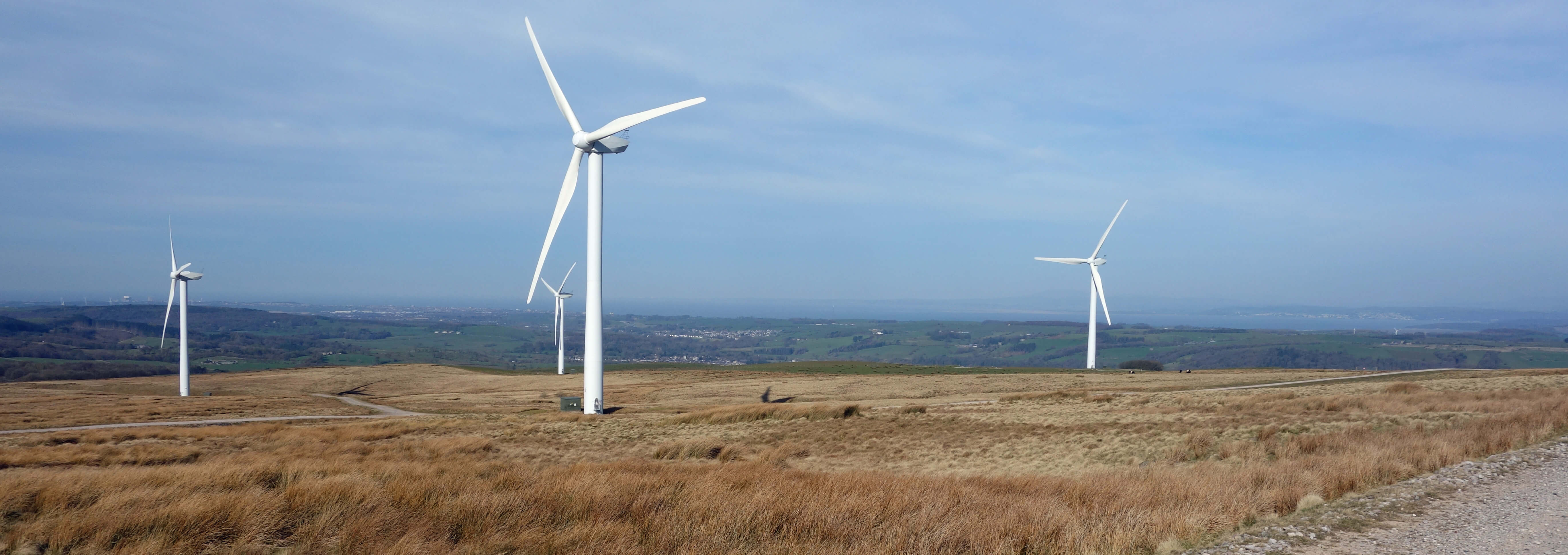
The Caton windmills
Date: April 5th 2020
Start: SD543644, Brookhouse (Map: OL41)
Route: SE, E on Quarry Road – picnic site – around the windmill track – and back
Distance: 5 miles; Ascent: 230 metres
Home
Preamble
Index
Areas
Map
References
Me
Drakkar
© John Self, Drakkar Press, 2018-

Top photo: The western Howgills from Dillicar;
Bottom photo: Blencathra from Great Mell Fell


 Right: Brown hare (Photo: The Mammal Society).

