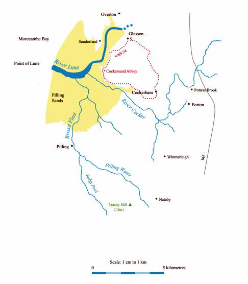
The Land of the Lune
Chapter 15: Into Morecambe Bay
The Introduction
The Previous Chapter (The Salt Marshes)
The road between Sunderland and Overton
The Lune from the Conder (continued) ...
The road south from Overton across Lades Marsh
leads to Sunderland, the end of the west bank of
the Lune. Unlike Overton, Sunderland has had
no new building for nearly a century. It looks like the
set for a film based in a 19th century fishing village, as
indeed it became in 2006 when used to film The Ruby
in the Smoke. With the tidal waters covering the road,
it is detached, both physically and mentally, from the
modern world.
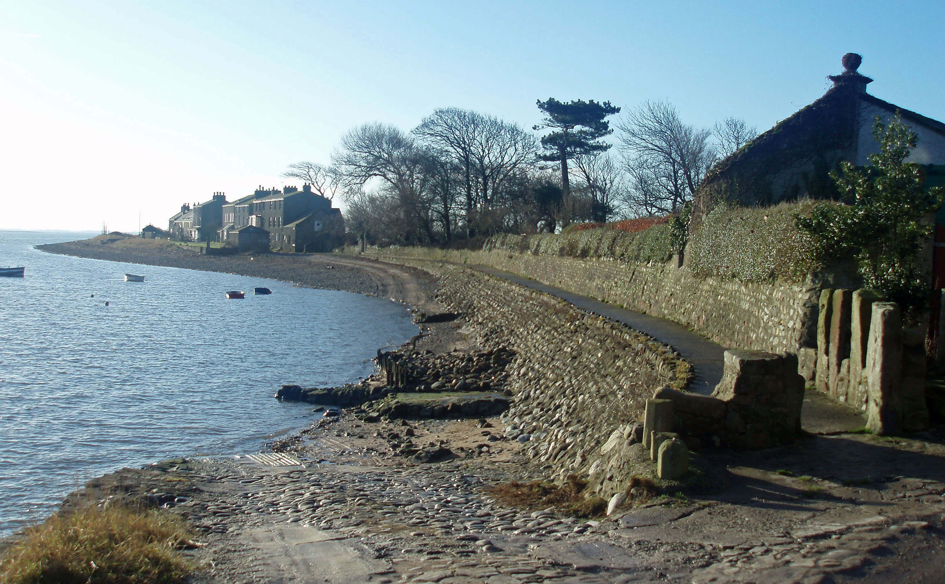 Right: Second Terrace, from First Terrace
It consists of two terraces, First Terrace and Second
Terrace, reasonably enough, and, a little apart, the
elegantly verandahed Old Hall, which bears a date of
1683. The hall became the home of Robert Lawson, a
Quaker merchant who built warehouses and workshops
at Sunderland for the complete building and fitting out of
ships. The houses all have their backs to the prevailing
westerly winds and hence have views across the estuary
to the masts of Glasson Dock and the Bowland Fells
beyond. There is even a glimpse of our old friend,
Ingleborough.
The terraced cottages are mainly 18th century, some
converted from the old warehouses. They have charm but
are not pretty as this is too tough a place for adornment.
A few cottages are named after the ‘cotton tree’, once
a feature of Sunderland but a victim of a gale in 1998,
after surviving for nearly 300 years. The tree was in fact
a female native black poplar, of which there are only two
in Lancashire (one is at Freeman’s Wood by Aldcliffe
Marsh). Or perhaps three, because there are apparently
shoots from the roots of the old Sunderland tree.
In front of the cottages a dozen boats rest at anchor
or doze on the mud, depending on the state of the tide. A
couple of them look like active fishing boats, a remnant
of the traditional occupation of Sunderland residents.
The heyday (such as it was, for Sunderland can never
have been much larger than it is now) was the period
from 1680, when it was recognised as a ‘legal quay’,
which meant that ships were allowed to unload goods
there, until about 1750, when St George’s Quay became
active. During that period, many ships avoided the
difficult journey up the Lune by having goods taken
ashore at Sunderland for transport across land or by
ferryboat to Lancaster. There was also a good trade in
towing or guiding boats up the estuary to Lancaster
but Sunderland’s business evaporated as fast as it had
begun, with the development of better docking facilities
in Lancaster, Fleetwood and especially Glasson.
After the demise of the port, Sunderland had an even
shorter-lived period of activity as a bathing resort. In the
early 19th century people became increasingly attracted
to sea bathing, although at first this was, for the sake
of propriety, not in the sea but in sea water within bath
houses. Sunderland was one of the first places to have
a bath house, with sea water being pumped into baths
at what was then the Ship Inn. By the 1830s, however,
the difficulties of access compared to Morecambe and
Heysham led Sunderland to become the quiet backwater
that it is today.
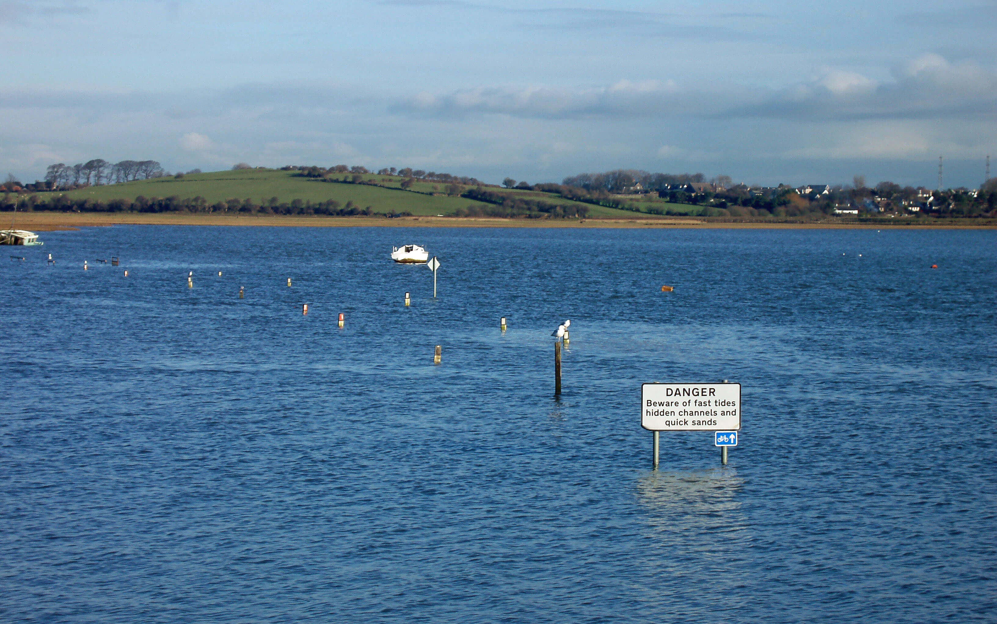
The most remarked upon feature of Sunderland
nowadays is that it is one of only two places in England
(the other being Lindisfarne) that is cut off twice a day
by the tide. However, this is only the case if lack of
vehicular access constitutes being cut off: Sunderland
can always be reached on foot from the west. It would
seem easy to provide a road on the landward side of
the flood embankment but no doubt the residents of
Sunderland want no more than the few visitors prepared
to make a committed effort to get there.
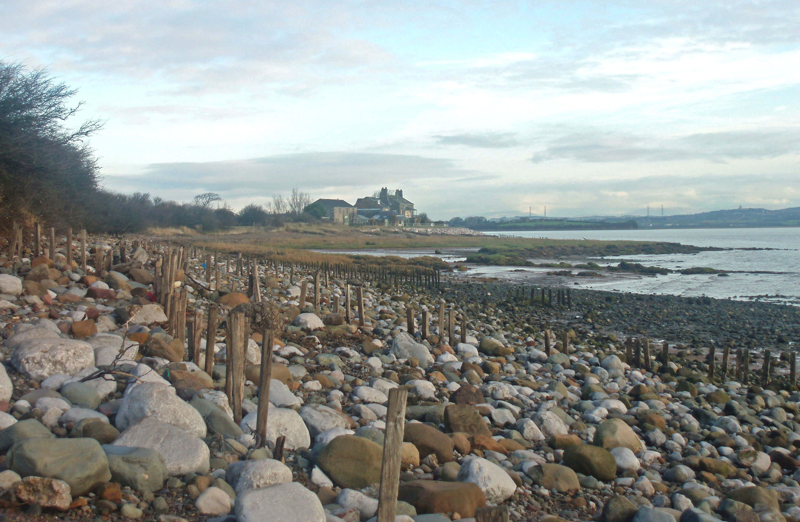 Left: Pebbles and old groynes (to reduce erosion) at Sunderland Point
The best way to visit Sunderland, where there is not
really much space to park a car anyway, is to park at or
cycle to Potts Corner on the Morecambe Bay shore and
then walk south along the coast. There are magnificent
views across the bay, with the Fylde coast to Fleetwood
to the south, the south Lakes coast to the Isle of Walney
to the north, and on the horizon the glinting blades of the
offshore wind turbines.
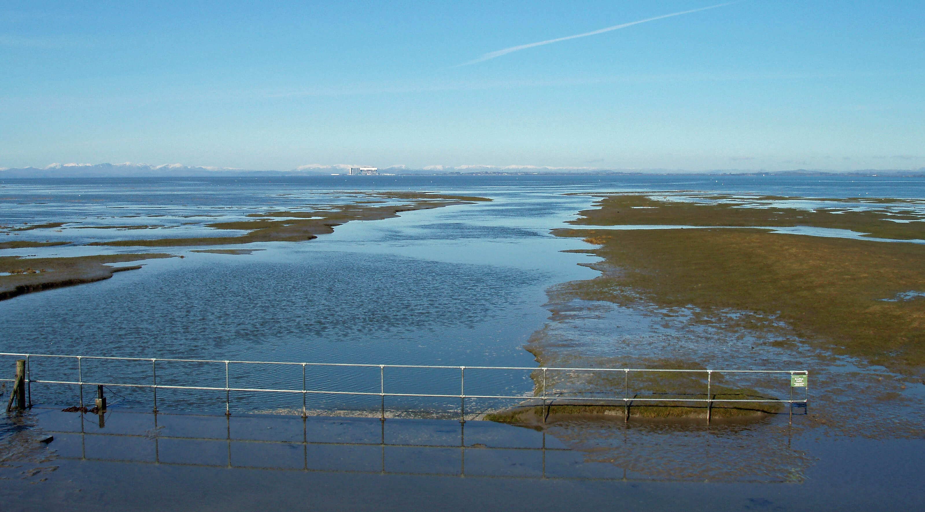
The mud and sea stretch for miles, glittering in the
sunlight and providing spectacular sunsets. There is the
odd abandoned craft and the perhaps odder individual
who feels confident enough about the tides and the mud
to venture far off shore but it is the enormous numbers
of wading birds that catch the eye. Morecambe Bay is
said to be the most important estuary in England for
its seabird and waterfowl populations, especially for
over-wintering birds – greylag geese, mallard, red-breasted merganser, pink-footed geese, pintail, pochard,
shelduck, shoveler, wigeon, and so on. Over 160 species
have been recorded. They are attracted, of course, by the
food in the mud, which may look unappetising to us but
contains, for example, about 5000 Baltic tellins, which
are small shellfish, per square metre (I have taken the
experts’ word for this).
If you keep your eyes to the west, as you should, you
will miss Sambo’s Grave, which is to be recommended.
This is apparently a tourist attraction but it is a tawdry
and maudlin site, a poignant but pathetic memorial
to our own inglorious past as much as to Sambo, a
slave who died at Sunderland in 1736: “here lies poor
Sambo: a faithful Negro”, isolated as a heathen unfit for
consecrated ground.
If you must look landward, look instead for the
Belted Beauty moth. This endangered moth has colonies
at only three sites in England and Wales and, until the
colony at Sunderland was confirmed in 2004, it was
thought to live only on coastal sand dunes. Here its
habitat is salt marsh, with sea rush and autumn hawkbit.
The males fly at night, as moths tend to do, and rest
during the day; the poor females are wingless.
Searching for moths in salt marsh is not to everyone’s
taste but the moths’ existence here is an indication
of the special nature of this vulnerable promontory.
If you continue the walk south to Sunderland Point
(there is no public footpath but I don’t think anyone
will object), you’ll see that the fields, some 2m above
beach level, are virtually unprotected and appear to be
crumbling fast under the western gales.
[Update: The point is now protected by large boulders.]
 Right: Hang glider over Sunderland
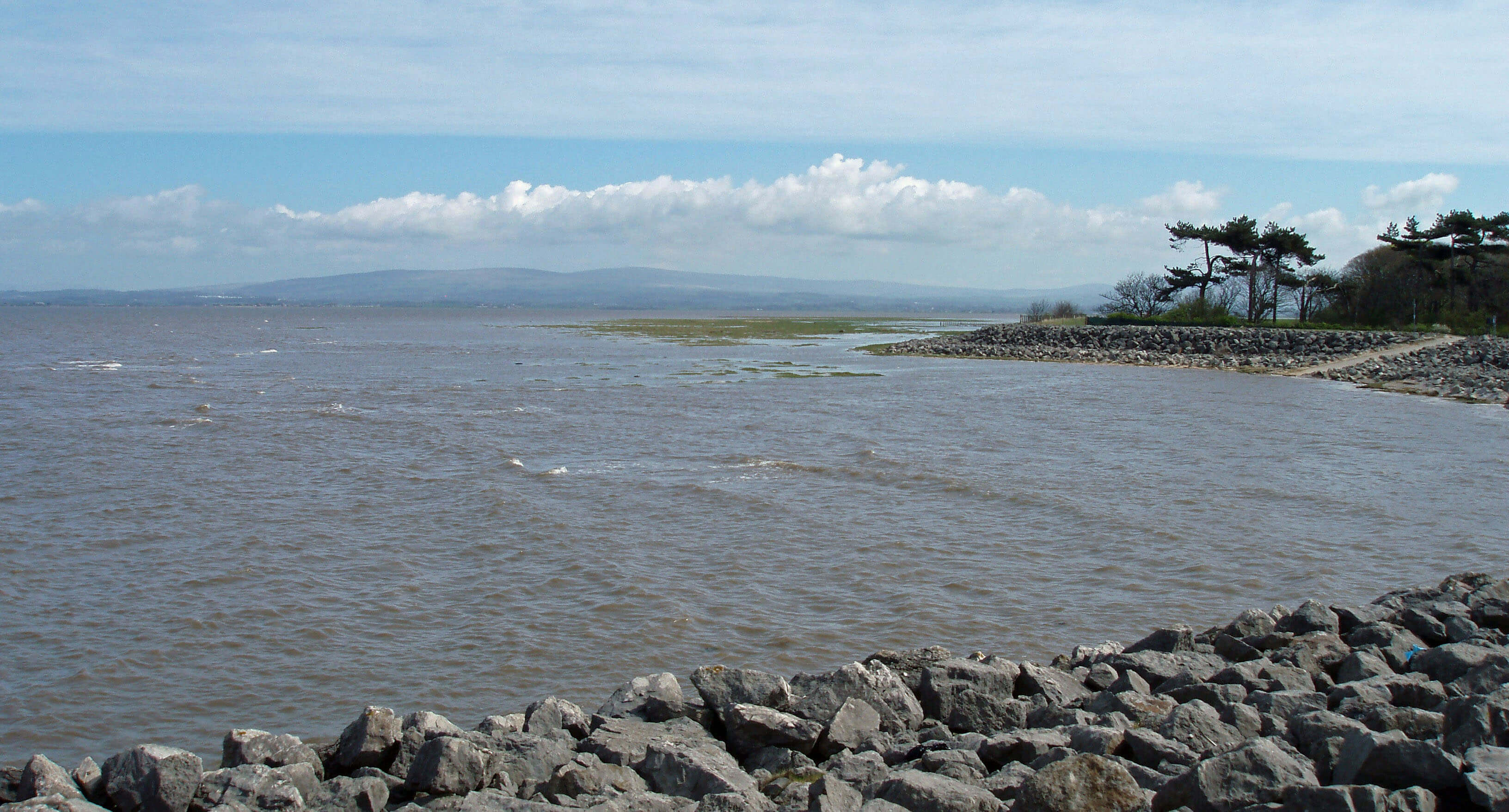
From the end of the promontory, we can see across to
the Plover Scar lighthouse and may fear that our journey
down the Lune and its tributaries has come to an end. But
if the beginning of a river is always a matter of debate,
so is its end. At high tide the Lune is 1km wide from
Sunderland Point and disappears into the wide expanses
of Morecambe Bay, but at low tide the Lune can be
considered to continue for a further 7km or so between
Cockerham Sands and Middleton Sands before finally
joining the waters of Morecambe Bay at the Point of
Lune. According to the Environment Agency by-laws,
the Lune estuary lies landward of a line from Knott End
jetty to Heysham No. 2 buoy and thence to Heysham
lighthouse. For the sake of completeness, then, we will
take the Point of Lune as the end of our story, which will
enable us to include the gentle tributaries of the River
Cocker and Broad Fleet.
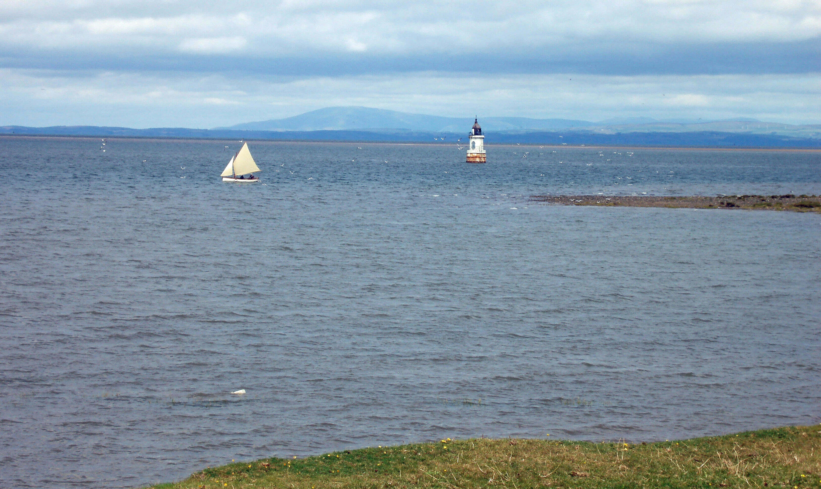
Plover Scar lighthouse
[Update: I received a nice letter from a man who recognised himself
and his wife in this photo. Actually, I think he recognised the boat! He said that he had made the
boat a few years earlier copying "a boat [his] grandfather had built 99 years ago in Overton on the
style of the local salmon fishing 'wammel' boats."]
The River Cocker
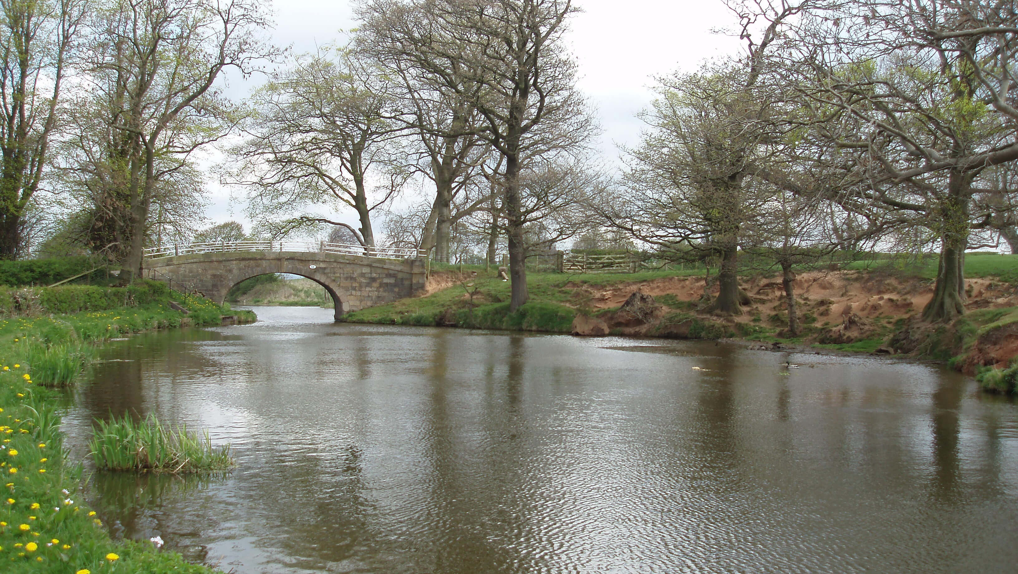 Left: Lancaster Canal near Winmarleigh
Right: Ellel Grange
The Cocker is barely large enough to be a river but is
not sprightly enough to be a beck. It arises north of
Cocker Clough Wood on a ridge between the Conder and
the Wyre, carefully avoiding both. It runs past Hampson
Green, under the M6 and railway line, past Bay Horse,
and is joined by Potters Brook just before crossing the
Lancaster Canal.
Potters Brook flows from Forton, known to many
through the distinctive Forton (recently renamed
Lancaster) Service Station, with its tower no longer a
restaurant-cum-viewpoint. For travellers from the south
the tower marks a gateway to the dramatic northern
landscapes. Forton has long been on travellers’ routes:
before the railway and canal, the Roman road from
Lancaster passed here, probably by Forton Hall Farm
and Windy Arbour. Today, Forton consists mainly of new
bungalows, plus the 1707 United Reformed (formerly
Independent) Church, with bright yellow door to enable
it to be located in the overgrown churchyard.
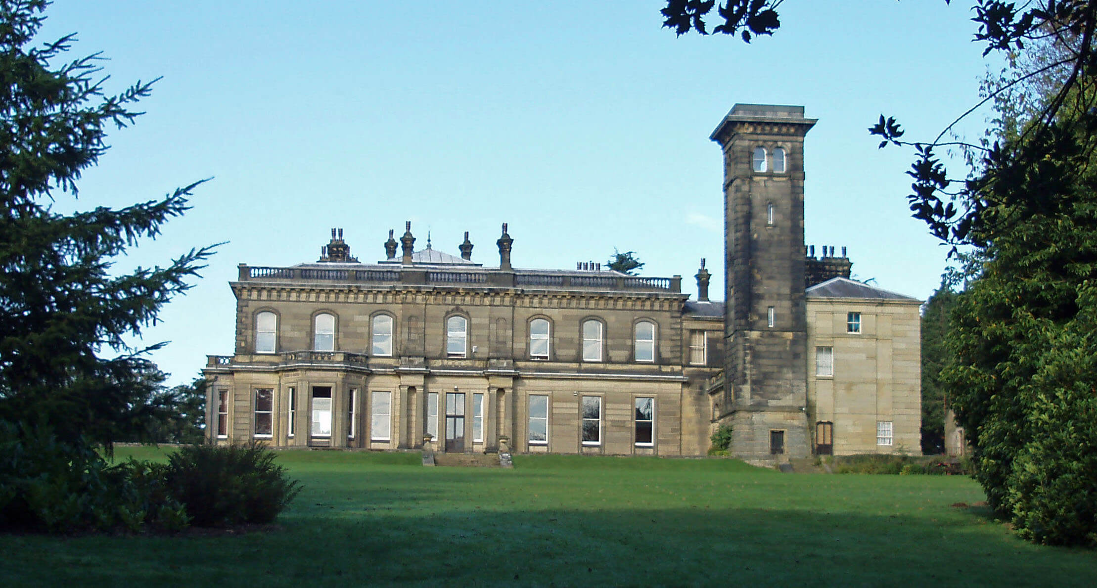
The Cocker swings north towards Ellel Grange.
This Italianate villa, as it’s always described, was built
in 1859 for William Preston, who became High Sheriff
of Lancashire in 1865. It is said to be modelled on Queen
Victoria’s Osborne House (completed in 1851), but then
so are innumerable contemporary British villas. The
grange is now the international headquarters and Special
Ministries Unit of the Ellel Ministries.
The Ellel Ministries make the name of Ellel known to
people throughout the world but few of those people are
aware that the name refers to a tiny village near Lancaster.
The story of the Ellel Ministries begins in 1970 when Peter
Horrobin was repairing a sports car and – here I must quote
from their website so that you don’t think me lacking in
due seriousness – “God spoke to him about how he could
straighten the chassis and rebuild the car, but much more
importantly, God could rebuild broken lives.” And if He
whispered ‘Ellel’ that was fortunate because apparently in
old English it means ‘all hail’.
When Ellel Grange came up for sale in 1985 Horrobin
raised nearly Ł0.5m from supporters to convert the grange
into a ministry. The Ellel Ministries are now an international
brand with branches in Australia, Canada, Germany, India,
Norway, Singapore, South Africa and the United States.
What do the Ellel Ministries do? This may be as
treacherous as the sands of Morecambe Bay, but I will
venture in. The mission is “to proclaim the Kingdom of
God by preaching the good news, healing the broken-hearted and setting the captives free.” In practice, this
means “discipleship, healing and deliverance training”.
The theology, however, is controversial. According
to others, the Ellel Ministries have “extreme doctrinal
positions on deliverance and demonology” that “are void of
biblical foundations”. A review of Horrobin’s book Healing
through Deliverance concluded that it argued that “those
who did not believe that Christians can be demonized …
are themselves demonized.” Verily, I should steer clear, at
least until my broken heart needs healing.
The Cocker continues south past Cockerham,
flowing under Cocker House Bridge, where there is
an old boundary stone. Cockerham is an old village,
appearing in the Domesday Book as Cocreham. Its
church, thought to have been founded in the 11th century
and rebuilt in the 17th century, 1814 and 1911, is a plain,
sturdy structure standing apart from the village.
At the north end of Cockerham is the vicarage built
in 1843 for the Rev. Dodson, whom we met in Littledale.
The earnestness we saw there is seen also in his
determination to rid Cockerham of all sinful activities,
such as cock fighting, hare coursing, horse racing and
even bowling. After the Rev. Dodson left, a public house
was built in 1871 without, it seems, unduly disturbing
the peace of the village. Apart from the pub, the only
other establishments in Cockerham today seem to be a
beauty salon and a funeral directors. I’m not sure if the
Rev. Dodson would approve of the implicit philosophy
of life.
The Cocker dawdles through flat land drained by
many ditches in Winmarleigh Moss. This is Lancashire’s
largest remaining uncultivated peat mossland,
supporting rare insect species such as the large heath
butterfly and bog bush cricket. Winmarleigh itself is
a scattered village. Winmarleigh Hall was built on the
site of Old Hall in 1871 for John Wilson-Patten, MP
for Lancashire North for 42 years. He became Baron
Winmarleigh, the first and last, as he outlived his two
sons and grandson. The hall is now owned by NST Travel
Group, which claims to be “Europe’s largest educational
and group travel company”. Residential visitors can
tackle a variety of challenging activities set out in the
grounds of the hall.
Beyond Cocker Bridge, the Cocker runs between
sea defence embankments built in 1981. In 1969 the
only colony of natterjack toads in Lancashire had been
found on Cockerham Moss. Natterjack toads are the
rarest of six British amphibians and are protected by
law. The site was washed over by the highest tides but
not after the wall was built. Perhaps coincidentally, the
colony became extinct after 1981. The Herpetological
Conservation Trust is now trying to restore the habitat
and reintroduce the natterjack toad.
Part of Cockerham Moss was enclosed only after
draining in the 19th century. The few buildings are
modern and of brick. The terrain is flat and featureless,
given over to sheep and cattle, with some arable farming
if dry enough.
Similarly, north of the Cocker Channel, lies the
flat drained land of Thurnham Moss. At the seaward
extremity of this bleak landscape are the remains of
Cockersand Abbey. The meagre remains today do
not indicate the extent and importance of the abbey.
Originally, the abbey stood up to where the sea wall is
now. Today, there are just a few stones scattered about
with only the chapter house still standing, partly because
it was used as a burial place after being adopted by the
Daltons. The red sandstone masonry of the old abbey
was re-used in nearby farm buildings and in the sea wall,
a somewhat ironic use of the stones since the abbots
lived in fear of being submerged by the sea.
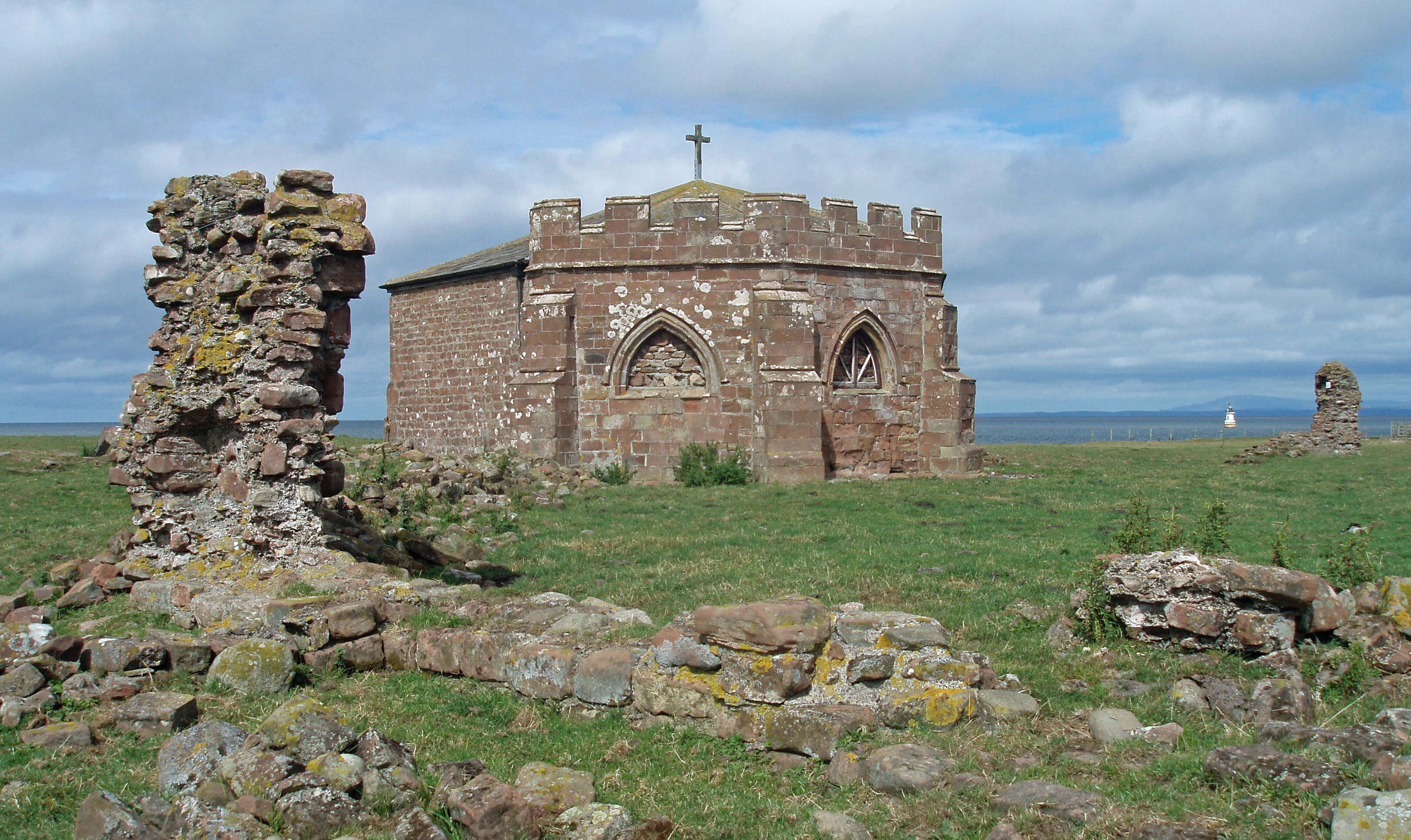
The remains of Cockersand Abbey
Cockersand Abbey was established as a monastic cell
in the 12th century by Hugh the Hermit, as he would need
to have been to choose this bleak, exposed, otherwise
godforsaken spot, cut off from the mainland by Thurnham
Moss. By 1190 this St Mary’s of the Marsh had become a
Premonstratensian abbey.
The abbey became very rich during the 13th century,
through being granted much land in the northwest of
England. At that time people were desperate to go to
heaven and believed that a prayer on their behalf from
monks would help. A gift to the abbey proved your piety.
The monk’s life was not entirely one of cloistered
contemplation. According to British History Online: in
1316, the abbey suffered badly from Scottish raids; in 1327,
a canon was pardoned for the death of a brother; in 1347,
the abbot and four canons were accused of using violence;
in 1363, the abbey was ravaged by plague; in 1378, the
king was begged for special compensation because “each
day they are in danger of being drowned and destroyed
by the sea”; in 1402, there was fear of violence from
parties with whom they were in litigation; in 1488, two
apostate canons were excommunicated, the brethren were
forbidden to reveal the secrets of the order, and two other
canons were accused of breaking their vow of chastity; in
1497, the canons were forbidden to “exchange opprobrious
charges” and to draw knives upon one other; in 1500,
various diseases were attributed to “inordinate potations”
and there were minor disorders, such as disobedience to the
abbot, lingering in bed and neglecting services on pretext
of illness.
It all gives new meaning to the Dissolution of the
Monasteries. At that time (1539) Cockersand was the
third richest abbey in Lancashire. Its annual income was
estimated at Ł157, revised (to no avail) to Ł282 after it was
decreed that monasteries with an income less than Ł200
would be taken over by the king. Its lands, valued at Ł798,
were bought by John Kechyn of Hatfield in 1544 and then
passed to Robert Dalton of Thurnham Hall.
Beyond the sea wall and embankment the Cocker
disappears into the mudflats of the Lune estuary and
Morecambe Bay, forming part of the Wyre and Lune
Sanctuary Nature Reserve, established as a national
wildfowl refuge in 1963. This affords protection for
internationally important numbers of wintering knot,
grey plover, oystercatcher, pink-footed geese and
turnstone. It also provides an important staging post for
birds such as sanderling. The embankment runs 8km
west, past the village of Pilling, and is crossed through
flood gates by Wrampool Brook and Broad Fleet.
Walk 24: Glasson, Cockersand Abbey and Cockerham
Map: 296 (please read the general note about the walks in the
Introduction).
Starting point: Near Glasson marina (446561).
This is a walk best done on a grey, rainy day with a strong westerly wind and a high tide – to better get into the spirit of the
place. (Only joking.)
Walk southwest through Glasson to Tithe Barn Hill, and then turn right along Marsh Lane to Crook Farm. Follow the sea
wall south to the Abbey Lighthouse Cottage, Plover Hill (7m high) and Cockersand Abbey, to which make a short detour. Across
the shimmering waters of Morecambe Bay, Fleetwood and the Isle of Walney may be seen.
Continue past Bank Houses and the Cockerham Sands caravan park, and along the 1km embankment. Turn right towards the
Patty’s Farm holiday cottages, before which you cut southeast through the Black Knights Parachute Centre, which may be busy
with planes and parachutists (but not if you’ve chosen a windy day). Across the fields, turn left on the A588 for 200m, and then
walk to St Michael’s Church. From the church take the path northeast to the Main Street of Cockerham.
Walk north through Cockerham and take the path northeast to Batty Hill. Continue north along a muddy track and then walk
northeast to Cock Hall Farm (the high point of the walk, at 27m). Turn northwest past Thurnham Church and walk through the
Thurnham Hall Country Club and across a field to Bailey Bridge. Cross the bridge and stroll along the canal towpath back to
Glasson.
[Update: It is best not to tackle this walk after a period of heavy rain,
when the fields will be waterlogged and the 'muddy track' I mentioned will be a pond.
I am advised that the footpath at Cock Hall Farm has been altered to go around the farm.]
Short walk variation: Follow the long walk past Bank Houses to the end of the embankment and then turn left instead of right.
Walk north either past the fishery of Thursland Hill or through Norbreck Farm, renowned for its pedigree Belgian Blue cattle.
Either way you will eventually reach Moss Lane. Continue due north, either across fields or on a quiet lane to the east, to cross
the canal and then turn left to the marina.
Broad Fleet
Broad Fleet slides into the Lune estuary from Pilling
Moss, via its tributaries of Pilling Water from
Nateby and Ridgy Pool from Eagland Hill. In the Lake
District a ‘water’ is a lake; Pilling Water is not a lake
but it flows little faster than one. And Ridgy Pool flows
like a pool.
Nateby and Eagland Hill are 10m above sea level
and some 10km from the Lune. Obviously, the region is
flat. There are long, wide views over large, rectangular
fields for cows, sheep and intensive crop production.
Given the monotonous terrain perhaps I should argue
that Broad Fleet is not really a tributary of the Lune and
not bother with this section. However, there is nowhere
that some expert in something doesn’t find engrossing.
Unfortunately for the visitor, the main interest here
is underground, where recent studies have revealed
unexpected insights into the past, present and possibly
future of Pilling Moss.
 Right: The rather serious Nateby church
The story begins with the Ice Age, when boulder clay
was dumped over the Fylde region, leaving occasional
small drumlins. By 4000 BC, the region had become a
forest, as shown by the large number of ‘moss stocks’,
that is, old tree trunks uncovered in the fields and dated
to that period. The roots were upright and the trunks had
been hacked off, showing that the trees were felled and
that there was a large local community to carry out this
arduous work.
This is supported by extensive finds of Neolithic
implements and the discovery of ancient earthworks
around Nateby. Today, the gentle undulations in the
fields appear unremarkable but aerial photographs reveal
various regular shapes, such as a 200m-diameter henge
dated to about 2500 BC. Many Bronze Age remains have
been found north of Nateby.
With the forest removed, the region became
heathland but after the climate became damper in about
1400 BC it slowly turned into a bog, a process thought
to have been complete by 800 BC. Old tracks, formed
by laying down tree trunks to cross the bog, have been
dated to that time. Over the centuries, layers of peat were
formed, the first 1m or so being of rough peat, from the
heathland vegetation, and then up to 4m of softer peat,
mainly from sphagnum moss. The extent of the bog can
be judged by the place names on today’s map: I counted
eight Moss Sides and three Moss Edges surrounding an
area of about 25 sq km.
During the investigations of the Nateby earthworks
a Roman road (or by-road) was discovered. It has been
traced to join the Roman road that we’ve followed
south from Lancaster and is believed to have continued
west, south of Pilling Moss, to meet a port on the River
Wyre. In the following centuries, habitation was limited
to the drumlins raised a metre or two above the bog.
Many farmsteads were drolly given a name with ‘hill’
in it. Unsurprisingly, there are few old buildings of
architectural merit. For example, the village of Nateby,
mainly a row of semi-detached houses today, was little
more than a church a century ago. The new buildings in
the region are mostly of red brick.
[Update: Experts now seem to doubt that what was discovered
was a Roman road. They seem unsure about the henge mentioned above too.]
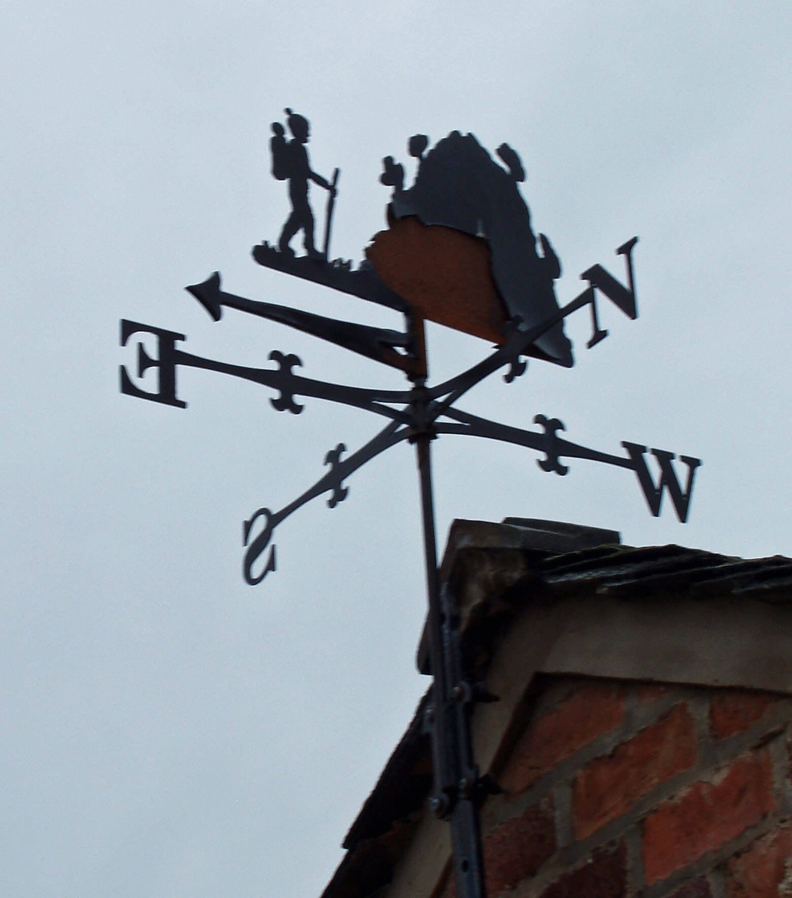 Left: The weather-vane at Island House
(exaggerating the steepness of the island a little)
Left: The weather-vane at Island House
(exaggerating the steepness of the island a little)
Pilling, however, is an old village, being owned by
Cockersand Abbey in the 12th century and passing to the
Dalton family in the 16th century. It was very isolated,
having the sea to the north and Pilling Moss to the
south. There are only two buildings that interrupt the flat
horizons: Damside mill and the church steeple.
The windmill was built in 1808 to a height of
22m, the tallest in Fylde. By the 1940s it had become
derelict but, rather miraculously, it has been restored
as a residence, complete with a traditional ‘boat top’,
installed in 2007. It puts into perspective a proposal for
two 125m wind turbines at Eagland Hill, which was
rejected in 2008.
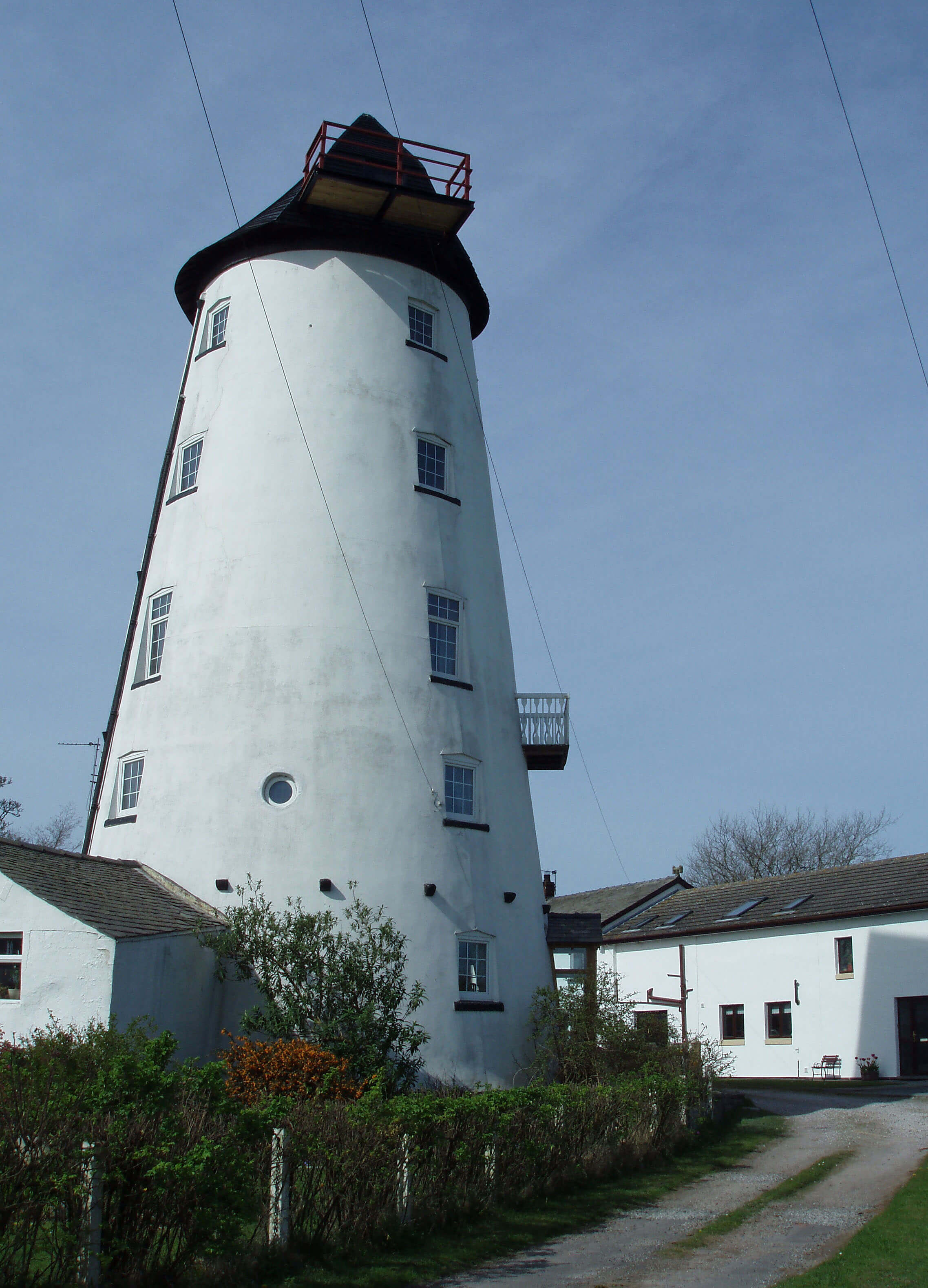 Right: Damside mill, Pilling
The steeple belongs to the St John the Baptist
Church built in 1887 by Paley and Austin again. Here,
they not only tackled the novelty (for Loyne) of a steeple
but enlivened it by using different coloured stones, such
as pink ones for the parapet. The church replaced one
that still stands in the field behind, with a date of 1717
over the door and a sundial bearing the name of George
Holden, who in Pilling literature is said to have “devised
the modern tide tables”.
On this journey I have learned to be wary of simply
repeating such claims. The facts are far from simple.
Holden’s Liverpool Tide Tables, said to be the first
high-quality such tables, were published for many years
from 1770. There were three George Holdens involved.
George I (1723-1793) was vicar of Pilling Church from
1758 to 1767, after which he moved to Tatham, to become
curate there until he died. George II (1757-1820) lived
in Horton-in-Ribblesdale, where he was a schoolmaster,
from 1783. He succeeded George I to the Tatham curacy
but still lived in Horton. George III (1783-1865) was
the curate at Maghull near Liverpool from 1811. I am
relieved that George III had no children.
The publication of the tide tables was passed on as a
lucrative family side-line. Notwithstanding the fact that
George I lived in the Pilling parsonage right beside the
tidal floodgates, Pilling’s pride in its involvement seems
exaggerated, for three reasons. First, the original tide
tables were published by brothers, George I and Richard
(1718-1775). Richard was a teacher in Liverpool,
specialising in mathematics and navigation. He seems
the more likely to have had the necessary skills to prepare
the tide tables. Secondly, the Holdens’ closely-guarded
‘secret method’ was checked against the meticulous data
gathered by William Hutchinson, the Liverpool dock
master. This data was never returned and I can find no
details of the ‘secret method’. Hutchinson himself had
theories about lunar effects on tides and the extent to
which the Holdens were dependent upon him is unclear.
Thirdly, none of the tide tables were produced while
George I was actually in Pilling: the Georges beavered
away on the tables while in Tatham, Horton and Maghull.
(I bet you wish now that I had just repeated the claim.)
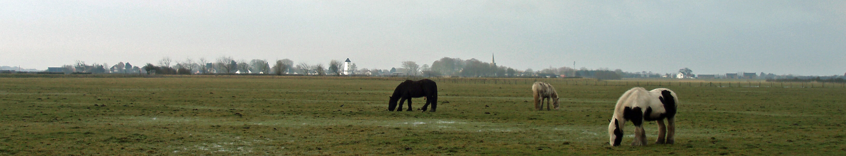 Left: Pilling from Lane Ends
Today, Pilling Moss is farming land, crisscrossed by
many ditches. It was drained in the 19th century, after
which it was possible to lay a railway line across it in
1870. The single-line track ran, rather informally, from
Garstang to Pilling and, later, Knott End. The ‘Pilling
Pig’, named from the sound of the engine or whistle,
became a familiar feature, and today a model of it stands
at Fold House as one of the few things for tourists to
look at. The line closed for passengers in 1930 and for
freight in the 1950s.
Once the bog had been drained, the peat began to
shrink and much of it was cut for fuel, an activity that
ended in the 1960s. The farmland is now lower (leaving
some lanes perched 1m or more above it), the rich soil is
disappearing, and, who knows, the area is ready for its
second flooding.
This is precisely what the Pilling Embankment
built in 1981 is intended to prevent. In the meantime,
the embankment provides (from the section open to the
public between Lane Ends and Fluke Hall) a view of
Broad Fleet seeping into Morecambe Bay, and of the
Lake District hills behind Heysham Power Station and,
suitably enough, of where we began, the Howgills, far
behind the Ashton Memorial. And to show that I am not
alone in considering this still to be within Loyne, the last
house as the road peters out beyond Fluke Hall is called
Lune View Cottage.
Broad Fleet entering Morecambe Bay
Here’s a fascinating fact that I’ve kept up my
sleeve in order to finish this flat Fylde section with a
flourish: when it’s in the mood, the River Lune can bring
700,000,000,000 litres of water into Morecambe Bay in
one day. We now know where they all come from.
Reflections from the Point of Lune
And so, at the Point of Lune, the waters of the Lune
and all its tributaries finally merge into Morecambe
Bay and the Irish Sea. The final sentence of Return to the
Lune Valley (2002) concludes that a tour down the Lune
valley is “an interesting journey and a pleasant one”.
‘Pleasant’ is perhaps as positive as one can be about the
Lune valley itself but it is possible to support a claim
that the wider area within the Lune watershed is the most
varied of any river in England.
Natural England has produced an analysis of
England in terms of 159 ‘National Character Areas’,
that is, areas that are “distinctive with a unique ‘sense of
place’”. The Loyne region includes parts of ten of these
National Character Areas. No other English river of the
size of the Lune and its tributaries, if any at all, passes
through so many Character Areas. In the following
review of our journey, the Character Areas are indicated
in italics.
The River Lune rises in the Howgills, which are
composed of ancient sedimentary rocks that have been
eroded into steep, rounded, grassy hills, incised by swift-flowing becks and grazed by sheep, but largely devoid of
people. As the Lune swings west, on its northern side are
the Orton Fells, composed of limestone. Below dramatic
limestone pavements, there is fertile soil supporting
improved pasture.
At Tebay, the Lune turns south and is joined by
becks from the western Howgills and, from the west,
from the Birkbeck and Shap Fells, part of the Cumbria
High Fells. Below Sedbergh, the Lune forms the western
boundary of the Yorkshire Dales Character Area, which
is not the same as the National Park. From the Yorkshire
Dales the major tributaries of the Rawthey, Dee, Greta
and Wenning flow. This part of the Yorkshire Dales
is mainly of limestone, overlain with sandstone and
siltstones, capped by millstone grit on the highest tops. It
includes some of the best limestone scenery in England,
with impressive pavements, gorges, potholes and cave
systems.
As the Lune continues south of Sedbergh, its western
watershed is much closer than that to the east. The rolling
semi-improved, upland pastures from Firbank Fell down
to Kirkby Lonsdale form part of the South Cumbria
Low Fells, which stretch west towards Windermere and
Coniston. From Kirkby Lonsdale the west bank of the
Lune forms the eastern fringe of the Morecambe Bay
Limestones Character Area, which extends to Kendal
and Ulverston.
To the east of the Lune south of Kirkby Lonsdale
is the Bowland Fringe, an area of lush pasture, hay
meadows, woodlands, marshes and becks, in which there
are many isolated stone farmsteads and small villages.
The pace of change is slow and many prehistoric features
survive, including traces of Roman roads. The Lune and
its tributaries are notable for the number of medieval and
later halls and manor houses, later adapted for a variety
of contemporary uses.
As the Lune flows on in its widening floodplain,
it is joined by becks from the Bowland Fells, an area
of millstone grit forming a wild, windswept, upland
plateau of bog and heath. Just north of Lancaster, the
Lune becomes tidal and enters the Morecambe Coast
and Lune Estuary Character Area. Here the low-lying
land is covered with glacial and alluvial deposits and
was once an area of fens, marshes and bogs. Today, it has
been largely drained to provide pasture but there are still
extensive areas of inter-tidal marshes. Finally, joining the
Lune estuary, are rivers and drainage channels from the
flat lands of the northern Fylde, part of the Lancashire
and Amounderness Plain.
From this great variety of landscape types derives
a range of human activities, although the Lune and
its tributaries remain relatively undeveloped. It also
provides such varied scenery and specific habitats for
wildlife that much of the area has been recognised
nationally and internationally, through designations as
parts of National Parks, Areas of Outstanding Natural
Beauty and Sites of Special Scientific Interest. Most
of the region is farmed but even the areas that seem
most like wilderness require a delicate balance between
conservation and development, between the past and the
future.
Even within such an apparently timeless region as
Loyne, the threat of the future looms. On many mornings
I set off to investigate a part of Loyne without a cloud
in the sky. As the day progressed and the boots became
muddier and the legs became wearier, so the sky often
became hazier. But this was usually not a natural haze.
It was caused by the vapour trails of the jets crossing
the Loyne skies. The Loyne is on a busy flight path:
often I could count a dozen or more jets in the sky at
one moment.
As I wander on the green hills and among the grey
villages of Loyne, many thousand people a day cross
the skies above me. Clearly, I am misguided. I am
envious of people who have acquired a sufficiently deep
appreciation of their local surroundings and can, in a
week or two, similarly appreciate wherever they are off
to. Perhaps I should join them, but I suspect that I will
look forward most to seeing those green hills and grey
villages out of the jet’s windows as I return.
The last view of the Lune, at high tide from the embankment beyond Fluke Hall,
with the Bowland Fells in the distance
References
Abram, Chris (2006), The Lune Valley: Our Heritage (DVD).
Alston, Robert (2003), Images of England: Lancaster and the Lune Valley, Stroud: Tempus Publishing Ltd.
Ashworth, Susan and Dalziel, Nigel (1999), Britain in Old Photographs: Lancaster & District, Stroud: Budding Books.
Baines, Edward (1824), History, Directory and Gazetteer of the County Palatine of Lancaster.
Bentley, John and Bentley, Carol (2005), Ingleton History Trail.
Bibby, Andrew (2005), Forest of Bowland (Freedom to Roam Guide), London: Francis Lincoln Ltd.
Birkett, Bill (1994), Complete Lakeland Fells, London: Collins Willow.
Boulton, David (1988), Discovering Upper Dentdale, Dent: Dales Historical Monographs.
British Geological Survey (2002), British Regional Geology: The Pennines and Adjacent Areas,
Nottingham: British Geological Survey.
Bull, Stephen (2007), Triumphant Rider: The Lancaster Roman Cavalry Stone, Lancaster: Lancashire Museums.
Camden, William (1610), Britannia.
Carr, Joseph (1871-1897), Bygone Bentham, Blackpool: Landy.
Champness, John (1993), Lancaster Castle: a Brief History, Preston: Lancashire County Books.
Cockcroft, Barry (1975), The Dale that Died, London: Dent.
Copeland, B.M. (1981), Whittington: the Story of a Country Estate, Leeds: W.S. Maney & Son Ltd.
Cunliffe, Hugh (2004), The Story of Sunderland Point.
Dalziel, Nigel and Dalziel, Phillip (2001), Britain in Old Photographs: Kirkby Lonsdale & District, Stroud: Sutton Publishing Ltd.
Denbigh, Paul (1996), Views around Ingleton, Ingleton and District Tradespeople’s Association.
Dugdale, Graham (2006), Curious Lancashire Walks, Lancaster: Palatine Books.
Elder, Melinda (1992), The Slave Trade and the Economic Development of 18th Century Lancaster, Keele: Keele University Press.
Garnett, Emmeline and Ogden, Bert (1997), Illustrated Wray Walk, Lancaster: Pagefast Ltd.
Gibson, Leslie Irving (1977), Lancashire Castles and Towers, Skipton: Dalesman Books.
Gooderson, Philip (1995), Lord Linoleum: Lord Ashton, Lancaster and the Rise of the British
Oilcloth and Linoleum Industry,
Keele: Keele University Press.
Gray, Thomas (1769), A Guide to the Lakes, in Cumberland, Westmorland, and Lancashire, Kendal: Pennington.
Halton Rectory (1900), Annals of the Parish of Halton.
Harding, Mike (1988), Walking the Dales, London: Michael Joseph.
Hayes, Gareth (2004), Odd Corners around the Howgills, Kirkby Stephen: Hayloft.
Hayhurst, John (1995), Glasson Dock - the survival of a village, Lancaster: Centre for North-West Regional Studies.
Hindle, Brian Paul (1984), Roads and Trackways of the Lake District, Ashbourne: Moorland Publishing.
Hindle, David and Wilson, John (2005), Birdwatching Walks in Bowland, Lancaster: Palatine Books.
Hudson, Phil (1998), Coal Mining in Lunesdale, Settle: Hudson History.
Hudson, Phil (2000), Take a Closer Look at Wenningdale Mills, Settle: Hudson History.
Humphries, Muriel (1985), A History of the Ingleton Waterfalls Walk, Ingleton Scenery Company.
Hutton, Rev. John (1780), A Tour to the Caves, in the Environs of Ingleborough and Settle, in the West-Riding of Yorkshire. With
some Philosophical Conjectures on the Deluge, Remarks on the Origin of Fountains, and Observations on the Ascent and
Descent of Vapours, occasioned by Facts peculiar to the Places visited, Kendal: Pennington.
Johnson, David (2008), Ingleborough: Landscape and History, Lancaster: Carnegie Publishing.
Johnson, Lou, ed. (2005), Walking Britain (on-line guide).
Johnson, Thos (1872), A Pictorial Handbook to the Valley of the Lune and Gossiping Guide to
Morecambe and District.
Jones, Clement (1948), A Tour in Westmorland, Kendal: Titus Wilson & Son.
Kenyon, David (2008), Wray and District Remembered.
Lancashire County Council (2006), Lancaster: Historic Town Assessment Report, Preston, Lancashire County Council.
Lancaster Group of the Ramblers’ Association (2005), Walks in the Lune Valley.
Lord, A.A. (1983), Wandering in Bowland, Kendal: Westmorland Gazette.
Marshall, Brian (2001), Cockersand Abbey, Blackpool: Landy.
Mason, Sara (1994), The Church and Parish of Tunstall.
Mitchell, W.R. (2004), Bowland and Pendle Hill, Chichester: Phillimore & Co. Ltd.
Mitchell, W.R. (2005), Around Morecambe Bay, Chichester: Phillimore & Co. Ltd.
Moorhouse, Sydney (1976), Twenty Miles around Morecambe Bay, Morecambe: Trelawney Press.
Morton, H.V. (1927), In Search of England, London: Methuen.
Pearson, Alexander (1930), The Annals of Kirkby Lonsdale and Lunesdale Today, Kendal: Titus Wilson & Son.
Penney, Stephen (1983), Lancaster in Old Picture Postcards, Zaltbommel: European Library.
Raistrick, Arthur, Forder, John and Forder, Eliza (1985), Open Fell Hidden Dale, Kendal: Frank Peters.
Roskell, Ruth Z. (2005), Glimpses of Glasson Dock and Vicinity, Blackpool: Landy.
Routledge, George (1854), A Pictorial History of the County of Lancaster.
Salisbury, John (2004), Nateby and Pilling Moss: the Pre-Historic Legacy, Pilling: Sue White.
Sellers, Gladys (1986), The Yorkshire Dales: a Walker’s Guide to the National Park, Milnthorpe: Cicerone Press.
Sharp, Jack (1989), New Walks in the Yorkshire Dales, London: Robert Hale.
Shotter, David and White, Andrew (1995), The Romans in Lunesdale, Lancaster: Centre for North-West Regional Studies.
Slater, David et al (1989), The Complete Guide to the Lancaster Canal, Lancaster Canal Trust.
Speight, Harry (1895), Craven and the North West Yorkshire Highlands, London: Elliot Stock.
Stansfield, Andy (2006), The Forest of Bowland and Pendle Hill, Tiverton: Halsgrove.
Swain, Robert (1992), Walking down the Lune, Milnthorpe: Cicerone Press.
Trott, Freda (1991), Sedbergh, Sedbergh: T.W. Douglas & Son.
Trott, Stan and Trott, Freda (2002), Return to the Lune Valley, Kendal: Stramongate Press.
Wainwright, Alfred (1970), Walks in Limestone Country, Kendal: Westmorland Gazette.
Wainwright, Alfred (1972), Walks on the Howgill Fells, Kendal: Westmorland Gazette.
Wainwright, Alfred (1974), The Outlying Fells of Lakeland, Kendal: Westmorland Gazette.
Wainwright, Martin, ed. (2005), A Lifetime of Mountains: the Best of A. Harry Griffin’s Country Diary, London: Aurum Press Ltd.
Wellburn, Alan R. (1997), Leck, Cowan Bridge and the Brontës.
White, Andrew (1990), Lancaster: a Pictorial History, Chichester: Phillimore & Co. Ltd.
White, Andrew, ed. (1993), A History of Lancaster, Keele: Ryburn Publishing.
White, Andrew (2004), Life in Georgian Lancaster, Lancaster: Carnegie Publishing.
Wildman, Dorothy (2004), Caton as it was.
Williamson, Peter (2001), From Source to Sea: a Brief History of the Lune Valley.
Wilson, Stephen (1992), Geology of the Yorkshire Dales National Park, Skipton: Yorkshire Dales National Park Committee.
Wilson, Sue, ed. (2002), Aspects of Lancaster, Barnsley: Wharncliffe Books.
Winstanley, Michael, ed. (2000), Rural Industries of the Lune Valley, Lancaster: Centre for North-West Regional Studies.
Back Cover Blurbs
“This is not a walking book although it does give 24 descriptions of walks and it’s not a history book - and does give
more history of the area than most of us dreamt of. The Land of the Lune is best described as a book of the Lune
landscape. It uses the language and stories of people who live there now and in past centuries, but I am left with a more
powerful impression of the hills, valleys and rivers that will outlast us all. John Self has clearly explored the Lune
Valley thoroughly. His love for the landscape comes through in his words complemented by his colour photography.”
(Lancaster Guardian, in describing its “Books of 2008”)
“... 230 extremely interesting pages on the areas of the Lakes, Yorkshire Dales and Lancashire through which the Lune
makes its way to the sea via Morecambe Bay.” (The Dalesman Magazine)
“The Land of the Lune is a guide to the region within the Lune watershed ... areas of England we know and love for
reasons which become obvious as you flick through this glossy paperback and see some of the stunning images captured
on camera ... Well-known peaks, pathways, becks and bridges litter the 230 pages and the author visits man-made
features of interest as well as exploring the way the landscape has developed over the centuries ... It is well-researched
and comprehensive.” (Westmorland Gazette)
“The Lune is one of Cumbria’s overlooked rivers, perhaps because the county has to share it with Yorkshire and
Lancashire ... Yet between its birth in the Howgill Fells and its end in Morecambe Bay its sixty-six miles drain a vast
area of hill country, claiming parts of Mallerstang, Whernside, Ingleborough and the Forest of Bowland in its domain.
John Self traces the course of the river and its tributaries with a collection of walks to help readers explore this unfairly
neglected watercourse.” (Cumbria Magazine)
“ ... a quality guide to the region of northwest England that lies within the Lune watershed. Filled with detail and colour
photographs.” (Carnforth Books)
“I would like to offer my congratulations on a fascinating and masterly piece of work. The range of your study is vast,
and I have learnt a great deal about an area which I thought, mistakenly, I knew something about!” (JS, Caton)
“If you have produced and published this beautiful book ‘all by yourself’ then I am amazed!!” (JH, Stockport)
“My wife recently gave me your book which I have enjoyed immensely. It is the first one where the author has delved
into the furthest reaches of the tributaries.” (JT, Kirkby Lonsdale)
“An extremely interesting and well produced book with a lot of information for anyone interested in visiting that area
of Cumbria and Lancashire.” (A review on Amazon)
“The book is well written by someone with a sense of humour and provides the keen walker and those just seeking
information about the Howgill hills a great reference book ... A real good read.” (Another review on Amazon)
“... a very nice book, obviously loads of research, good pictures and well written.” (LS, Preston)
“... attractive and helpful to a rambler like myself.” (JI, Lancaster)
“I enjoyed every page, and it won’t be long before I start all over again - as you do with excellent books.” (RH,
Bangor)
Carlin Gill from Grayrigg
The Introduction
The Previous Chapter (The Salt Marshes)
© John Self