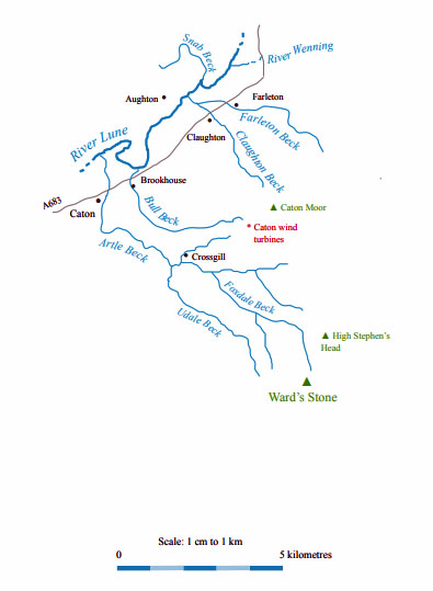
The Land of the Lune
Chapter 12: The Lune Floodplain and the Top of Bowland
The Introduction
The Previous Chapter (Wenningdale, Hindburndale and Roeburndale)
The Next Chapter (The Lune to Lancaster)
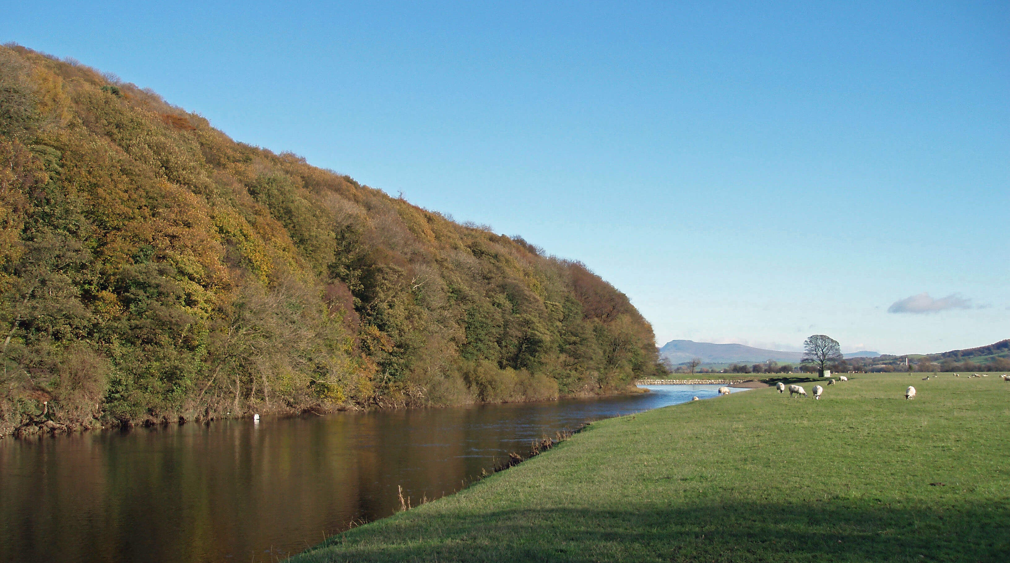
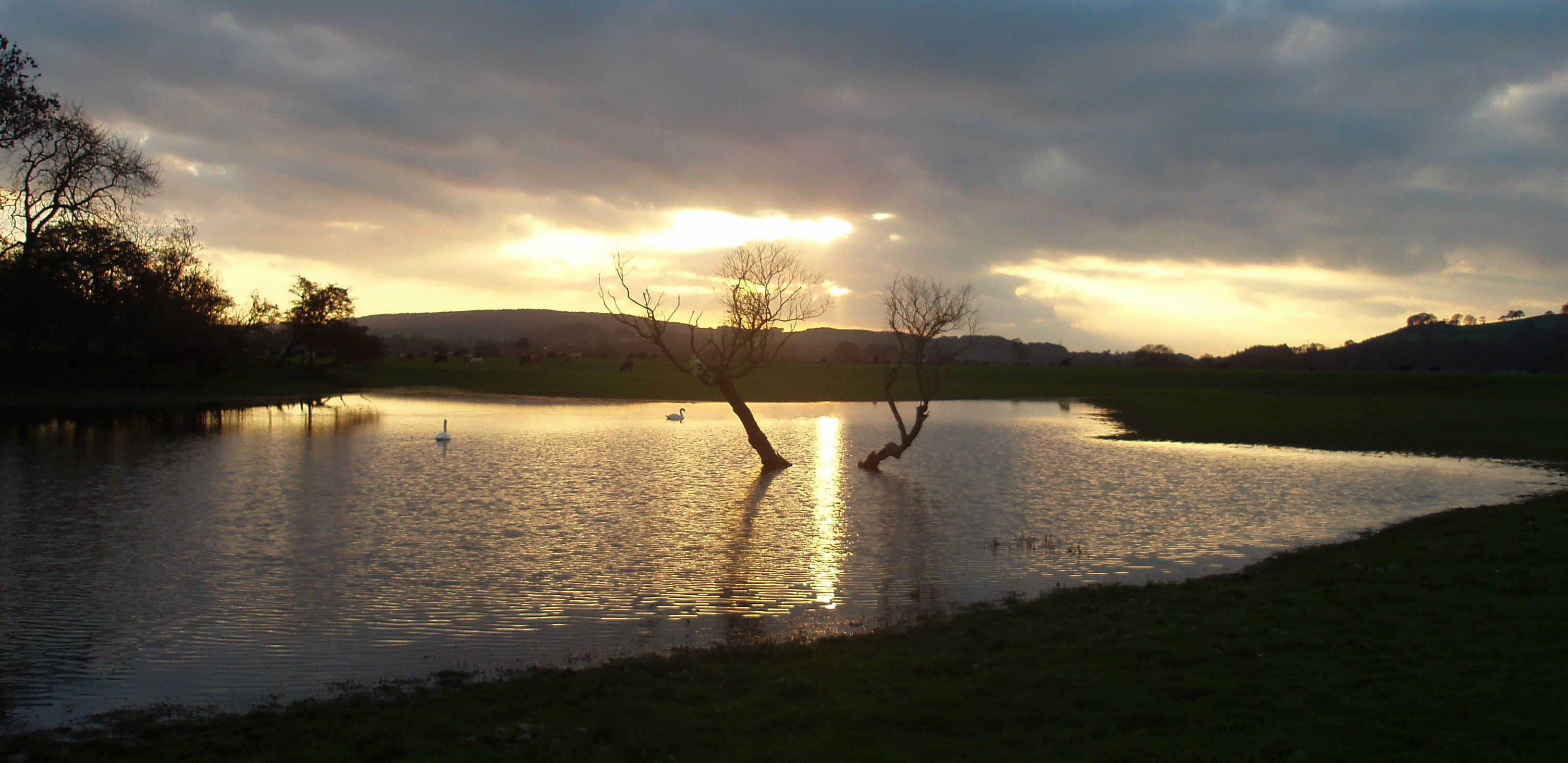
The Lune at Lawson’s Wood
The Lune from the Wenning ...
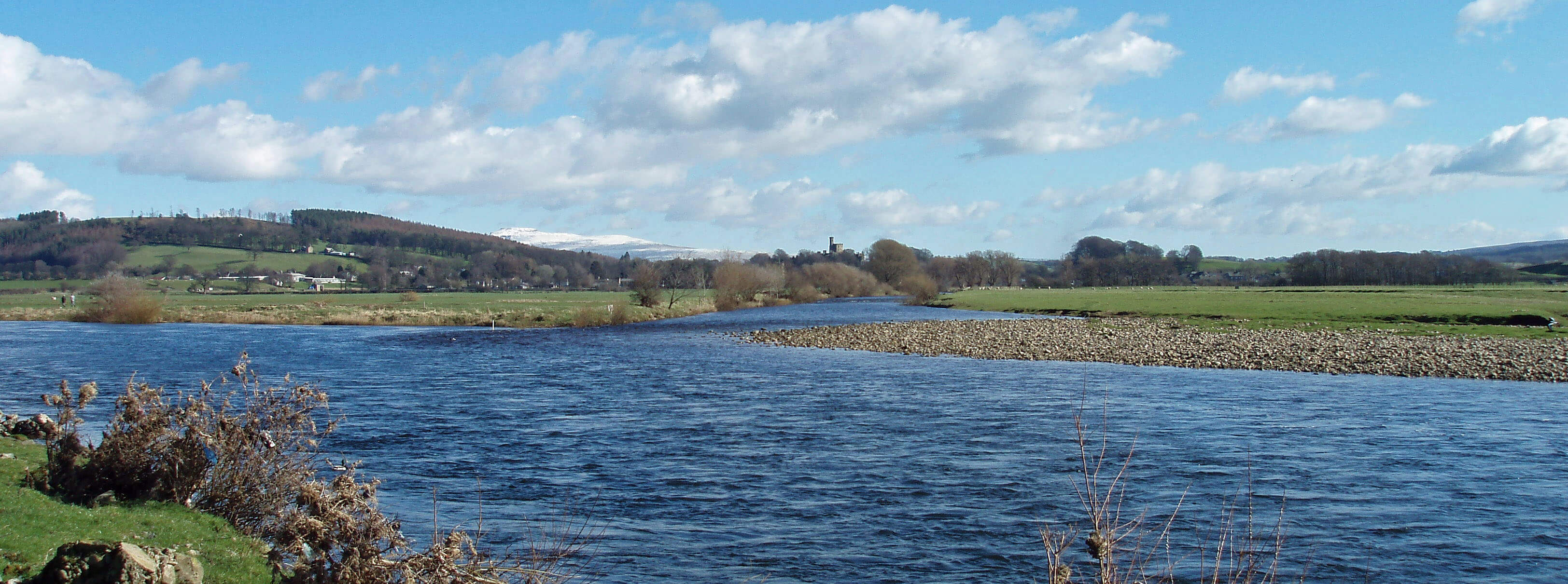 Right: The Wenning joins the Lune
The augmented Lune flows in the middle of
its floodplain and there is naturally a sense of
remoteness, with wide views back to Hornby and
across to Claughton Moor. Birds of the river congregate
here and noisily object to being disturbed. In early spring
hundreds of curlew gather on the flat fields on their way
upriver to their breeding grounds.
There are footpaths on both banks of the river,
although walkers are rare in the middle section. On the
east bank, a permissive path from Hornby eventually
joins the public footpath below Claughton and on the
west bank the Lune Valley Ramble continues. The
Ramble cuts across from the Lune to The Snab, leaving
a long sweep of the Lune to the birdlife. The ponds that
have formed here are well used by swan, coot, moorhen
and heron. Above The Snab, on the footpath to Eskrigge,
there are good views across to Hornby, with Ingleborough
behind, and it’s also possible to see the flat green centre
of the ancient moat near Camp House.
[Update: There is no longer a bridge across
Claughton Beck - and I'm not sure if the permissive path still exists.]
Snab Beck makes its way to the Lune, running from
Higher Snab through a deep, wooded gully. The beck
used to be a fast-flowing tributary of the Lune until its
banks were silted up from the trampling of cattle and
sheep. The Lune Rivers Trust has tried to restore the beck
to its former state in the hope of attracting back wildlife
that has been lost, such as otter and water vole. Otters
are regularly recorded within Loyne but not so regularly
that the event is not thought worth recording. They have been
seen between Arkholme and Caton quite often and also
upriver at Tebay and Sedbergh and on the Wenning and
Roeburn tributaries. Water voles are thought to have
declined by over 90% since 1960 because of loss of
habitat and predation by the American mink that has
escaped from fur farms. The water vole was given full
legal protection in 2008.
Snab Beck now runs below the footpath and then
out to a large isolated pond, before following a route
west back to the Lune, which is soon joined on the
opposite bank by the combined forces of Farleton Beck
and Claughton Beck.
Farleton Beck and Claughton Beck
Farleton Beck and Claughton Beck are usually small
and sluggish but it is not always so. In 1967, on
the day of the Wray flood, similar but not so extensive
damage was caused in the villages of Farleton and
Claughton, through which the becks flow. The level
of the flood is marked on the wall inside the Fenwick
Arms.
Farleton is a cul-de-sac of mainly new houses lined
up around the old farms of Bank House and Brades.
Farleton’s only claim to fame is that in 1920 the owner
of the garage that used to exist next to the Old Toll
House was the first to paint white lines on a road, in
order to help motorists negotiate the dangerous corner.
This fact is so often repeated that it has become a self-evident truth. However, it is my sad duty to report that
many websites assert that Edward Hines, traffic engineer
of Detroit, used white lines in 1912. Ah well, it wasn’t
such a glorious claim to fame, anyway.
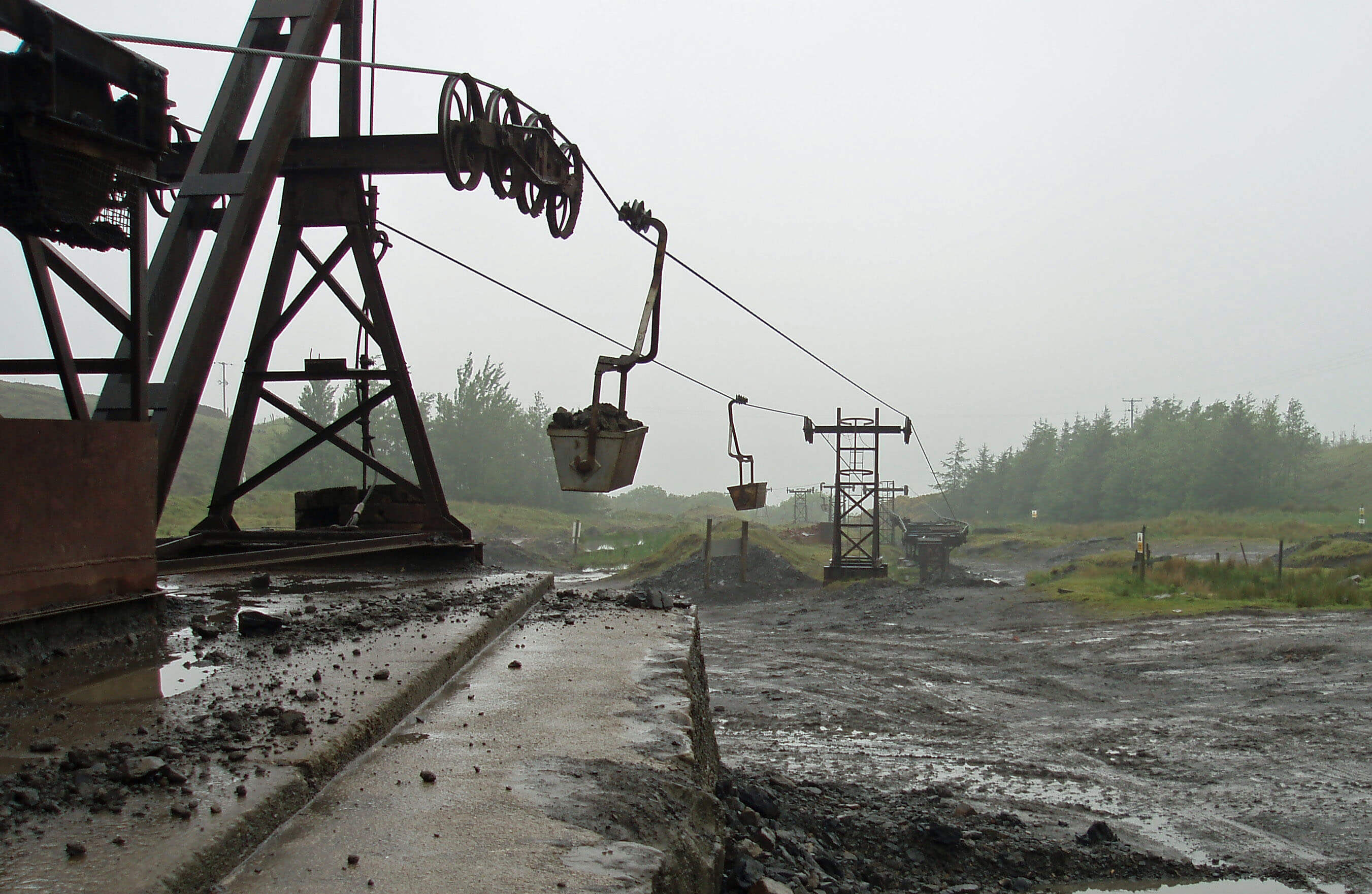
 Left: The clay pit of Claughton brickworks
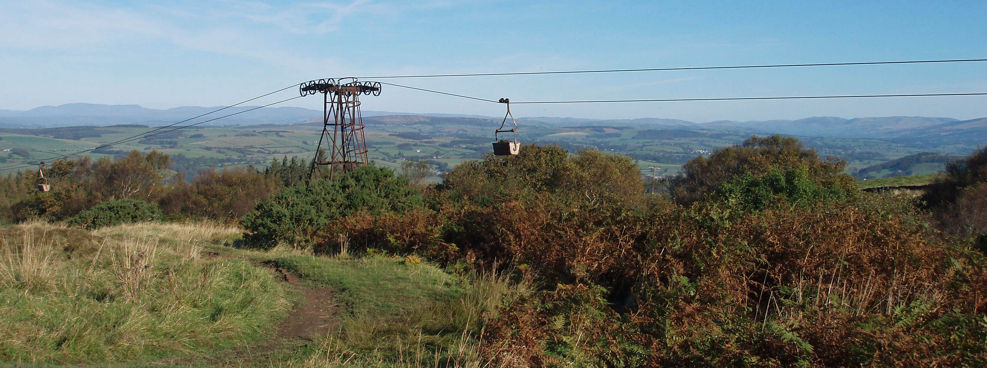
Right: The Claughton ropeway
Claughton Beck arises on Claughton Moor and runs
through the clay pit of Claughton brickworks, now owned
by Hanson Brick Ltd. This industry has survived, against
the odds, since the late 19th century. One of the aerial
ropeways installed in about 1900 is still used to bring
down the clay and shale from the moor and is thought to
be the last such ropeway still in use in England. The view
into the pit, with the buckets swinging overhead, is a
glimpse of a bygone industrial age. The pit, incidentally,
is not as large as might be imagined for a century’s
worth of bricks but for those concerned that the whole
of Claughton Moor might eventually be carried away in
these buckets it is reassuring that planning permission
for mineral extraction ends in 2018. The pit is due to be
returned to a natural state by 2020. Actually, quarrying to
the south and west of the pit has already ended, as rock,
rather than shale, has been reached but enough shale to
last about forty years lies to the east of the present pit. No
doubt, an application to extend the present permission
will be made in due course.
[Update: Yes, the permission was extended.
It now runs to 2036. I am now doubtful that one of the present ropeways was
installed in about 1900. At that time, the present clay pit did not exist.
Clay then was taken from lower down the hill. After a dormant period, because of
the financial crisis of 2008, the pit and ropeway were refurbished during the 2010s.]
Halfway down the hill, Claughton Beck runs
behind Claughton Hall, which has a magnificent view
of Ingleborough and the Howgills. The hall, parts of
which are said to be of the 13th century, looks grim and
austere, with its front always in the shade. It is hard to
get a close view of the hall because it is surrounded by
fences, plantations and the bank of a large, new pond.
There are two unequally large, stern towers, with oddly
placed small windows and uneven roofs, and tall, narrow
chimneys. It is difficult to believe that in the 1930s this
hall was moved stone-by-stone from its position in
Claughton and rebuilt to the original plan here, without
the opportunity for more substantial change being taken.
Perhaps the labourers reflected upon this while, as they
hauled the stones up, the clay for new bricks was passing
down over their heads.
Claughton Hall is owned by the Oyston family,
which may explain its increasing reclusion. Owen
Oyston, a media tycoon, was jailed for six years in 1996
after being controversially convicted of rape. After a
groundbreaking legal battle to establish that it wasn’t
necessary to admit guilt first, he was released on parole in
1999. But his trademark sheepskin coat and large fedora
have gone, and no longer do the bison roam extrovertly
in the field in front of the hall as they used to.
Claughton Hall Farm, an old building of character,
was left where it was, next to St Chad’s Church, a
medieval church re-built in 1815. One of the two bells is
dated 1296, making it the oldest dated bell in England.
As with Farleton’s claim to fame, I am afraid that I have
to pour some cold water. In 2002 St Chad’s was declared
redundant and permission granted for it to be converted to
residential use. In 2005 there was a planning application
to remove the bells so that they may be displayed in
St Margaret’s Church, Hornby, although in 2009 they
seemed to be still with St Chad’s.
The Lune from Farleton Beck and Claughton Beck ...
Sunset over a Lune-side lagoon
The Lune Valley Ramble passes Afton Barn
Cottage, which is a kind attempt to help us with
the pronunciation of the village above it, Aughton. I’m
tempted to suggest an extra f is needed but it depends
on how you say “good afternoon”. Although most of
Aughton’s buildings have been adapted for Lancaster
commuters, one or two barns managed to survive until
the present ban on conversion came into force. The
houses are arranged around a triangle, mainly on the two
quiet sides (not that the third side is busy).
The village stirs itself every 21 years for the
Aughton Pudding Festival, at which the ‘world’s largest
pudding’ is prepared. In the 18th century, Aughton, like
other Lune villages, made baskets from osiers, which
were made more supple by boiling. In 1782 someone
had the bright idea to use the osier-boiler to make a large
pudding, which became a tradition, which then lapsed
and was revived in 1971. On the last occasion a concrete
mixer was used. Why 21 years? I suppose it takes that
long to forget what a jolly silly idea it is. (It is said to be
because they used to cut the willow beds down every 21
years but does that require a large pudding?) Note it in
your diary: the next great pudding is due in 2013.
[Update: The 2013 Pudding Festival did happen, but with
relatively little fanfare. Perhaps it will lapse in 2034?]
Above Aughton, at appropriately named Whinney
Hill, is the Thoroughbred Rehabilitation Centre, opened
by Princess Anne in 2007. This transferred here from
Nateby, near Preston, and is said to be Europe’s first
charity dedicated to the welfare of ex-racehorses.
Aughton Woods line the steep northern slopes
above the floodplain. These woodlands have probably
never been cleared and include many species, such
as birch, oak, elm, ash and, notably, the small-leaved
lime. The woods, however, are not entirely natural, as
there are remains of about thirty charcoal hearths and
much sycamore, an alien tree, has had to be removed.
The Wildlife Trust manages parts of the area, some of
which are County Biological Heritage Sites. There are
permissive footpaths in Burton Wood and Lawson’s
Wood, allowing extensive banks of bluebells to be
viewed in spring.
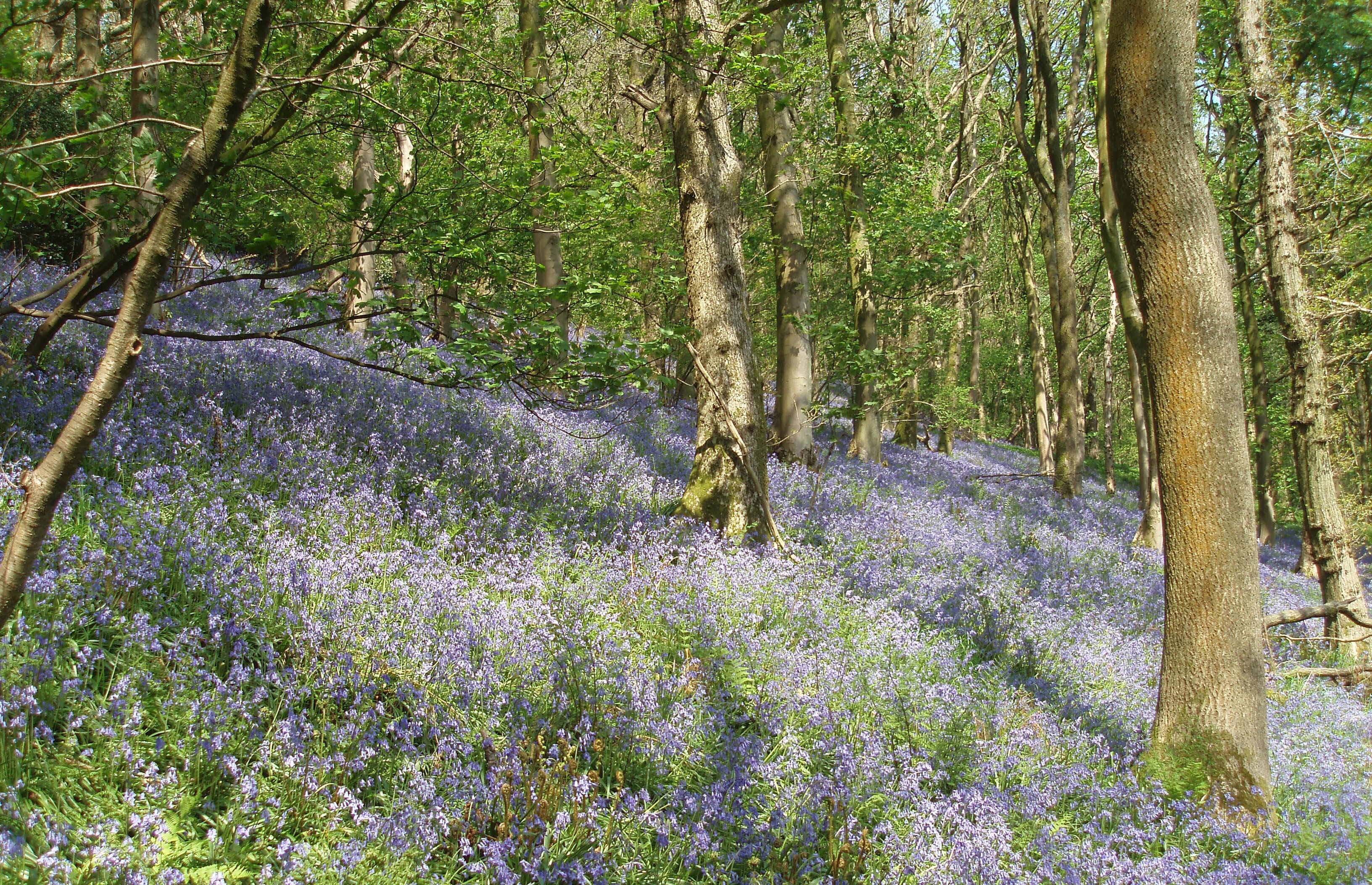
Bluebells in Burton Wood
Opposite Burton Wood the Lune turns on a huge
meander. The lines of the parish boundaries and the
public footpaths show that the course of the Lune has
changed here. For some years the owner of the land on
the south bank, eroded by the Lune, insisted that walkers
must follow the official line of the footpath, that is, into
the middle of the Lune. Happily, a permissive path on
the bank was eventually agreed.
At the furthest point of the meander the Lune runs
by the dismantled Wennington-Lancaster railway line,
which at this point forms the beginning (or end) of the
River Lune Millennium Park, a leisure area leading to
Salt Ayre in Lancaster. Here also Bull Beck joins the
Lune.
Bull Beck
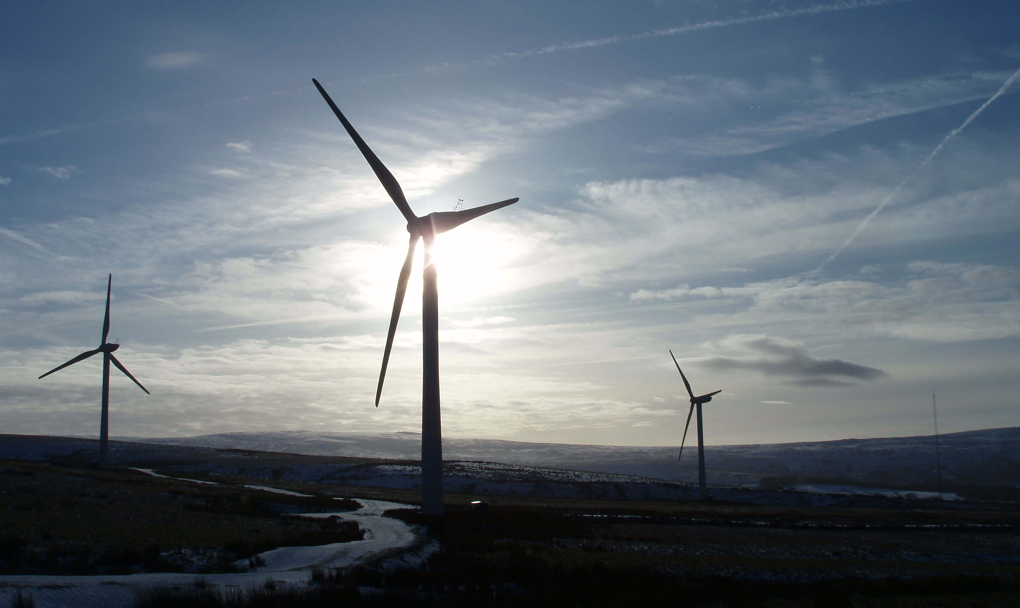 Right: The wind turbines on Caton Moor
Bull Beck rises as Tarn Brook – a name whose
significance you may ponder for a minute – in the
shadow of the Caton wind turbines and near the spoil
heaps of the disused Claughton Quarries. The new picnic
site at the top of Quarry Road provides a fine view over
the Lune valley to the Lakeland hills, accompanied by
the hum, or more often the squeal, of the wind turbines.
Tarn Brook runs through a narrow wooded valley in
a region of old farmsteads such as Annas Ghyll and
Moorside Farm. The substantial Moorgarth was built in
the 1820s as a workhouse for 150 paupers from parishes
within about 15km. It was closed after an inspection in
1866 found it “wholly unsuitable” for the care of the
poor and later, in 1902, it was converted into a residence
for the architect Harry Paley, son of the Paley of Paley
& Austin.
Tarn Brook becomes Bull Beck in honour of the
Black Bull, the 16th century (or older) public house in
the village of Brookhouse, a name that underlines the
significance of Tarn Brook. Yes, it is the first ‘brook’,
rather than ‘beck’, that we have met, a transition in
nomenclature that is complete about 20km further
south. This is not just a terminological curiosity but
also an indication of the scope of Viking influence,
consistent with the disappearance of ‘fell’, ‘force’
(waterfall), ‘garth’ (yard), ‘gill’ (ravine), ‘keld’ (spring),
and ‘thwaite’ (meadow) across the Forest of Bowland.
Indeed, the name of Bowland is probably derived from
the Norse ‘bu’ for cattle rather than from the bow and
arrow.
Modern housing for Lancaster commuters has now
engulfed the old core of Brookhouse. There are three
halls within tottering distance of the Black Bull: the
Hall, the Old Hall, and Old Hall Farm. The Old Hall
was probably the ancient manor for the Caton estate,
although the present building is of the 17th century. The
church of St Paul’s, where there has been a church since
at least the 12th century, has helpfully retained something
of its past in both major re-buildings. The 1537 re-building retained the 12th century arched doorway in the
west wall, although it has been incongruously filled with
a jumble of oddments, some of antiquity. In 1865 the
church was again re-built (by the ubiquitous Paley) but
this time retaining the 1537 tower.
Bull Beck continues past the A683 picnic site, which
is a meeting point for bikers, to join the Lune.
The Caton wind turbines were the first modern windmills
to be constructed in Loyne – and the second. Elsewhere
in the Lune valley, wind turbine proposals have led to
heated debates and campaigning in STILE, that is, in
‘Stop Turbines In the Lunesdale Environment’, seemingly
oblivious of the fact that they are already here. Perhaps the
second set of wind turbines, twice as high as the first, are
more difficult to not notice.
Ten wind turbines were erected in 1994, even
though the site is within the Forest of Bowland Area of
Outstanding Natural Beauty. Its closeness to the pit being
gouged out by Claughton brickworks made it hard to argue
that the area was so outstanding that it must not be spoiled.
These turbines had a maximum capacity of 3MW, enough
to power about 1,700 households.
In 2006 they were replaced by eight turbines, yielding
16MW. Actually, with these turbines occupying four times
the area, the yield per ‘cubic metre of wind’ is less. The
turbines are now visible from all directions (including from
much of Loyne and indeed from areas of the Lakes and
Dales) and not just from the north and west. A proposal
in 2009 for a further twenty turbines across the moor was
entirely predictable (indeed, was predicted in the first
edition of this book). These turbines were proposed for the
area above the Claughton brickworks. However, showing
a newly-discovered appreciation of the virtues of (the
remainder of) Caton Moor, the proposal was rejected in
2010 by Lancaster City Council.
The aesthetic appeal of wind turbines is much debated
but generally with the long-distance view in mind. What
about the aesthetics on the spot? A position on Caton Moor
above Moorcock Hall gives the finest view there is of
the middle stretches of the Lune, with the Lakeland hills
behind. It also provides the longest possible view of the
Lune valley, from the Lune Gorge to the estuary – but now
the latter must be viewed through the blades of the wind
turbines.
The Lune from Bull Beck ...
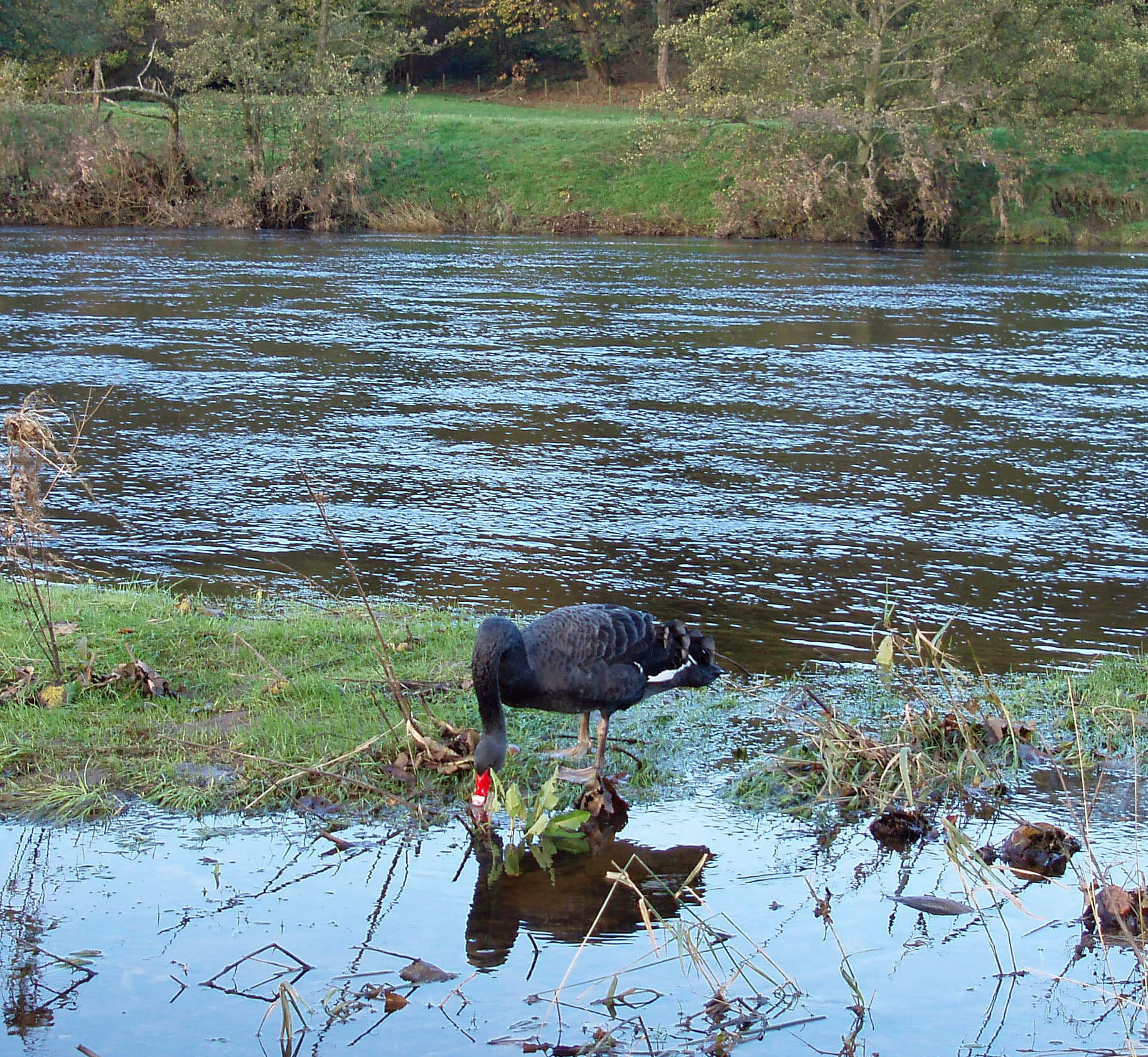 Right: An alien black swan joins the Lune avifauna
The steep banks of the Lune are pitted with holes.
These are nests excavated by sand martins, which
arrive back in England in April and can be seen in large
numbers swirling and swooping over the river seeking
flies before returning to their nest.
Below Bull Beck is the lowest ford of the Lune still
in regular use. It is a little disconcerting to see tractors
setting off into a river that seems too deep but they head
boldly diagonally across to reach the farmer’s land
within the great meander.
The Lune continues its long curve to face whence
it came and then turns sharply under Lawson’s Wood to
head towards a bridge painted grey, with red roses. On
the side it says “Manchester Corporation Water Works
1892”. Within the bridge is an aqueduct carrying up to
250 million litres of water every day from Thirlmere to
Manchester. The Victorian style contrasts with the 1950s
austerity of the Haweswater Aqueduct passed near
Kirkby Lonsdale. The two aqueducts are now part of a
more complex system, collecting water from Ullswater
and Windermere as well, being joined near Shap, and
providing water to Liverpool, Blackpool and Lancaster
as well as Manchester.
The Thirlmere Aqueduct is 150km long, the longest
in England to work by gravity alone. As can be seen, the
four pipes across the bridge drop several metres to be
taken underground on the south side of the Lune. This is
the sharpest drop along the whole length of the aqueduct
(the average drop is just 30cm/km, and the water flows
at 6km/hour) and hence the point under the greatest
hydrodynamic pressure. The square buildings, south and
on the hill north, have valves that can be closed to enable
repairs. A Ł23m programme to inspect and repair the
entire length of the aqueduct was begun in 2006, which
is the first time that the aqueduct has been completely
drained since it opened in 1894.
A few years ago, the platform across the aqueduct
was opened to walkers, which was much appreciated,
as also was the new bridge obviating the difficult ford
across Artle Beck, 0.5km below the aqueduct.
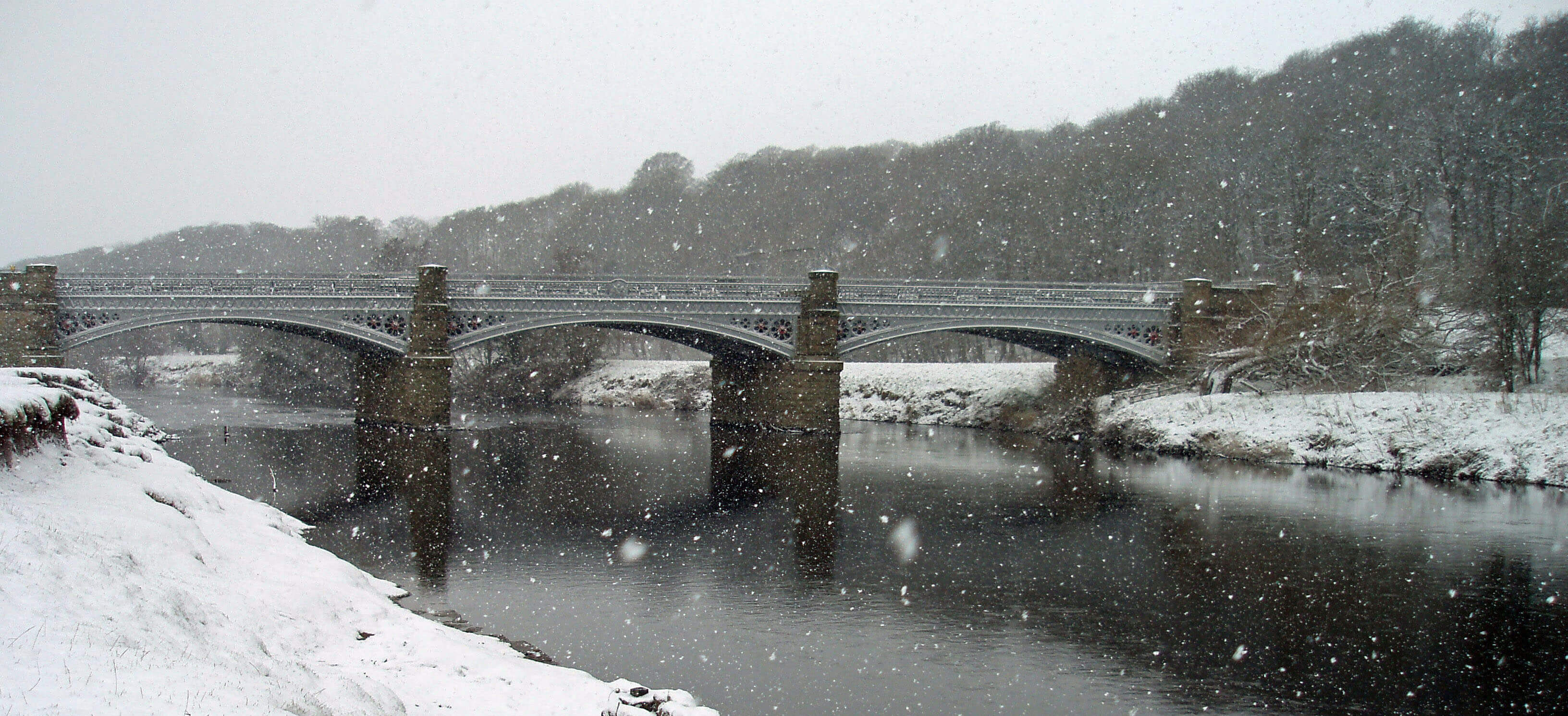
The Thirlmere Aqueduct (or Waterworks Bridge)
Artle Beck
Artle Beck acquires its name somewhere between
Crossgill and Potts Wood, by which point it has
already absorbed innumerable becks flowing into the
Littledale valley. From the north, Crossgill Beck runs
from the Caton wind turbines towards Roeburn Glade,
built on the site of the old Brookhouse Brick Company,
which closed down in the 1960s. Crossgill is probably
named after the ancient cross, marked on old maps, that
used to stand in the base that can be seen by a track (the
old Littledale Road) to the north. It is
an old farming hamlet: one building
bears a date of 1681. In 1780 a corn
mill was listed here – by 1850 it was
a bobbin mill, and it closed in 1945 as
a sawmill.
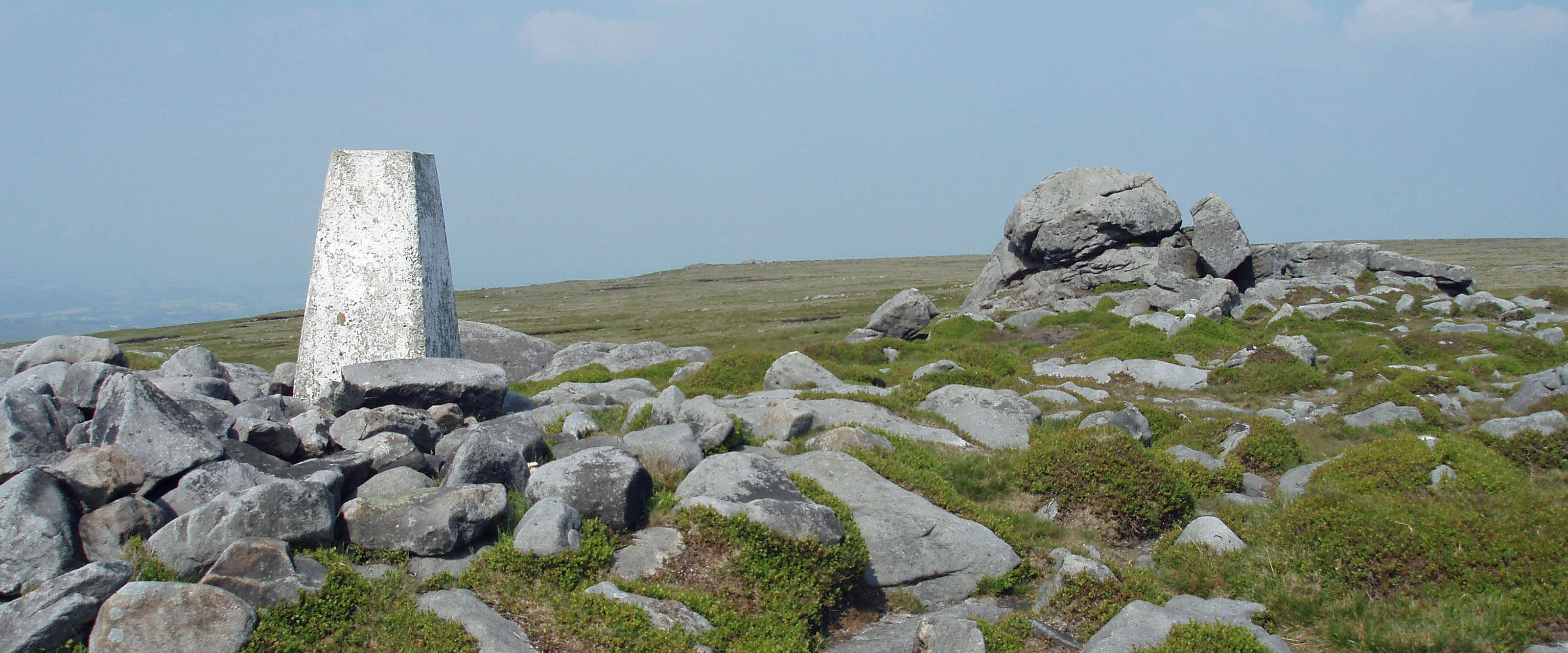 Right: The trig point and Ward’s Stone
From the south, Foxdale Beck and
Udale Beck drain Blanch Fell and Black
Fell below Ward’s Stone (561m), the
highest point in the Forest of Bowland.
Ward’s Stone naturally affords a fine
view of the extensive plateaux of
southern Bowland, although the flat
top prevents views into the valleys. On
the top, erosion has exposed gritstone
boulders, some with fanciful names,
such as the Queen’s Chair. A few raised
islands of peat remain but generally
the surface is stony. After dry weather, it is dusty and the
gritstone sparkles in the sunlight but usually the sombre
colours intensify the wild, windswept remoteness.
The upland moors provide a breeding habitat for
birds such as curlew, snipe, redshank, ring ouzel, merlin,
golden plover, peregrine falcon, and hen harrier. The
last is the symbol of Bowland. The hen harrier is one
of England’s most threatened birds and Bowland is
its most important breeding site in England. In 2005
fifteen pairs nested in Bowland, more than in the rest
of England. Unsurprisingly, the Bowland Fells are a
Special Protection Area under the European Union’s
Wild Birds Directive.
[Update: The number of hen harriers nesting in Bowland
has declined. There were none at all in 2017 but there has been a slight increase since.
By an amazing coincidence, all the nests in the last decade were on United Utilities land, with none on
gamekeeper-managed grouse moors.]
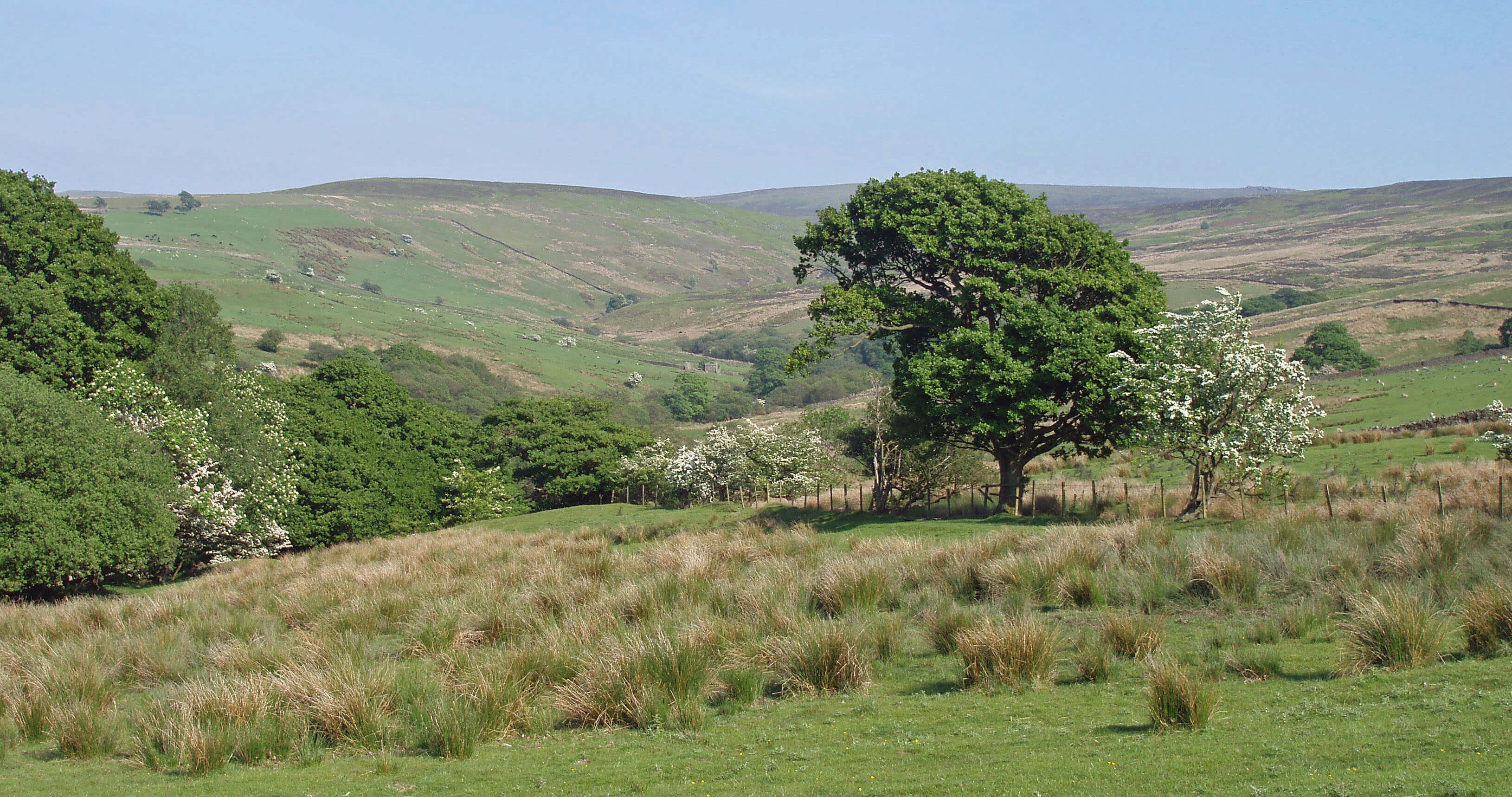 Left: Littledale, looking up Udale Beck to Blanch Fell, with Ward’s Stone on the horizon
The Littledale region is also a good one for observing
the lapwing, a bird that is distinctive in all three main
identifying characteristics: appearance (with a long
crest), flight (an acrobatic tumble) and call (a ‘pee-wit’).
The lapwing is declining drastically in other parts of the
country but in higher areas of Loyne where the sheep
numbers are not too high, such as Littledale, there has
been an increase.
The Black Side of Ward’s Stone is rough country
that until recently was reserved for grouse and grouse
shooting. The British record bag of 2929 grouse was made
in Littledale and Abbeystead on August 12th 1915. The
fine body of gentlemen (including four military officers
not distracted by the war on at the time) responsible for
this superlative achievement deserve naming: Major the
Hon. E. Beaumont, Capt. the Hon. H. Bridgeman, Major
the Hon. J. Dawnay, Capt. the Hon. T. Fitzherbert, Mr.
E. de C. Oakley, the Earl of Sefton, the
Hon. H. Stonor, and the Hon. J. Ward.
Today, it is CRoW land, open
to us all (except when the grouse-shooters decide to take priority, as they
are allowed to do on 28 days a year).
There’s an access point from Littledale
by Sweet Beck above Belhill Farm and
also a permissive path (not marked on
OS maps) from near Deep Clough by
Ragill Beck to Haylot Fell. Foxdale
Beck below White Spout and Cocklett
Scar is an attractive secluded spot. The
best walking is to be found on the ridge
that goes up to High Stephen's Head, for this is
mainly grass, in contrast to the heather,
bogs and rocks found below Ward’s
Stone.
Foxdale Beck passes Littledale Hall, which is not as
old as it looks. It was built in the Gothic Revival period
for the Reverend John Dodson, who had been Vicar of
Cockerham from 1835 to 1849. It became a Christian
retreat in 1988 and a rehabilitation centre in 2006. Near
the Hall is Littledale Chapel, also built by the Rev.
Dodson but now used as a barn.
It is sometimes worthwhile to pause and ask: Why?
Why did the Rev. Dodson leave his flock at Cockerham
to build a hall and chapel in Littledale? It was because of
the Gorham Judgement, a significant event in the history
of tension between church and state. A Mr Gorham had
been rejected as a vicar by the church because he did not
believe in its teachings on baptism but, after an appeal to
the Privy Council, the church had been overruled. Many
clergy strongly objected to a secular court overriding
spiritual authority, including our Rev. Dodson, who
set out to build a ‘free church’, as it says above the
doorway.
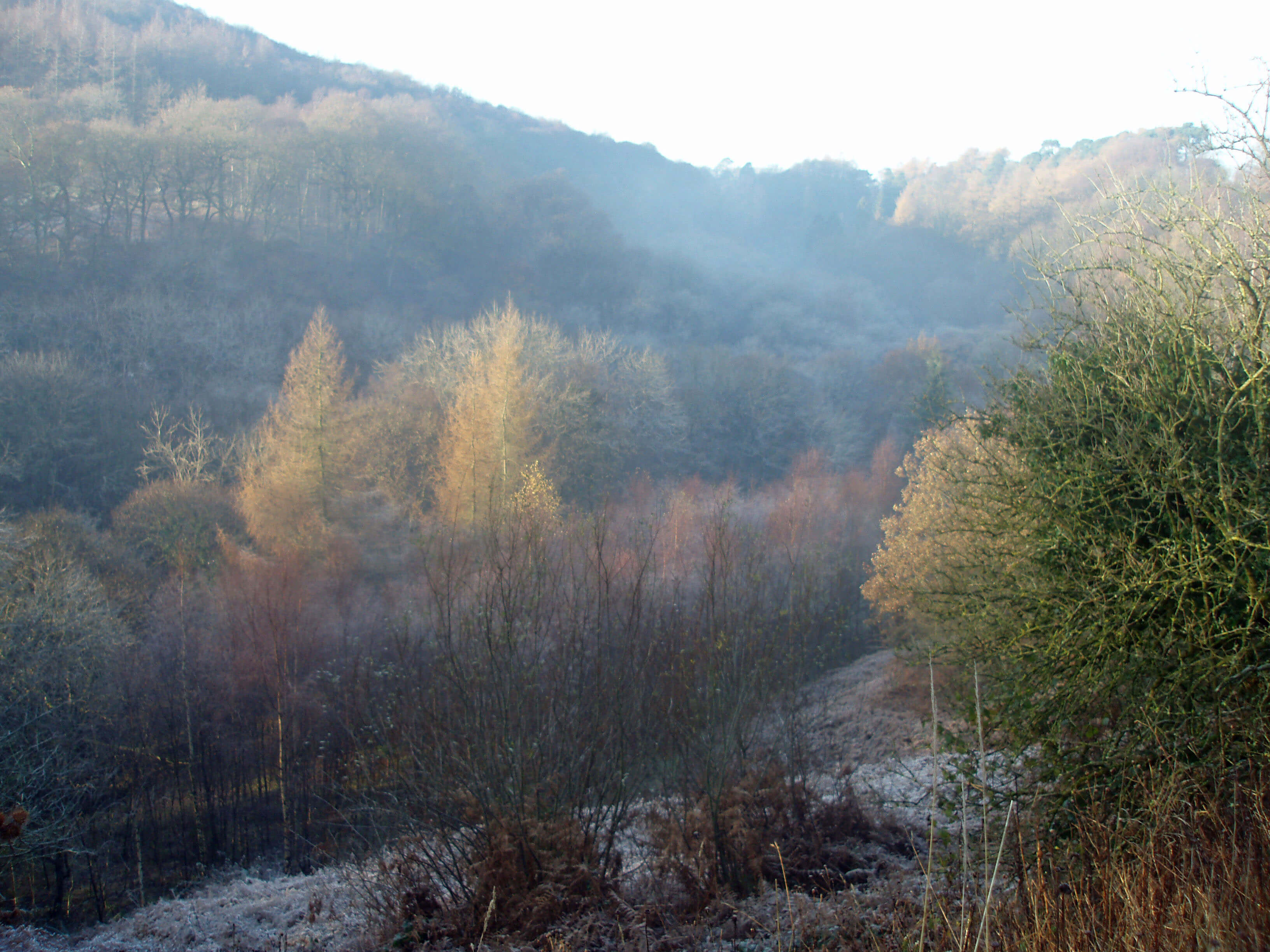 Right: Autumn mists over Artle Beck
From Fostal Bridge Artle Beck runs through a deep
valley shaded by woodland, which is important for its
over 160 species of moss and liverwort, and past the
sites of coal mines at Hollinhead and Hawkshead that
were active until the early 19th century. On the opposite
bank is Stauvins Farm, which was the home of Harry
Huddleston (1910-2005). He was the first Englishman
to represent his country abroad at sheepdog trialling.
Sheepdog triallers do not rank high on the nation’s
sporting pantheon but for a section of the Loyne
community the magnificent name of Harry Huddleston
was one to be revered. He competed into his eighties
and when no longer able to walk operated from his car,
which he positioned next to the pen gate to help guide
the sheep. Nobody objected.
The beck emerges at Gresgarth Hall, the country
home of the internationally renowned garden designer
Lady Arabella Lennox-Boyd (oh, and Sir Mark Lennox-Boyd, former MP for Morecambe). As we would expect,
the gardens of Gresgarth Hall are impressive indeed,
having been transformed since 1978 from a gloomy,
dank, tree-shaded area, engulfed by rhododendron and
laurel, into a light, open parkland with terraced gardens,
herbaceous borders, a new lake, a water garden, an
orchard, a nuttery, and so on, with Artle Beck running
through them.
The gardens are open several times each summer,
usually in aid of the Conservative party, but don’t let that
put you off. Apart from the gardens, you will be able to
view the hall itself, which was largely rebuilt in the early
19th century. Perhaps you will be able to detect the rough
external masonry of the little that remains of the older
14th century hall.
The Gresgarth estate came into the ownership of
the historic Curwen family in 1330 when John Curwen
married Agnes de Caton. The Curwens owned extensive
land in Cumberland and Galloway when the England-Scotland border was more fluid. It is believed that after
the First War of Scottish Independence, which ended in
1328, John Curwen was granted the Gresgarth estate
(and dear Agnes, heiresses at that time being wards
of the crown) in compensation for losing his land in
Galloway.
John Curwen would have been well aware of the
threat from the Scottish, since Robert the Bruce had
ransacked Lancaster in 1322, and turned whatever
building then existed (thought to have been a rest home
for monks) into a tower house. The Curwens owned
the hall until the 17th century, since when it has passed
through many hands, including the Girlingtons, whom
we met as owners of Thurland Castle.
Below Gresgarth, Artle Beck is more sedate. In
the beck, opposite Bridge End, a Roman milestone was
found in 1803. It is usually said to be six foot high but it is
actually rather bigger, as can be checked in the Lancaster
City Museum. Its carvings indicate that it marked a point
four Roman miles from Lancaster, which is indeed the
straight-line distance to the Lancaster fort. It is therefore
an important indication of the path, now lost but probably
straight along this section, of the presumed road between
the forts at Lancaster and Over Burrow.
Artle Beck runs past Caton, which the afore-mentioned Thos Johnson considered “about the least
interesting of all the villages in the vale of the Lune.”
Although Caton is a workaday place this characterisation
is unfair because it doesn’t distinguish between the parish
and the village. Caton is old enough to be mentioned
in the Domesday Book but until relatively recently
Caton referred to four distinct communities: Littledale,
Caton Green, Brookhouse and Town End. The seat of
the manor, the original Caton Hall, was at Caton Green
and the parish church was at Brookhouse, which was, if
anywhere was, the centre of old Caton. Incidentally, the
present Caton Hall was the last home of the renowned
landscape architect, Thomas Mawson, who designed
many of Lakeland’s grand gardens and died here in
1933.
The Top 10 halls in Loyne
1. Gresgarth Hall
2. Underley Hall
3. Whittington Hall
4. Middleton Hall
5. Leck Hall
6. Burrow Hall
7. Ingmire Hall
8. Killington Hall
9. Ashton Hall
10. Thurnham Hall
It was only from the late 18th century that Town End
grew rapidly to become the industrial centre of Caton,
after the building of five mills. Ball Lane Mill was burnt
down in 1846; Rumble Row Mill and Forge Mill closed
down in the 1930s; Willow Mill and Low Mill continued
until the 1970s. The last three survive after conversion to
small business units and residences. Low Mill is reputed
to have been the oldest cotton mill in England, built in
1783 on the site of a corn mill that may have dated back
to the 13th century. A millrace taken from Artle Beck at
Gresgarth powered all the mills except Ball Lane. Its
route across Artle Beck near Forge Mill and through
Caton to Low Mill can still be traced. The millpond by
Low Mill is now a fishery. As with all becks off the hills,
the water supply was unreliable and Low Mill became
one of the first to use steam power in 1819.
All this activity led the centre of gravity of Caton
to move to Town End. This was confirmed by the
building of the turnpike road, the present A683, in 1812,
bypassing the old road through Brookhouse and Caton
Green, and by the arrival in 1850 of the railway, with
Caton Station.
This history explains the relative dearth of old
buildings in Caton. The oldest church is the Wesleyan
Methodist one of 1837. Many of the house names reflect
Caton’s practical past: the Rock m Jock cottages are
said to refer to the noise from the nearby Willow Mill;
Farrer House (which is an old building, dated 1680) is
the old blacksmith’s; the Ship Inn is supposed to refer
to the sailcloths produced at Willow Mill. Even the Fish
Stones are concerned with trade – the three semi-circular
slabs are where fish were sold in the Middle Ages. By the
Fish Stones is a very old oak tree, so decrepit that fears
that it is disobeying its preservation order prompted the
High Sheriff of Lancashire to plant a successor oak tree
in 2007.
[Update: The old oak tree continued to show little
sign of life and on June 20th 2016 was finally deemed to have passed away.]
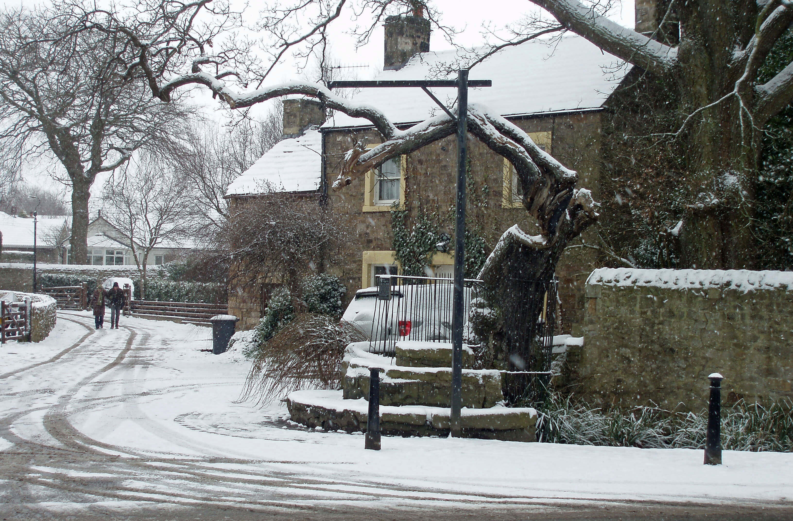
The Fish Stones and ye olde oake treee in Caton
The Introduction
The Previous Chapter (Wenningdale, Hindburndale and Roeburndale)
The Next Chapter (The Lune to Lancaster)
© John Self