
Home
Preamble
Index
Areas
Dales
Hills
Lakes
Places
Reserves
Rivers
Structures
Villages
References
Me
Saunterings: Walking in North-West England
Saunterings is a set of reflections based upon walks around the counties of Cumbria, Lancashire and
North Yorkshire in North-West England
(as defined in the Preamble).
Here is a list of all Saunterings so far.
Guaranteed ad-free, AI-free and free!
162. A Cracking Bit of Wensleydale
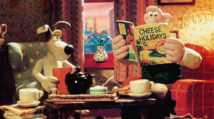 “Eeeeeeeeee, these bank holidays, it’s a problem to decide …
Gromit, that’s it! Cheese! We’ll go somewhere where there’s cheese!”
A Grand Day Out (1989).
Yes but why did Wallace and Gromit decide to travel to the moon, even if it was made of cheese, when it
might have been a tad easier to visit Wensleydale, home of their favourite cheese?
We didn’t make the same mistake. On the August bank holiday Sunday we headed for Hawes,
in order to walk in a bit of
Wensleydale where we had not set foot
before. The Preston to Richmond bus arrived at our stop with no passengers. Was there really nobody
in Preston or Lancaster who fancied a holiday bus trip to the Yorkshire Dales? It cost us £5 return –
surely a bargain for a 60-mile trip, much of it through iconic Dales scenery. Are people saving
every penny to pay their energy bills? Or are they so enamoured of their cars that they never
even think of going anywhere without them? Or are they influenced by the comment (variously
attributed) that anyone travelling on a bus is a failure in life?
We walked north from Hawes over the River Ure (which was very low) up to the hamlet of
Sedbusk. Sedbusk could be a name invented by a novelist to sound Dalesian. There are
Sed-s and -busks around so why not join the two? The real Sedbusk
is "a very typical settlement of the northern
flank of Wensleydale", with a number of interesting vernacular buildings
(according to a website no longer on-line).
We, however, did not pause to study them but walked on along an airy track that led eventually
to the farm of Litherskew.
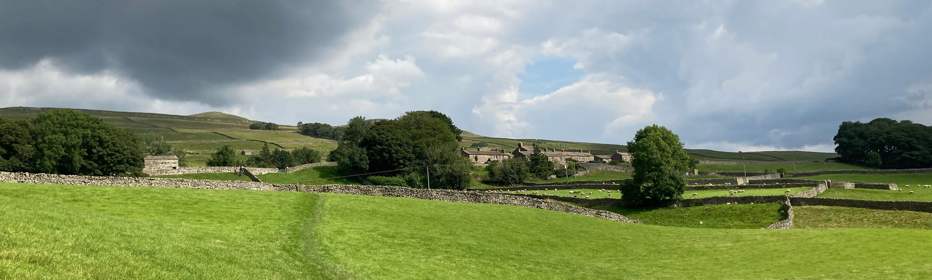
Approaching Sedbusk
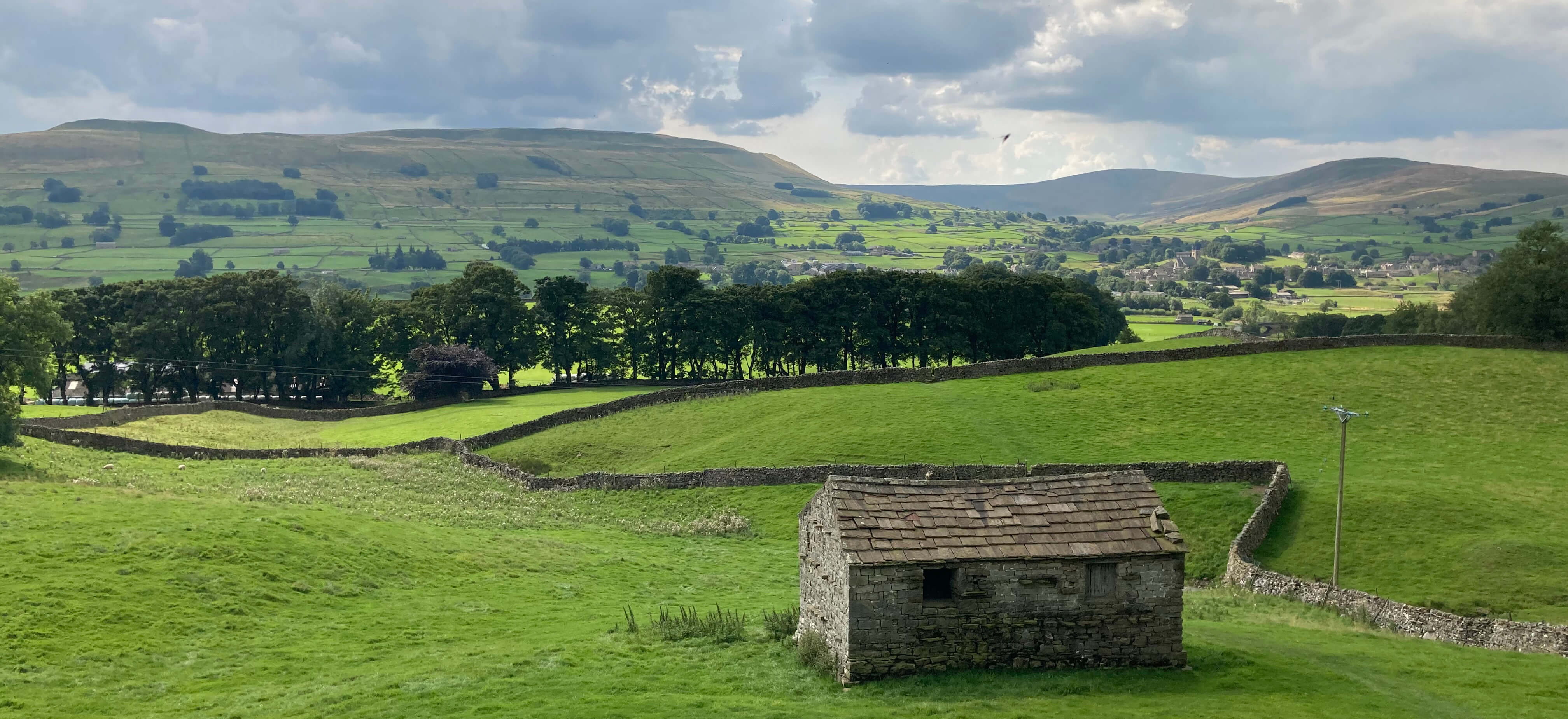
Looking back towards Hawes from Sedbusk
Wensleydale here is a wide valley, rising in stages on both sides up to heights of
500 metres or more. There are therefore excellent long-ranging views along and across the dale. There
is, however, little of drama in the scene. The limestone scars are relatively small and
most of the valley is, of course, given over to green fields for sheep and cattle, with a few
scattered trees. Disappointingly, there are only occasional glimpses of the river. Perhaps
when the river is fuller it is more noticeable but I doubt that it is significantly so.
Of course, the river here is still small, being only ten miles or so into its seventy mile
journey to become the River Ouse. It is also rather secretive, there being no footpaths
by the river between Hawes and where we were heading, Camshouse Pasture.
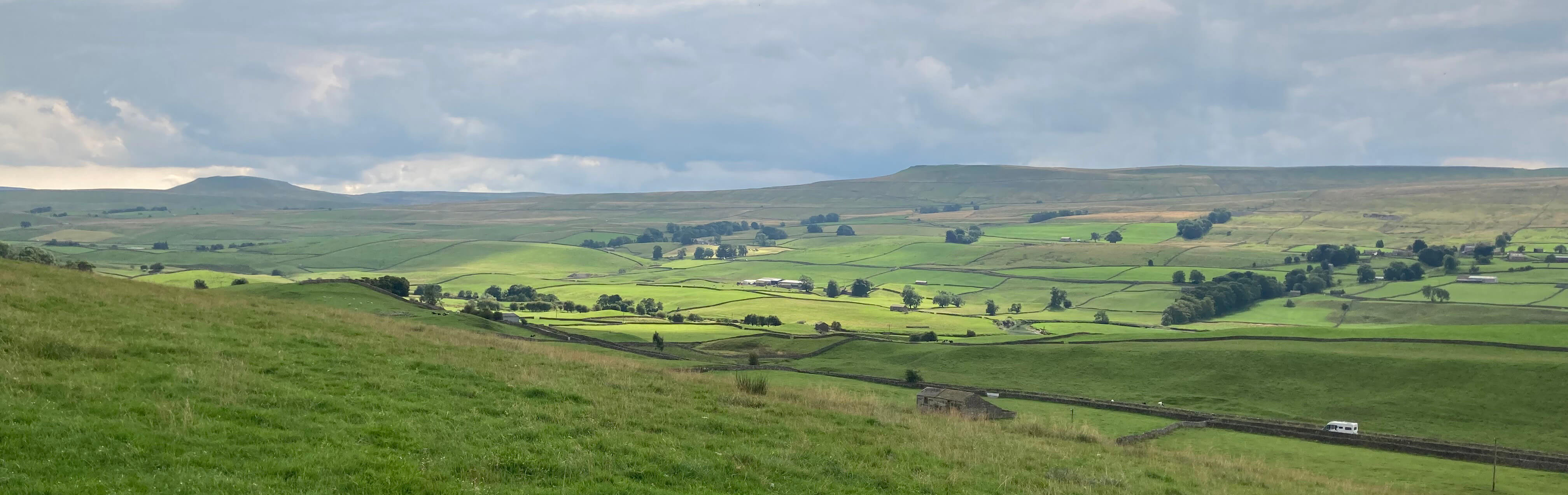
Wensleydale, looking east (the top in the distance is Addlebrough)
We headed for the stepping stones below Hunger Hill.
Stepping stones always bring us a frisson of excitement.
A planned walk lies in the balance.
Will the stones be underwater (not likely on this occasion)? Will the
stones all be there? Will there be a gap tempting us to risk life and limb? The Yorkshire
Dales seems particularly fond of stepping stones, with a number of them
being well-known. I expect somebody has written a catalogue of Dales stepping stones
and perhaps even devised a ‘stepping stones trail’ over all of them.
In the event, our stepping stones were all there, riveted to the river bed, tracing a graceful
curve across the river.
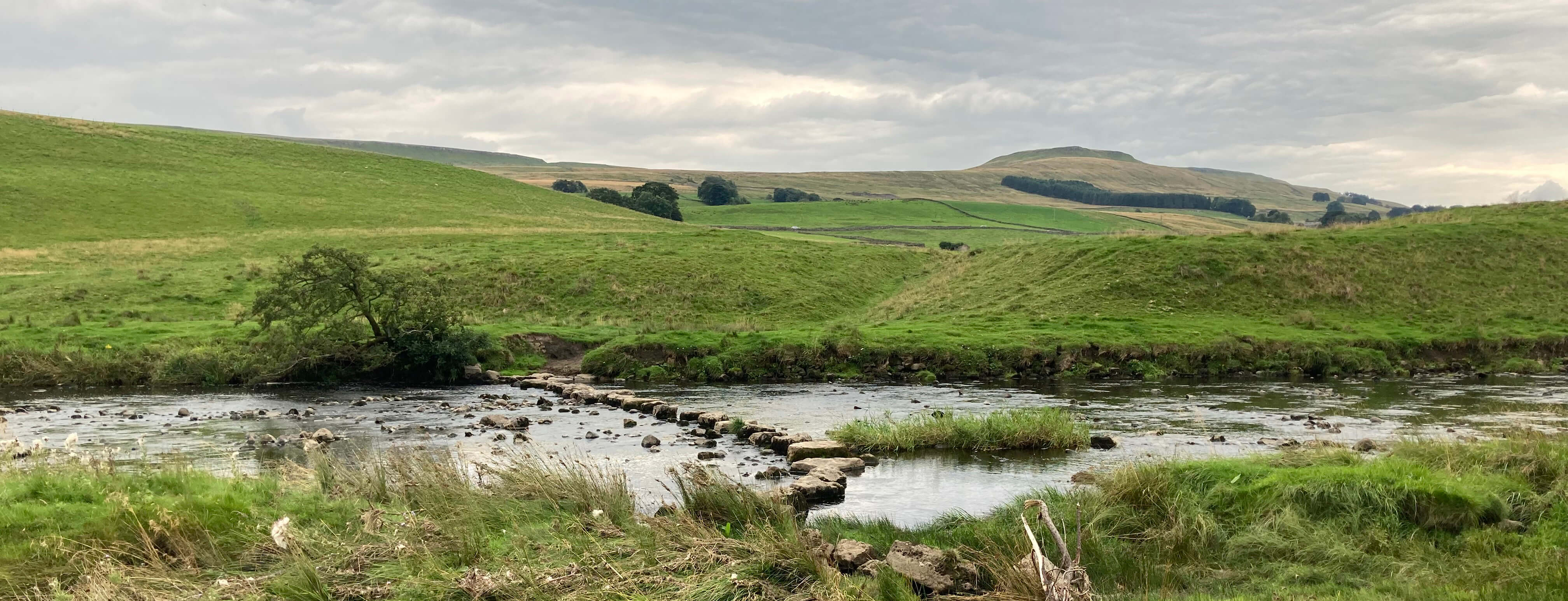
The stepping stones over the River Ure
We picnicked
on the opposite bank (just over there in the photo), where we could admire the
stepping stones and reflect upon our heroic
crossing. Our plans beyond this point were vague, as we hadn’t dared to be too optimistic
that we’d be able to cross. We improvised.
We walked up across fields, up Mire Bank Lane, and up High Lane to reach the
Cam High Road, which is the old Roman Road that continued east to the fort at Bainbridge.
Its Roman-ness was not obvious to us but it provided a fine walking track up to the west,
which we followed to a height of about 460 metres. By now, clouds had settled over the
valley, removing almost all colour from the scene. Prominent ahead was the distinctive
top of Yorburgh (515 metres), which I am not sure that I’d heard of before. It’s a
subsidiary of Wether Fell (614 metres) and it overlooked most of this walk.
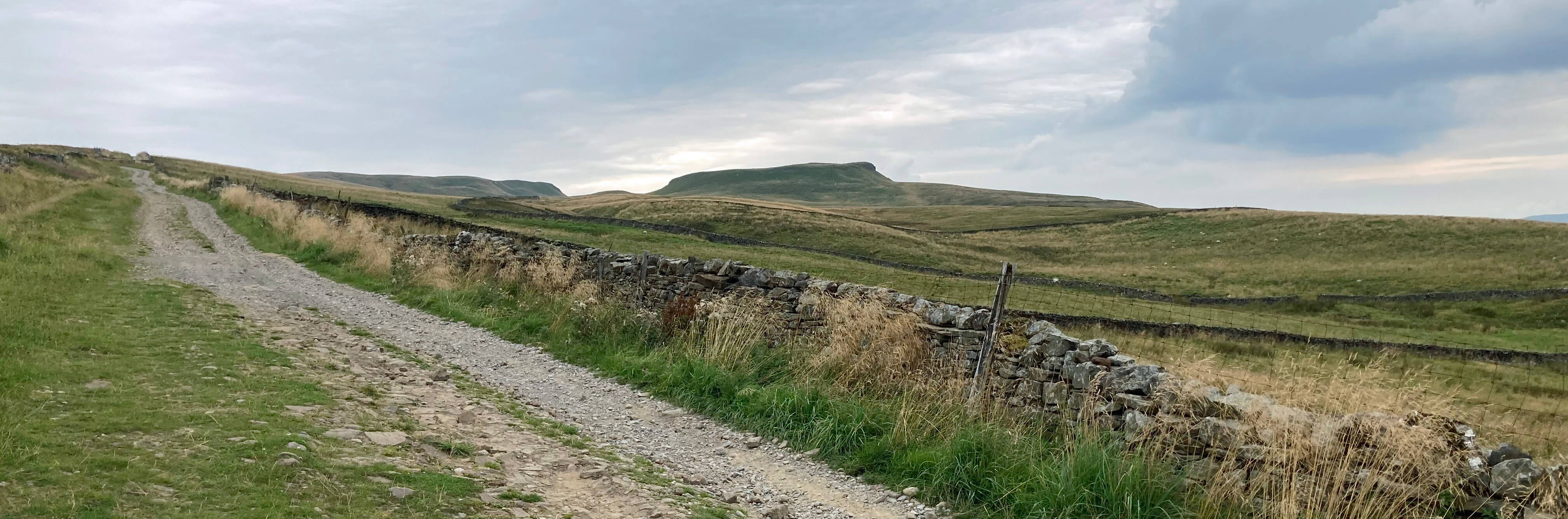
Cam High Road, an old Roman Road (the hill ahead is Yorburgh)
The path north down to the village of Burtersett could be clearly seen ahead of us but it
is probably less clear to those walking up. Burtersett is an appealing village, particularly
appealing to us as we could make use of the drink-making facilities kindly provided in its Institute.
I had not prepared adequately for this walk, otherwise I might have sought out Hillary Hall,
home of the Hillary family, from which the mountaineer Sir Edmund Hillary was descended, his
grandparents having left Wensleydale for New Zealand.
Note added in September 2026: This is a mistake.
I have received the following message from a descendant (now
living in Queensland but soon to visit Wensleydale) of
the Hillary family of Burtersett saying "What takes us from Queensland to beautiful
Yorkshire is my family history - I’m a descendant of the Hillary family. We stay at
Beebole Cottage - formerly the stables of Countersett Hall. Both were built in the
1600’s by Richard Robinson my 6th g-grandfather (and an early Yorkshire Quaker). His
daughter Mary married John Hillary and the Hillarys went on to live in Hillary Hall.
If I can point out what I think is an error in your walk 162 post - I don't think
(unfortunately) that there is any evidence that “my” Hillary family are in any way
connected to my southern hemisphere compatriot Sir Edmund. It is Sir Edmund’s maternal
side that come from Yorkshire not his paternal - so they are not Hillarys. The “myth”
is frequently repeated in much Wensleydale tourist material……just showing the levels
to which you Poms will sink to attract we ANZAC tourists!". I see now that this
accords with
Wikipedia's comment that Sir Edmund Hillary's grandfather was from Lancashire and
that his maternal great-grandparents, the Clarks, were from Yorkshire.
But
the no doubt manifold attractions of Burtersett did not detain us as we felt
an irresistible necessity to get to Hawes in time for some
sustenance before our bus came. So we took the easy path across
the fields back to Hawes.
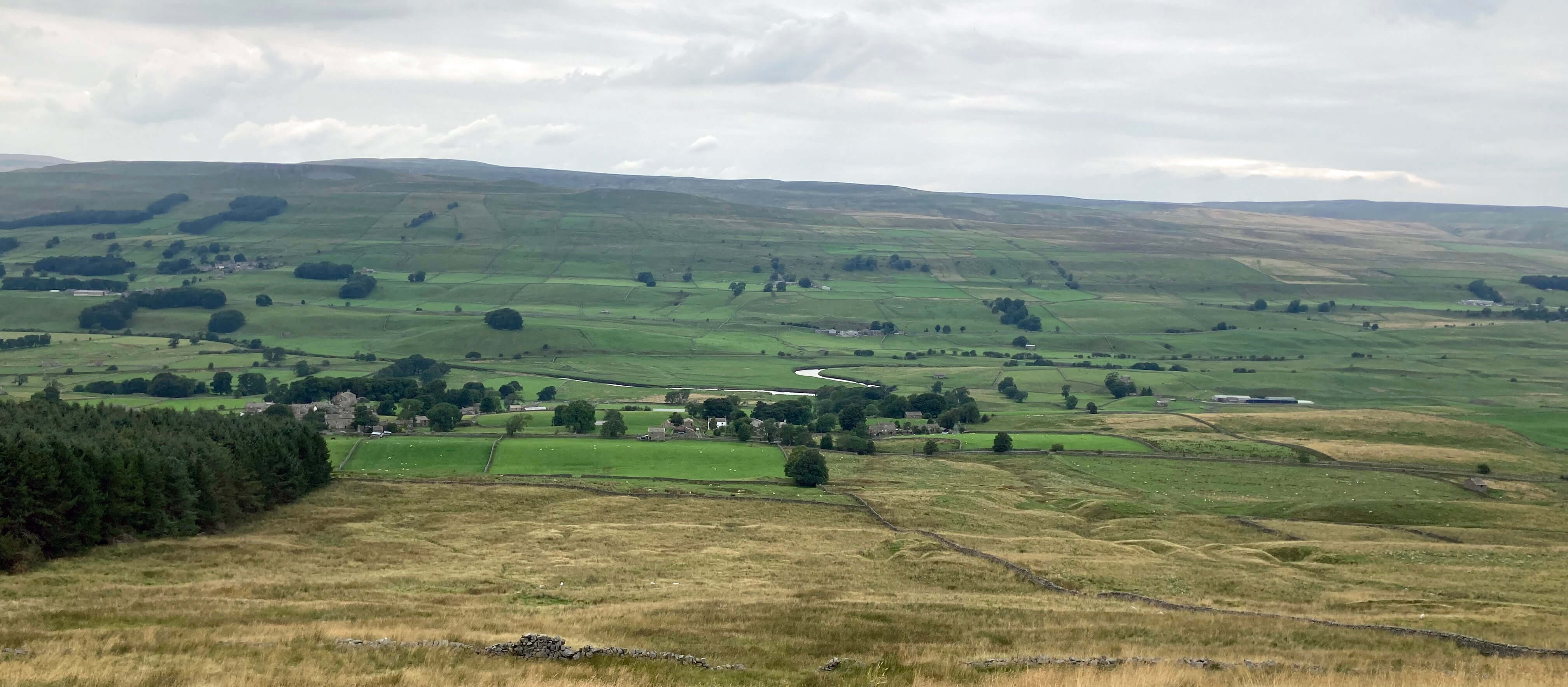
The path down to Burtersett
By the way, I am very much looking forward to our soon-to-be new Prime Minister,
renowned champion of British cheese, immediately announcing, as a matter of the highest priority
in this time of national crisis,
that our present Minister for Defence, Mr Wallace, will
be moved to his rightful role as Minister for Cheese. Gromit will be the Crackers Minister.
Date: August 28th 2022
Start: SD876898, Dales Countryside Museum, Hawes (Map: OL30)
Route: N, NE – Sedbusk – E along track that ends below Litherskew,
SE across Camshouse Pasture – old railway line
– SW over stepping stones, across field, up Mire Bank Lane, E and SE on High Lane – Cam High Road
– SW, N – Burtersett – W, NW – Hawes
Distance: 8 miles; Ascent: 250 metres
722 +602 /2400
Home
Preamble
Index
Areas
Dales
Hills
Lakes
Places
Reserves
Rivers
Structures
Villages
References
Me
© John Self, 2018-
Contact: johnselfdrakkar@gmail.com

Top photo: The western Howgills from Dillicar;
Bottom photo: Blencathra from Great Mell Fell